National Weather Service United States Department of Commerce

Record Heat for the Intermountain West and Northern Plains; Heavy Rainfall and Severe Weather Threats

Record setting heat is expected over the next several days from the Intermountain West through the northern Plains. Furthermore, fire weather concerns increase with dry and breezy conditions. Meanwhile, heavy rainfall and severe thunderstorm threats for the Ohio/Tennessee Valleys, central Appalachians and Southeast today. The threat shifts to central Gulf Coast and across central Texas this week. Read More >

North Platte Fire Weather Forecast Services

For comments, concerns, or questions, please reach out to the LBF Fire Weather Program Manager.

Request a Spot Forecast - Official Use Only


Fire Weather Planning Forecast

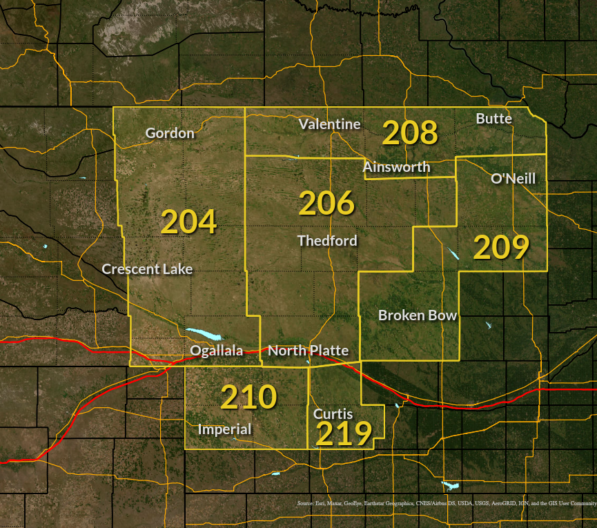
Click on Your Location for the latest Fire Weather Forecast

NWS Rapid City NWS Sioux Falls NWS Cheyenne NWS Boulder NWS Goodland NWS Hastings NWS Omaha Fire Weather Zone 209 Fire Weather Zone 219 Fire Weather Zone 210 Fire Weather Zone 204 Fire Weather Zone 208 Fire Weather Zone 208

Backup Fire Weather Planning Forecast Link

Forecast Information

NWS North Platte Area Forecast Discussion NWS North Platte Point Forecast Matrix Fire Weather Dashboard Graphical Fire Weather Forecast


Storm Prediction Center Fire Weather Outlooks

Hot-Dry-Windy Index


Weather Observations

Current Weather Observations Nebraska Mesonet Fire Weather Snooper

72-Hour RAWS Observations:

Bessey | Crescent Lake | McKelvie | Valentine

NWS/RAWS 24-hour Trend Summary Western Nebraska 24-Hour Lightning Archive


Other Pages

Nebraska Forest Service Rocky Mountain Area Fire Weather Annual Operating Plan Rocky Mountain Area Coordination Center Drought Monitor


2 Day Forecast Graphs for Select Cities