
Tropical Depression Two is expected to gradually strengthen and could bring tropical storm conditions to the Florida Panhandle beginning late Monday. Areas of flash flooding will be possible through Thursday along the eastern and central Gulf Coast. Severe thunderstorms will develop and move along a cold front crossing the Upper Midwest Monday, and through the Ohio Valley/Mid-Atlantic on Tuesday. Read More >
North Platte, NE
Weather Forecast Office
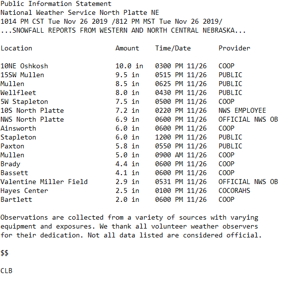
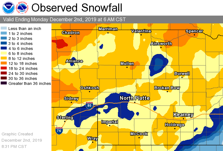
A series of storms affected the forecast area the week of Thanksgiving. The first snowstorm to move through the area begin in the evening on Monday November 25, 2019 across western Nebraska. Snow continued into Tuesday spreading eastward across the state. A good portion of southwest, western and north central Nebraska saw significant snowfall.
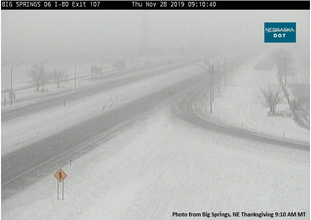
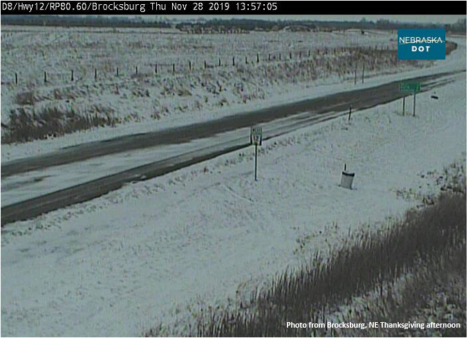
A second system moved through the area on Thanksgiving day and brought areas of light freezing drizzle and light snowfall accumulations. Areas of light freezing drizzle and fog were mostly seen across portions of southwest Nebraska while areas of light snow mixed with freezing drizzle at times were across north central, central into north eastern Nebraska.
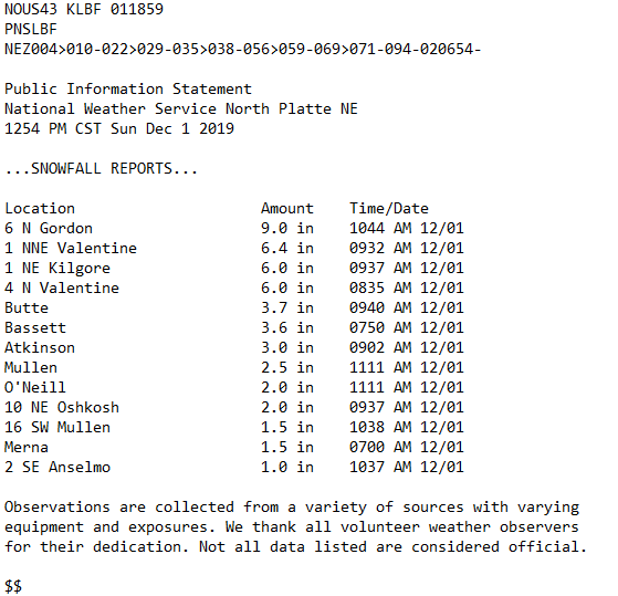
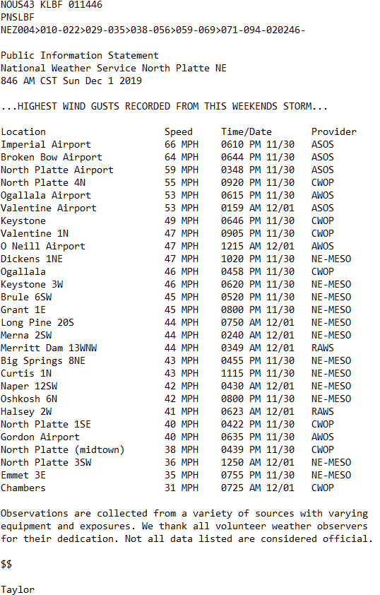
A third and final storm system for the week of Thanksgiving moved through the area Friday morning through Saturday night. This system brought blizzard conditions across northern Nebraska along with high winds across portions of southwest and north central Nebraska.
HAZARDS
Active Alerts
National Radar
National Hurricane Center
Storm Prediction Center
Weather Prediction Center
River Flooding
Decision Support
Submit a Storm Report
Recent Storm Reports
CURRENT CONDITIONS
CoCoRaHS
Enhanced Data Display
Local Radar
National Radar Mosiac
Observations
National Snow Cover
Precipitation Mapped
Regional Links
Satellite
Snowfall Analysis
FORECASTS
Area Forecast Discussion
Aviation Weather Center
Local Aviation Weather
Fire Weather
Recreation Forecast
National Graphical Forecast
Local Graphical Forecast
CLIMATE
Local Climate
National Climate
North Platte - Daily
North Platte - Monthly
Valentine - Daily
Valentine - Monthly
Broken Bow - Daily
Broken Bow - Monthly
Imperial - Daily
Imperial - Monthly
NIDIS Drought
NOAA Climate Science
Local Storm Reports
Local Drought Statement
US Dept of Commerce
National Oceanic and Atmospheric Administration
National Weather Service
North Platte, NE
5250 E. Lee Bird Drive
North Platte, NE 69101-2473
308-532-4936
Comments? Questions? Please Contact Us.

