
Tropical Depression Two is expected to gradually strengthen and could bring tropical storm conditions to the Florida Panhandle beginning late Monday. Areas of flash flooding will be possible through Thursday along the eastern and central Gulf Coast. Severe thunderstorms will develop and move along a cold front crossing the Upper Midwest Monday, and through the Ohio Valley/Mid-Atlantic on Tuesday. Read More >
Overview
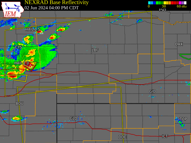
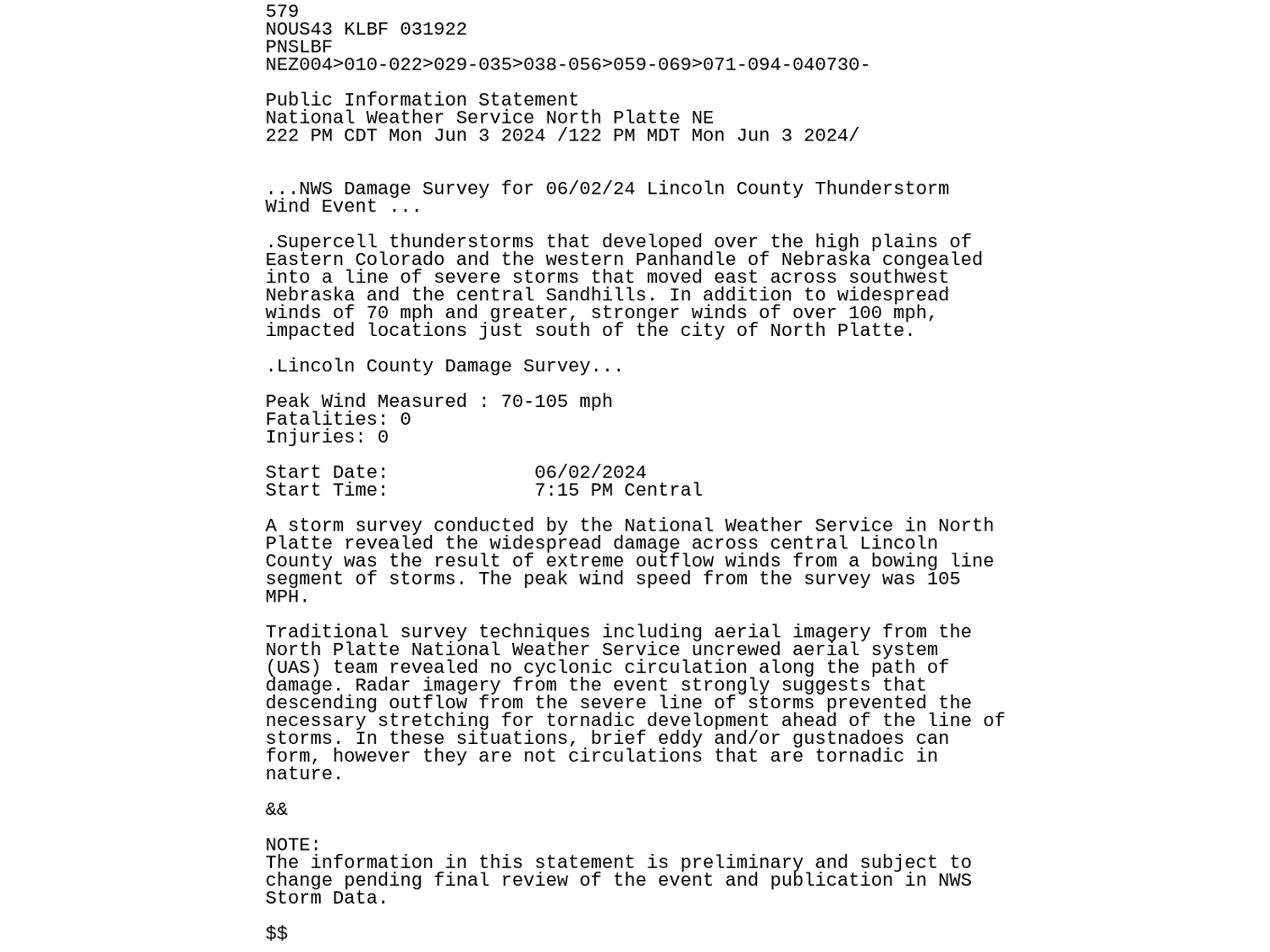
Supercell thunderstorms developed in the late afternoon across the Nebraska Panhandle and western Nebraska and moved eastward in the evening hours. As they storms moved eastward, they formed into a line of storms, extending from Cherry County south towards the Nebraska state line. Strong straight-line winds were found throughout the line of storms, with the strongest winds across the southern portion of the line. In addition to widespread winds of 70 mph and greater, stronger winds of over 100 mph, impacted locations just south of the city of North Platte. A storm survey conducted by the National Weather Service in North Platte revealed the widespread damage across central Lincoln County was the result of extreme outflow winds from a bowing line segment of storms. The peak wind speed from the survey was 105 mph.
Wind & Hail:
Storms were initially discrete with reports of severe hail in addition to damaging wind gusts and even a brief tornado in Cheyenne County. As the late afternoon progressed, storms grew upscale and morphed into a large MCS stretching from immediately north of the Interstate 80 corridor south towards Highway 34. Once this transition occurred, wind became the predominant threat and hail reports were generally limited to dime size (0.50" diameter) or less. Damaging wind reports began coming in from Ogallala down through Imperial where multiple automated sites measured 60 to 80 mph peak gusts.
As the line of storms tracked east in a more favorable environment, reports of 60+ mph gusts continued. Large areas of blowing dust preceded storm arrival due to outflow immediately ahead of the line of storms. The storm complex then moved into Lincoln County and eventually North Platte between 7:00 and 7:30pm CDT, knocking out power to the entire city. Around the same time, a measured 97 mph gust was reported by a personal weather station immediately southwest of the city. Storm impacts were highest south of Interstate 80 where damage surveys estimated 90-105 mph winds. This resulted in many instances of tree and power line damage throughout the city. Peak winds at the North Platte Regional Airport reached 82 mph at 7:23pm CDT. Storms continued east into central Nebraska with multiple 60 to 70 mph wind gusts being reported in Custer County. Storms eventually exited for WFO North Platte County Warning Area around 10pm CDT.
Wind
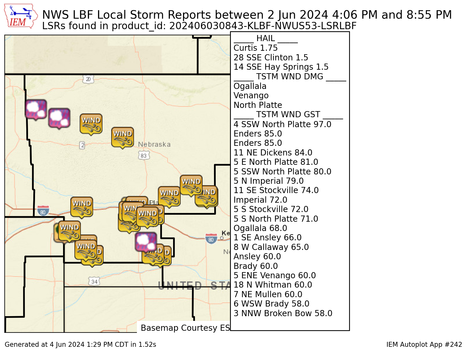
...HIGHEST WIND REPORTS...

Location                     Speed     Time/Date       Provider

...Nebraska...

...Chase County...
Enders                       85 MPH    0645 PM 06/02   Public
5 N Imperial                 79 MPH    0628 PM 06/02   Mesonet
Imperial                     72 MPH    0640 PM 06/02   AWOS

...Cherry County...
18 N Whitman                 60 MPH    0553 PM 06/02   Public
7 NE Mullen                  60 MPH    0632 PM 06/02   Public

...Custer County...
1 SE Ansley                  66 MPH    0855 PM 06/02   Mesonet
8 W Callaway                 65 MPH    0812 PM 06/02   CO-OP Observer
Ansley                       60 MPH    0855 PM 06/02   Mesonet
3 NNW Broken Bow             58 MPH    0833 PM 06/02   ASOS

...Frontier County...
11 SE Stockville             74 MPH    0804 PM 06/02   Storm Chaser
5 S Stockville               72 MPH    0756 PM 06/02   Public

...Keith County...
Ogallala                     68 MPH    0609 PM 06/02   Mesonet

...Lincoln County...
4 SSW North Platte           97 MPH    0718 PM 06/02   Public
11 NE Dickens                84 MPH    0700 PM 06/02   Public
5 E North Platte             81 MPH    0722 PM 06/02   Official NWS Obs
5 SSW North Platte           80 MPH    0711 PM 06/02   NWS Employee
5 S North Platte             71 MPH    0721 PM 06/02   Public
Brady                        60 MPH    0737 PM 06/02   CO-OP Observer
6 WSW Brady                  58 MPH    0739 PM 06/02   Public

...Perkins County...
1 SW Brandon                 60 MPH    0558 PM 06/02   Trained Spotter
 |
 |
 |
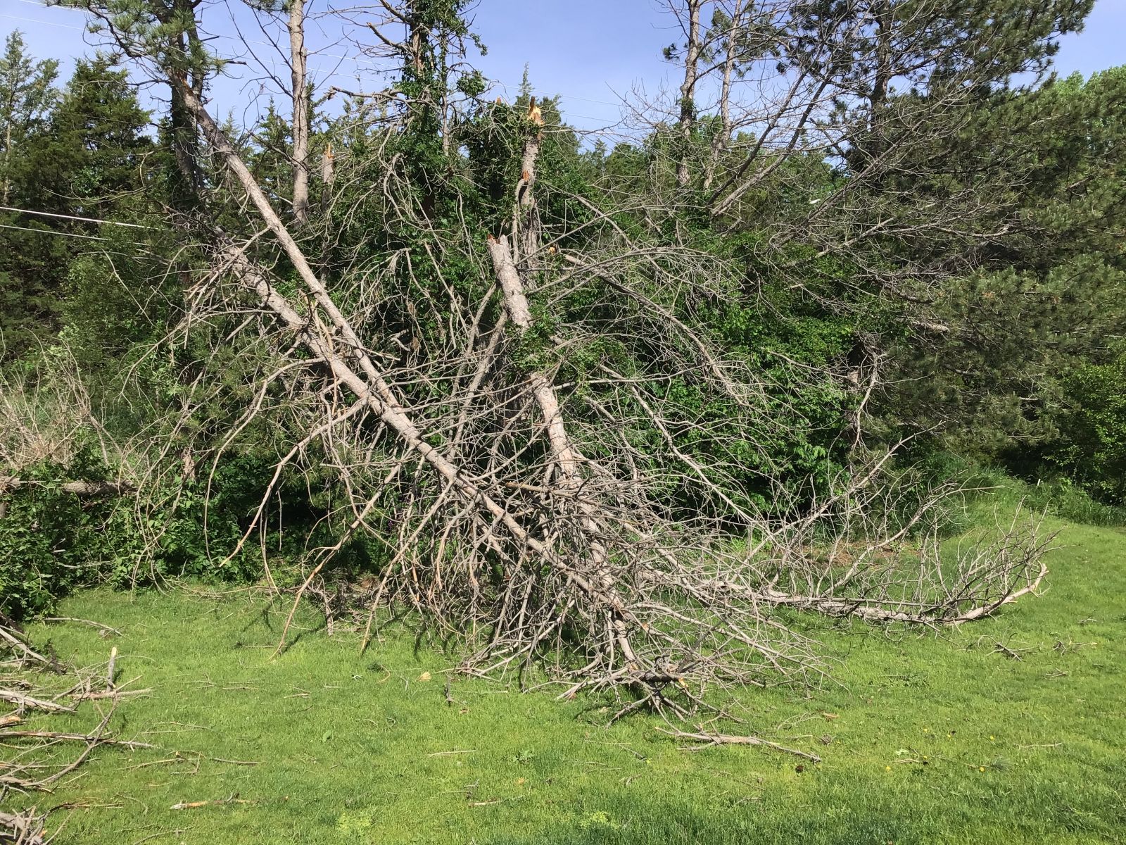
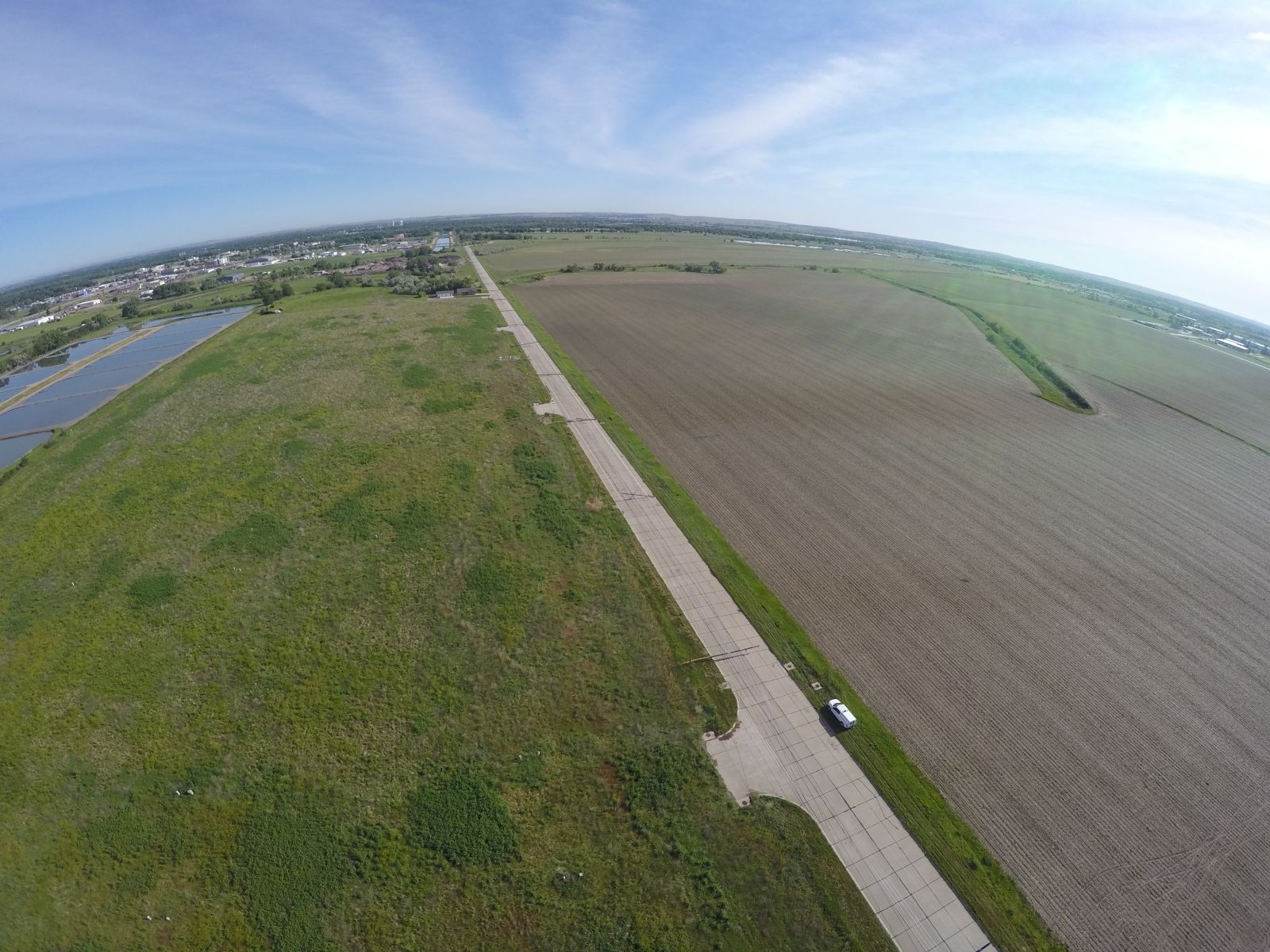
| Figure 1: Snapped trees in Indian Hills Subdivision NWS Damage Survey |
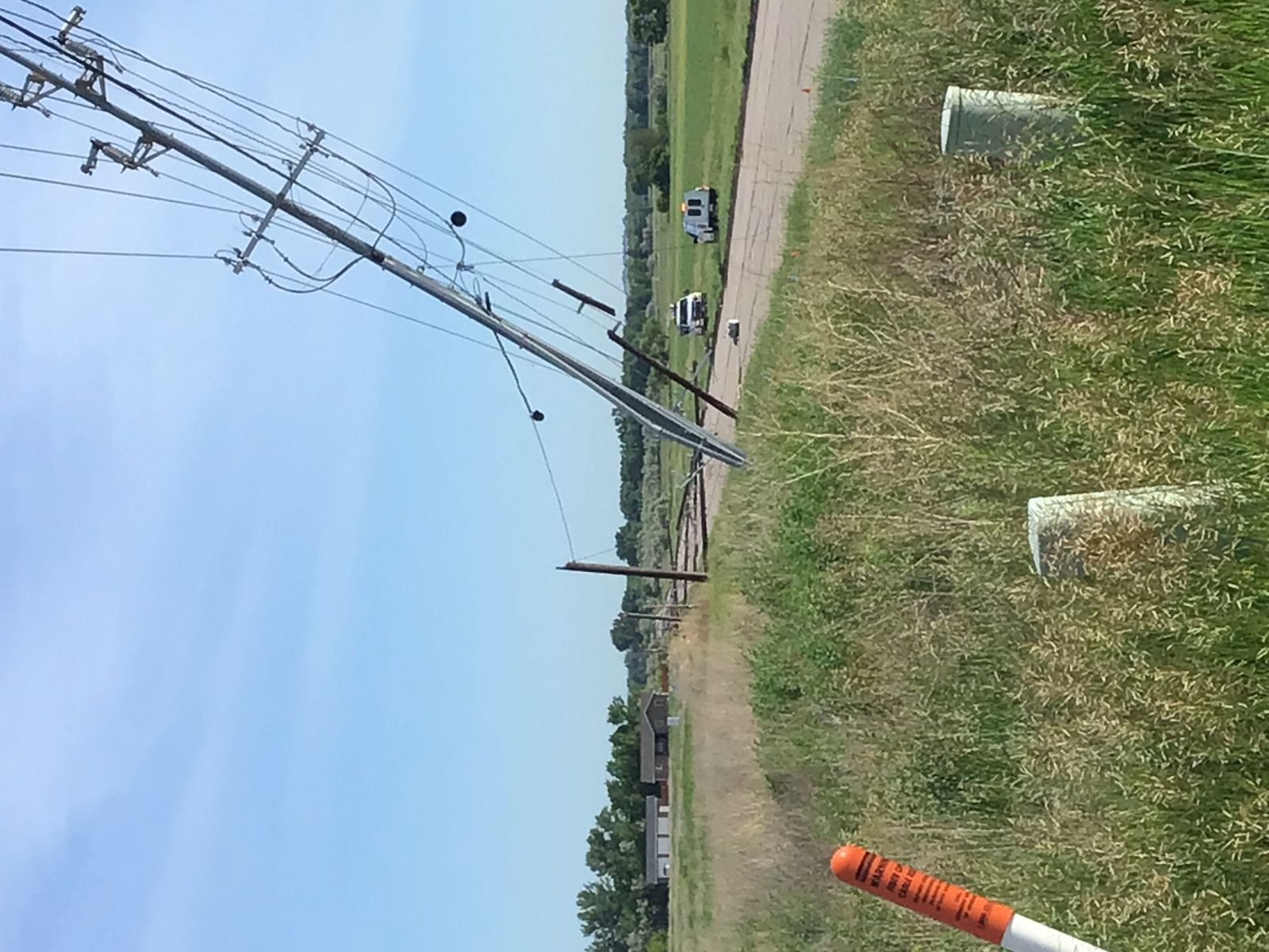
Figure 2: Snapped power poles along S. Victoria Lane NWS Damage Survey |
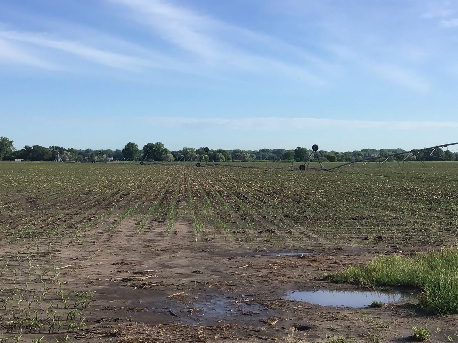
Figure 3: Overturned pivot off E. State Farm Road NWS Damage Survey |
 |
 |
 |
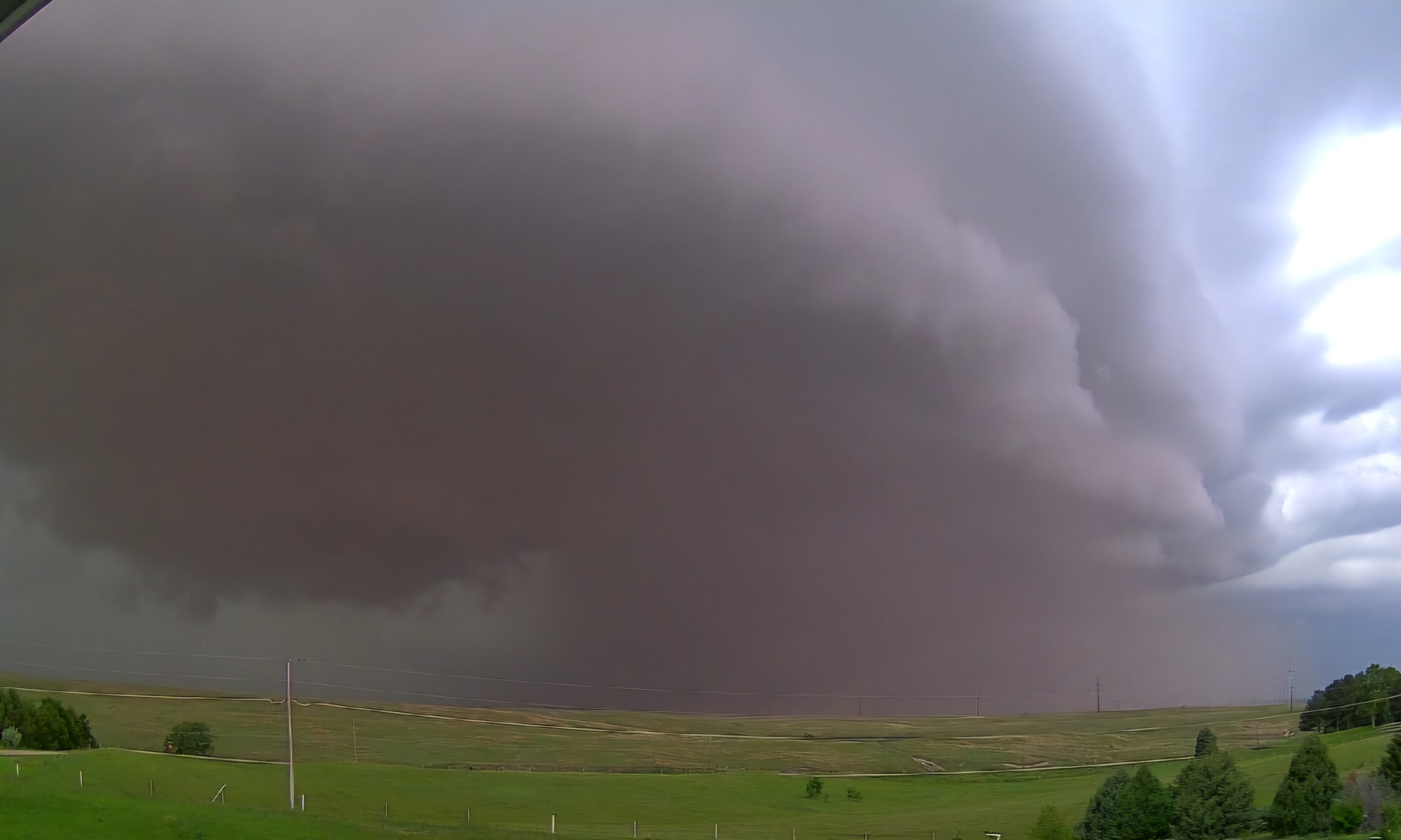
| Figure 4: Storm approaching Jandebeur Heights Subdivision Photo courtesy Darren Snively |
Figure 5: Uprooted tree in mid-town North Platte Photo courtesy Brandon Myers |
Figure 6: Drone view of snapped power poles NWS Damage Survey |
Hail
...HAIL REPORTS...

Location                     Size      Time/Date       Provider

...Nebraska...

...Frontier County...
Curtis                       1.75 in   0724 PM 06/02   Public

...Sheridan County...
14 SSE Hay Springs           1.50 in   0406 PM 06/02   Public
24 NNE Ellsworth             1.50 in   0450 PM 06/02   Public
Radar
 |
| Radar loop depicting timing and evolution of June 2 severe event. Animation created by Iowa State Mesonet. |
Storm Reports
 |
 |
| Damage Survey Findings | Map depicting all severe weather reports received as of Tuesday morning, 06/04. Image created by Iowa State Mesonet. |
Environment
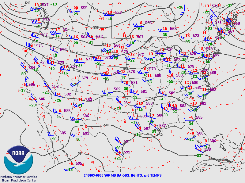
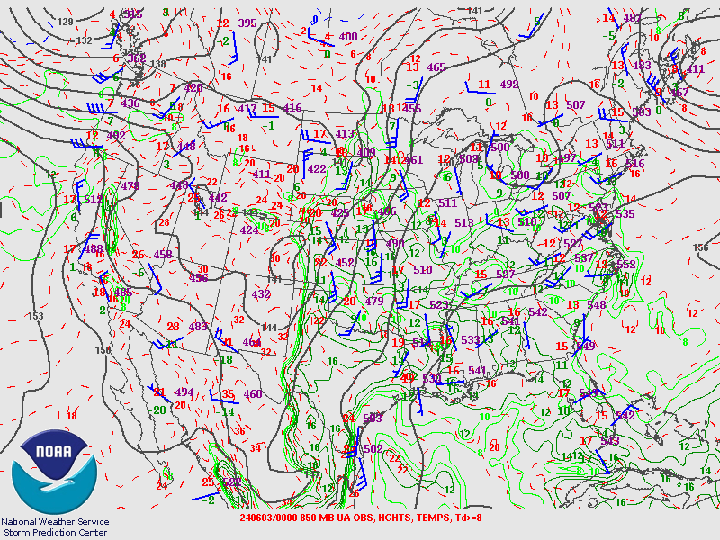
A subtle 500 hPa shortwave interacted with a developing dryline across the central Nebraska Panhandle into northeast Colorado. Storms initiated by mid-afternoon and tracked east into a more unstable airmass.
 |
 |
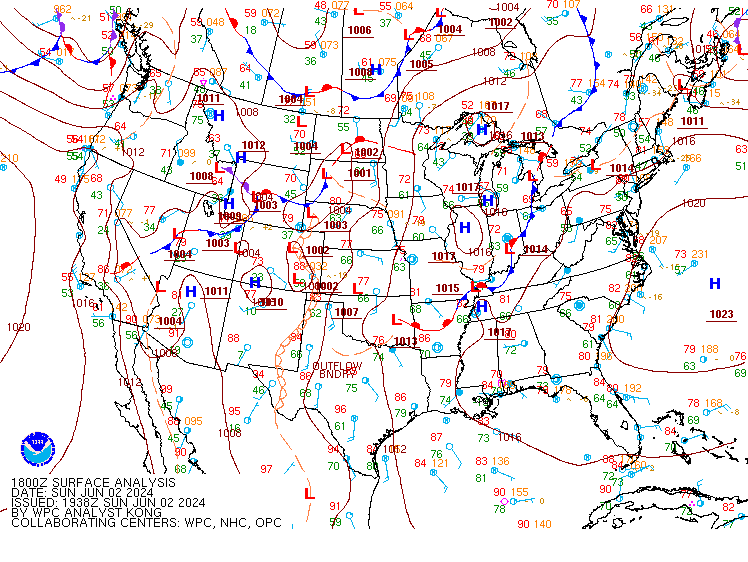 |
| Figure 1: 500 hPa map valid 7 pm CDT June 2 | Figure 2: 850 hPa map valid 7 pm CDT June 2 | Figure 3: Surface map valid 1 pm CDT June 2 |
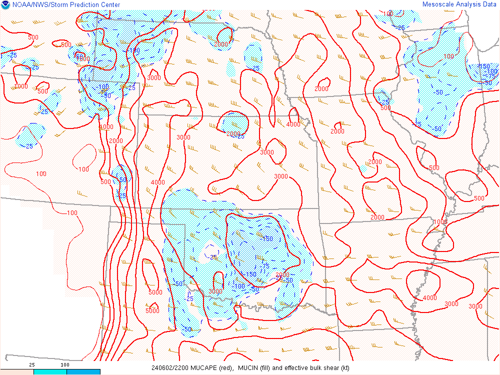
Near-storm environment summary.
 |
 |
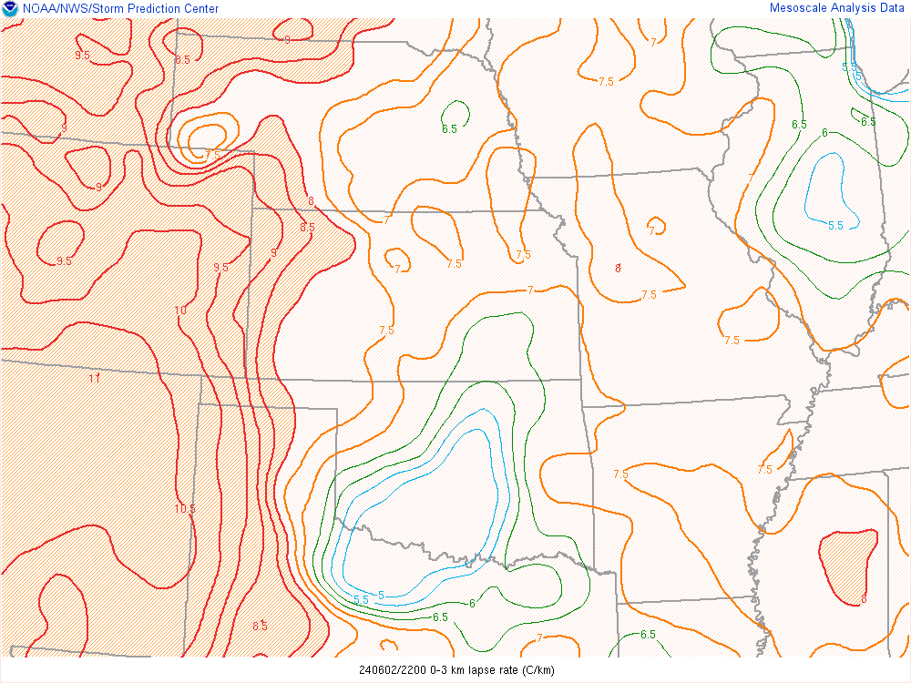 |
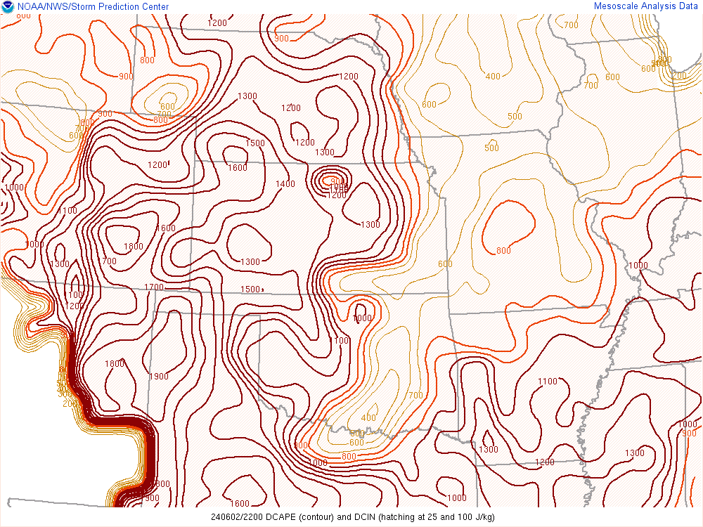
| Figure 4: Most Unstable CAPE & 0-6km Bulk Shear valid 5 pm CDT June 2 | Figure 5: Downdraft CAPE valid 5 pm CDT June 2 | Figure 6: Low-Level (0-3km) Lapse Rates valid 5 pm CDT June 2 |
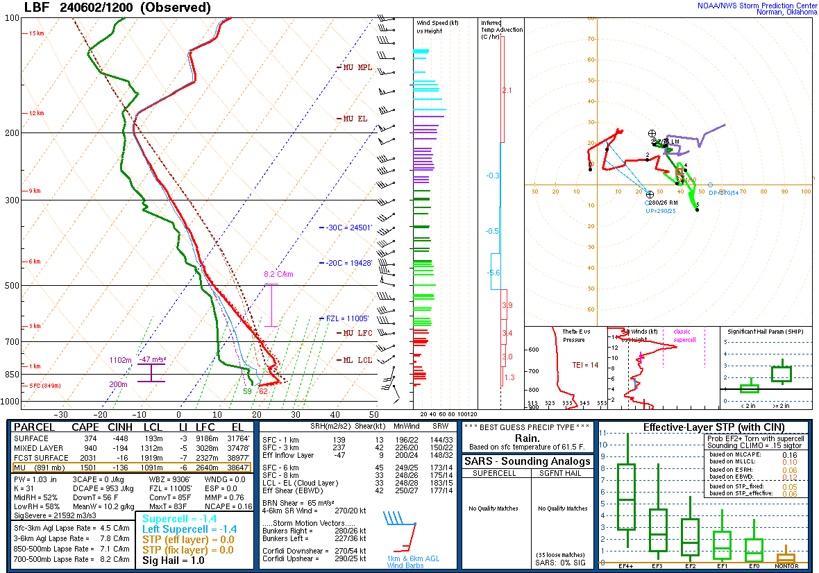
Observed soundings through the day.
 |
 |
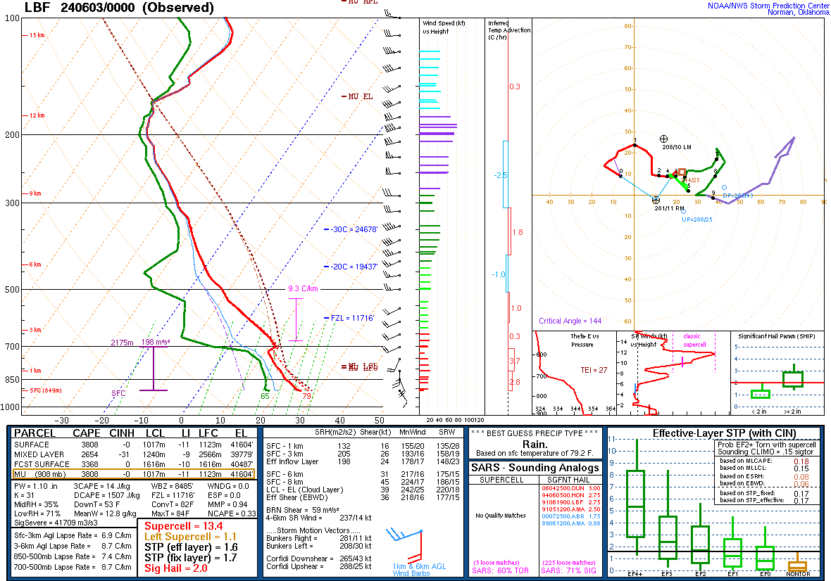 |
| Figure 7: LBF RAOB valid 06/02 7am CDT | Figure 8: LBF RAOB valid 06/02 3pm CDT | Figure 9: LBF RAOB valid 06/02 7pm CDT |
 |
Media use of NWS Web News Stories is encouraged! Please acknowledge the NWS as the source of any news information accessed from this site. |
|

