Northern Indiana
Weather Forecast Office
Northern Indiana Fire Weather Page
National Weather Service Products
IWX Products
- NWS Spot Forecast Information (OFFICAL USE ONLY)
- Fire Weather Watch/Red Flag Warning
- Planning Forecasts
- Hourly Weather Graphs (Great for planning burns 1 or more days in advance)
- Text Routine Planning Forecast (Available during normal fire weather season)
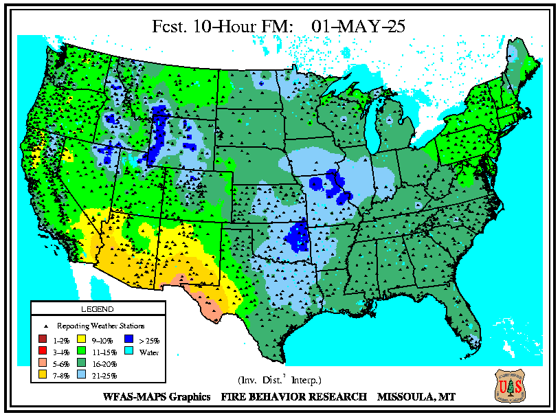
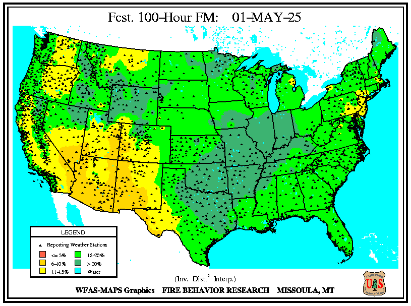
- Graphical Forecast for Basic Fire Weather Elements
Annual Operating Plans
Storm Prediction Center Fire Weather Products
Day 1 Fire Weather Outlook
Day 2 Fire Weather Outlook
Day 3 to 8 Outlook
Government Partners
Eastern Area Coordination Center (EACC)
|
|
|
|
|
|
|
|
|
|
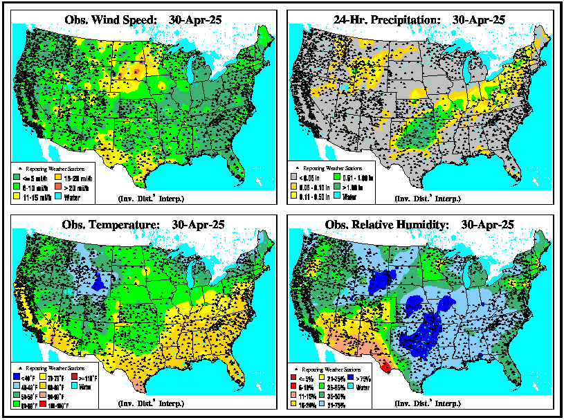
Observed Winds/Precip/Temperature/RH |
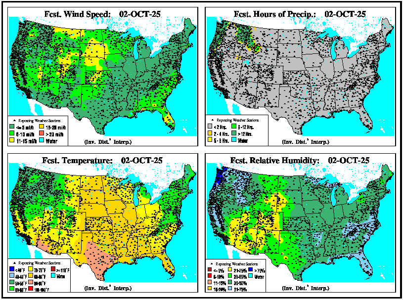
Forecast Winds/Precip/Temperature/RH |
|
|
|
05/19/23 RC
Hazards
Heat Related
Winter Related
Watch/Warning
Outlook
Storm Reports
Storm Prediction Center
Submit a Report
Event Ready
Climate
FWA Daily
SBN Daily
FWA Monthly
SBN Monthly
CoCoRaHS
Spring Frost Climatology
Fall Frost Climatology
Severe Climatology
Local Information
Skywarn
COOP
Our Office
WSR-88D
Headline Criteria
NOAA Weather Radio
Weather History
Probabilistic Snowfall
Public Information Statement
Social Media Feeds
Weather Events Page
US Dept of Commerce
National Oceanic and Atmospheric Administration
National Weather Service
Northern Indiana
7506 E 850 N
Syracuse, IN 46567
574-834-1104
Comments? Questions? Please Contact Us.