Central Illinois
Weather Forecast Office
1991-2020 New Monthly Climate Normals - Peoria & Springfield
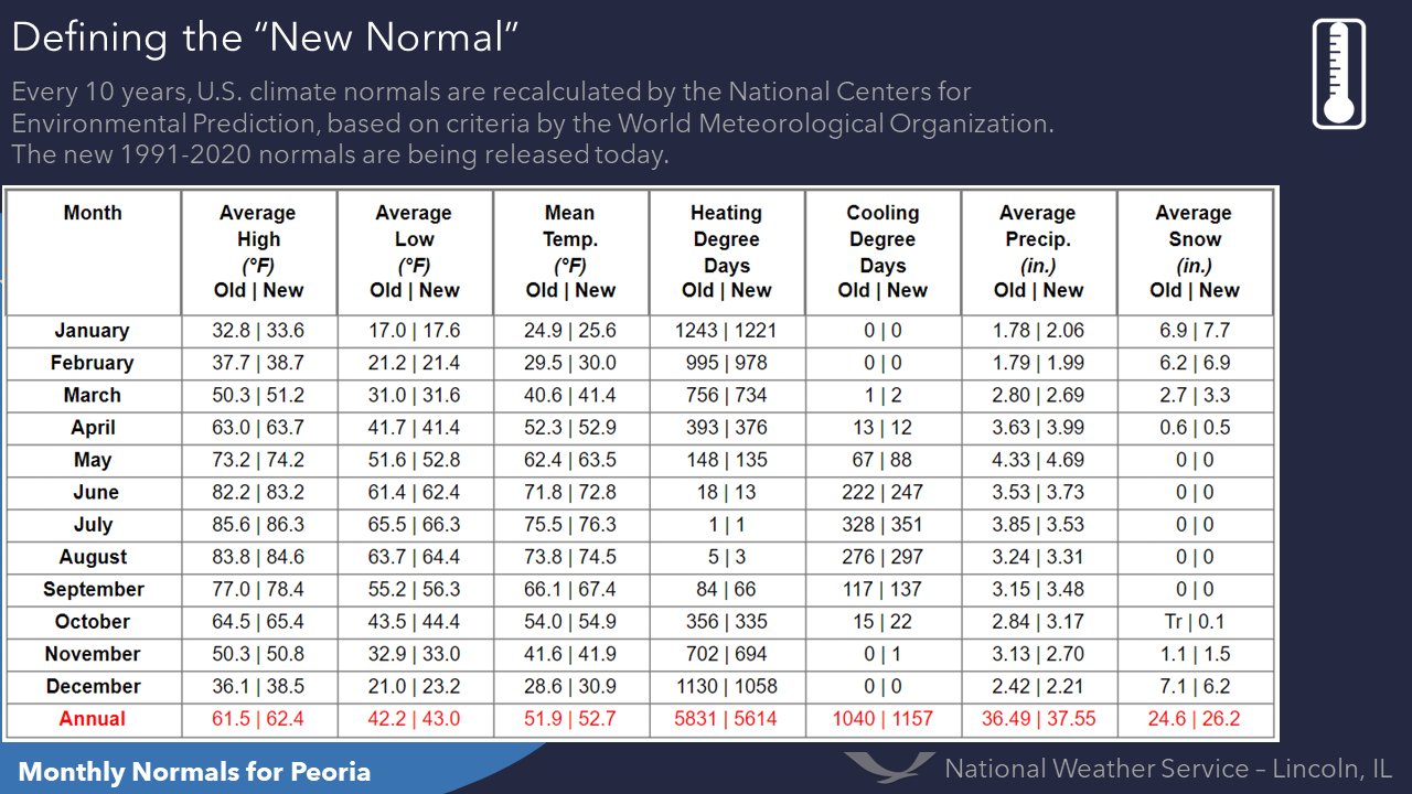
Below are the new monthly climate normals for Peoria and Springfield. Both locations had temperatures increase each month since the last normals were released a decade ago, with December being the most noticeable. Precipitation and snowfall are each about 1-1.5" higher than before for the year. More information about the new climate normals and how they are determined can be found here.
 |
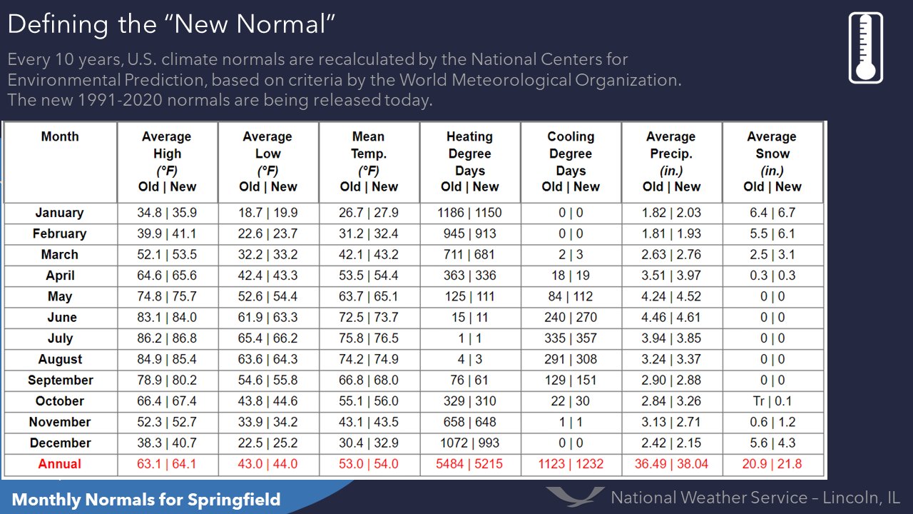 |
| Peoria New vs. Previous Climate Normals | Springfield New vs. Previous Climate Normals |
 |
Media use of NWS Web News Stories is encouraged! Please acknowledge the NWS as the source of any news information accessed from this site. |
|
US Dept of Commerce
National Oceanic and Atmospheric Administration
National Weather Service
Central Illinois
1362 State Route 10
Lincoln, IL 62656
217-732-7321 (forecast recording) or 217-732-3089
Comments? Questions? Please Contact Us.

