
Catastrophic Super Typhoon Bavi's eyewall has reached Rota and is expected to bring dangerous winds, heavy rainfall and storm surge to Guam, Rota, Tinian and Saipan. A Typhoon Warning remains in effect. Heavy to excessive rainfall will continue to bring a flooding threat from coastal Mid-Atlantic to southern New England through Monday. Read More >
Central Illinois
Weather Forecast Office
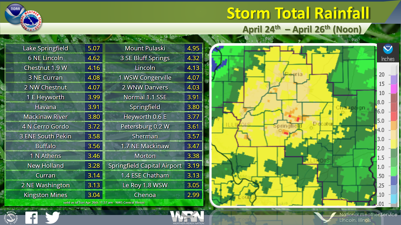
Several rounds of heavy rain impacted central and eastern Illinois. Rain totals from Friday April 24th until Sunday April 26th at Noon, were heaviest between the Illinois River Valley and the I-55 corridor, where 2.50 to 5.00 inches of accumulation occurred. Totals in east central Illinois, from Shelbyville to Champaign/Urbana and eastward ranged from 1.00 to 2.50 inches.
US Dept of Commerce
National Oceanic and Atmospheric Administration
National Weather Service
Central Illinois
1362 State Route 10
Lincoln, IL 62656
217-732-7321 (forecast recording) or 217-732-3089
Comments? Questions? Please Contact Us.

