Central Illinois
Weather Forecast Office
|
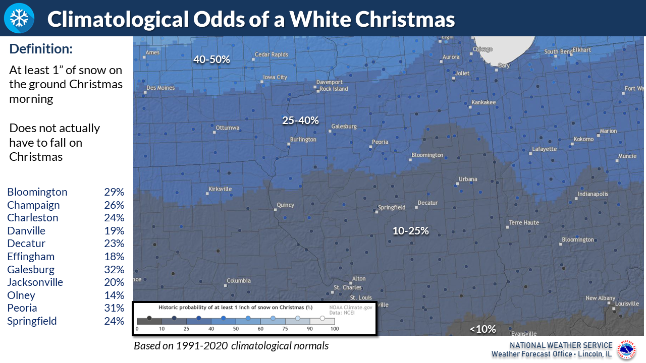
Across Illinois, there is normally a wide range in White Christmas chances. A White Christmas is defined as having at least 1 inch of snow on the ground Christmas morning. As one might expect, chances increase the further north you go across the state. Across the northern third of the state, odds are generally in the 40-60% range, with 20-30% in central Illinois, and less than 20% in the southern parts of the state. An interactive map is available at the following link:
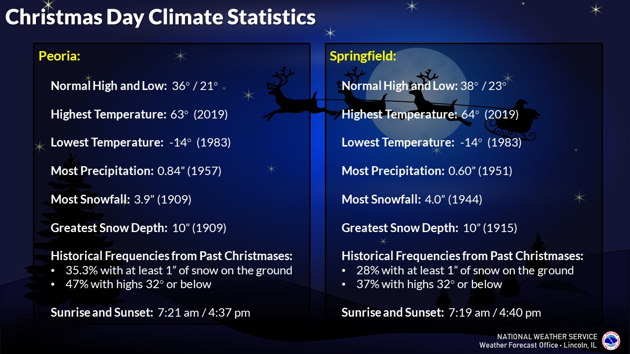
Specific Christmas Day climate statistics are available for Peoria and Springfield.
|

US Dept of Commerce
National Oceanic and Atmospheric Administration
National Weather Service
Central Illinois
1362 State Route 10
Lincoln, IL 62656
217-732-7321 (forecast recording) or 217-732-3089
Comments? Questions? Please Contact Us.


 Follow us on X
 Follow us on Facebook
 Follow us on YouTube
 ILX RSS Feed