
Tropical Depression Two is expected to gradually strengthen and could bring tropical storm conditions to the Florida Panhandle beginning late Monday. Areas of flash flooding will be possible through Thursday along the eastern and central Gulf Coast. Severe thunderstorms will develop and move along a cold front crossing the Upper Midwest Monday, and through the Ohio Valley/Mid-Atlantic on Tuesday. Read More >
Grand Rapids, MI
Weather Forecast Office
.png)
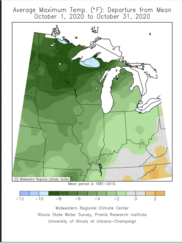
Temperatures averaged below normal across all of Michigan. The coldest departures from normal were over the Western Upper Peninsula where temperatures averaged more than 10 degrees below normal.
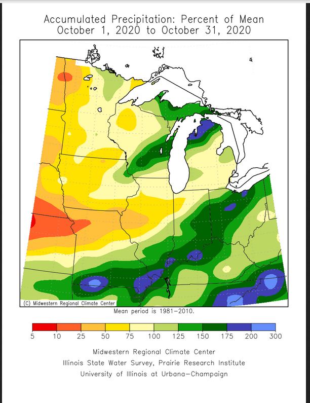
Precipitation was below normal across all of the southern 2/3 of Lower Michigan. The northern 1/3 of lower Michigan had above normal precipitation.
Traverse City had the greatest monthly precipitation of any NWS network climate reporting station in Lower Michigan with 6.57 inches.
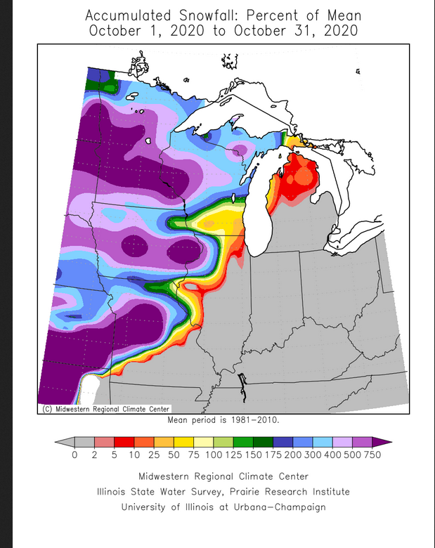
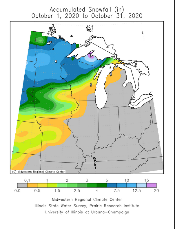
Snowfall fell in record or near record amounts across Iowa, Minnesota, and parts of Wisconsin and the Michigan Upper Peninsula.
Marquette Michigan recorded 22.1" of snow in October, that now stands as there all time record snowfall for October. The old record was 18.6" in 1979.
US Dept of Commerce
National Oceanic and Atmospheric Administration
National Weather Service
Grand Rapids, MI
4899 Tim Dougherty Drive SE
Grand Rapids, MI 49512-4034
616-949-0643
Comments? Questions? Please Contact Us.

