
Remnant moisture from Tropical Storm Rachel will persist over portions of the Great Basin and Southwest on Monday, bringing a potential heavy to excessive rainfall risk. Well above average and potentially record breaking temperatures will develop across the Plains and Midwest early this week, spreading into the Lower Mississippi Valley and Southeast midweek. Read More >
Grand Rapids, MI
Weather Forecast Office
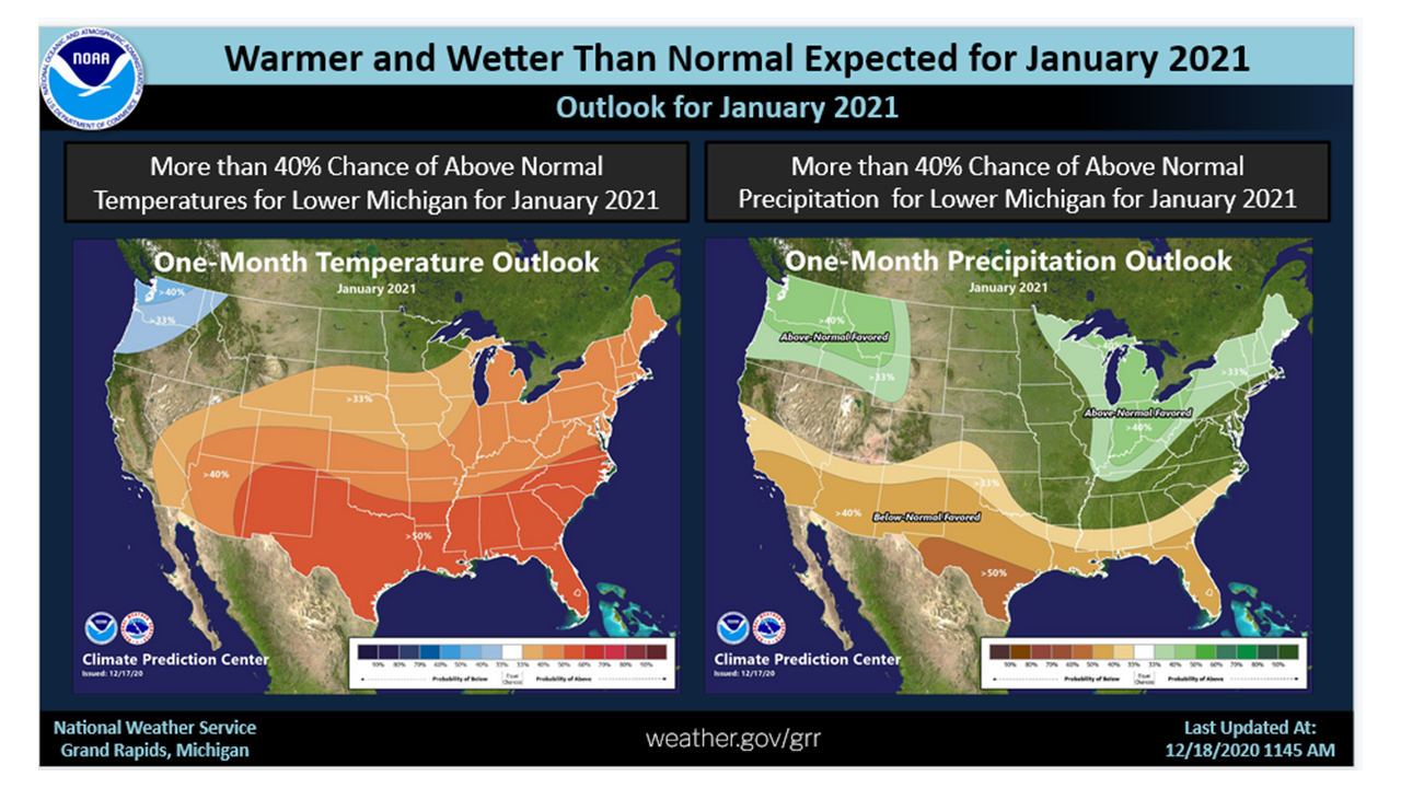
Overall, the month of January in Southwest Lower Michigan is expected to be warmer and wetter than normal. That is not to say we will not have periods of very cold temperatures, but that the warmer periods, when the entire month is averaged, will prevail. For the last 10 Januarys, 5 were warmer than normal, 2 were colder than normal and 3 where near normal between 2011 and 2020. As for precipitation, there was 5 Januarys that were wetter than normal, 4 were near normal and there was 1 below normal precipitation for the Januarys between 2011 and 2020. There is clearly a trend toward wetter Januarys. This used area wide data all of our long term climate stations averaged together.

US Dept of Commerce
National Oceanic and Atmospheric Administration
National Weather Service
Grand Rapids, MI
4899 Tim Dougherty Drive SE
Grand Rapids, MI 49512-4034
616-949-0643
Comments? Questions? Please Contact Us.


 Follow us on X
 Follow us on Facebook
 Follow us on YouTube
 GRR RSS Feed