
Tropical Depression Two is expected to gradually strengthen and could bring tropical storm conditions to the Florida Panhandle beginning late Monday. Areas of flash flooding will be possible through Thursday along the eastern and central Gulf Coast. Severe thunderstorms will develop and move along a cold front crossing the Upper Midwest Monday, and through the Ohio Valley/Mid-Atlantic on Tuesday. Read More >
Grand Rapids, MI
Weather Forecast Office
Here is a look at the past climatology trends from the past 30 years. This is not a forecast.
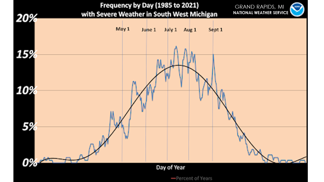
The first graphic shows the frequency by day of severe weather in Southwest Michigan from 1985 to 2021. The black line is the trend line. Typically the highest occurrence of severe weather is from June to September with peaks and lulls.
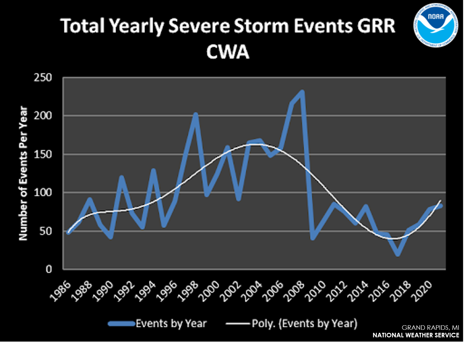
Second, is a graph showing the trends of severe storms from 1985 to 2021.
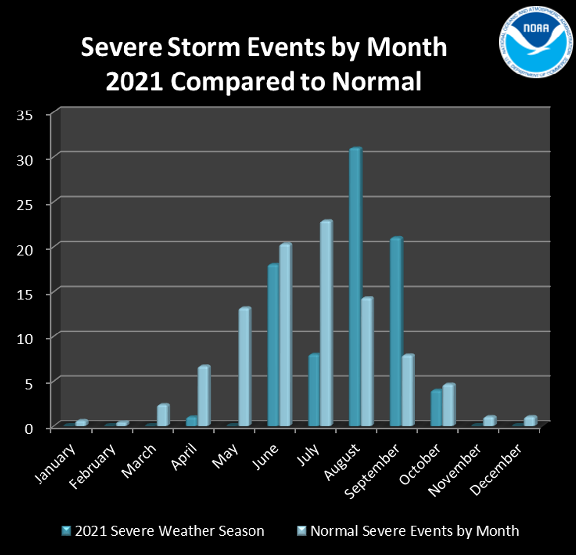
Lastly is a chart showing severe storm events from last year compared to normal. A severe storm event is large, damaging hail or damaging winds.
US Dept of Commerce
National Oceanic and Atmospheric Administration
National Weather Service
Grand Rapids, MI
4899 Tim Dougherty Drive SE
Grand Rapids, MI 49512-4034
616-949-0643
Comments? Questions? Please Contact Us.

