
Areas of rain and thunderstorms are forecast Monday across the central and eastern states. Some mixed rain and snow is possible in the high Sierra Mountains. Heavy to excessive rain may bring flooding in the central Appalachians. Read More >
Grand Rapids, MI
Weather Forecast Office
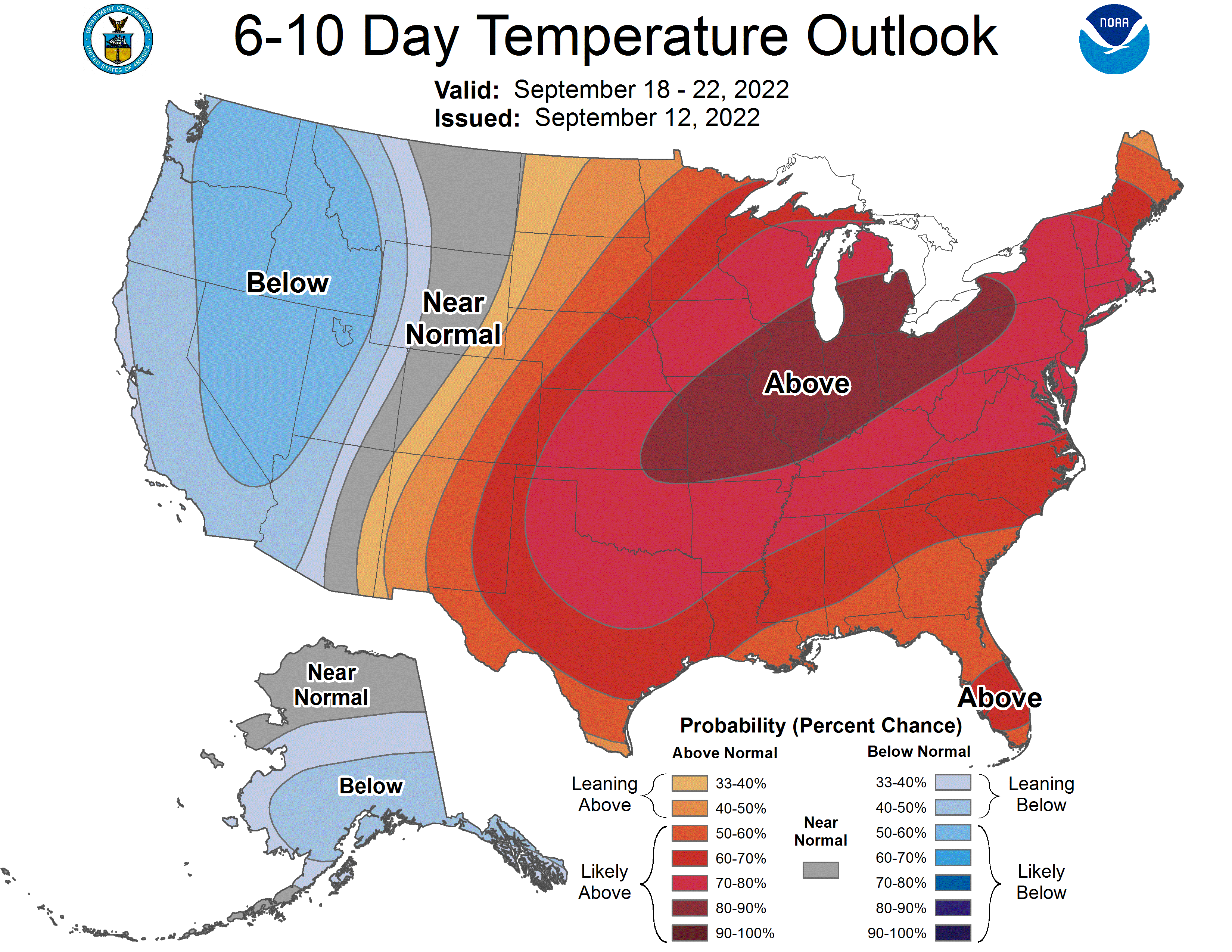
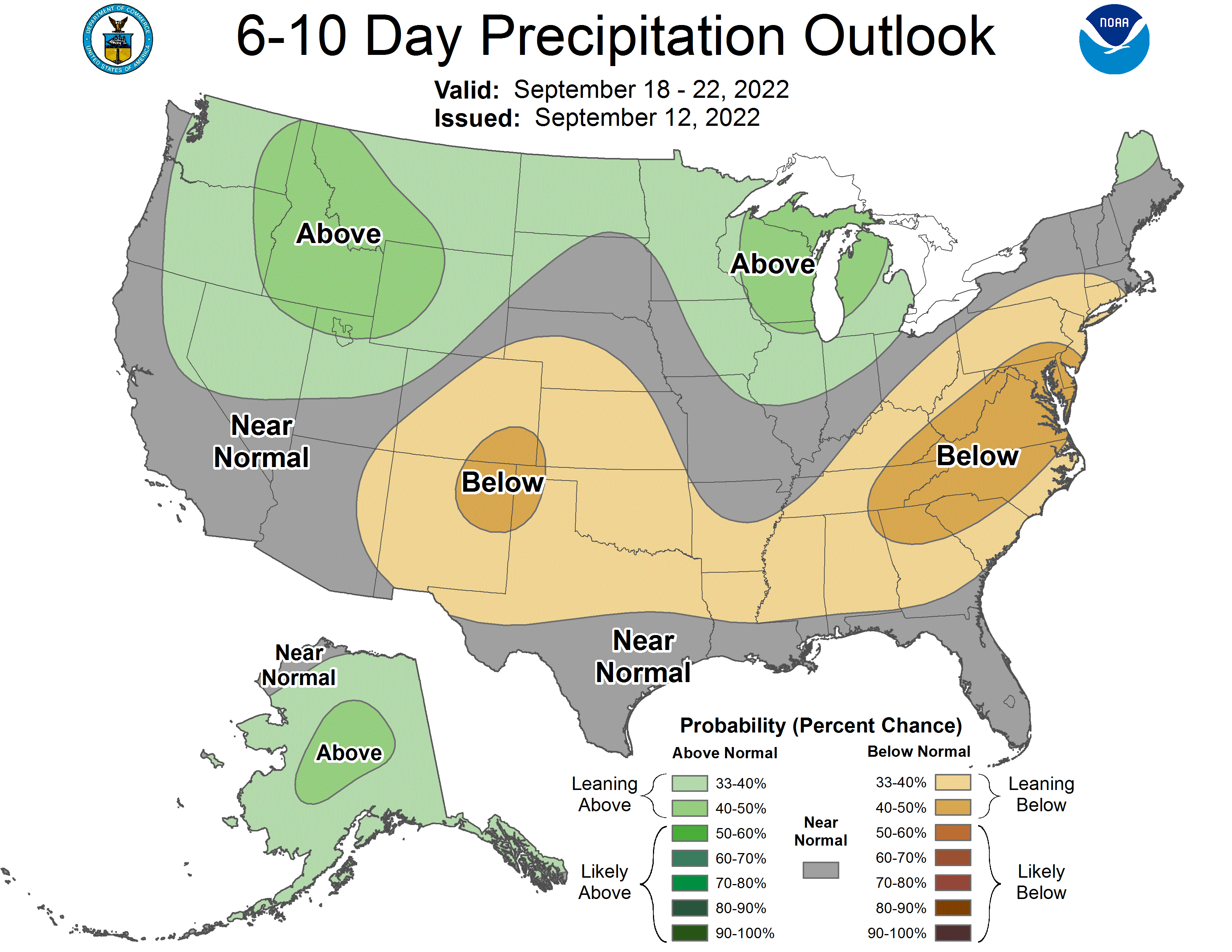
As we enter the Autumn season we will have a brief respite of cooler weather with a warmer period in the next 6 to 10 days. Below is a series of images and links from the Climate Predictions Center summizing the trends. After that 6 to 10 day period we wil return to a regularly scheduled fall of temperatures in a March towards winter.
.png)
Here is the Contiguous United States and for more infomration go here

US Dept of Commerce
National Oceanic and Atmospheric Administration
National Weather Service
Grand Rapids, MI
4899 Tim Dougherty Drive SE
Grand Rapids, MI 49512-4034
616-949-0643
Comments? Questions? Please Contact Us.


 Follow us on X
 Follow us on Facebook
 Follow us on YouTube
 GRR RSS Feed