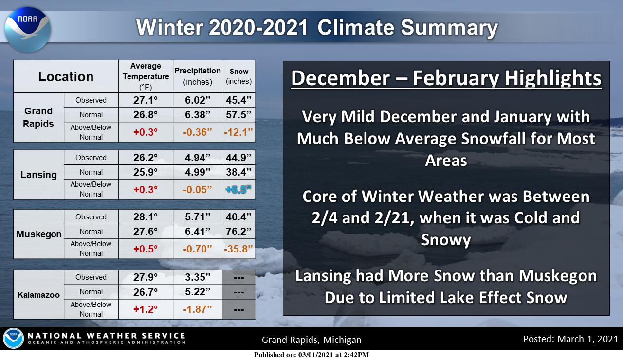
Gusty winds and dry conditions will continue to bring elevated to critical fire weather conditions to the southern Plains and Southeast early this week. A Pacific storm system will bring low elevation rain and heavy high elevation mountain snow to northern and central California through early week, expanding into the Pacific Northwest, Great Basin, and southern California on Tuesday. Read More >
Grand Rapids, MI
Weather Forecast Office

.png)
The snowfall on this map is from July 1st, 2020 through March 22th, 2021
The snowfall difference map is the difference between the 2020-2021 snowfall map and the
1991 to 2021 Seasonal Normal from NCEI.
Links to our winter event summaries:
US Dept of Commerce
National Oceanic and Atmospheric Administration
National Weather Service
Grand Rapids, MI
4899 Tim Dougherty Drive SE
Grand Rapids, MI 49512-4034
616-949-0643
Comments? Questions? Please Contact Us.


.PNG)
.PNG)