
Tropical Depression Two is expected to gradually strengthen and could bring tropical storm conditions to the Florida Panhandle beginning late Monday. Areas of flash flooding will be possible through Thursday along the eastern and central Gulf Coast. Severe thunderstorms will develop and move along a cold front crossing the Upper Midwest Monday, and through the Ohio Valley/Mid-Atlantic on Tuesday. Read More >
Event Overview
 |
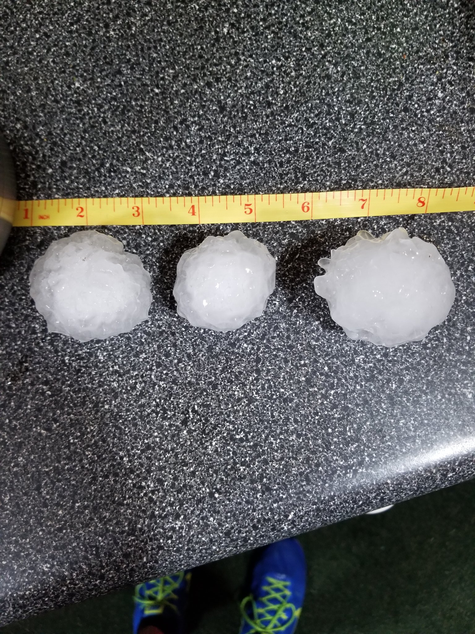
| Baseball (2.75") size hail that fell in Battle Creek during the evening of June 1st, 2019. Photo courtesy of Jadon Carrasco. |
On June 1st, 2019, two rounds of severe thunderstorms went through western Lower Michigan. The first round brought damaging winds to Mason County, especially around Ludington, and quarter (1.00") to golf ball (1.75") size to Jackson county. The second round brought significant large hail as large as baseballs (2.75") to the Battle Creek and surrounding areas as well is widespread wind damage across Allegan, Barry, and Eaton counties. Outside of the worst weather, pea to penny (0.25-0.75") size hail was reported across much of western Lower Michigan throughout the day.
Fast Facts:
- The 2.75" hail that fell in Battle Creek was the largest hail reported in western Lower Michigan since 7/4/2012 (when 2.75" hail fell in Mecosta county).
Stories Made by Neighboring Offices:
Damaging winds in Mason, Allegan, Mason, and Eton Counties
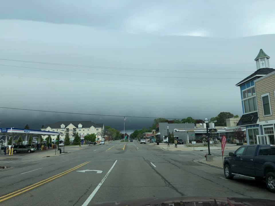
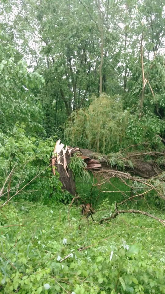
During the morning hours, a decaying line of thunderstorms moved over Lake Michigan and into Mason and Oceana counties. While the radar presentation of the thunderstorms was not impressive, we believe a "bore"-like feature propagated through Lower Michigan leading to a period of strong to damaging winds downing trees and power lines. An observation site at Big Sable Point measured a wind gust of 55 mph with 40-50 mph wind gusts observed along the lakeshore, with reports of downed trees as far east as Montcalm county. This situation was hard to forecast but nonetheless still very impactful. At one point in time, most of the city of Ludington was without power on June 1st.
The winds also led to a rise in water levels along the shoreline of Ludington, with the NOS Gauge about 1.5 miles inland from the open water measuring a 1.5 ft rise as the decaying thunderstorms moved overhead. A water rise of nearly 5 feet was reported along the immediate lakeshore with both piers around Ludington Harbor submerged in water. The record high Lake Michigan water levels likely contributed to the localized effect.
During the evening hours, a line of thunderstorms that originally developed in eastern Wisconsin raced across Lake Michigan and impacted areas from Allegan to Eaton counties. The cities of Allegan and Hastings were especially hard hit with numerous reports of downed tree limbs and power outages. Wind gust speeds likely exceeded 60 mph in the hardest-hit areas.
 |
 |
 |
 |
| Dramatic shelf cloud as seen in Ludington. Photo courtesy of Julie Giles Sherlock. | Shelf cloud as seen in Ludington. Photo courtesy of Chandra Rae. | Trees down in the Ludington area. Photo courtesy of Chandra Rae. | Trees down near Shelbyville. Photo courtesy of Bruce and Jodi Vitale Haveman. |
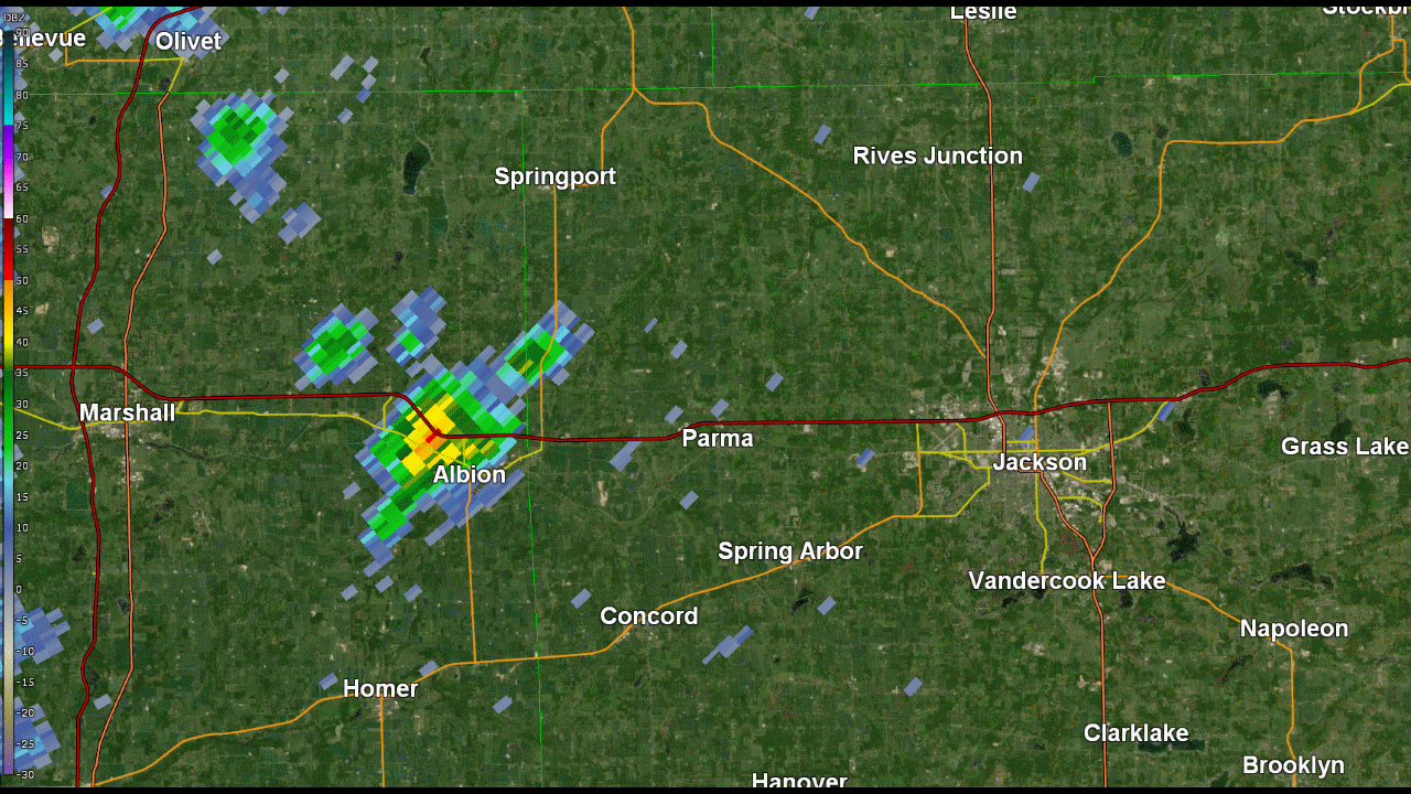
Jackson County Hailstorm:
​During the early afternoon hours, a severe thunderstorm developed rapidly in eastern Calhoun and western Jackson county and produced 1.0-1.75" hail from Albion to Parma.
 |
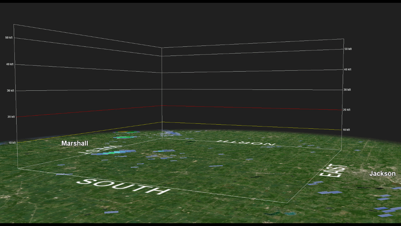 |
| Lowest-scan radar reflectivity from KGRR (Grand Rapids) from 12:20 to 12:58 PM EST. The pink and purple areas are regions of large hail. | Composite "3-D" radar reflectivity from KGRR (Grand Rapids) from 12:20 to 12:58 PM EST. The pink and purple areas are regions of large hail. |
 |
 |
 |
| Hail that fell in Albion (estimated 1-1.25" in diameter). Photo courtesy of Melissa Brown. | Hail that fell in Spring Arbor. Photo courtesy of Paul Smith. | Hail that fell in Parma (estimated 1.5-1.75" in diameter). Photo courtesy of Jason Mulcahy. |
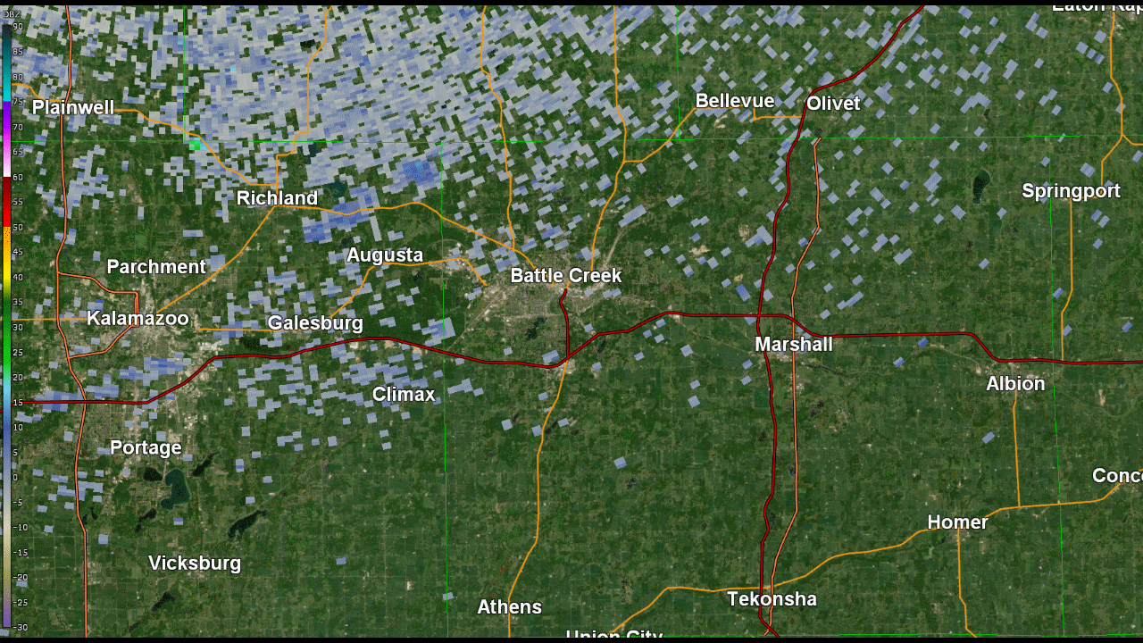
Battle Creek Hailstorm:
Around dinner time, thunderstorms developed rapidly along the edge of a southward-moving low-level wave across northern Calhoun and eastern Kalamazoo counties. The thunderstorms did not take long to become intense and started dropping 2-2.75" hail within only 15-20 minutes of developing right over the cities of Battle Creek and Climax. An overwhelming number of studies have shown that the largest hail (2" or greater) almost always are produced by supercell thunderstorms, or storms with rotating updrafts. Indeed, these thunderstorms were supercells with sustained mid-level rotation.
 |
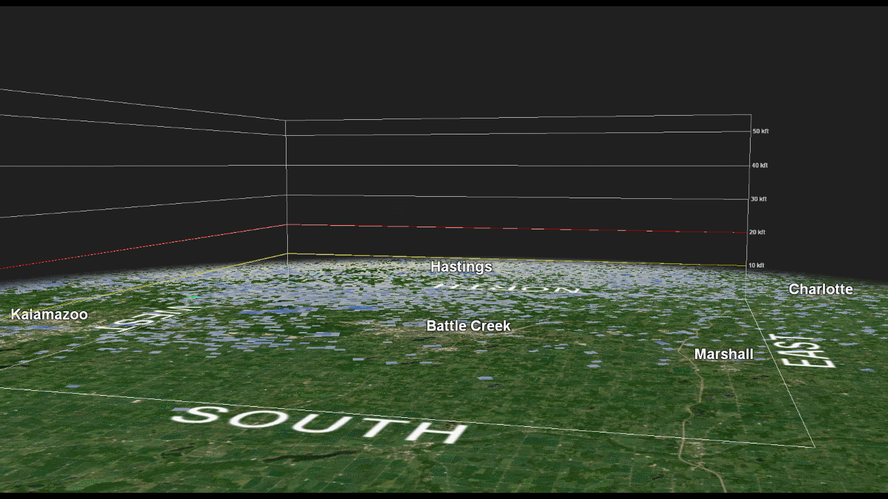 |
| Lowest-scan radar reflectivity from KGRR (Grand Rapids) from 6:04 to 7:20 PM EST. The pink and purple areas are regions of large hail. | Composite "3-D" radar reflectivity from KGRR (Grand Rapids) from 6:04 to 7:20 PM EST. The pink and purple areas are regions of large hail. Note how fast the pink areas appear--only 20 minutes after the storms developed! |
Hailstones greater than 2" in diameter are rare in Michigan, but they are large enough to cause significant damage to property. A hit in the head with such a large hail stone can also kill animals and even people. As a result of the large hail, numerous windows were smashed in cars and homes across Battle Creek and Climax.
.png) |
 |
 |
 |
| Hail that fell in Battle Creek (estimated 2.75" in diameter). Photo courtesy of Jadon Carrasco. | Hail that fell in Battle Creek. Photo courtesy of Donnie Lithander. | Hail that fell in Battle Creek. Photo courtesy of @SkinnyJoe on Twitter. | Hail that fell in Climax. Photo courtesy of Sally Ellis. |
 |
 |
 |
 |
| Damage to windows of a car in Battle Creek. Photo courtesy of Becky Thomas. | Damage to a vehicle in Battle Creek. Photo courtesy of Kathy Meyer. | Damage to a metal roof of a porch in Battle Creek. Photo courtesy of Chuck Ahrens. | Hail that fell in Springfield. Photo courtesy of Cindy Coffman. |
The majority of strong to violent tornadoes are produced from supercells. Thankfully, conditions were not quite right for tornadoes during the event, though there were several reports of funnels across Calhoun county.
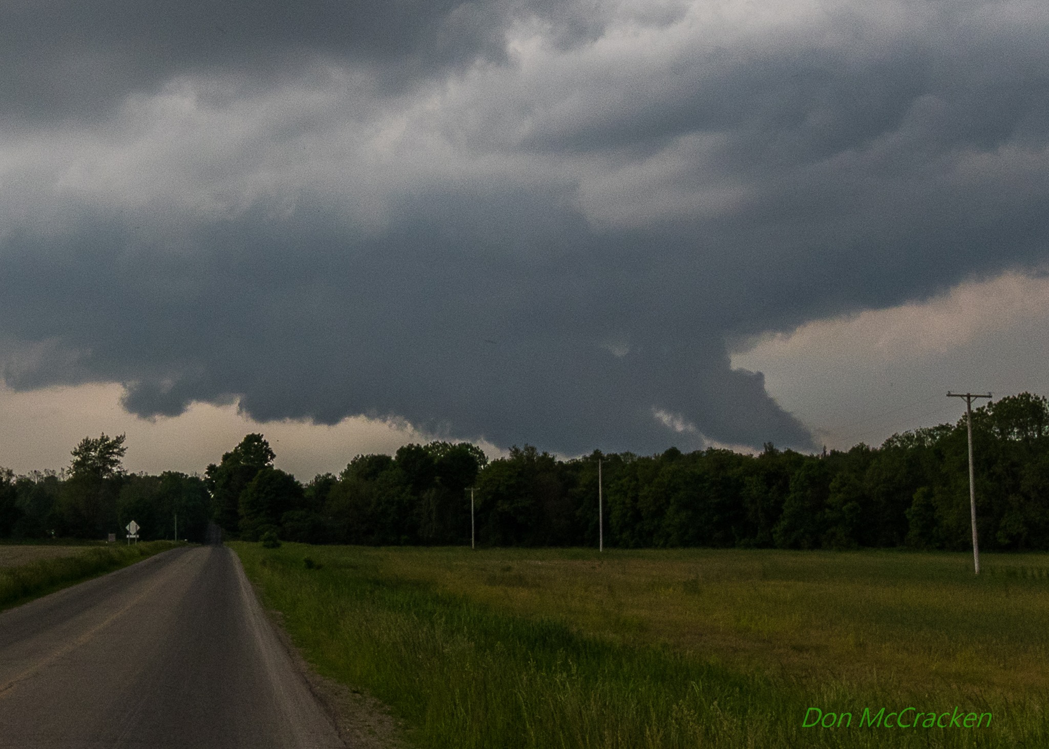 |
| Picture of a wall cloud located near the southern border of Calhoun county. There were many reports of funnels with these supercell thunderstorms. Thankfully, nothing touched down. Photo courtesy of Don McCracken. |
Summary:
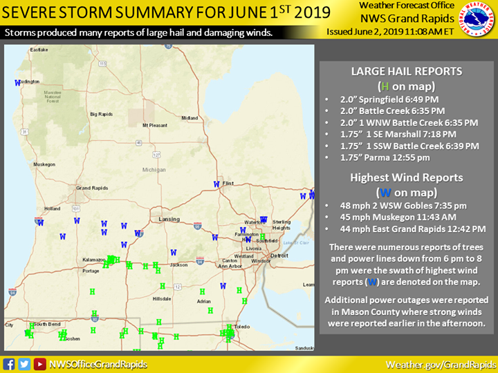
Overall, June 1st was an active day across Lower Michigan. It's not often we have to deal with two rounds of severe thunderstorms in one day. Below is a radar loop from roughly 10 AM to 10 PM as well as a map summarizing all the reports across the area.
 |
 |
Thank you to everyone who gave us permission to use their photos! Media use of NWS Web News Stories is encouraged! |
|

