
Heat expands across the Desert Southwest, Plains, Mississippi Valley and Midwest into Monday. Fire weather concerns continue for portions of the Intermountain West. Active monsoonal moisture fuels thunderstorms over the Southwest with possible flash flooding. Tropical cyclone Fausto in the Pacific, should weaken as it approaches Hawaii; Dangerous surf, swells and rip currents are expected. Read More >
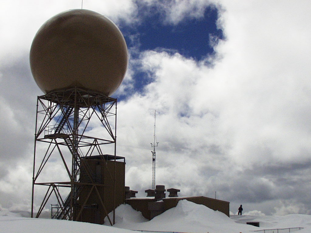
Grand Junction, CO
Weather Forecast Office
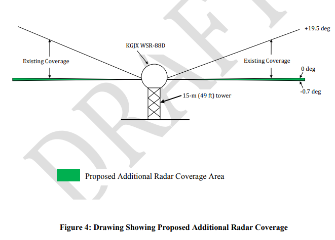
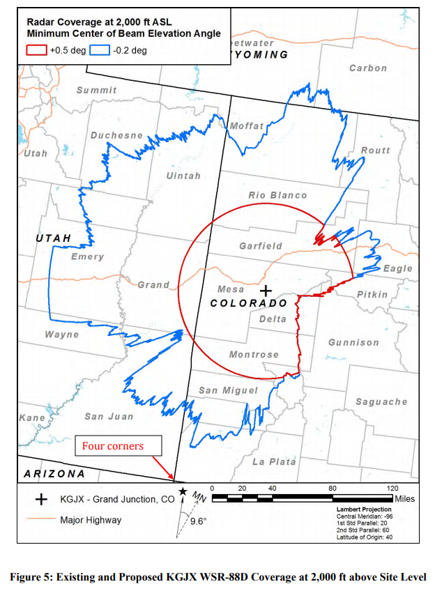
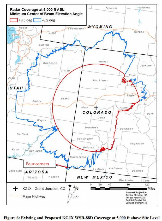
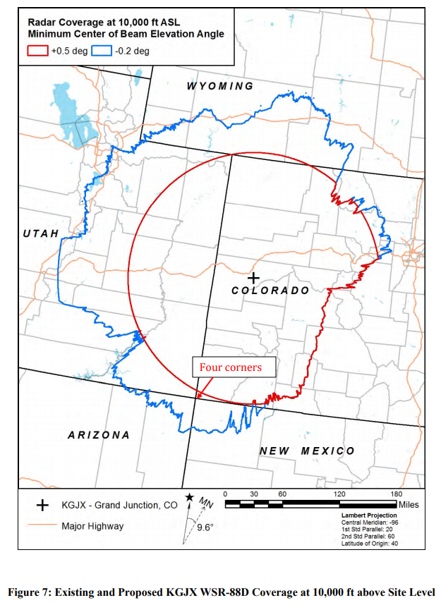
The National Weather Service is proposing to lower the elevation scan of the WSR-88D
Doppler Radar in Grand Junction, CO. This will allow for better scanning of the atmosphere
from a radar that is located over 10,000 feet in elevation. These improvements will provide
better radar coverage for much of eastern Utah and western Colorado.

A Draft Environmental Assessment (EA) for lowering the minimum scan angle of the
Weather Surveillance Radar-Model 1988 Doppler (WSR-88D) serving the Grand Junction,
CO, area is now available for public comment. The Draft EA document can be obtained at:
DRAFT Environmental Assessment
A few images from the report can be seen below. |
 |
Proposed Additional Radar Coverage Area
Impacts to Coverage Area
Hazards
Detailed Hazards Viewer
National Briefing
Outlooks
Transportation Decision Support
Winter Storm Severity Index
Forecasts
Aviation Weather
Fire Weather
Forecast Discussion
Forecast Points
Local Area
Severe Weather
Soaring Forecast
Winter Weather
Hydrology
Recreational River Report
River Forecast
Weather Safety
Preparedness
NOAA Weather Radio
StormReady
SkyWarn
US Dept of Commerce
National Oceanic and Atmospheric Administration
National Weather Service
Grand Junction, CO
2844 Aviators Way
Grand Junction, CO 81506-8644
970-243-7007
Comments? Questions? Please Contact Us.

