
Tropical Depression Two is expected to gradually strengthen and could bring tropical storm conditions to the Florida Panhandle beginning late Monday. Areas of flash flooding will be possible through Thursday along the eastern and central Gulf Coast. Severe thunderstorms will develop and move along a cold front crossing the Upper Midwest Monday, and through the Ohio Valley/Mid-Atlantic on Tuesday. Read More >
Grand Junction, CO
Weather Forecast Office
Southwest winds will increase today ahead of an approaching cold front, set to move through the area tonight and bring cooler temperatures with it. Stronger winds will mix to the surface given warmer daytime surface heating, despite presence of scattered to broken cloud cover. Winds will be strongest across eastern Utah and far western Colorado, where a wind advisory is in effect through 10 pm today. Winds in the lower elevations under the wind advisory could gust as high as 55 mph, while the higher elevations under the wind advisory could gust as high as 65 mph. Breezy conditions will continue overnight as the front passes through. Some showers are possible today and Friday, but most will be high based with virga only enhancing the wind gusts at the surface.
Unsettled weather looks in store late Sunday into much of the coming week as a stronger and cooler trough moves into the Great Basin and affects the western slope, bringing more widespread showers and thunderstorms.
Animation of Forecasted Wind Gusts Today through Friday

Wind Advisory: Today through 10 pm (May 16)

Forecasted High Temperature Today

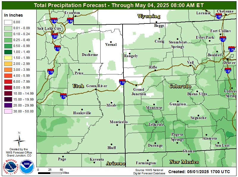
Total Precipitation Forecast
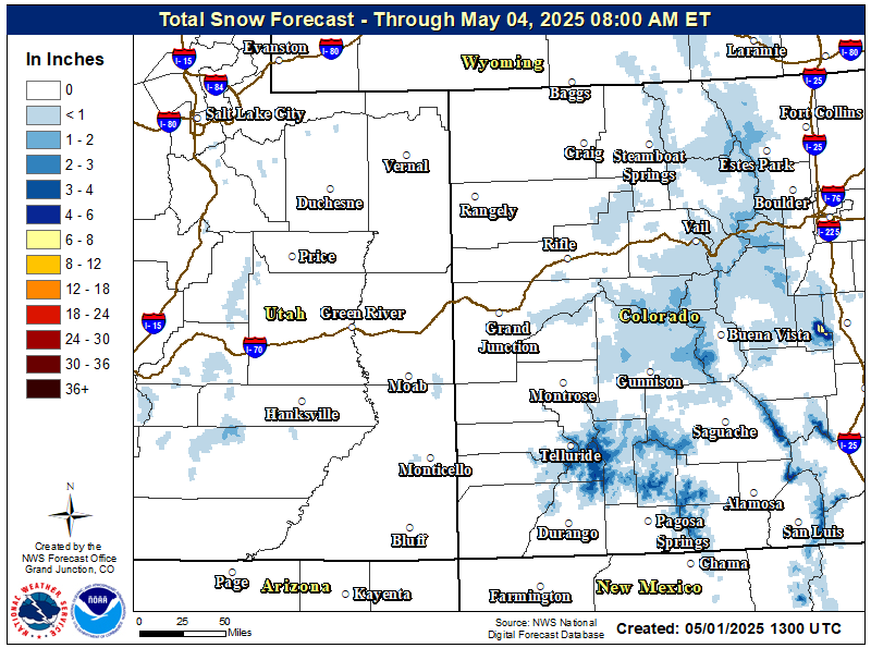
Total Forecasted Snow Accumulation
Hazards
Detailed Hazards Viewer
National Briefing
Outlooks
Transportation Decision Support
Winter Storm Severity Index
Forecasts
Aviation Weather
Fire Weather
Forecast Discussion
Forecast Points
Local Area
Severe Weather
Soaring Forecast
Winter Weather
Hydrology
Recreational River Report
River Forecast
Weather Safety
Preparedness
NOAA Weather Radio
StormReady
SkyWarn
US Dept of Commerce
National Oceanic and Atmospheric Administration
National Weather Service
Grand Junction, CO
2844 Aviators Way
Grand Junction, CO 81506-8644
970-243-7007
Comments? Questions? Please Contact Us.

