An atmospheric river will bring heavy rainfall to lower elevations of California this week, and heavy snow to the Sierra Nevada mountains. Flash flooding, some of which may be locally considerable, will be a concern on the western foothills of the Sierra Nevada mountains through Tuesday. Landslides, rockfalls and mudslides are possible in the Southern California mountains. Read More >
Grand Junction, CO
Weather Forecast Office
Red Flag Warnings in effect for Sunday!
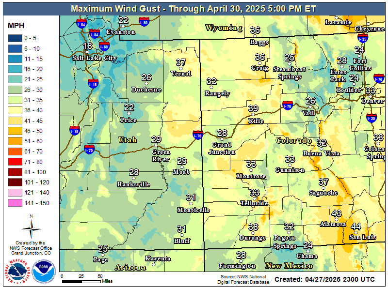
A dry weather system will move through the Rocky mountains this weekend. Winds will become even stronger on Sunday. In anticipation of critical fire weather conditions, Red Flag Warnings have been issued for much of eastern Utah and western Colorado where fuels are critical. Additionally, a Dense Smoke Advisory has been issued once again for the Highway 550 corridor from Molas Pass south to the New Mexico border tonight through Sunday morning, due to smoke from the 416 Fire north of Durango. Be sure to heed any road closures due to smoke and fire management activities. Also, due to critical fire weather conditions and strong winds expected this weekend, outdoor burning is strongly discouraged.
Red Flag Warnings shown in red through Sunday.
Strongest Winds Through Sunday
Hazards
Detailed Hazards Viewer
National Briefing
Outlooks
Transportation Decision Support
Winter Storm Severity Index
Forecasts
Aviation Weather
Fire Weather
Forecast Discussion
Forecast Points
Local Area
Severe Weather
Soaring Forecast
Winter Weather
Hydrology
Recreational River Report
River Forecast
Weather Safety
Preparedness
NOAA Weather Radio
StormReady
SkyWarn
US Dept of Commerce
National Oceanic and Atmospheric Administration
National Weather Service
Grand Junction, CO
2844 Aviators Way
Grand Junction, CO 81506-8644
970-243-7007
Comments? Questions? Please Contact Us.

