
Gusty winds and dry conditions will continue to bring elevated to critical fire weather conditions to the southern Plains and Southeast early this week. A Pacific storm system will bring low elevation rain and heavy high elevation mountain snow to northern and central California through early week, expanding into the Pacific Northwest, Great Basin, and southern California on Tuesday. Read More >
Grand Junction, CO
Weather Forecast Office
Hot temperatures continue today with some lower elevations reaching triple digits. In addition to the heat, critical fire weather conditions will occur across most lower elevations in eastern Utah and western Colorado this afternoon and evening due to the combination of low relative humidity, gusty winds and dry fuels. Dry westerly flow and hot temperatures will continue through the rest of this week.
Red Flag Warning from 12 PM until 8 PM Today

Today's High Temperatures

Today's Low Relative Humidity

Maximum Wind Gusts Today

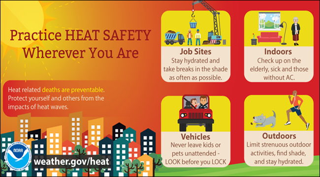
Beat the Heat: Follow These Heat Safety Tips to Stay Safe
Hazards
Detailed Hazards Viewer
National Briefing
Outlooks
Transportation Decision Support
Winter Storm Severity Index
Forecasts
Aviation Weather
Fire Weather
Forecast Discussion
Forecast Points
Local Area
Severe Weather
Soaring Forecast
Winter Weather
Hydrology
Recreational River Report
River Forecast
Weather Safety
Preparedness
NOAA Weather Radio
StormReady
SkyWarn
US Dept of Commerce
National Oceanic and Atmospheric Administration
National Weather Service
Grand Junction, CO
2844 Aviators Way
Grand Junction, CO 81506-8644
970-243-7007
Comments? Questions? Please Contact Us.

