National Weather Service United States Department of Commerce

Storm Impacting the Northwest U.S.; Fire Weather Conditions in Southern California; Severe Weather in the South

A Pacific storm is bringing areas of low elevation rain, moderate to heavy mountain snow, and high winds to the Northwest. Strong Santa Ana winds and very dry conditions are producing elevated to critical fire weather conditions in southern California. Isolated strong to severe thunderstorms are possible through early Wednesday morning across parts of northeast Texas into western Tennessee. Read More >

Click a location below for detailed forecast.

Last Map Update: Thu, Apr 3, 2025 at 4:12:09 pm CDT

There is a moderate Heat Risk today across Deep South Texas and the Rio Grande Valley due to the combination of high humidity and very warm temperatures. If you are spending time outdoors, make sure to take frequent breaks in the shade and stay hydrated.
There is a High Risk of life-threatening rip currents and elevated surf along the beaches of the lower Texas coast through this weekend. A High Surf Advisory is in effect until at least 7 PM Friday.
A Wind Advisory is now in effect for inland to coastal portions of Cameron, Willacy, and Kenedy counties until 5 PM this afternoon. Expect southeast winds of 25 to 35 mph, with gusts of 45-50 mph.
Small Craft Advisories remain in effect across all coastal waters through at least 7 AM Saturday, with hazardous conditions likely into next week.
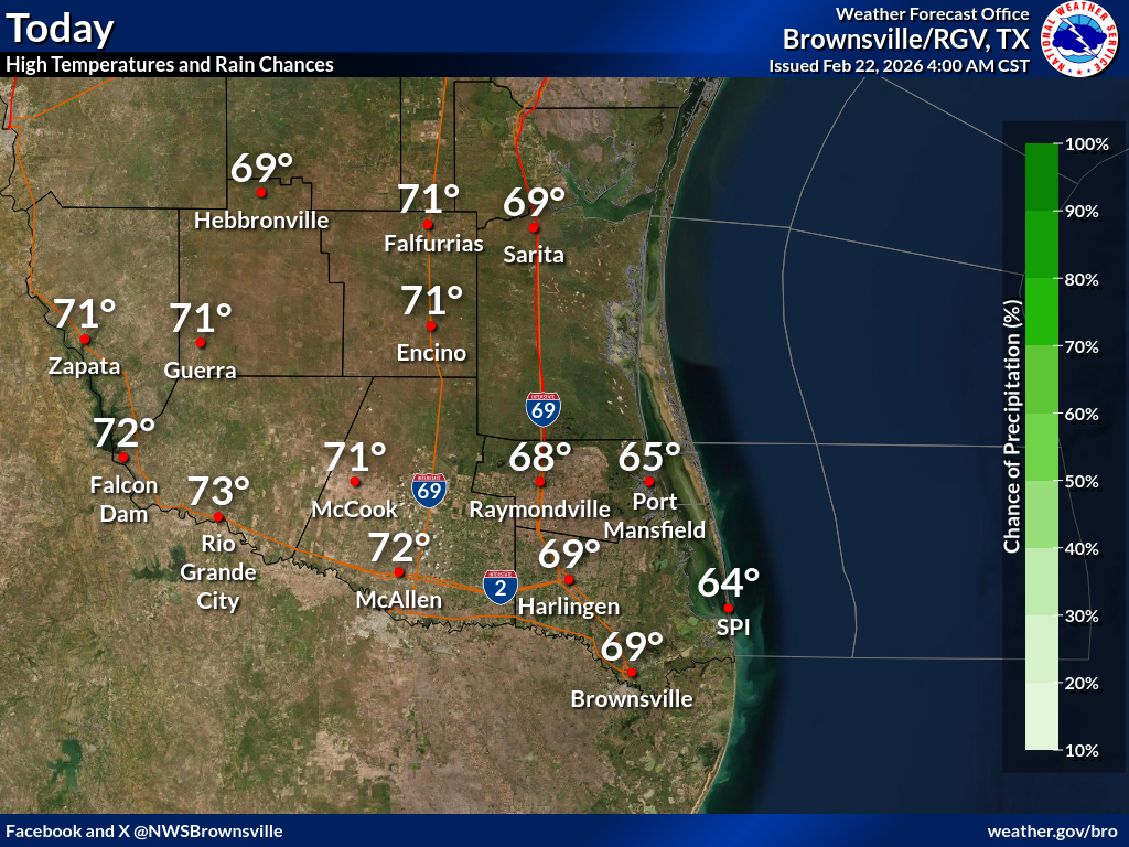
Unseasonably warm and dry conditions are expected to continue through the remainder of the workweek. Friday will be windy with winds out of the south-southeast. A cold front passes through late Saturday into Sunday bringing unseasonably cool air into the region. However, a warming trend begins to take place Monday of next week.
Tonight's low temperatures and rain chances.

 
Current Observations ( )
Location Sky/Weather Temp Dewpt RH Wind Baro Remarks
Brownsville
N/A
N/A
N/A
N/A
N/A
N/A
N/A
Harlingen
N/A
N/A
N/A
N/A
N/A
N/A
N/A
McAllen
N/A
N/A
N/A
N/A
N/A
N/A
N/A
Bayview
N/A
N/A
N/A
N/A
N/A
N/A
N/A
Weslaco
N/A
N/A
N/A
N/A
N/A
N/A
N/A
Edinburg
N/A
N/A
N/A
N/A
N/A
N/A
N/A
Zapata
N/A
N/A
N/A
N/A
N/A
N/A
N/A
Hebbronville
N/A
N/A
N/A
N/A
N/A
N/A
N/A
Falfurrias
N/A
N/A
N/A
N/A
N/A
N/A
N/A
Laredo
N/A
N/A
N/A
N/A
N/A
N/A
N/A
Kingsville
N/A
N/A
N/A
N/A
N/A
N/A
N/A
Alice
N/A
N/A
N/A
N/A
N/A
N/A
N/A
Notes:
  • In the Location column, click on links for a list of recent observations at sites of interest. A new window will open.
  • In the Wind column, the letter indicates direction the wind blows from (N=North, E=East, S=South, W=West, NE=Northeast, etc). VRB is "variable" and G is "gust". Wind speeds are in MPH.
  • In the Baro (pressure) column, values are in inches.
  • In the Remarks column, HX is the Heat Index and WCI is Wind Chill Index (if shown). These are "Feels Like" temperatures. VSB is Visibility. "N/A" will be displayed if values are not available.
 
Text Product Selector (Selected product opens in current window)


Beach Page Tropical Marine Weather Fire Weather Hazards Outlook Rivers-Flooding
Beach Tropical Marine Weather Fire Weather Hazards Outlook Rivers-Flooding
Observations Forecaster Discussion Satellite Preparedness NOAA Weather Radio Spanish Weather Radio
Observations Forecasters Discussion Satellite Preparedness Weather Radio Spanish Weather Radio
RGV Outreach Web Newsletter RGV Drought Rip Current Safety Flood Safety Skywarn
Outreach Newsletter Drought Rip Current Safety Flood Safety Skywarn
RGV Event Summaries Seasonal Outlooks RGV Storm Data Reports (short form) Research User Guides Skywarn
Event Summaries Seasonal Outlooks Storm Data Research User Guides Severe Weather Drill