Flood Outlook
Current Conditions
|
|
|
|
|
Current Vis/IR Loop (click for loop)
|
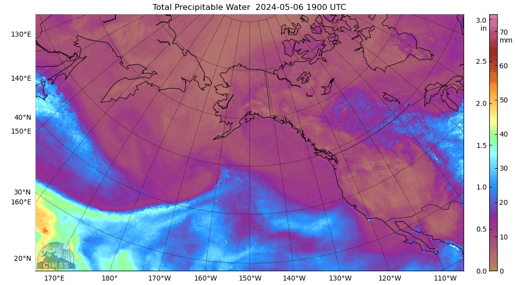
Total Precipitable Water Loop
|
|
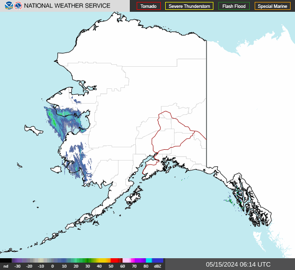
Alaska Mosaic Radar Loop
|
|
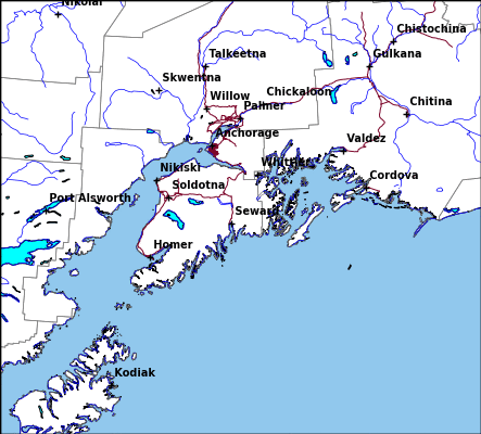
Kenai Radar Loop
|
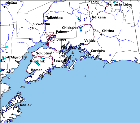
Middleton Radar Loop
|
Sitka Radar Radar Loop
|
|
Fairbanks Radar Loop
|
King Salmon Radar Loop
|
Bethel Radar Loop
|
|
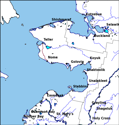
Nome Radar Loop
|
Observed Precipitation
|
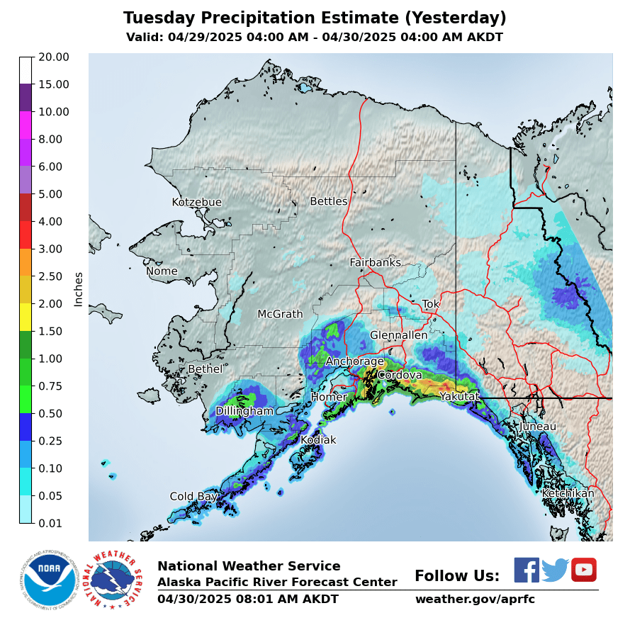
Yesterday
|
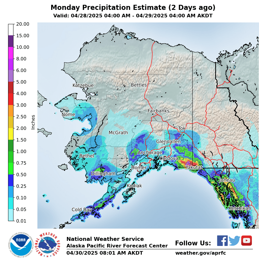
2 Days Ago
|
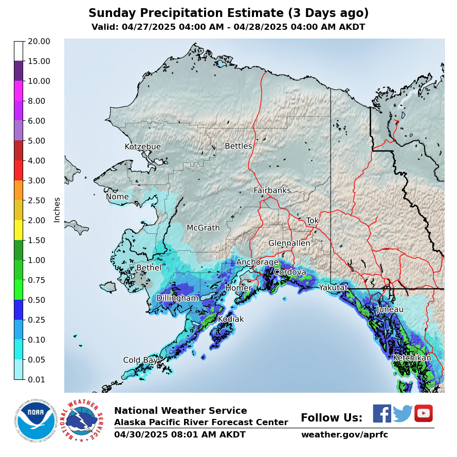
3 Days Ago
|
|
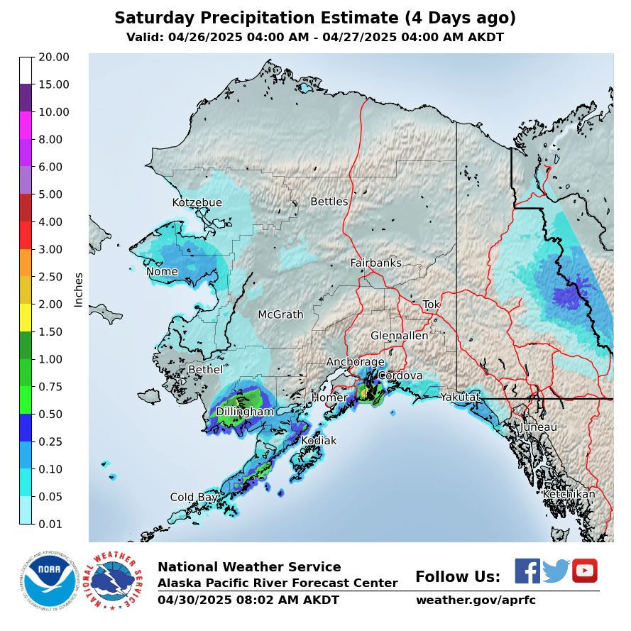
4 Days Ago
|
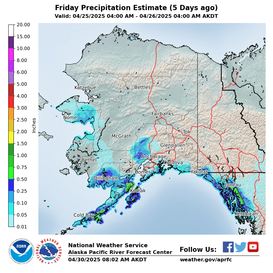
5 Days Ago
|
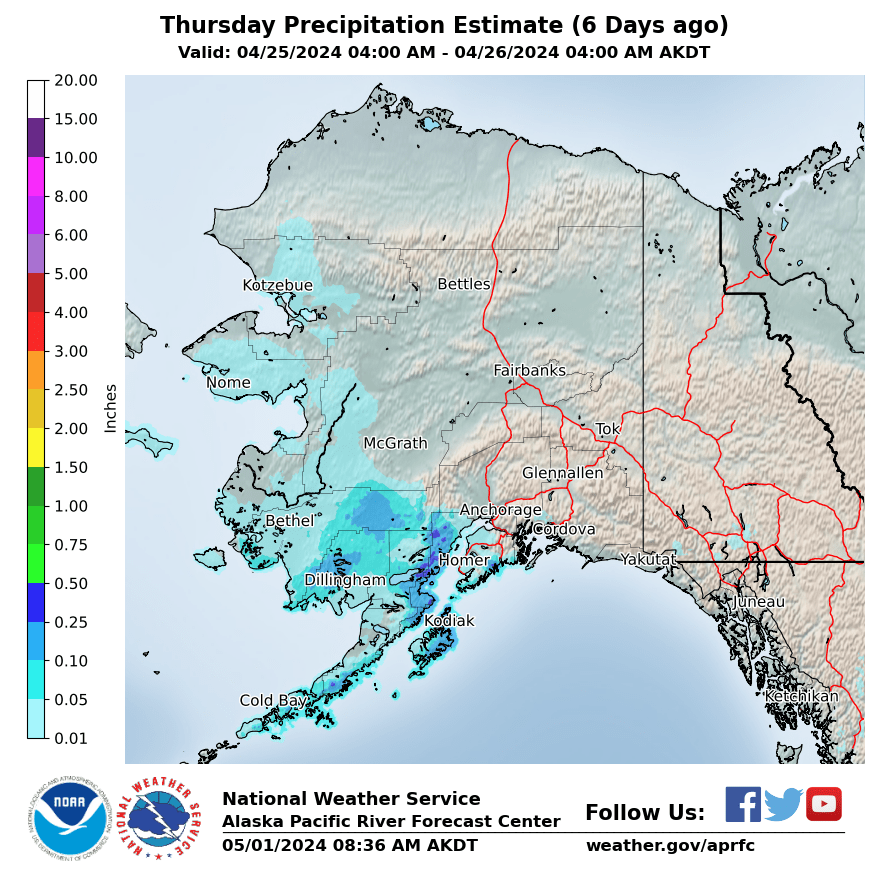
6 Days Ago
|
|
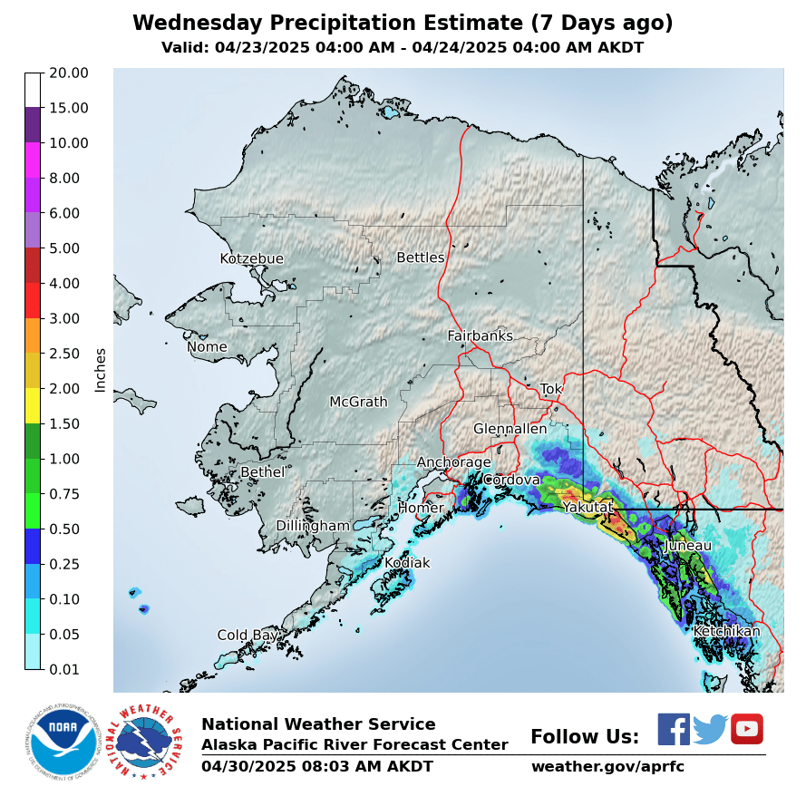
7 Days Ago
|
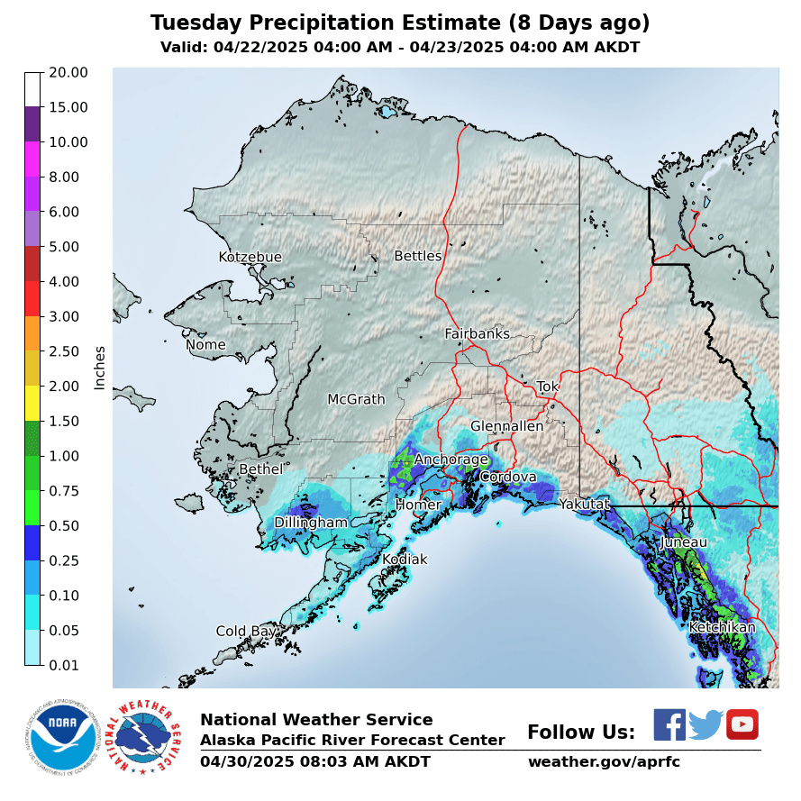
8 Days Ago
|
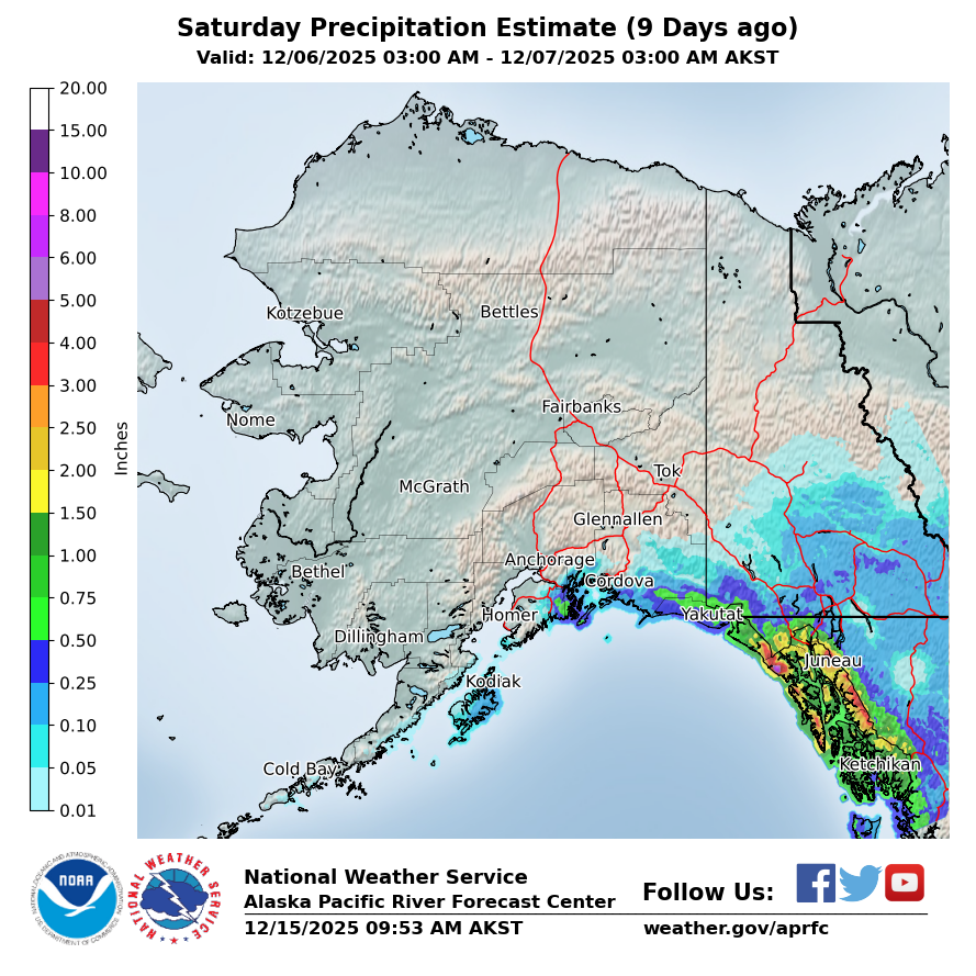
9 Days Ago
|
|
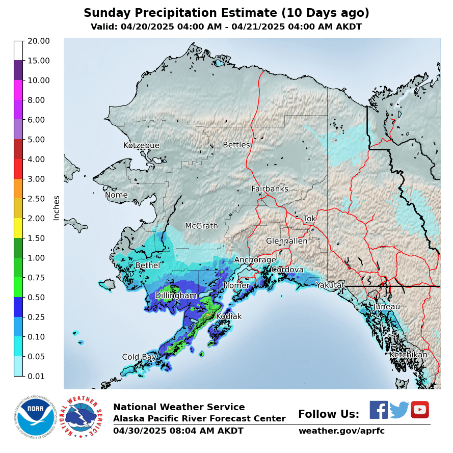
10 Days Ago
|
Forecasted Precipitation
|
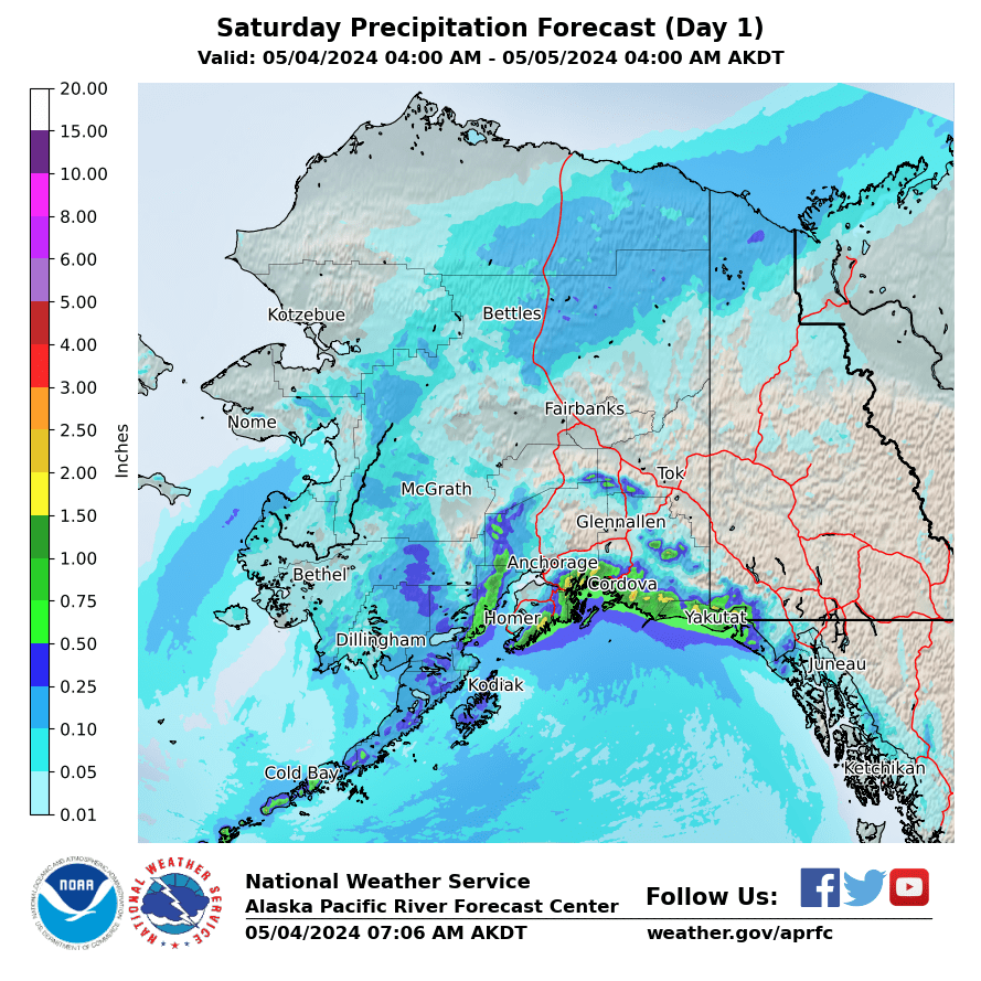
Day 1
|
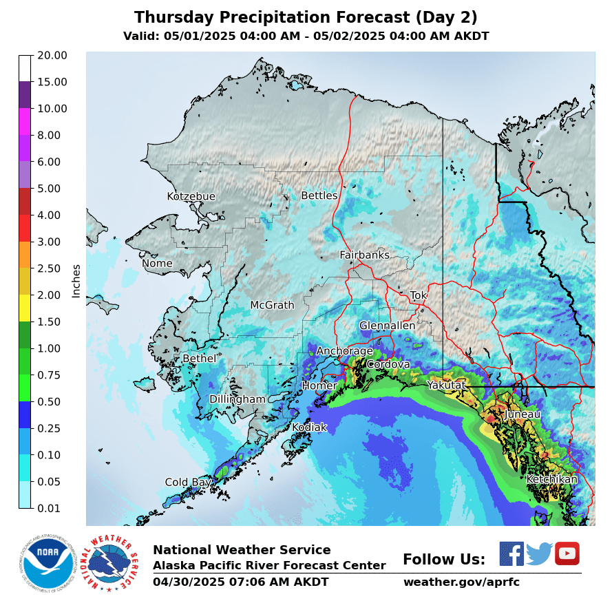
Day 2
|
Day 3
|
|
Day 4
|
Day 5
|
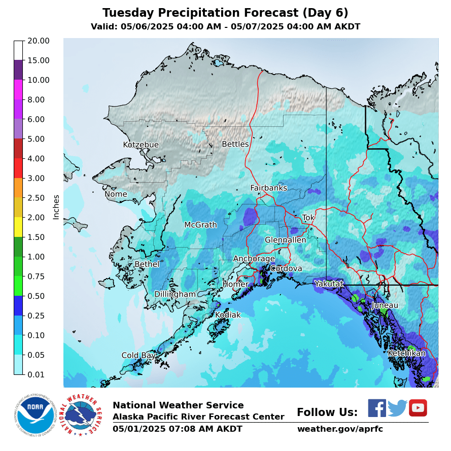
Day 6
|
|
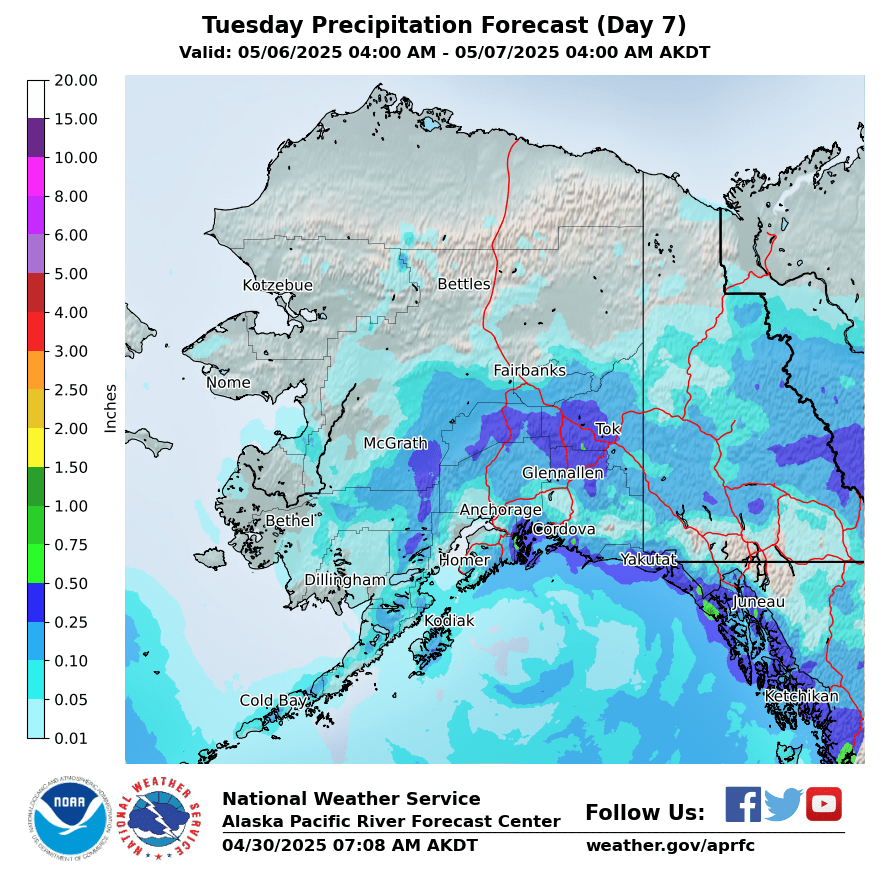
Day 7
|
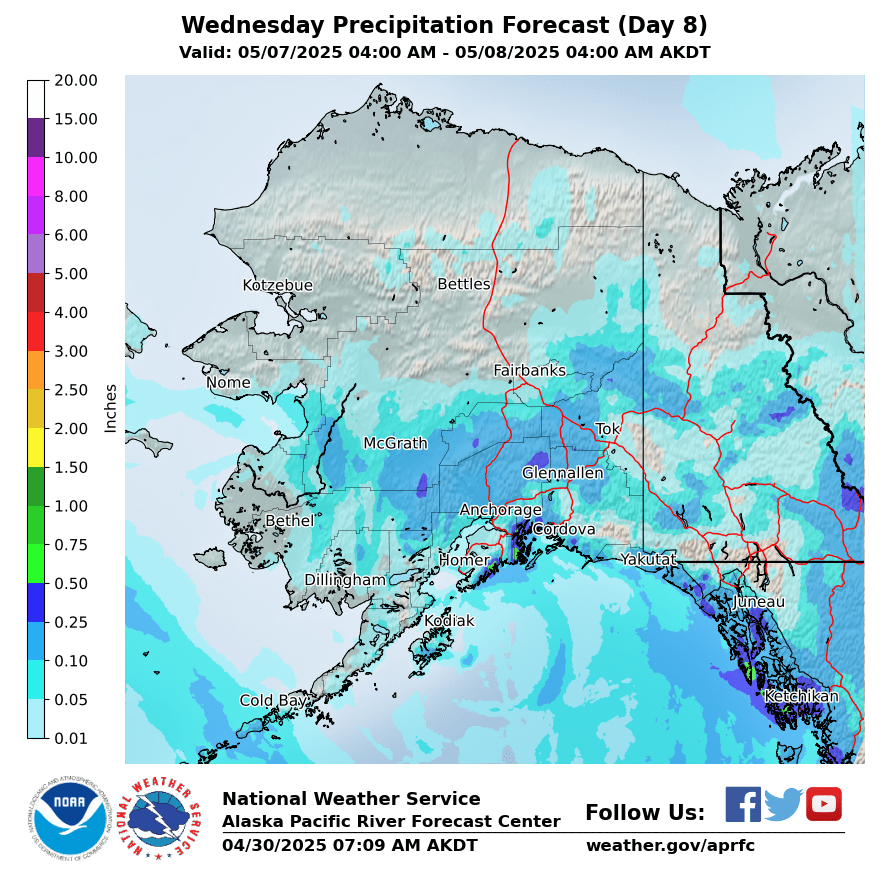
Day 8
|
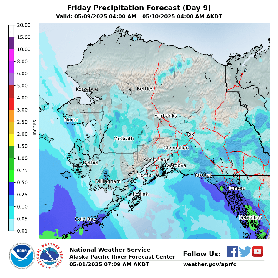
Day 9
|
|
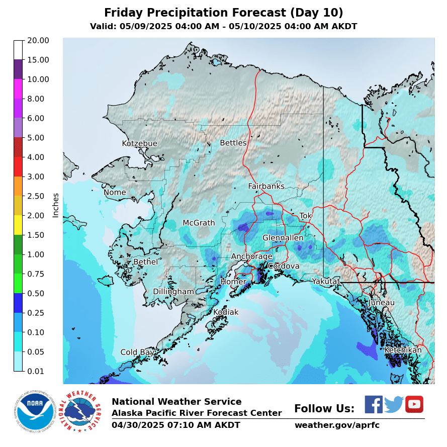
Day 10
|
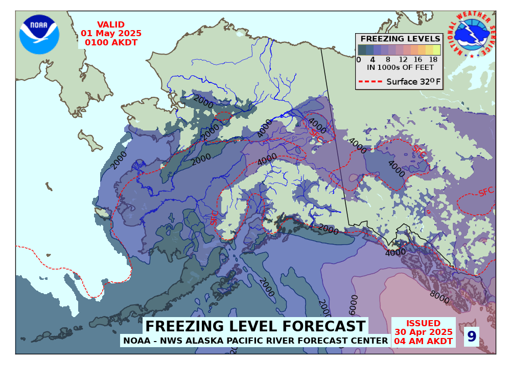
Forecasted Freezing Levels (click for Loop)
|
|
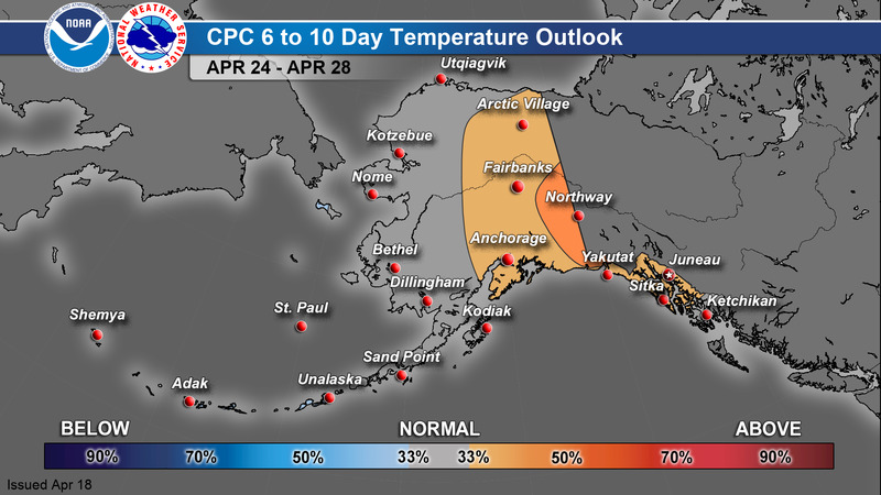
CPC 6-10 Day Outlook
|
Temperature
|
Precipitation
|
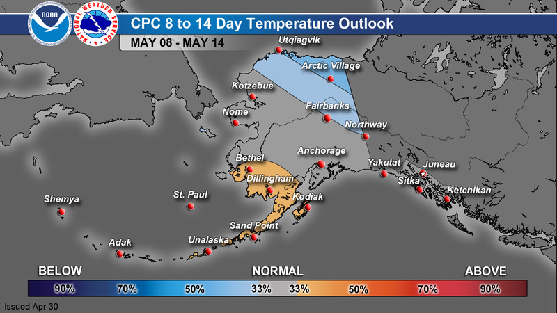
CPC 8-14 Day Outlook
|
Temperature
|
Precipitation
|
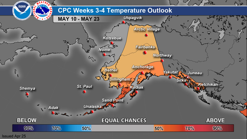
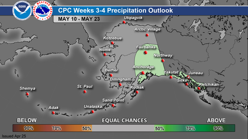
CPC Week 3-4 Outlook
|
Temperature
|
Precipitation
|
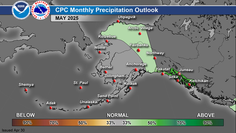
CPC 1 Month Outlook
|
Temperature
|
Precipitation
|
>
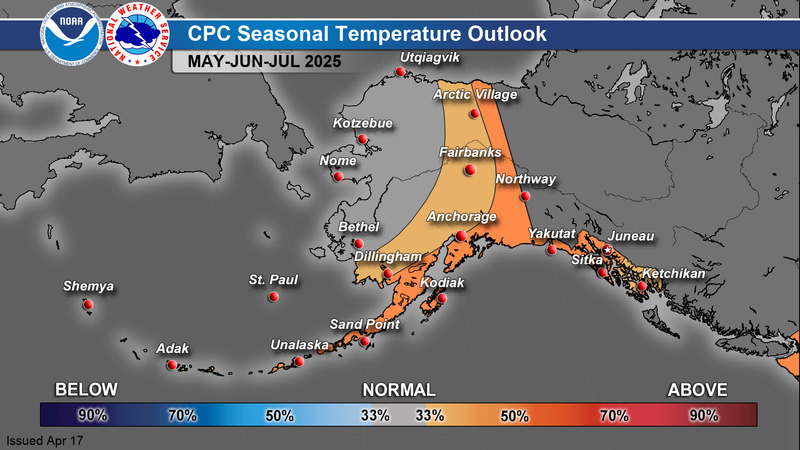
CPC 3 Month Outlook
|
Temperature
|
Precipitation
|
For additional climate outlook data, see: https://www.cpc.ncep.noaa.gov/
A Guide to Interpreting CPC Products: https://www.weather.gov/afc/GuideToInterpretCPCProducts
Alaska Drought Monitor
|
|
163
FXAK68 PAFC 200034
AFDAFC
Southcentral and Southwest Alaska Forecast Discussion
National Weather Service Anchorage AK
434 PM AKDT Sun Jul 19 2026
.SHORT TERM FORECAST SOUTHCENTRAL ALASKA (Days 1 through 3/Tonight
through Wednesday)...
A high amplitude trough is centered along the west coast of mainland
Alaska and southward well down into the Pacific (around 40N
latitude), with a corresponding high amplitude downstream ridge
over Southeast AK and the Yukon. In between is an atmospheric
river supported by a 100+ kt meridional jet streak. A narrow band
of moderate to heavy rain has been sitting over the same areas for
the first half of today, from the Kenai Peninsula to Anchorage
and the Susitna Valley. A short-wave moving through the base of
the trough is now causing the trough to become slowly take on a
negative tilt. As a result, low level southeast flow is increasing
across the Kenai Peninsula leading to an expanding downslope hole
across the interior western Kenai, Anchorage, and the Matanuska
Valley. Rain has ended across most of Anchorage (as of 2pm),
lingering over far western Anchorage. After rapid rises along
Campbell and Chester Creeks, water levels are now quickly falling.
meanwhile, rainfall rates have picked up for much of coastal
Kenai Peninsula on up to the western to central Susitna Valley
(including the Parks Highway corridor). A Flood Warning is in
effect for Seward until 10am Tuesday for urban and river/stream
flooding and a Flood Advisory is in effect for the Yentna River
for minor flooding of low lying areas along the river. Warmer and
drier conditions are being observed in the Copper River Basin,
with partly sunny skies. Lastly, elevated winds and waves can be
found ahead of a surface front from the northern Gulf coastal
waters into Prince William Sound, with southeasterly gap winds
extending inland.
The upper level trough will continue to become more negatively
tilted tonight while slowly progressing northeastward. Heavy rain
across the Kenai Peninsula and Susitna Valley will shift back
north and east overnight tonight through Monday. In addition to
the aforementioned areas where flooding is expected, other areas
to closely watch for potential minor flooding include the
southwestern Kenai (Anchor River), other rivers and streams in the
Susitna Valley, and Anchorage (for urban flooding as rain spreads
back in on Monday). The upper trough will weaken as it continues
north and east Monday night through Tuesday. The upper jet (and
atmospheric river) will also weaken with time. As a result, expect
a narrow band of much lighter rain to spread across the the Copper
River Basin Monday night through Tuesday morning.
There will be a brief break in rainfall behind the upper trough
(24 hours or less) before the next storm approaches from the
Bering Sea in continued progressive flow aloft. Rain will reach
Kodiak Island Monday night, then overspread much of Southcentral
on Tuesday. The upper trough will move through very quickly, so
this will be a glancing blow of rain, with the system exiting to
the north and east on Wednesday morning. Models have been waffling
with the track of the next low across the Bering Sea, but the
latest guidance seems to be locking into a similar track. Based on
this, expect another round of rain Wednesday night through
Thursday.
-SEB
&&
.SHORT TERM FORECAST SOUTHWEST ALASKA AND BERING SEA/ALEUTIANS
(Days 1 through 3)...
A Bristol Bay low will move northward up the Mainland coast
continuing today`s southerly and easterly winds and rain showers
over Southwest Alaska through tomorrow evening. Another low moves
across the Aleutians early this week with a ridge and more zonal
flow behind it.
Twelve hour rainfall amounts as of 4:00pm today are a few
hundredths of an inch over the region with wind gusts during this
time ranging 20 to 30 knots in Southwest Alaska as a low moves up
the coast then inland. As this low moves inland this evening,
more widespread rain is expected over the Kuskokwim Delta through
tomorrow. Short-lived, weak ridging diminishes these rain showers
for the Mainland and the AK Pen late Monday afternoon / evening.
Another round of rain arrives Tuesday.
A band of thunderstorms associated with a separate low will
continue to move through the far western Bering Sea into this
evening. This separate low pressure system moves out of Russia
and into the Bering Sea today through Tuesday bringing more
widespread rain and strong winds to the region. This separate low
moving through the Bering Sea reaches the Pribilof Islands Tuesday
morning then moves in a more easterly direction towards the
Mainland into Tuesday evening. This brings rain showers and
southerly to southwesterly winds into the Pribilofs, Eastern
Aleutians, AK Pen and the Mainland through Wednesday. The strong
southwesterly winds 20 to 30 knots bringing wave heights to 8 feet
along the Bristol Bay coastline during this time. Also, this will
coincide with a core of moderate to heavy precipitation moves
through the area from south of the Pribilofs to the Eastern
Aleutians / AK Pen and the Mainland.
Zonal to southwest flow dominates in the Western Bering Sea mid-
week with warm tropical air bringing shortwave energy and a
resurgence of rain across the region.
- JOHNSTON
&&
.LONG TERM FORECAST (Days 4 through 7: Thursday through
Sunday)...
A pattern change is in the works during the long term period next
week. An upper low and front will be progressing through interior
Alaska on Thursday. Behind this feature forecast models are in
somewhat good agreement with the development of a building ridge
of high pressure over the southern Bering on Friday. The ridge
amplifies further over the weekend. For Southcentral, northerly
flow behind the departing upper low and trough will bring in drier
conditions and a potential break from persistent rain chances
over the state. High pressure over the Bering will favor drier
conditions as well. The one caveat will be the potential for
smaller shortwave disturbances to ride over the top of the ridge
and into Southwest Alaska with renewed rain chances on Sunday.
-BL
&&
.AVIATION...
PANC...Steady rain will temporarily let up this evening, but will
return during the late overnight and intensify through Monday
morning. A period of winds blowing out of the Turnagain Arm is
possible, likely sometime between 4z and 12z tonight, though
confidence for timing and exact magnitude for any period of
gustier winds remains low. LLWS will remain possible until winds
at the surface turn out of the southeast later this evening.
Generally VFR conditions will prevail until rain intensity picks
up early Monday morning, likely pushing ceilings and visibility
down into MVFR range.
&&
$$
532
FXAK69 PAFG 192210
AFDAFG
Northern Alaska Forecast Discussion
National Weather Service Fairbanks AK
210 PM AKDT Sun Jul 19 2026
.SYNOPSIS...
Cool and wet weather continue across Western Alaska today while the
eastern half of the state experiences a warming & drying trend as
an upper-level ridge over Eastern Alaska reinforces southerly
Chinook flow over the state. Southerly gap winds through the
Alaska Range Passes have continued to gust upwards of around 55 to
70 mph today, which will gradually weaken from this evening
through Monday morning. Out west, a low sitting around Bristol Bay
will support continuous rain showers along the coast well into
next week. By Tuesday, the ridge over Eastern Alaska starts to
break down and allows for southwest flow to set up over the state.
With this new pattern, an increase in thunderstorm activity &
widespread rain showers across the Interior become likely. In the
meantime, we are continuing to monitor the development of another
low pressure system moving into the Bering Sea for the latter half
of the week for minor coastal impacts & high surf due to gusty
WSW winds. There is high uncertainty with the track of this
system, however, with the models placing the track anywhere
between the Bering Strait to the Yukon Delta. We will publish
necessary updates through the week.
&&
.KEY MESSAGES...
Central and Eastern Interior...
- Warming temperatures into the mid 70s/low 80s this afternoon
with low to mid 80s on Monday and some upper 80s in the Yukon
Flats. Temperatures cool back into the 60s and 70s again on
Tuesday.
- There has been a brief lull in thunderstorm activity today with
chances returning Monday and Tuesday afternoon in the Eastern
Interior and north towards the Eastern Brooks Range.
- Southerly gap winds through Alaska Range Passes and Delta
Junction continued today with gusts upwards of around 55 to 70
mph. Winds will gradually diminish this evening into Monday.
West Coast and Western Interior...
- Widespread continuous showers are expected through early next
week with the highest rainfall totals in the YK Delta, southern
Seward Peninsula, & Kobuk Valleys. Rainfall totals between 0.25
to 0.50 inches, with locally higher amounts near 0.75" possible
through Tuesday.
- A few isolated thunderstorms are possible this afternoon over
the extreme northern Seward Peninsula & western Brooks Range,
shifting southward to encompass the entire Seward Peninsula by
Monday afternoon. Thunderstorm chances diminish from Tuesday,
onward.
- Another low making its way into the Bering Sea for the latter
half of next week may support additional widespread showers &
breezy winds across Western Alaska. Minor coastal impacts are
possible, primarily high surf. (See the coastal section for
additional information)
North Slope and Brooks Range...
- Scattered showers and isolated thunderstorms are in store for
the Western Brooks Range & Western Arctic Plains for this
afternoon. Shower & thunderstorm coverage shifts southeastward
for Monday through Tuesday.
- Temperatures warm through early next week with 70s to near 80F
possible in the Arctic Plains. Cooler temperatures in the
50s/60s are expected along coastal areas through midweek.
- Areas of low stratus and patchy fog may continue to develop
during the evenings & overnights along the Arctic Coast into
next week.
&&
.FORECAST ANALYSIS AND DISCUSSION...
The ongoing forecast remains on track with troughing out west and
ridging building in the east. Wedged in between is southerly
chinook flow over the AK Range and Brooks Range. Western Alaska
will remain cool and wet for the foreseeable future as several
shortwave troughs and weak low pressure systems move through from
south to north. Wind through the AK Range Passes and in Delta
Junction have been around 50 to 60 mph and will peak tonight.
North of both ranges we are expecting significantly warmer
temperatures in the 70s and 80s with the warmest spots being in
the Yukon Flats where high temperatures approach 90 degrees on
Monday. In addition to warming temperatures, we will see an
increase in thunderstorm activity on Monday and Tuesday in the
Interior and Brooks Range as a front lifts northward. This front
will cool things down significantly from Tuesday onward, bringing
a persistent cool and wet pattern once again. On the North Slope,
it will remain warm through the middle of the week but the broad
scale troughing will win out by the end of the week, cooling
things down significantly and bringing more active weather.
Overall, the summer-like weather on the North Slope and in the
Central/Eastern Interior will be short-lived as cooler and wetter
weather prevails towards the middle and end of the week. The West
Coast will continue to see areas of rain/showers with cool
temperatures. One thing we will be monitoring, which will be
elaborated on in the Extended Discussion and Coastal Hazard
section below, is the potential Bering Sea low by the end of the
week. Significant impacts are not expected but minor coastal
impacts/high surf and heavy rain/gusty winds appear to be on the
agenda right now.
&&
.FIRE WEATHER...
With broad troughing to the west and ridging to the east, strong
southerly flow continues to work over the Alaska Range. Warmer and
dry conditions are expected for areas just north of the Alaska Range
with strong gusty winds up to 65 mph expected through the passes and
up to 55 mph in Delta Junction. Peak observed gusts so far today
have been up to 62 mph in the passes and 53 mph at Delta. Wind
Advisories remain in effect for this region tonight into Monday.
Another round of southerly gap winds through Alaska Range passes is
expected late Tuesday into Wednesday and Wednesday night.
Temperatures have already begun warming across the Interior north to
the Arctic Coast, which are expected to peak on Monday as highs
climb well into the 70s/80s. Heat Advisories remain in effect for
Monday for the Yukon Flats and Fortymile Country for highs around 85-
90F and the Arctic Plains for highs up to around 80F. Minimum RHs
through Monday will drop to around 25-35% across much of the
Interior north to the Brooks Range and Central Arctic Plains, with
improvement expected Tuesday onwards. There is a limited overlap of
critical wind and low RH expected, with elevated conditions possible
where the warmest and dries conditions overlap with breezy winds.
Dry conditions across the Interior today through Monday morning with
will give way to isolated to scattered showers and thunderstorms
lifting north along a NW to SE oriented front that will build in
Monday afternoon and shift north on Tuesday. The best thunderstorm
chances Monday afternoon and evening will be from the Upper Tanana
Valley northwest to the Central Brooks Range, with isolated activity
continuing Monday night for the Yukon Flats and Brooks Range.
Tuesday is shaping up to see the highest thunderstorm coverage
across the Yukon Flats north through the Brooks Range, peaking
during the afternoon and evening.
Across Western Alaska, isolated to scattered showers and very
isolated thunderstorms will continue through Monday, with heavy
precipitation expected in the Western Alaska Range. A closed low
moving into Southwest Alaska on Tuesday will bring steadier rain for
the Y-K Delta and Southwest Interior north to the Seward Peninsula.
Looking ahead, a coastal storm is expected to move into Western
Alaska Wednesday into Thursday, with widespread precipitation and
gusty winds moving across all of Northern Alaska mid to late week.
Colder temperatures will accompany this system as widespread highs
in the 50s/60s return, with locally colder conditions farther north.
&&
.HYDROLOGY...
No concerns at this time.
&&
.EXTENDED FORECAST DAYS 4-7...WEDNESDAY THROUGH SUNDAY
Wednesday afternoon an approximately 540 decameter closed off low
will move towards St. Lawrence Island. Accompanying this low will be
gusty winds, heavy rain, and minor coastal concerns. The 12z model
guidance is in good agreement that the surface low should be around
990 mbs. This would allow for wind gusts of 30 to 50 mph being
possible across the West Coast and Western Interior. Attached to the
low pressure system, a stout atmospheric river will also be pushed
into the West Coast. This additional moisture could produce
widespread moderate to heavy rainfall across the West Coast. As the
low moves east on Thursday, this rain will move east and north
towards the Brooks Range and Eastern Interior.
Looking towards the weekend there is large model uncertainty
regarding the pattern. A ridge axis extending north into the
Interior from the North Pacific High is the source of this
uncertainty. Depending on the strength of the ridge axis would
dictate how far into the Interior an arctic trough is able to dig
southwards. This arctic trough will move onto the North Slope
Saturday morning, bringing very cold 850mb temperatures. These
temperatures are introducing the possibility of light to moderate
snowfall in the Brooks Range on Saturday and Sunday. If the ridge
axis is on the weaker side than snow chances could be possible in
the higher terrain of the Interior. On the flip side of that if the
ridge holds than it would just be more rain.
&&
.Coastal Hazard Potential...
We have issued a Special Weather Statement for potential coastal
impacts later this week from a Bering Sea storm. The main things
we are monitoring are the track and strength of the storm but
there is uncertainty with both of these. The good news is, the
storm doesnt look to intensify too much and impacts should be
minor. The West Coast from the Yukon Delta to Kivalina should
monitor the latest forecasts at weather.gov/afg to stay aware of
potential impacts from this storm.
Current coastal flood guidance is hinting at high surf and
potentially minor flooding. Fortunately, significant impacts are
not expected. We will continue to update as necessary.
&&
.AFG WATCHES/WARNINGS/ADVISORIES...
AK...Wind Advisory for AKZ837-847-849.
Heat Advisory for AKZ833-835.
Heat Advisory for AKZ806-808.
PK...None.
&&
$$
Synopsis...Chambers
Key Messages...Chambers
Forecast Analysis and Discussion...Bianco
Fire Weather Discussion...MacKay
Extended Forecast Discussion...Dennis
Coastal Hazard Potential... Bianco
957
FXAK67 PAJK 200541
AFDAJK
Southeast Alaska Forecast Discussion
National Weather Service Juneau AK
941 PM AKDT Sun Jul 19 2026
.UPDATE...
&&
.AVIATION... With high pressure in the Gulf of Alaska, flight
conditions have been VFR in SE AK this evening. Tonight, MVFR
ceilings with the marine layer are possible for coastal areas
including Yakutat, Sitka, Klawock, and Gustavus. However, the
marine layer is looking less impressive on satellite than last
night, so there is uncertainty in these lower ceilings occurring.
Similar to this morning the marine layer clouds should improve to
VFR by around 18Z Monday.
Monday evening, the front currently impacting the Central Gulf
Coast will dissipate and move toward the Northeast Gulf Coast.
The front will begin increasing rain chances for Yakutat by the
end of the TAF period. Based on current guidance, the front looks
to increase rain chances for the Northern Panhandle after 06Z
Tuesday.
&&
.PREV DISCUSSION......ISSUED AT 326 PM Sun Jul 19 2026
SYNOPSIS...
Key Messages:
- Clearing skies across the interior with widespread dry
conditions persisting into Monday.
- A front will bring a few showers for Yakutat and possibly into
northern panhandle Monday night into Tuesday.
- Increasing forecast confidence of another round of warm
temperatures through midweek, especially across the southern
panhandle.
SHORT TERM.../Through Tuesday/...Cloud cover slowly decreased
through the morning into this afternoon allowing for mostly
scattered to clear skies this afternoon. Because of this
temperatures have already reached into the mid to high 60s with the
likelihood of areas reaching 70 degrees this evening before
temperatures begin to cool for the night. We are in for an even
warmer day tomorrow with widespread high 60s to mid 70s. The warmest
location will be along the southeastern panhandle, near Hyder, where
maximum temperatures to around 80 degrees is anticipated. There is a
chance that areas along Prince of Wales Island and near Ketchikan
and Annette Island will see temperatures reach into the 80s, but
forecast confidence remains low. Warmest temperatures overall will
be inland away from cooler ocean and glacier influences. With this
dry and clearer weather, afternoon sea breezes are likely to
develop. These sea breezes can quickly increase winds and create
gusty conditions during late morning to evening hours.
Rain chances return to the northern gulf and panhandle Tuesday as
weak area of lower pressure moves near the Kenai Peninsula. Most
precipitation will be directed to the west of the area, but light
rain is likely to fall from Baranof Island and northward. Highest
rain totals will be located near Icy Bay and Yakutat. No significant
accumulation or impacts are anticipated with rain totals remaining
below half an inch. Temperatures on Tuesday will also be on the
warmer side, but do not look to be as warm as Monday. This is mainly
due to increasing cloud cover front the low pressure system.
LONG TERM.../Wednesday through Saturday/... Wednesday brings us
back to our regularly scheduled programing with rain chances
looking to increase late in the evening or overnight across much
of the northern panhandle. A surface low looks to spin up coming
off the Aleutians and travel along the north gulf coast through
the beginning of the week, bringing this rain we are expecting.
Then, general onshore flow is expected to bring wetter conditions,
working their way southward, through the end of the week. Winds
are expected to be the most impactful with Skagway, currently
expected to reach 15-20mph S, but otherwise most other communities
can expect lighter winds.
AVIATION.../through Monday afternoon/...Fairly benign flying
conditions through the period. Marine layer is slowly burning off
with skies becoming few-sct AOA 3500ft. Marine layer not expected
to build back in as much tonight with skies generally remaining
few-sct for the interior. However, PAYA and PASI have a better
chance of skies becoming broken, although CIGs likely remaining
VFR at around 3500ft. PAKW does have a potential for similar low
CIGs and reduced VIS developing tonight like the past few nights,
but confidence is too low to include for this forecast. Some
elevated daytime winds 10-15kt for PAKT, PASI and especially PAGY,
otherwise lighter winds will continue to prevail.
MARINE...
Outer Waters: High pressure remains over the eastern Gulf and
will linger into midweek, with elevated northwesterly winds up to
around 20 kt for Cape Edgecombe and southward. To the west, a weak
front pushing eastward will shift winds in the NE gulf coast
south to southeasterly briefly on Monday, before the ridge
strengthening once again Tuesday into Wednesday, bringing broad
fresh to strong northwesterlies, with strongest winds near Cape
Spencer and near Cape Edgecombe on south. Seas in the Gulf should
remain around 4 to 6 ft, though waves along Cape Decision down to
Dixon Entrance could increase to 5 to 7 ft due to higher wind
speeds. Waves could further increase around later Tuesday or
Wednesday for the same region with the uptick in winds. Marine
conditions will likely become hazardous to small craft by Tuesday
night for the southern coastal waters and near Cape Spencer.
Inner Waters: High pressure remains over the eastern Gulf through
into midweek with a stronger thermal gradient setting up, leading
to moderate to fresh breezes from west to northwest developing
each afternoon. Winds could occasionally become strong during the
afternoon for Icy Strait, Peril Strait and backside of Douglas
Island. The N-S channels of the southern panhandle will generally
see winds gentle to moderate, except for Clarence Strait, which
will continue to see northwest breezes up to 20kt each afternoon.
Northern Lynn Canal will increase from the south and become
moderate to fresh during the day as the thermal gradient increases
across Skagway. Winds expected to increase and become moderate to
possibly strong for Tuesday and Wednesday as ridging strengthens
over the eastern Gulf, further tightening the gradient.
&&
.AJK WATCHES/WARNINGS/ADVISORIES...
PUBLIC...Heat Advisory from 1 PM to 7 PM AKDT Monday for AKZ331.
MARINE...Small Craft Advisory for PKZ021.
&&
$$
SHORT TERM...EAB
LONG TERM...AGP
AVIATION...DS/Musall
MARINE...DS
Visit us at http://www.weather.gov/Juneau