National Weather Service United States Department of Commerce

Powerful Winter Storm from the Upper Midwest into the Northeast; Severe Thunderstorms in the Midwest and Ohio Valley

A rapidly-intensifying storm is expected to bring heavy snow, blizzard conditions, and icing from the Upper Midwest through the Great Lakes and Northeast. Scattered severe thunderstorms may produce severe/damaging wind gusts and a couple of tornadoes across parts of the Midwest and lower Ohio Valley through the evening. Arctic air will expand across the central and southern U.S.. Read More >


Marine Graphics

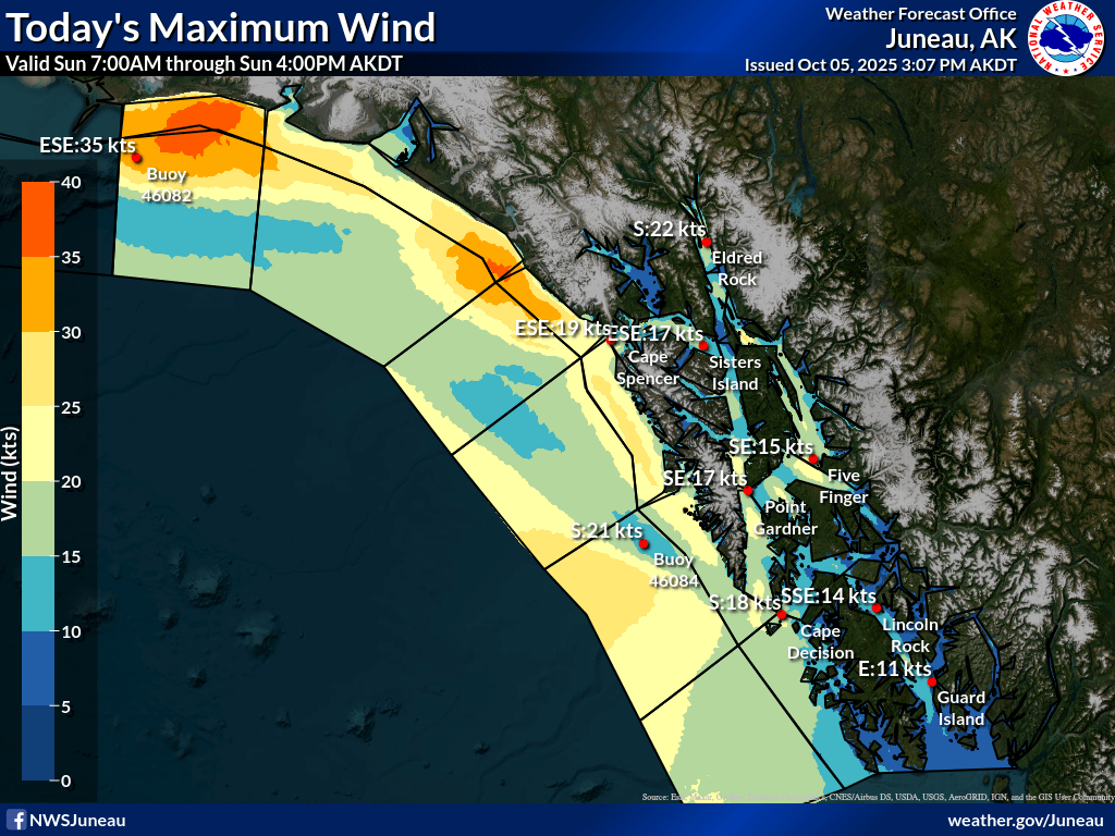
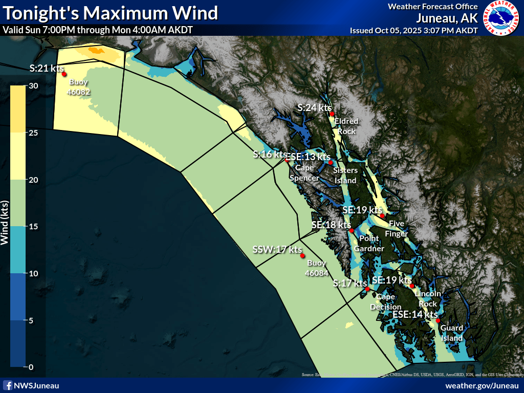
Click here for Local Forecast Graphics - Automatically updated maps showing highest forecasted wind speeds over a 12 hour period as well as other weather elements and zoomed in options.

Image showing the maximum winds in knots forecasted for today, 7am through 4pm. Image showing the maximum wind in knots forecasted for tonight, 7pm through 4am.


Need more detail!? 

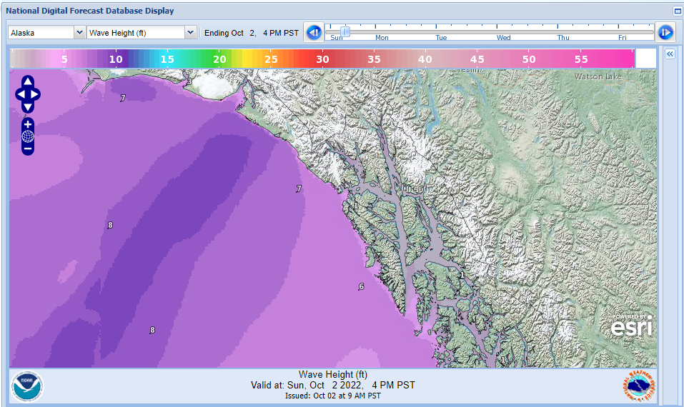
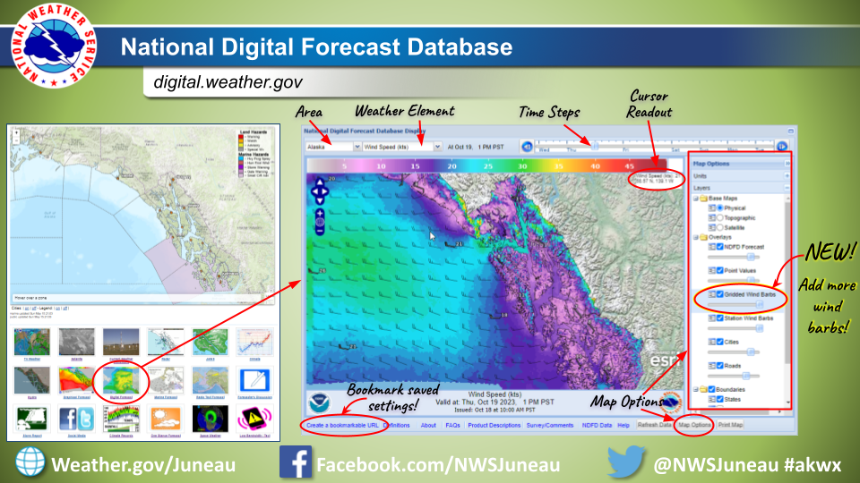
Use the Digital Forecast Database - Pan & Zoom to your area of interest and step through the wind forecast in 3hr timesteps or the wave height forecast in 6hr timesteps.

Wind Graphical Forecast    Marine Wave Height Graphical Forecast

Learn more about using this page and saving a personalized bookmark here

How to read wind barbs


Marine Fax Images:

For a complete list of marine fax images and schedules, go here:
Marine Radiofax Information


Related Information

  Beaufort Scale Information 

  Marine Text Products - Great for low-bandwidth
  Latest Buoy Observations
  Marine Exchange Observations for SE Alaska
  NDBC Buoy Map
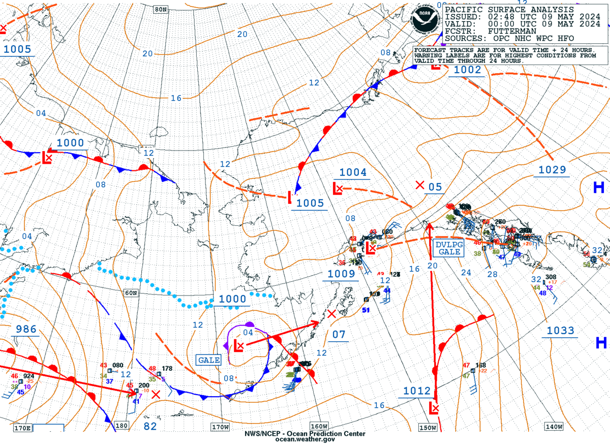
  Surface Analysis and Forecast (black & white)
  Marine & Safe Boating Safety!
  WRN Marine Ambassador program  

  SE Alaska Marine Brochure - PDF

 NOAA Weather Radio broadcast schedule