
Tropical Depression Two is expected to gradually strengthen and could bring tropical storm conditions to the Florida Panhandle beginning late Monday. Areas of flash flooding will be possible through Thursday along the eastern and central Gulf Coast. Severe thunderstorms will develop and move along a cold front crossing the Upper Midwest Monday, and through the Ohio Valley/Mid-Atlantic on Tuesday. Read More >
Overview
|
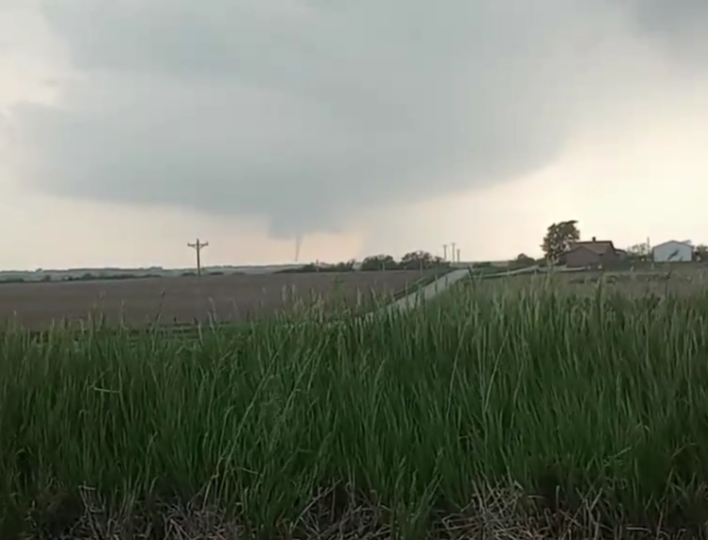
On the evening of May 12, 2023, a series of small supercell thunderstorms developed over parts of northeast Kansas and produced several brief tornadoes across Brown and Jackson counties. Isolated damage was reported, and the more significant damage was done to a homestead southwest of Reserve, KS. |
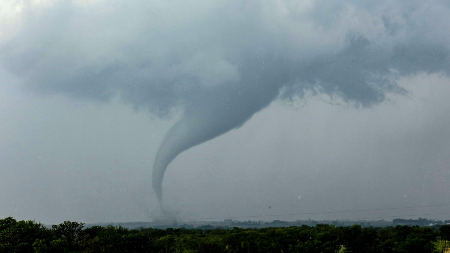 A tornado north of Hamlin, KS. Image Courtesy of Wayne Sclesky |
Tornadoes:
|
Tornado - SW of Reserve
Track Map .png) 
Downloadable KMZ File |
||||||||||||||||
|
Tornado - N of Holton
Track Map .png)
Downloadable KMZ File |
||||||||||||||||
|
Tornado - E of Netawaka
Track Map .png)
Downloadable KMZ File |
||||||||||||||||
|
Tornado - N of Whiting
Track Map 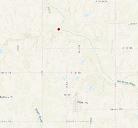
Downloadable KMZ File |
||||||||||||||||
The Enhanced Fujita (EF) Scale classifies tornadoes into the following categories:
| EF0 Weak 65-85 mph |
EF1 Moderate 86-110 mph |
EF2 Significant 111-135 mph |
EF3 Severe 136-165 mph |
EF4 Extreme 166-200 mph |
EF5 Catastrophic 200+ mph |
 |
|||||
Photos & Video
A Few of the Photos Received
 |
 |
 |
|
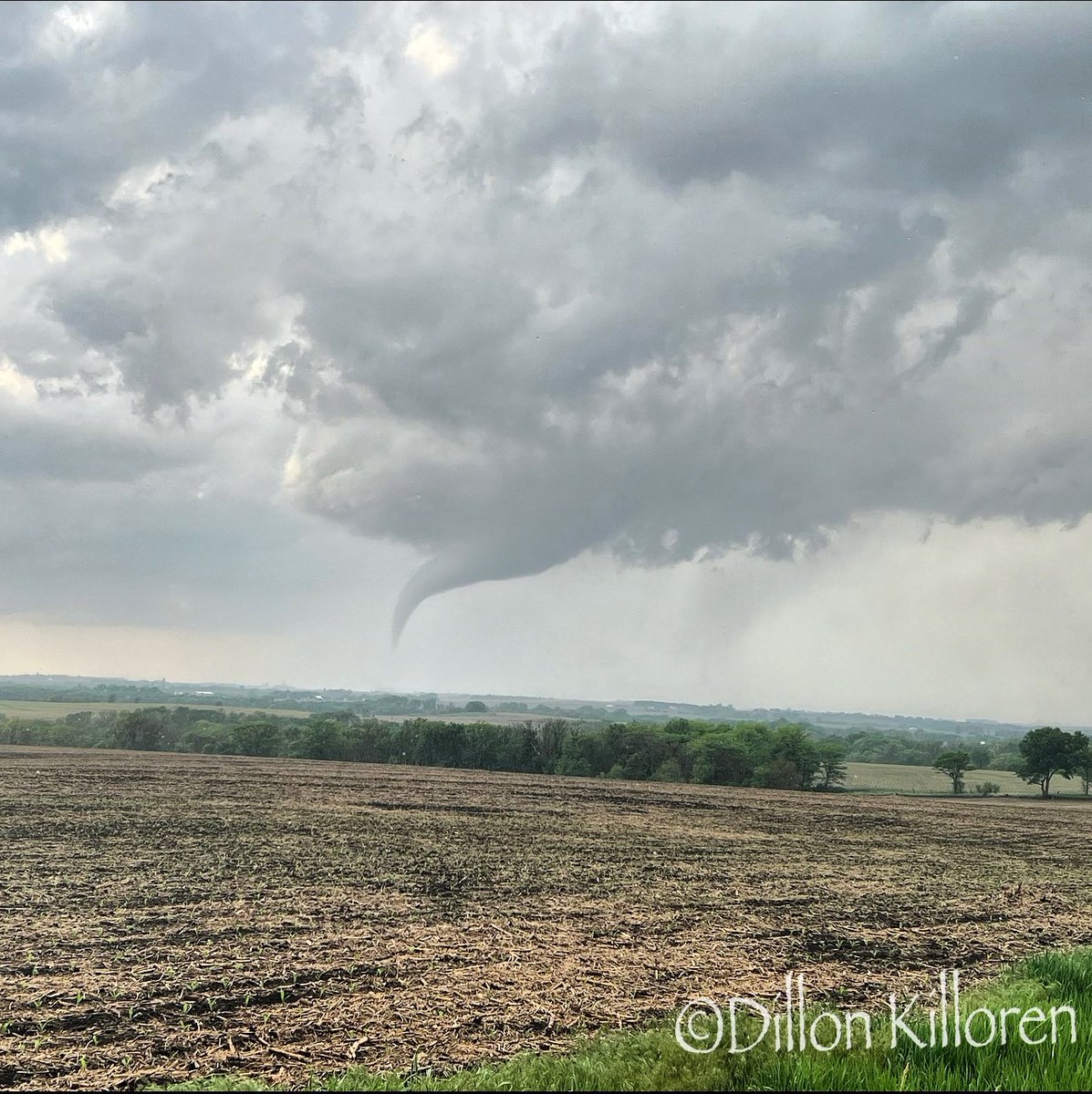
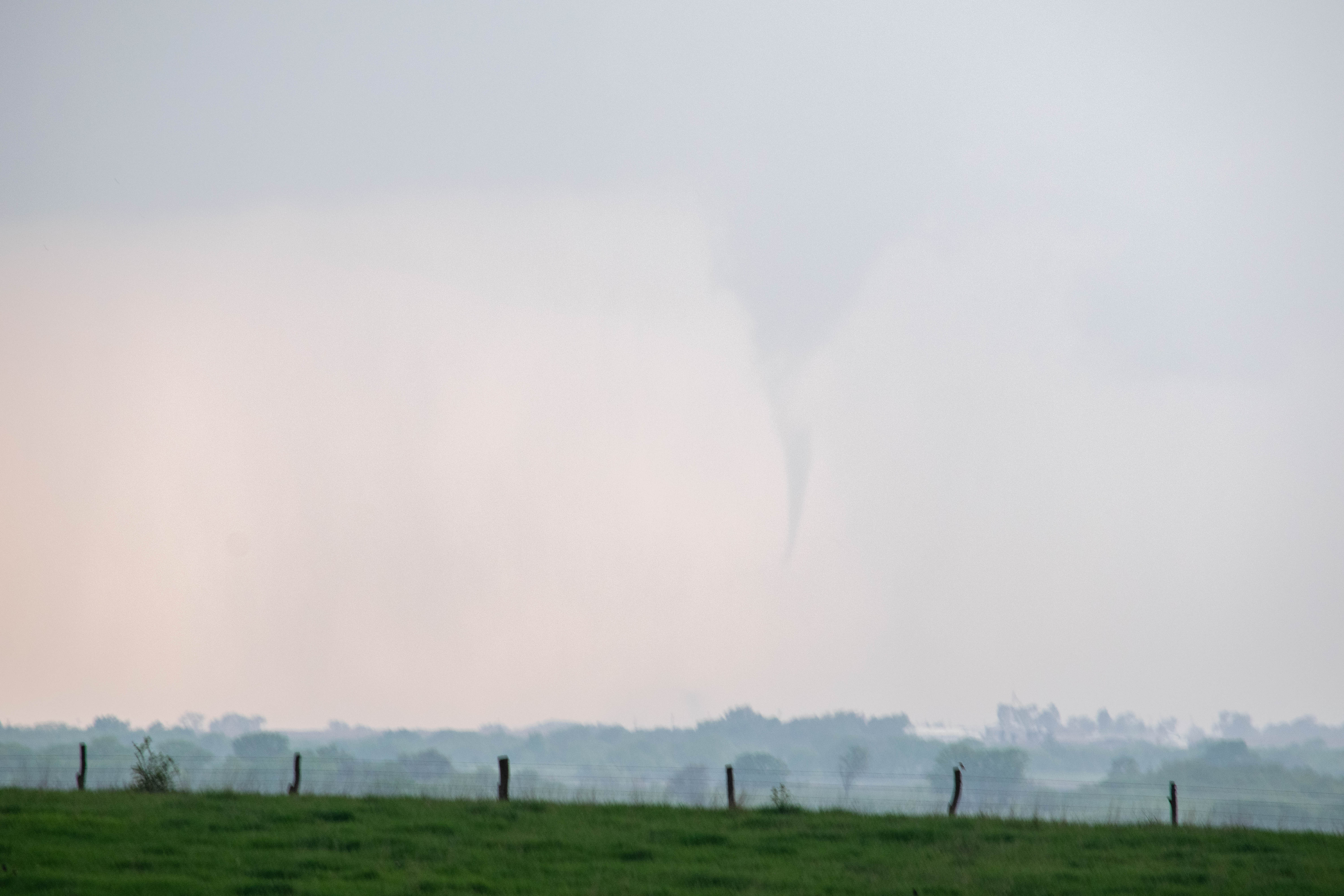
Tornado 1 north of Hamlin Courtesy Dillon Killoren |
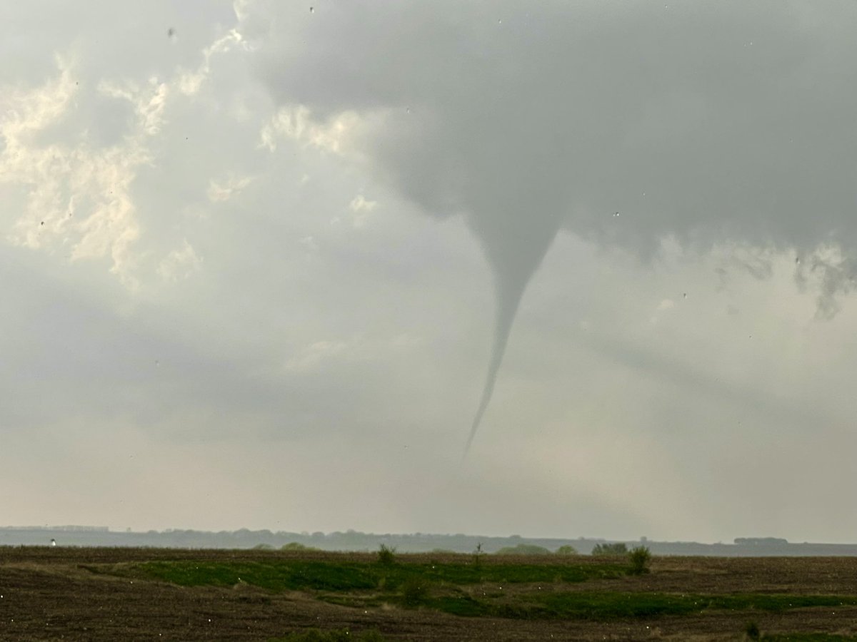
Tornado 1 north of Hamlin Courtesy Alex Pickman |
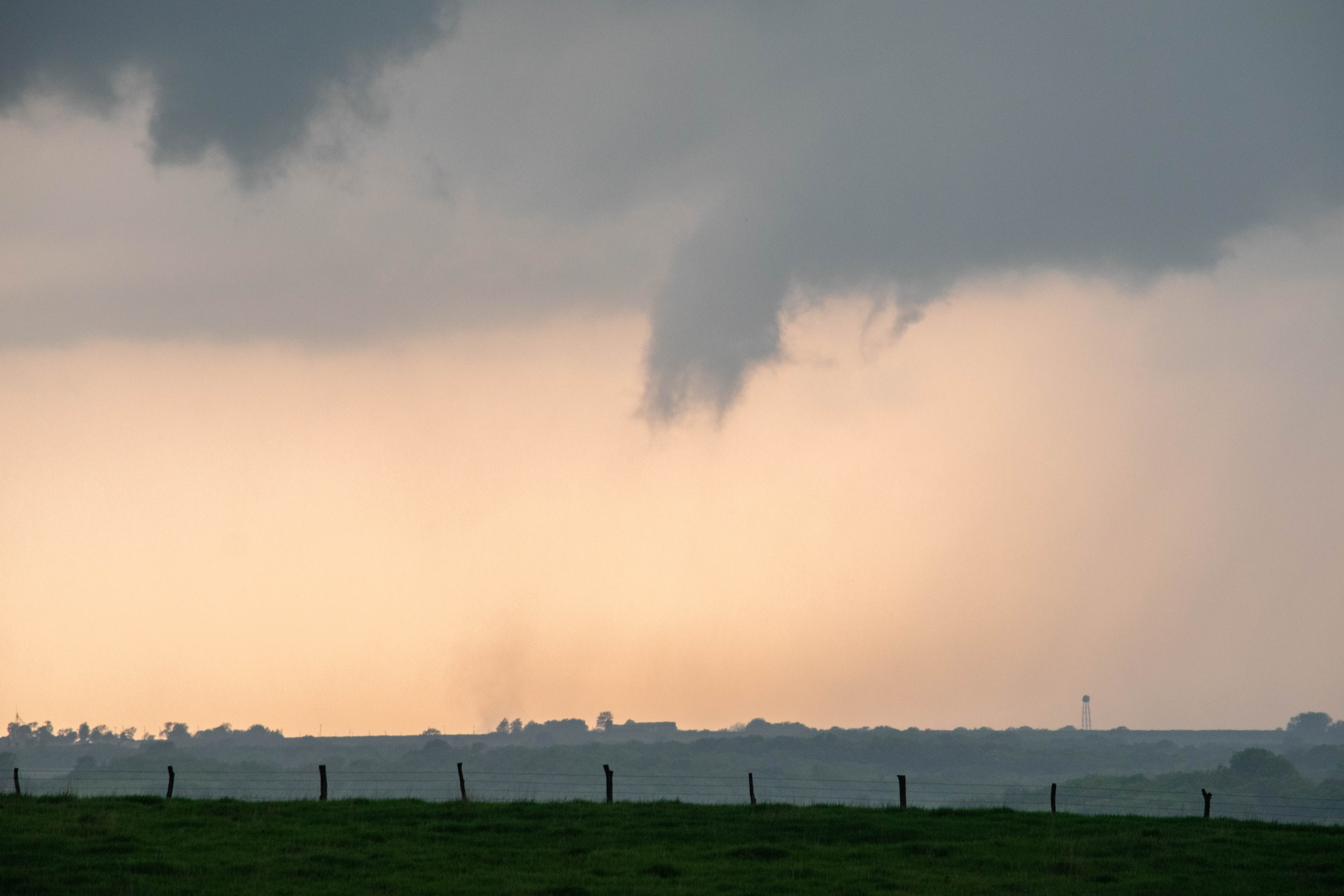
The Holton tornado as it was southeast of Netawaka. Courtesy James Oestmann |
 |
 |
 |
|
Holton tornado roping out near Netawaka. |
Tornado east of Netawaka kicking up dust at the surface. |
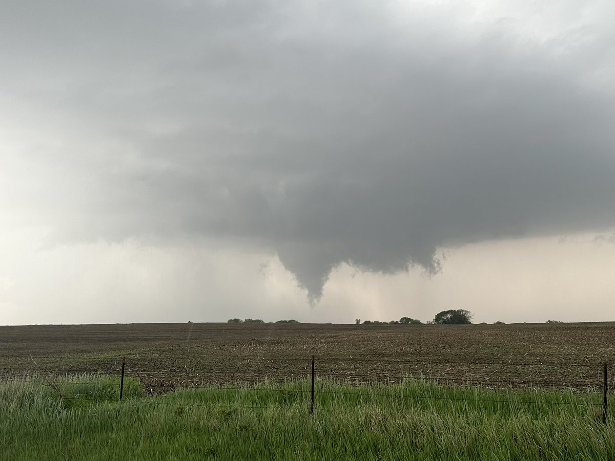
Final tornado just north of Whiting. Courtesy Joseph Irwin |
Radar
Radar Images from the Evening of May 12, 2023
 |
 |
 |
|
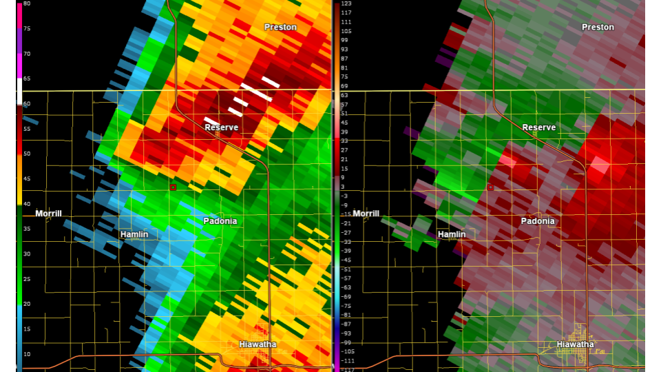
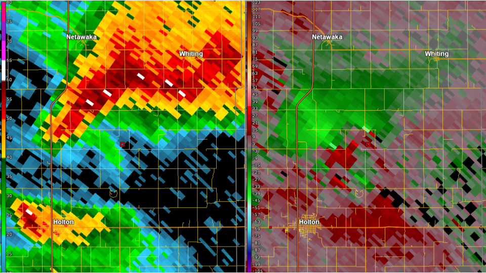
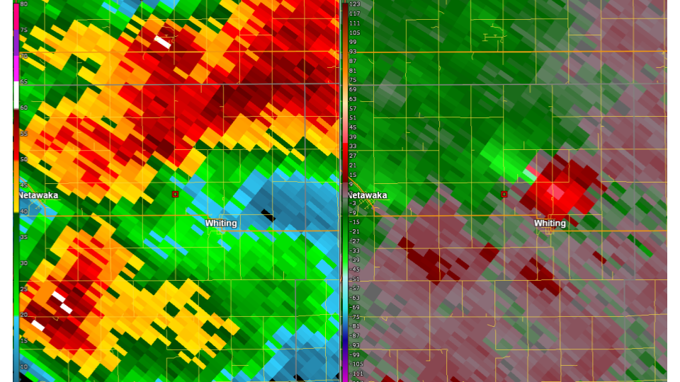
| Reflectivity and Storm Relative Velocity at 7:04PM Showing a Circulation southwest of Reserve, KS | Reflectivity and Storm Relative Velocity at 7:18PM Showing Possibly Two Circulations North-Northeast of Holton, KS | Reflectivity and Storm Relative Velocity at 7:41PM Showing a Circulation North of Whiting, KS |
Environment
Storm Prediction Center Outlooks - 1630z
 |
 |
 |
 |
|
Categorical Outlook |
Tornado Outlook |
Hail Outlook |
Wind Outlook |
Topeka Soundings
 |
 |
 |
|
12z (7 AM) Sounding |
19z (2 PM) Sounding |
0z (7 PM) Sounding |
 |
Media use of NWS Web News Stories is encouraged! Please acknowledge the NWS as the source of any news information accessed from this site. |
|

