
Tropical Depression Two is expected to gradually strengthen and could bring tropical storm conditions to the Florida Panhandle beginning late Monday. Areas of flash flooding will be possible through Thursday along the eastern and central Gulf Coast. Severe thunderstorms will develop and move along a cold front crossing the Upper Midwest Monday, and through the Ohio Valley/Mid-Atlantic on Tuesday. Read More >
July 8, 2009 - Small Storm Packs Big Punch
Widespread Wind Damage in East Central Kansas
A small, long-lived storm tracked across portions of northeast and east central Kansas during the late morning and afternoon hours of July 8th. The storm became better organized by mid afternoon across east central Kansas, producing concentrated areas of strong to severe straight-line wind damage from near Interstate 70 in western Douglas County to southern Anderson County.
A storm survey team from the National Weather Service in Topeka, KS determined peak wind speeds of 80 to 100 mph occurred in a 4 mile wide swath through portions of Franklin and Anderson Counties. This resulted in numerous large tree limbs and power poles down across portions of these areas.
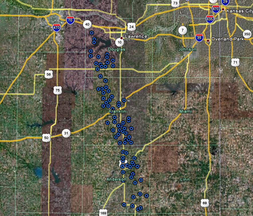
The map above shows wind damage reports received after the storm passed through portions of east central Kansas. Blue dots represent the location of each wind damage report.
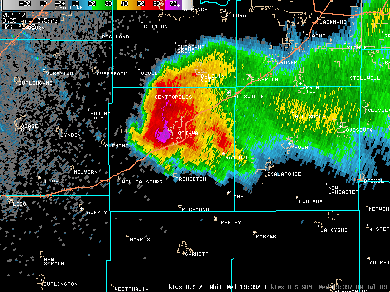
The image above shows the storm as it was moving through Ottawa, KS at 2:39 pm CDT. Several reports of wind damage were received in and around the city of Ottawa.
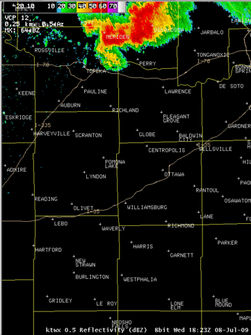
This animated loop shows the entire track of the storm as it moved through portions of northeast and east central Kansas.
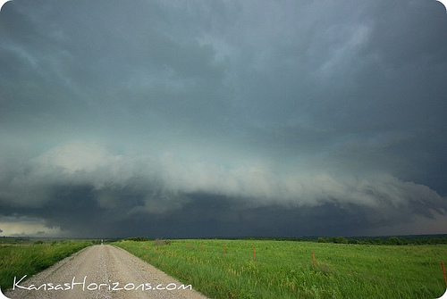
This is a photo of the storm as it neared Garnett, Kansas. The storm contained a shelf cloud in close proximity to the precipitation core suggesting a well-organized storm. Photo courtesy of Jim Saueressig II.
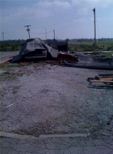
Roof damage to the Village Inn Motel in Ottawa, KS.
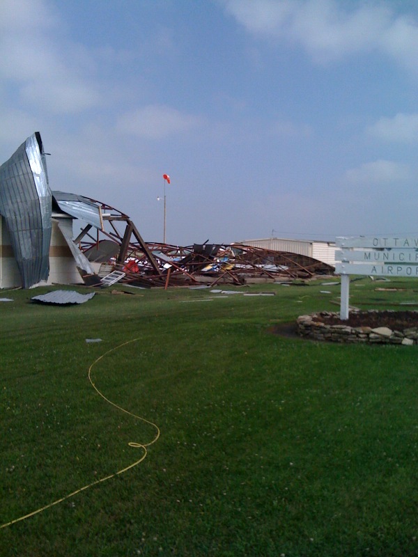

Heavy damage was noted at the Ottawa Municipal Airport 4 miles south of Ottawa, KS.
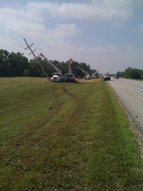
Several power poles were pushed over from severe straight-line winds along Highway 59, 3 miles south of Ottawa, KS.
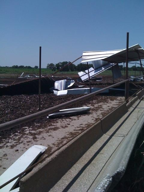
Damage to a free standing metal building for cattle in northeastern Anderson County near Highway 169.
.

