Tropical Depression Two is expected to gradually strengthen and could bring tropical storm conditions to the Florida Panhandle beginning late Monday. Areas of flash flooding will be possible through Thursday along the eastern and central Gulf Coast. Severe thunderstorms will develop and move along a cold front crossing the Upper Midwest Monday, and through the Ohio Valley/Mid-Atlantic on Tuesday. Read More >
|
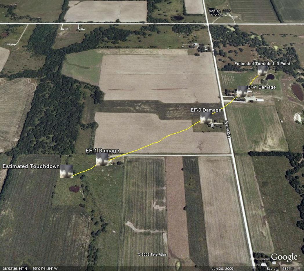
A map of the path of the EF-1 tornado that moved though the 9 and 10 hundred blocks on E 2300 rd Friday afternoon. The tornado appeared to have been on the ground for the entire 0.6 mile (1056 yards) length and produced damage consistent with an EF-1 tornado producing winds of approximately 90 mph. |
|
|
 |
 |
 |
 |
|
A Public Information Statement (PNS) that includes more detailed information from the damage survey is included below. |
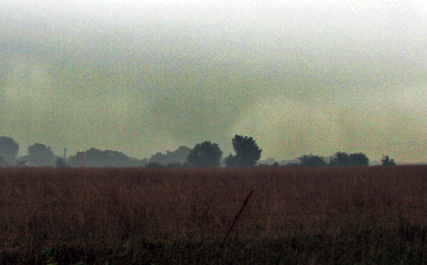
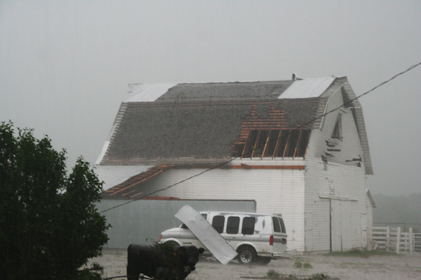
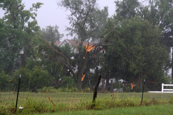
| PUBLIC INFORMATION STATEMENT NATIONAL WEATHER SERVICE TOPEKA KS 943 PM CDT FRI SEP 12 2008 ...PRELIMINARY DAMAGE SURVEY OF DOUGLAS COUNTY TORNADO... NATIONAL WEATHER SERVICE METEOROLOGISTS HAVE CONDUCTED A SURVEY OF THE DAMAGED PRODUCED BY A TORNADO SOUTH OF EUDORA DURING THE AFTERNOON OF 12 SEPTEMBER 2008. FOLLOWING ARE THE PRELIMINARY FINDINGS OF THIS SURVEY. THE PRELIMINARY RATING IS AN EF1 WITH WINDS ESTIMATED TO HAVE BEEN 90 MPH. THE TORNADO WAS ON THE GROUND FOR ABOUT 0.9 MILE WITH A MAXIMUM WIDTH OF 50 YARDS. THE TORNADO TOUCHED DOWN JUST NORTH OF N 900 RD AND WEST OF E 2300 RD APPROXIMATELY 5 MILES SOUTH SOUTHEAST OF EUDORA. IT THEN PROCEEDED NORTH NORTHEAST AND HIT SEVERAL STRUCTURES ALONG E 2300 RD DESTROYING A GARAGE AND SMALL BARN. A LARGER BARN SUSTAINED ROOF DAMAGE AND A PICKUP TRUCK WAS PUSHED 50 YARDS FROM IT ORIGINAL POSITION BY THE WINDS. THE TORNADO THEN LIFTED OFF THE GROUND BEFORE REACHING N 1000 RD. THE INFORMATION PRESENTED IN THIS STATEMENT IS PRELIMINARY AND MAY BE AMENDED OR ADDED TO IN THE FOLLOWING DAYS. $$ WOLTERS |
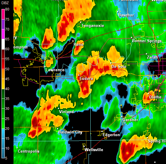
Below are radar images from 455 PM CDT September 12 2008, about the time of the damage pictured above.
 |
|
Above: Reflectivity image from 455 PM CDT September 12 2008.
|
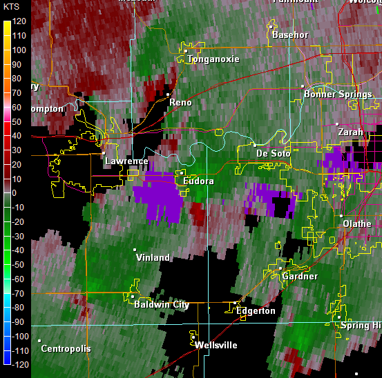 |
| Above: Storm-relative velocity image from 455 PM CDT September 12 2008. Area of rotation showing up south-southeast of Eudora near the Douglas/Johnson county line. |