
Tropical Depression Two is expected to gradually strengthen and could bring tropical storm conditions to the Florida Panhandle beginning late Monday. Areas of flash flooding will be possible through Thursday along the eastern and central Gulf Coast. Severe thunderstorms will develop and move along a cold front crossing the Upper Midwest Monday, and through the Ohio Valley/Mid-Atlantic on Tuesday. Read More >
Topeka, KS
Weather Forecast Office
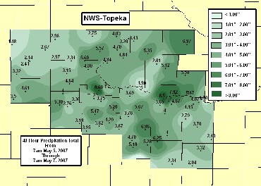
The same upper level low pressure system that helped to trigger shower and thunderstorm development across the Central Plains Friday night produced widespread heavy rain across the region Saturday and Sunday. This caused extensive river flooding across northeastern Kansas, and ponding of water over roadways and low lying areas across the region. Numerous reports of flooded roadways and homes were received.
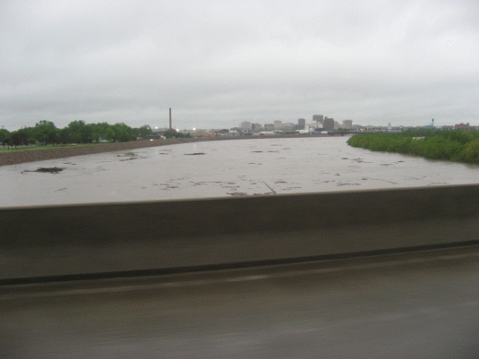 |
| Kansas River from Sardou Bridge in Topeka morning of May 7. |
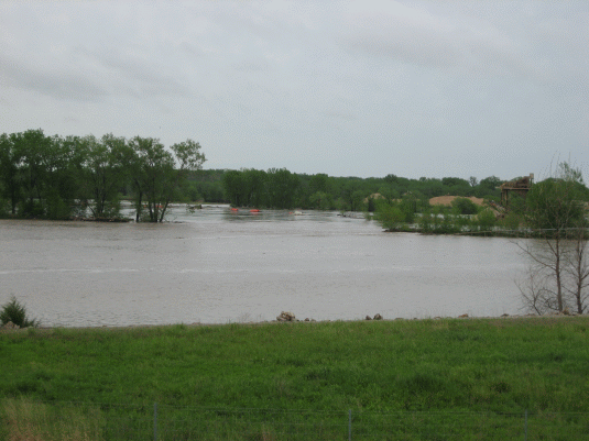 |
| Flooding east of Oakland Expressway to south of Kansas River, morning of May 7. |
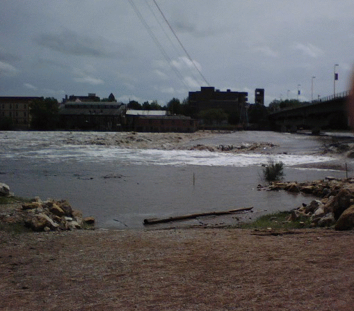 |
| The Kansas River at Lawrence, Monday afternoon, May 7. |
Cooperative Observers, Automated Surface Observation Stations, and Storm Spotters all reported rainfall amounts during the period to the National Weather Service at Topeka. Several Cooperative Observers also record and report river levels for local creeks and streams.
The National Weather Service Flood Safety Page can be found HERE.
US Dept of Commerce
National Oceanic and Atmospheric Administration
National Weather Service
Topeka, KS
1116 NE Strait Avenue
Topeka, KS 66616-1667
785-234-2592
Comments? Questions? Please Contact Us.

