
Tropical Depression Two is expected to gradually strengthen and could bring tropical storm conditions to the Florida Panhandle beginning late Monday. Areas of flash flooding will be possible through Thursday along the eastern and central Gulf Coast. Severe thunderstorms will develop and move along a cold front crossing the Upper Midwest Monday, and through the Ohio Valley/Mid-Atlantic on Tuesday. Read More >
Topeka, KS
Weather Forecast Office
A tremendous amount of rain fell across portions of East Central Kansas between Wednesday, June 27 and Sunday, July 1.
| Preliminary Storm Total Precipitation |
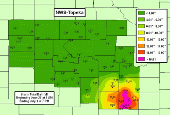 |
Thank you to local Storm Spotters, County Dispatchers and Emergency Management, local media members, and all others that have supplied information to the NWS-Topeka Office the past few days. Your help and dedication is much appreciated.
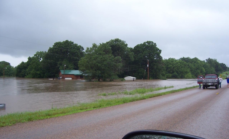
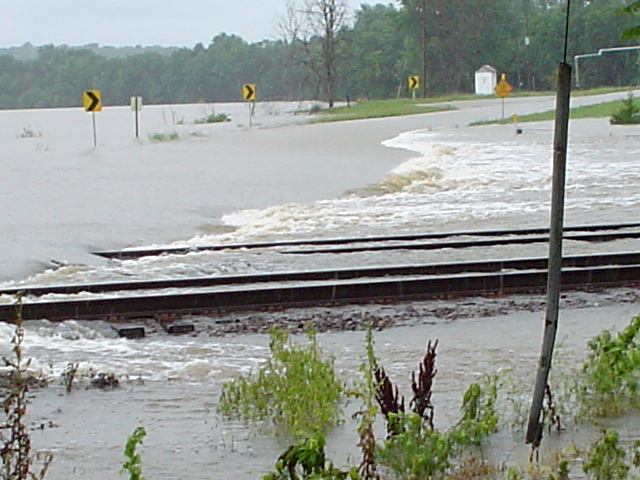
| Pictures below were taken near Lane, KS. | Pictures below were taken near Melvern, KS. |
 |
 |
 |
 |
 |
 |
 |
 |
US Dept of Commerce
National Oceanic and Atmospheric Administration
National Weather Service
Topeka, KS
1116 NE Strait Avenue
Topeka, KS 66616-1667
785-234-2592
Comments? Questions? Please Contact Us.

