
Tropical Depression Two is expected to gradually strengthen and could bring tropical storm conditions to the Florida Panhandle beginning late Monday. Areas of flash flooding will be possible through Thursday along the eastern and central Gulf Coast. Severe thunderstorms will develop and move along a cold front crossing the Upper Midwest Monday, and through the Ohio Valley/Mid-Atlantic on Tuesday. Read More >
Topeka, KS
Weather Forecast Office
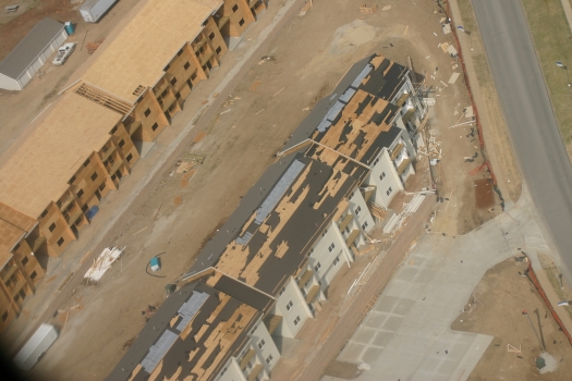
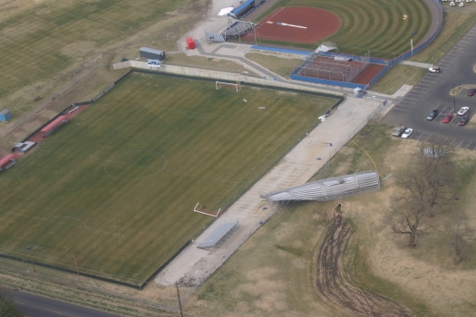
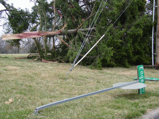
THE NATIONAL WEATHER SERVICE IN TOPEKA HAS SURVEYED THE WIND DAMAGE THAT  OCCURRED ACROSS MUCH OF LAWRENCE AROUND 8 AM CST,
MARCH 12.  THE LARGE AREA  OF WIND DAMAGE WAS CAUSED BY A SEVERE THUNDERSTORM MICROBURST OF 70 TO 90 MPH STRAIGHT LINE WINDS.
THE DAMAGE FROM THE MICROBURST IN LAWRENCE THIS MORNING INCLUDED EXTENSIVE DAMAGE TO TREES AND POWER LINES, ALONG WITH ROOF
AND SIDING DAMAGE TO BUILDINGS.
MICROBURSTS ARE VERY STRONG WINDS THAT QUICKLY DESCEND FROM THE BASE OF A SEVERE THUNDERSTORM AND THEN SPREAD OUT QUICKLY
 UPON IMPACT WITH THE GROUND. THESE STRAIGHT LINE DAMAGING WINDS CAN CAUSE EXTENSIVE DAMAGE ACROSS A LARGE AREA.
VIDEO RECEIVED SO FAR TAKEN IN LAWRENCE SHOW THE SUDDEN DOWNBURST FROM THE SEVERE THUNDERSTORM BASE AND THE FANNING
OUT OF THE DOWNBURST AS IT HITS THE GROUND, WHICH ALSO CAUSED WIDESPREAD BLOWING DUST.
Aerial Photos From KHP:

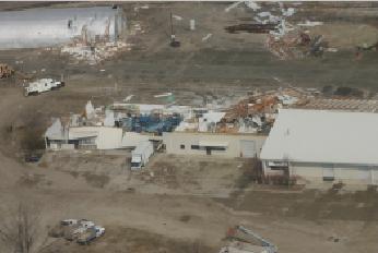

SOME NWS PHOTOS OF THE DAMAGE IN LAWRENCE


US Dept of Commerce
National Oceanic and Atmospheric Administration
National Weather Service
Topeka, KS
1116 NE Strait Avenue
Topeka, KS 66616-1667
785-234-2592
Comments? Questions? Please Contact Us.

