
Tropical Depression Two is expected to gradually strengthen and could bring tropical storm conditions to the Florida Panhandle beginning late Monday. Areas of flash flooding will be possible through Thursday along the eastern and central Gulf Coast. Severe thunderstorms will develop and move along a cold front crossing the Upper Midwest Monday, and through the Ohio Valley/Mid-Atlantic on Tuesday. Read More >
The Winter Storm of January 25th and 26th
A wintry mix of freezing rain, sleet and snow fell across North Central, Northeast and East Central Kansas on January 25th and 26th. The precipitation fell as mainly snow across North Central Kansas with reports of 4 to 6 inches common

Figure 1 Snow depth reports through 7 am 1/27/2004
Freezing rain occurred across much of the area on January 25th. Ice accumulations of 1/4 to 1/2 of an inch were reported (Figure 2) across Northeast and parts of East Central Kansas. The ice built up on trees and power lines and caused numerous power outages and downed limbs across North Central and Northeast Kansas. Slick roads also led to numerous accidents across the area.
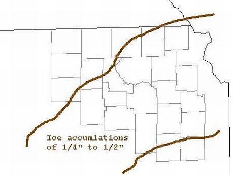
Figure 2 Ice Accumulations reported on 1/27/2004
The freezing rain occurred as a layer of warm air (located about 3000 to 6000 feet above the ground) spread over a layer of below freezing air at the surface (Figure 3). This allowed the precipitation to fall as rain instead of snow. When the rain struck the cold ground, trees and cars, it froze causing the widespread glazing exposed objects.
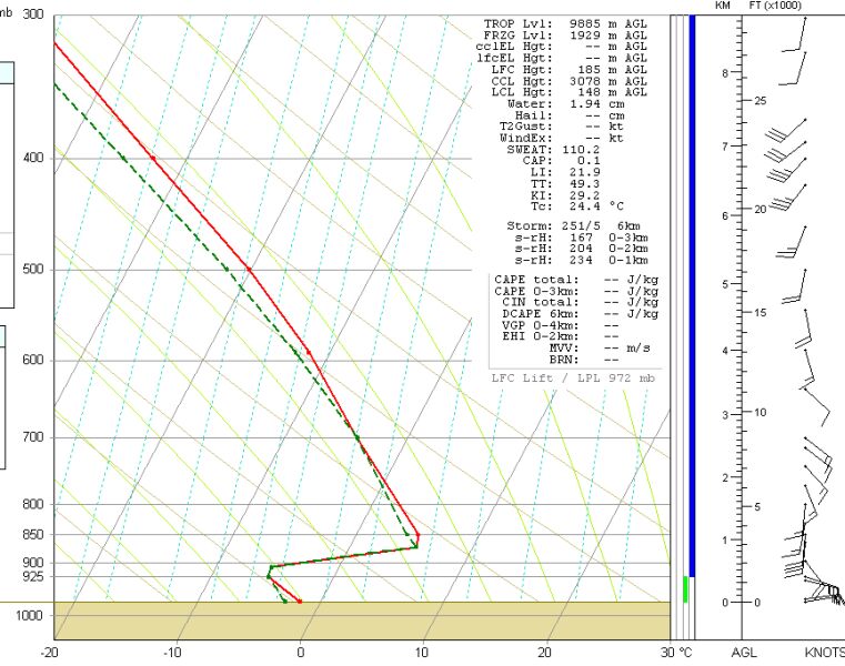
Figure 3 The Topeka sounding from 7 am 1/25/2004

