
Extremely critical fire weather concerns for portions of the southern High Plans as strong wind and very dry conditions could result in rapid spread of any fires. Meanwhile, severe thunderstorms are expected once again across areas of the Central and Southern Plains, then spreading in the Mississippi Valley regions on Monday. Damaging winds, very large hail and strong tornadoes are possible. Read More >
Six tornadoes struck Republic county during the evening hours of Sunday June 22. Three of the tornadoes were weak F0 tornadoes that were on the ground for less than a mile. There were two F1 tornadoes that were on the ground for 2 to 3 miles and one F2 tornado that was on the ground for four miles before it moved into Nebraska. A summary of the tornadoes can be found at the bottom of this page . The tornadoes were clustered in an area that extended from Courtland to Republic to Byron, Nebraska. Most the damage was to outbuildings although one house was destroyed northeast of Republic. Large hail was also reported across parts of the county, with hail up to the size of golf balls being reported just east of the town of Republic.
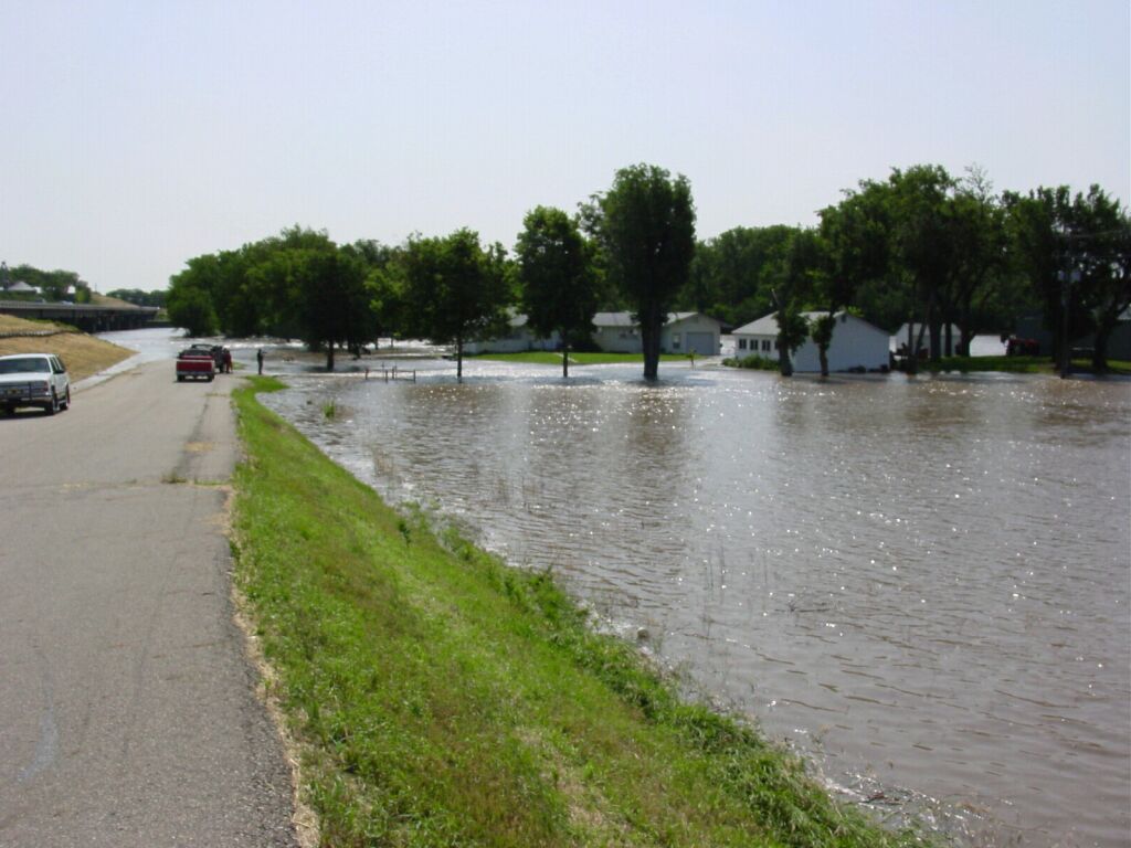
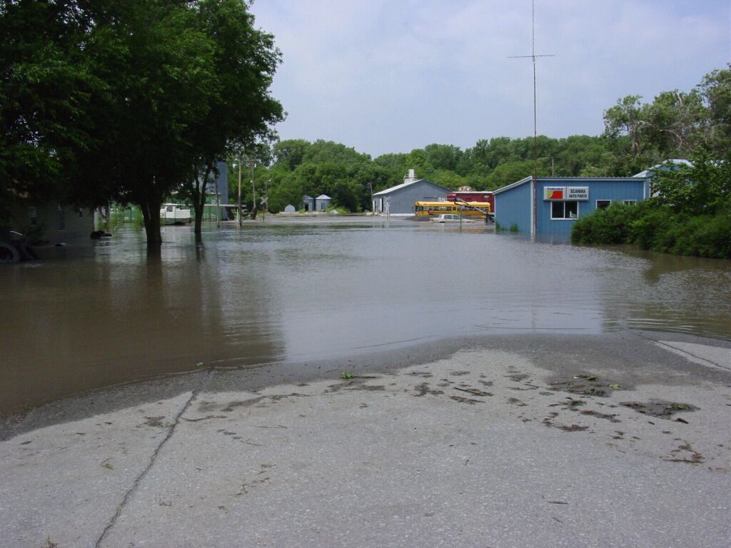
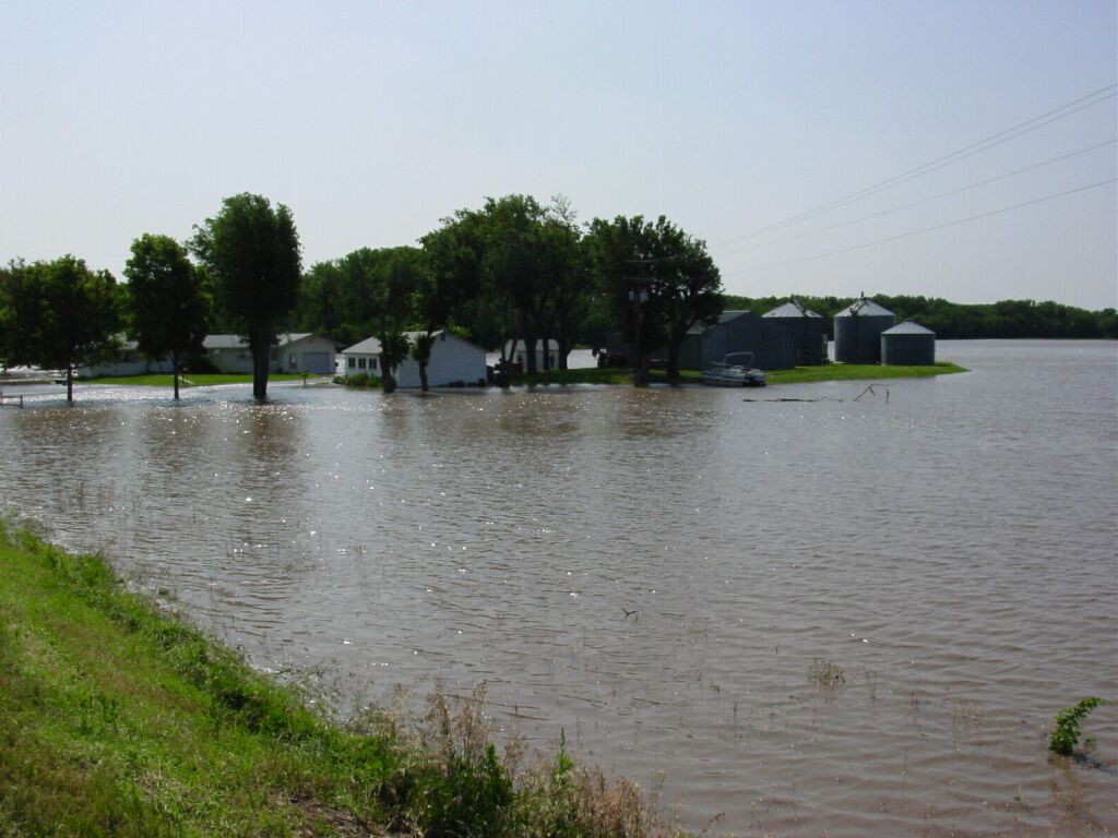
In addition to the tornadoes, torrential rains also occurred across Republic county. Radar indicated that the northwest corner of Republic county may have received in excess of 10 inches of rain Sunday evening and Monday morning. Courtland reported 7.30 inches of rain while Scandia reported 6.12 inches. Major flooding occurred along the Republican River with numerous people being evacuated. The river swelled to a mile wide near Scandia during the peak of the flooding. Across northern sections of Republic county, numerous gravel roads were reported to be washed out and many fields had been flooded.
Map of the the six tornado touchdowns across Republic county.
WSR-88D Radar reflectivity image and storm relatve velocity images from 828 pm of the tornadic storm over Republic county. A hook echo and strong rotation can be seen just southeast of the town of Republic. A tornado was reported 3 miles southwest of the town of Republic at 820 pm.
WSR-88D Radar 24 hour rainfall accumulation ending at 7 am Monday morning. The pinkish color indicates rainfall in excess of 12 inches. The rainfall estimates were about 25% too high across Republic county.
Some photos of damage and flooding across Republic county from the storms of June 22 and 23 2003.
 |
 |
 |
 |
 |
 |
 |
 |
 |
PRELIMINARY REPORT ON THE TORNADOES AND FLOODING ACROSS REPUBLIC
COUNTY.
SIX TORNADOES OCCURRED ACROSS REPUBLIC COUNTY SUNDAY EVENING. THREE
OF THE TORNADOES WERE RATED AT F0, TWO WERE RATED AT F1 AND ONE WAS
RATED AT F2.
AN F0 TORNADO TOUCHED DOWN ONE MILE NORTH OF COURTLAND. IT WAS ON
THE GROUND FOR ONE HALF OF A MILE AND WAS ABOUT 50 YARDS WIDE.
AN F0 TORNADO TOUCHED DOWN FIVE MILES NORTHEAST OF COURTLAND. IT
WAS ON THE GROUND FOR 1 MILE AND WAS ABOUT 75 YARDS WIDE.
AN F1 TORNADO TOUCHED DOWN FOUR MILES NORTH NORTHEAST OF COURTLAND.
IT WAS ON THE GROUND FOR 3 MILES AND IT MOVED NORTHEAST. IT WAS
ABOUT 150 YARDS WIDE.
AN F0 TORNADO TOUCHED DOWN FOUR MILES WEST OF MUNDEN. IT WAS ON THE
GROUND FOR ONE HALF OF A MILE AND IT WAS ABOUT 50 YARDS WIDE.
AN F1 TORNADO TOUCHED DOWN ONE MILE SOUTHEAST OF REPUBLIC AND LIFTED
3 MILES EAST OF REPUBLIC. THE TORNADO WAS ON THE GROUND FOR 2 MILES
AND WAS ABOUT 150 YARDS WIDE.
AN F2 TORNADO TOUCHED DOWN 3 MILES NORTHEAST OF REPUBLIC. IT WAS ON
THE GROUND FOR FOUR MILES BEFORE IT MOVED NORTH NORTHEAST INTO
NEBRASKA. IT WAS ABOUT ONE QUARTER OF A MILE WIDE.
ONE HOME WAS DESTROYED NORTHEAST OF REPUBLIC. A FEW OTHER HOMES
SUFFERED SOME DAMAGE, OTHERWISE MOST OF THE DAMAGE WAS TO OUT
BUILDINGS AND POWER POLES.
MAJOR FLOODING OCCURRED ACROSS NORTHERN AND WESTERN PARTS OF
REPUBLIC COUNTY. SEVERAL HOMES WERE FLOODED AND FAMILIES WERE
EVACUATED NEAR SCANDIA AS THE REPUBLICAN RIVER SWELLED TO A MILE IN
WIDTH. NUMEROUS FARM FIELDS WERE ALSO FLOODED AND SEVERAL GRAVEL
ROADS WERE WASHED OUT.