
Tropical Depression Two is expected to gradually strengthen and could bring tropical storm conditions to the Florida Panhandle beginning late Monday. Areas of flash flooding will be possible through Thursday along the eastern and central Gulf Coast. Severe thunderstorms will develop and move along a cold front crossing the Upper Midwest Monday, and through the Ohio Valley/Mid-Atlantic on Tuesday. Read More >
During the afternoon of May 19, 1960, an F4 tornado tracked across NE Kansas. There was one fatality in Shawnee County and 25 serious injuries. The tornado began just south of Wamego and tracked to near Leavenworth. Meriden, KS, was almost completely demolished, and the northern portion of Oskaloosa sustained significant damage as well. At times, the tornado was almost 2 miles wide.
R.A. Garrett, who was the official in charge at the U.S. Weather Bureau office in Topeka (the forerunner to today's National Weather Service), produced a detailed study, which can be found here:
/media/top/mwr-090-06-0231.pdf
Here are several figures from the study
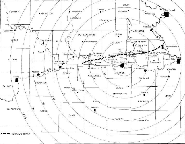
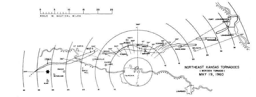
The tornado track was approximately 70 miles long, although there was evidence of multiple tornadoes along the track, as shown in the next image:
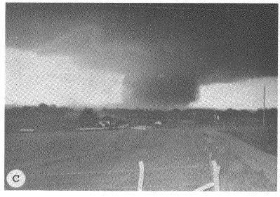
Several pictures of this tornado were taken by troopers from The Kansas Highway Patrol. Here is a photograph of the tornado just north of Rossville:
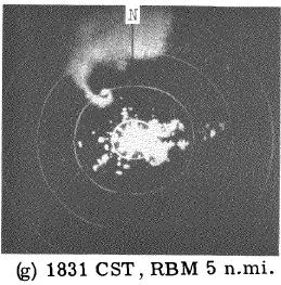
Weather radar technology in 1960 was primative compared to today's WSR-88D network. Here is a photograph of the radar scope as the tornado moved just north ot Topeka.
Although not the same tornado, here is an example of a similiar 'hook echo' feature as seen on the WSR-88D. This data is from the recent Oklahoma City tornado outbreak of May 10, 2010:
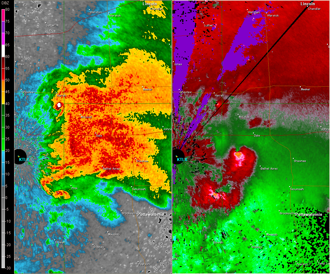
The WSR-88D data includes a much better resolution reflectivity product (left image) and also includes data on the winds inside of storms (right image). The 'wind' image on the right shows 3 probable tornadoes - can you find them?

