
Extremely critical fire weather concerns for portions of the southern High Plans as strong wind and very dry conditions could result in rapid spread of any fires. Meanwhile, severe thunderstorms are expected once again across areas of the Central and Southern Plains, then spreading in the Mississippi Valley regions on Monday. Damaging winds, very large hail and strong tornadoes are possible. Read More >
|
The Northeast Kansas Flood of 1951 - |
 |
|
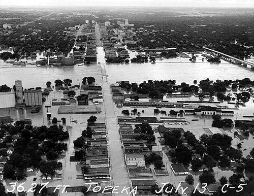
The Kansas River flooding overrunning Topeka homes and businesses. (July 13, 1951) (Photo courtesy of Topeka Capital-Journal.) |
|
|
This July of 2016 marks the 65th anniversary of the great flood of 1951 which killed 24 people and caused thousands to abandon their homes, schools and businesses. The unprecedented high waters affected all area river basins especially the Kansas, Neosho, Marias Des Cygnes and Verdigris. Damage costs in 1951 exceeded 760 million dollars, which today would be over 5 billion dollars.
|
|
 |
 |
|
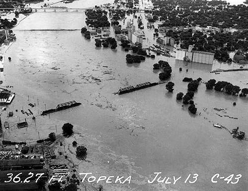
The Rock Island Bridge going down. (July 13, 1951) (Photo courtesy of Topeka Capital-Journal) |
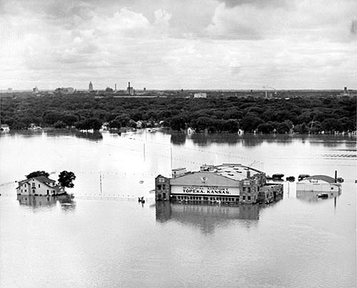
Topeka Municipal Airport, 3600 Sardou Ave. (Photo courtesy of Topeka Capital-Journal)
|
|
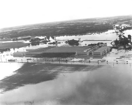
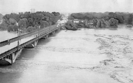
The flooding actually began in June and continued into mid July. Extremely heavy rains of 8 to 16 inches fell from July 9 - 13 culminating in the highest river stages since the Great Flood of 1844. July 13, 1951, can be rightly designated as the single day of greatest flood destruction in Midwestern United States history to that date. On July 13, the Kansas River crested at all official gaging stations, from Manhattan to Bonner Springs, at 4 to 6 feet above all previous recorded crests. The Marais Des Cygnes, Neosho and Verdigris Rivers were also at or near crests; exceeding all previous records by as much as 9 feet.
|
|
 |
 |
|
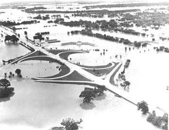
The cloverleaf in North Topeka at the junction of U.S. Hwys. 24 and 75. The recently opened Jayhawk Junior Motel was underwater up to its roof. Looking southeast. |
The Goodyear Tire & Rubber Plant, looking toward the north. |
|
Some 1951 Crests included:
KANSAS RIVER...(All on July 13) MANHATTAN...33.40 FT. (15.4 feet above flood stage) WAMEGO... 30.56 FT. (11.56 feet above flood stage ) TOPEKA... 40.80 FT. (14.80 feet above flood stage ) LECOMPTON...30.23 FT. (13.25 feet above flood stage ) LAWRENCE... 29.90 FT. ( 11.90 feet above flood stage)
MARAIS DES CYGNES RIVER OTTAWA 42.97 FT, (11.97 feet above flood stage) On July 11th.
NEOSHO RIVER EMPORIA... 33.40 FT. (13.4 feet above flood stage) On July 11th NEOSHO RAPIDS...34.30 FT. (12.30 feet above flood stage) On July 11th LEROY... 34.48 FT. (11.48 feet above flood stage) On July 12th BURLINGTON... 41.53 FT. (14.53 feet above flood stage) On July 12th � |
|
 |
|
|
The Lawrence Municipal Airport fairing no better. (Photo courtesy of Lawrence Journal World) |
Floodwater under the Lawrence bridge. (Photo courtesy of Lawrence Journal World) |
|
As a result of the floods in 1951, a series of flood control reservoirs and levees were built across Eastern Kansas. These systems prevented more widespread damage in many communities during the record rains and flooding of July 1993.
Additional Information on the flood can be found here. (PDF format) |
|