Pueblo, CO
Weather Forecast Office
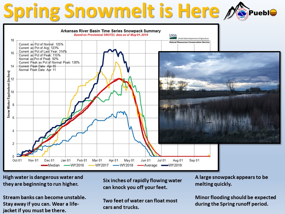
Spring snowmelt and runoff has started in south-central Colorado. A first wave has passed through the San Luis Valley and more is expected. Waters have been rising in the Arkansas basin but that snowmelt usually peaks later in May or even well into June on the main stem of the river.
This year’s heavy snowpack is likely to produce higher-than-normal water in lakes and streams across south-central and southeast Colorado. While these waters are a boon to farmers and communities across the state, they can create hazardous conditions along our streams and rivers.
Water is an enormously powerful force. Use extreme caution when near rivers and streams that are running high. Rivers do not have to be flooding to be dangerous. Stream banks can erode and become unstable. Rapidly flowing water can knock you off your feet.
Stay away from rivers and streams during the snowmelt. If you must be near them, wear a life jacket.
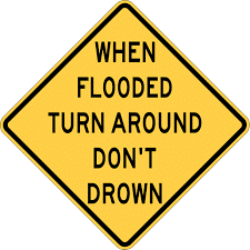
Do not drive into floodwaters. Half of all drownings in the United States are in vehicles. Turn Around. Don’t Drown.
ACTIVE ALERTS
Warnings by State - click ATOM button
Excessive Rainfall Forecasts
River Flooding
Convective Outlooks
Hurricanes
Fire Weather Outlooks
UV Alerts
Space Weather
Winter Winter Forecasts
Enhanced Data Display(EDD)
PAST WEATHER
Climate Monitoring
Astronomical Data
Certified Weather Data
CURRENT CONDITIONS
Radar
River Levels
Observed Precipitation
Surface Weather
Upper Air
Marine and Buoy Reports
Climate Monitoring
Snow Cover
Satellite
Space Weather
Enhanced Data Display(EDD)
FORECAST
Severe Weather
Drought
Fire Weather
Front/Precipitation Maps
Graphical Foreast Maps
Rivers
Marine
Offshore and High Seas
Hurricanes
Aviation Weather
Climate Outlook
Enhanced Data Display(EDD)
WEATHER SAFETY
Owlie Skywarn - for kids
NOAA Weather Radio
StormReady
Natural Weather Hazard Statistics
Red Cross
Federal Emergency Management Agency(FEMA)
National Weather Service SafetyBrochures
US Dept of Commerce
National Oceanic and Atmospheric Administration
National Weather Service
Pueblo, CO
3 Eaton Way
Pueblo, CO 81001-4856
(719) 948-9429
Comments? Questions? Please Contact Us.

