Catastrophic Super Typhoon Bavi's eyewall has reached Rota and is expected to bring dangerous winds, heavy rainfall and storm surge to Guam, Rota, Tinian and Saipan. A Typhoon Warning remains in effect. Heavy to excessive rainfall will continue to bring a flooding threat from coastal Mid-Atlantic to southern New England through Monday. Read More >
Pocatello, ID
Weather Forecast Office
The lightning strike graphics for Eastern Idaho are currently unavailable. We apologize for the inconvenience.
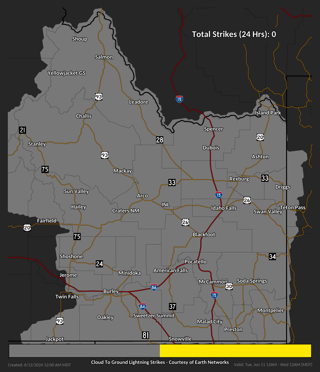
These graphics are cumulative lightning strike maps for eastern Idaho. Mouse-over each day to view the 24-Hour Cumulative Lightning Strike Map.
Updated daily at midnight, they are useful for determining where lightning has occurred over the previous 24 hour period, going back 6 days. This information could be helpful for determining where potential lightning-related fire starts may have occurred during recent thunderstorm activity. An individual strike shows up as a single yellow dot, multiple dots close together indicate an active thunderstorm moved through a particular area.
US Dept of Commerce
National Oceanic and Atmospheric Administration
National Weather Service
Pocatello, ID
1945 Beechcraft Ave
Pocatello, ID 83204
(208) 233-0834
Comments? Questions? Please Contact Us.