Pendleton, OR
Weather Forecast Office
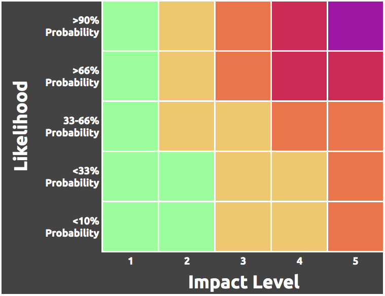
The Weather Risk Outlook colors are determined after NWS Pendleton meteorologists examine both the impact level of potential weather scenarios AND the associated probability of those scenarios. The resulting outlook displays the highest risk for each day.
NWS Pendleton meteorologists first use the impact table to determine the level of impact expected with a forecast weather event.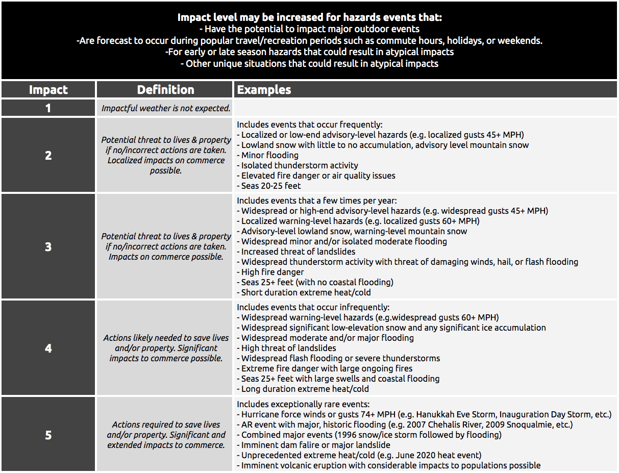
NWS Pendleton meteorologists then determine the color by determining the probability of occurrence using all the available information and then reference the matrix to determine the risk level associated with the forecast weather event.
US Dept of Commerce
National Oceanic and Atmospheric Administration
National Weather Service
Pendleton, OR
2001 NW 56th Drive
Pendleton, OR 97801
(541) 276-4493
Comments? Questions? Please Contact Us.

