| Overview | |||
|

| Reports | |
| Local Storm Reports | Public Information Statement |
| NOHRSC Interpolated Snowfall Map | SPC Event Archive |
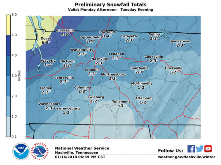
| Selected Snowfall Totals across Middle Tennessee | ||
| Snow Total | City | County |
| 7.0" | Indian Mound | Stewart |
| 6.0" | Dover | Stewart |
| 5.0" | Erin | Houston |
| 4.5" | 6 NNW Gainesboro | Jackson |
| 4.5" | 5 NW Gallatin | Sumner |
| 4.0" | Clarksville | Montgomery |
| 4.0" | 5 NW Columbia | Maury |
| 3.5" | Brentwood | Williamson |
| 3.5" | Cheatham Dam | Cheatham |
| 3.2" | 6 NNE Livingston | Overton |
| 3.1" | 6 S Gallatin | Wilson |
| 3.0" | Nashville | Davidson |
| 3.0" | Hermitage | Davidson |
| 3.0" | 8 W Baxter | Putnam |
| 3.0" | 3 SE Lavergne | Rutherford |
| 3.0" | Watertown | Wilson |
| 3.0" | Portland | Sumner |
| 3.0" | 2 W Smithville | De Kalb |
| 2.5" | Celina | Clay |
| 2.5" | Jamestown | Fentress |
| 2.5" | Franklin | Williamson |
| 2.5" | Carthage | Smith |
| 2.2" | NWS Nashville | Wilson |
| 2.2" | 4 SE Woodbury | Cannon |
| 2.0" | 1 NNE Manchester | Coffee |
| 2.0" | 2 E Lawrenceburg | Lawrence |
| 2.0" | Columbia | Maury |
| 2.0" | Doyle | White |
| 2.0" | 4 SSE Murfreesboro | Rutherford |
| 1.8" | 1 ESE Centertown | Warren |
| 1.6" | 6 NE Lewisburg | Marshall |
| 1.5" | 6 S Monterey | Cumberland |
| 1.5" | Dickson | Dickson |
| 1.5" | Cookeville | Putnam |
| 1.5" | Shelbyville | Bedford |
| 1.0" | 1 N Crossville | Cumberland |
| 1.0" | St. Joseph | Lawrence |
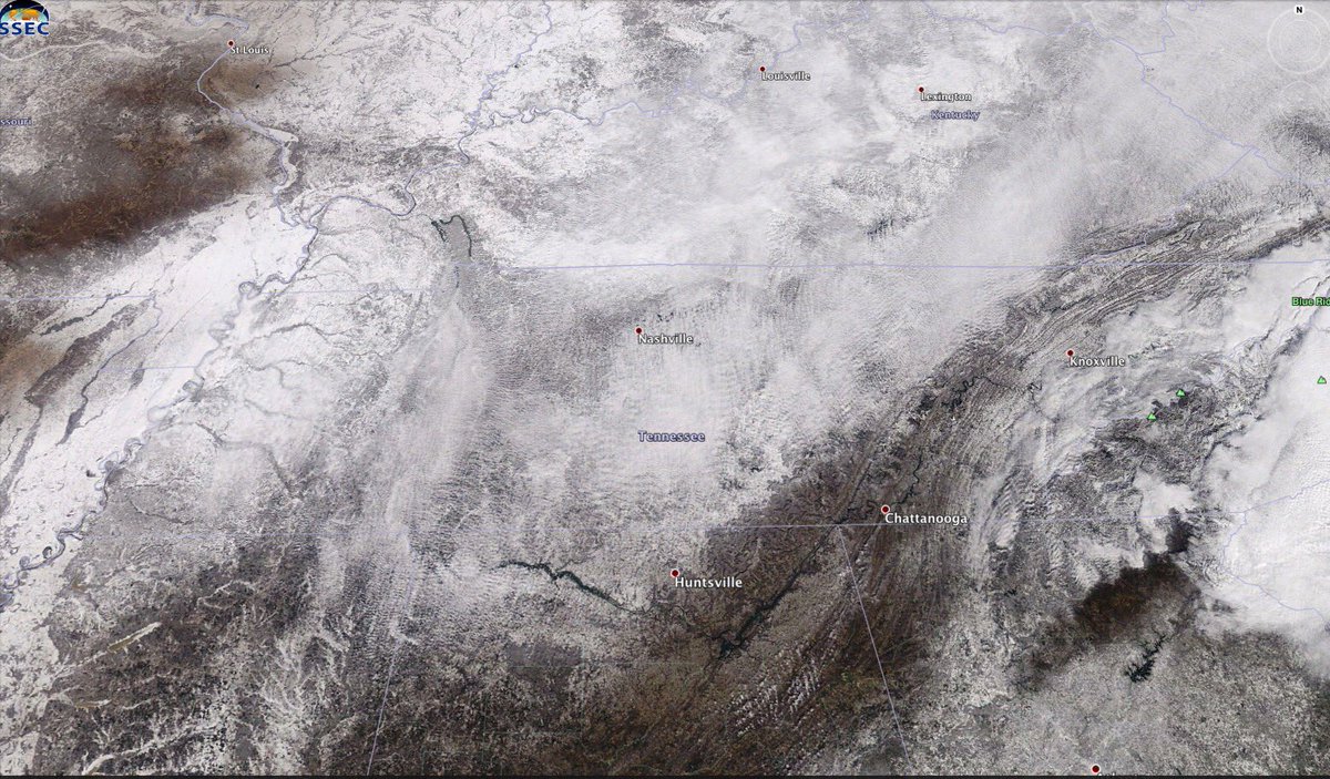
| Satellite Imagery | |
 Snow Cover from SSEC Satellite Imagery on January 17, 2018 |
| Photos | |||||
| Coming soon! | |||||