
| Downburst Statistics | |||||||
| # | Counties | Location | Max Winds | Time (CDT) | Fatalities | Injuries | |
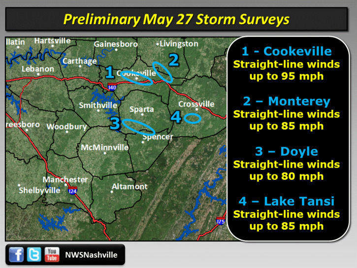
| 1 | Putnam/Cumberland | Cookeville/Mayland | 95 mph | 816 PM | 0 | 0 | |
| 2 | Overton/Putnam | Rickman/Monterey | 85 mph | 826 PM | 0 | 0 | |
| 3 | White | Doyle | 80 mph | 828 PM | 0 | 0 | |
| 4 | Cumberland | Lake Tansi | 85 mph | 839 PM | 0 | 0 | |
| Overview | |
| A late Spring storm system brought several waves of strong to severe thunderstorms to Middle Tennessee during the afternoon and evening hours on May 27. One supercell thunderstorm developed during the afternoon across Wilson County, then moved east-southeast across Smith, Putnam, White, and Cumberland Counties, producing very photogenic wall clouds and several reports of hail. Later in the day, two lines of severe thunderstorms called Mesoscale Convective Systems (MCS) moved southeast out of western Kentucky across the region, producing widespread wind damage and several reports of large hail. The worst damage occurred across Putnam, Jackson, Overton, Fentress, White, and Cumberland Counties, where straight-line winds up to 95 mph caused major wind damage. The second line of severe thunderstorms caused less severe but still widespread wind damage across Humphreys, Hickman, Maury, and Perry Counties. The Storm Prediction Center in Norman, Oklahoma stated that each of these two damaging lines of thunderstorms may be classified as a "derecho", which are long lived, damaging wind storms that travel hundreds of miles. |
| Reports & Outlooks | ||
| SPC Storm Reports | SPC Event Archive | Local Storm Reports |
| Storm Surveys |
 |
| Radar |
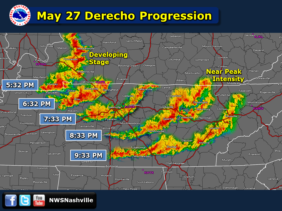 |
| Radar mosaic showing the progression of the damaging line of severe thunderstorms that affected the Upper Cumberland, which the Storm Prediction Center says was a derecho |
| Rickman/Monterey Downburst | ||||
| Counties: | Overton/Putnam | |||
| Time: | 815-833 PM | |||
| Estimated Peak Winds: | 85 mph | |||
| Damage Path Length: | 17 miles | |||
| Damage Path Width: | 1 mile | |||
| Fatalities: | 0 | |||
| Injuries | 0 | |||
|
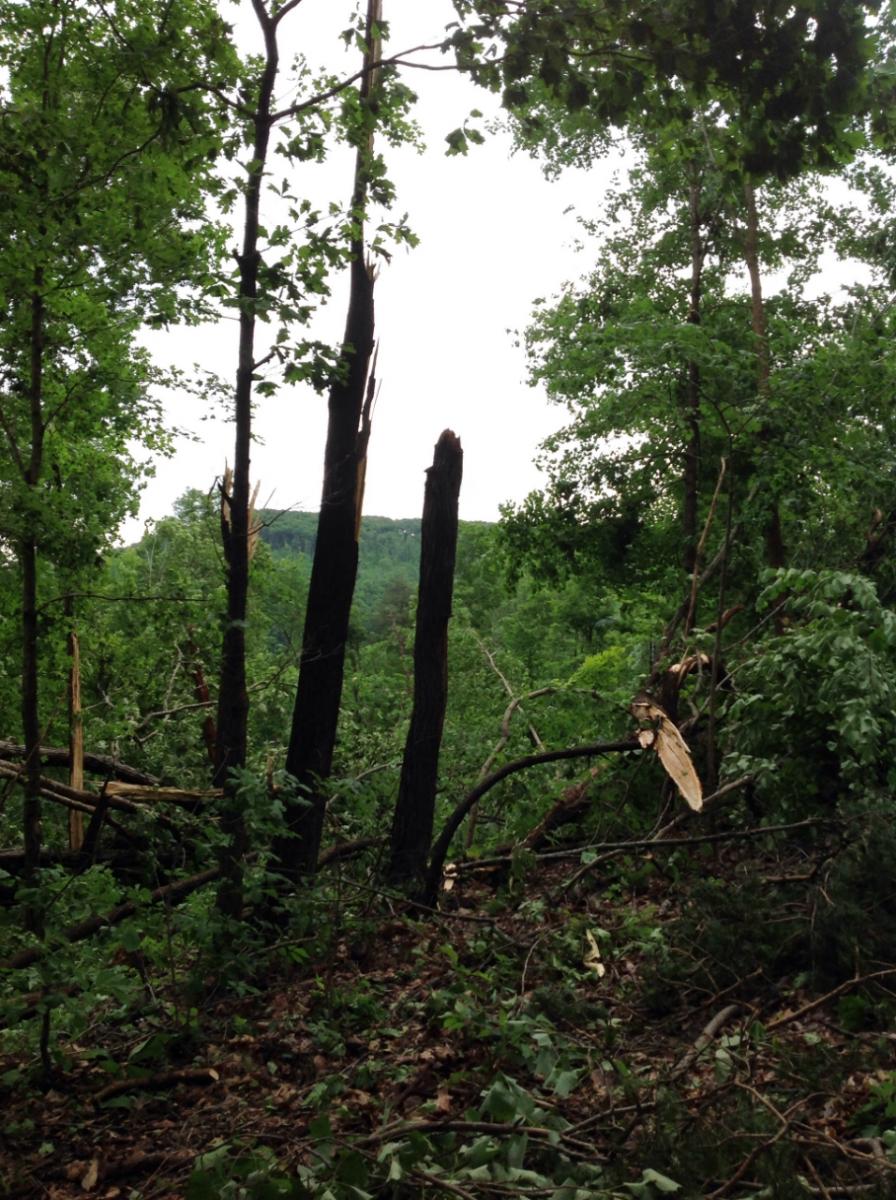
Storm Survey: A NWS storm survey found a severe 17 mile long by 1 mile wide downburst caused major wind damage along the Putnam/Overton County border southeast to around Monterey. Damage was first reported on Cindy Lane in northern Putnam County where trees were blown down. Numerous more trees were snapped and uprooted along Ben Mason Road just north of the county line in Overton County. The roof was blown off a large warehouse at a flea market on Highway 111, and a nearby outbuilding lost many wood panels on the outside walls. Dozens of large trees were also snapped and uprooted along Spring Creek Road in Rickman, with several falling on homes and vehicles. Farther to the east, a barn lost much of its roof on Highway 84 near Lewis Lane, and numerous trees and power lines were blown down along Highway 84 south of Boswell Road. Large trees were blown down and playground equipment destroyed in Whittaker Park in Monterey, and several more trees were blown down on Clinchfield Drive and Meadow Creek Road southeast of Monterey. Wind speeds were estimated up to 85 mph. |
||||
|
||||
|
Storm Survey Damage Photos: |
||||
 |
 |
|||
| Lake Tansi Downburst | ||||
| Counties: | Cumberland | |||
| Time: | 839-845 PM | |||
| Estimated Peak Winds: | 85 mph | |||
| Damage Path Length: | 3 miles | |||
| Damage Path Width: | 1/2 mile | |||
| Fatalities: | 0 | |||
| Injuries | 0 | |||
|
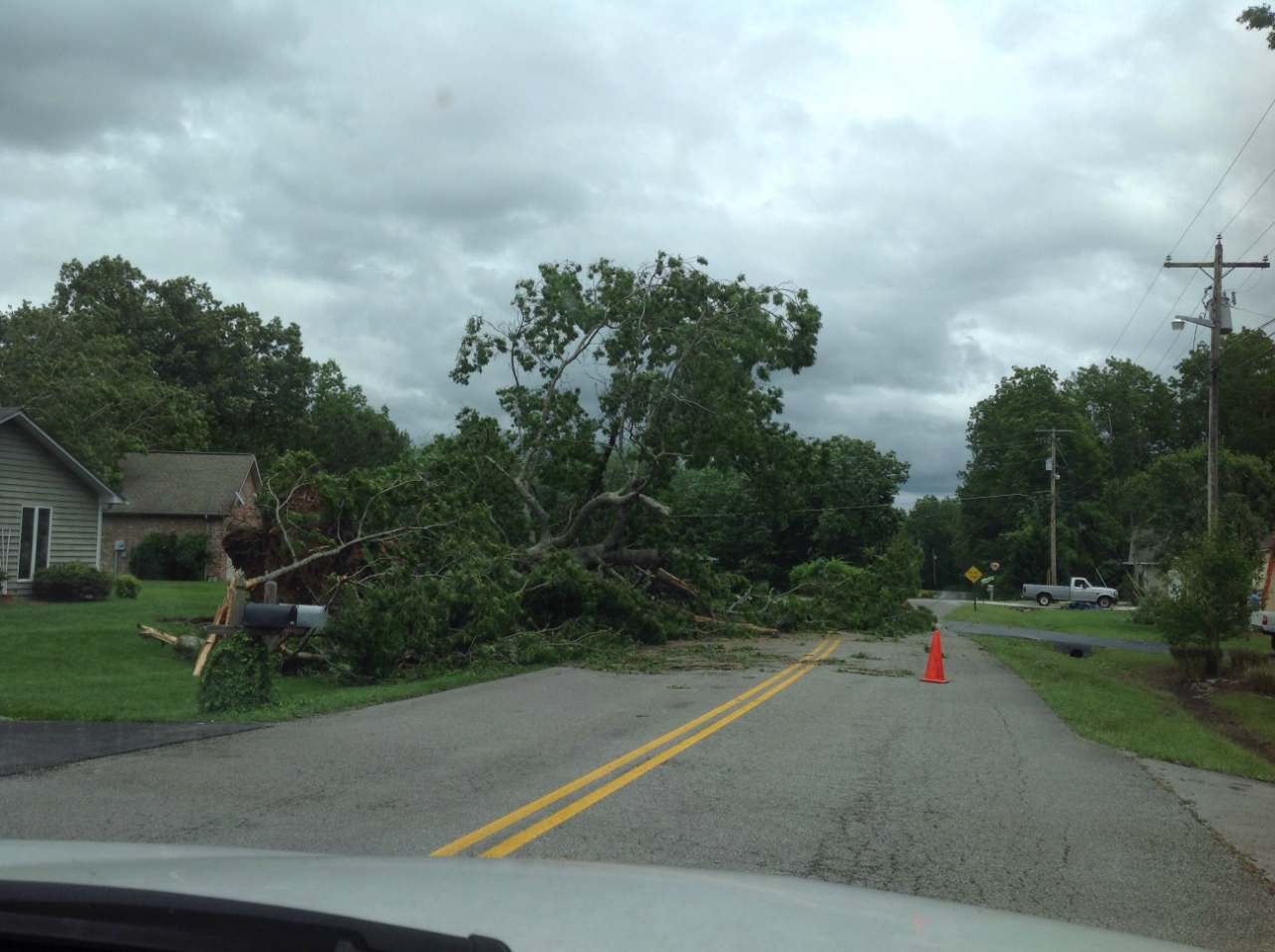
Storm Survey: A NWS storm survey found the rear flank downdraft of a supercell thunderstorm caused severe wind damage in a 3 mile long by 1/2 mile wide swath across Lake Tansi. Dozens of trees and power lines were blown down from Ona Road east-southeast across Cravens Drive, the Lake Tansi Golf Course, Seminole Loop, Cheyenne Drive, Pawnee Road, Pomo Circle, Piute Road, Natchez Trace, and Flathead Road. Many roads were blocked and some trees fell onto homes and vehicles. Wind speeds were estimated up to 85 mph. |
||||
|
||||
|
Storm Survey Damage Photos: |
||||
 |
 |
|||