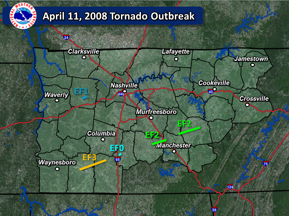
| Tornado Statistics | ||||||||
| # | Counties | Rating | Time (CST) | Length (miles) | Width (yards) | Fatalities | Injuries | |
| 1 | Dickson | EF1 | 0956 | 1.60 | 20 | 0 | 0 | |
| 2 | Lawrence/Giles | EF3 | 1101 | 22.0 | 300 | 0 | 1 | |
| 3 | Marshall | EF0 | 1140 | 0.10 | 10 | 0 | 0 | |
| 4 | Bedford/Coffee | EF2 | 1211 | 11.92 | 200 | 0 | 0 | |
| 6 | Cannon/Warren | EF2 | 1242 | 16.60 | 250 | 0 | 0 | |
| Reports & Outlooks | |||
| SPC Storm Reports | SPC Day 1 Outlook | SPC Event Archive | Public Information Statements |
| EF1 Dickson County Tornado | |
| Counties: | Dickson |
| Time: | 9:56 AM CST |
| EF Scale: | EF0 |
| Damage Path Length: | 1.60 miles |
| Damage Path Width: | 20 yards |
| Fatalities: | 0 |
| Injuries | 0 |
| Damage: STORM DATA: EF1 tornado flattened two barns, trees were snapped and uprooted, and outbuilding was destroyed. A 6 feet by 10 feet section of vinyl siding came off a house. Damage was in the Jones Creek Road and Rock Church Road areas. SHAMBURGER (2015): The time and path of this tornado was adjusted based on radar data and the narrative in Storm Data. |
|
| EF3 Lawrence/Giles County Tornado | ||
| Counties: | Lawrence/Giles | |
| Time: | 11:01 AM CST | |
| EF Scale: | EF3 | |
| Damage Path Length: | 22 miles | |
| Damage Path Width: | 300 yards | |
| Fatalities: | 0 | |
| Injuries: | 1 | |
|
Damage: |
||
NWS Storm Survey Photos: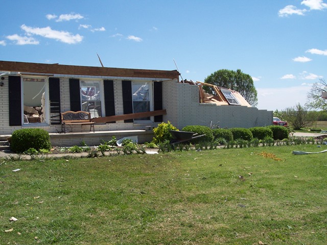 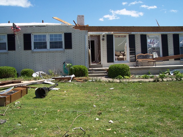 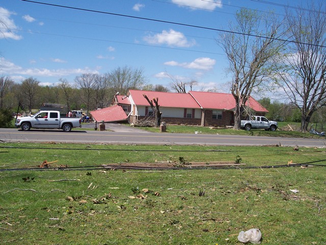 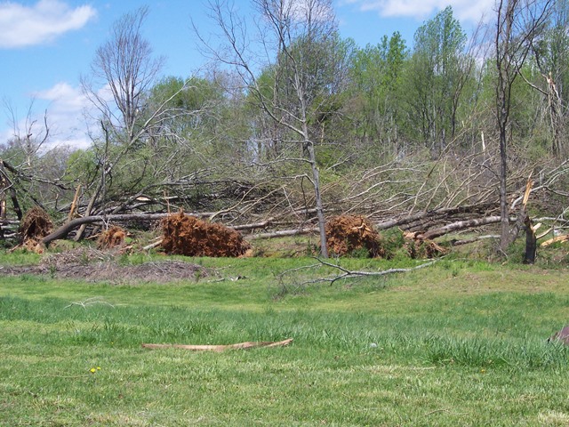 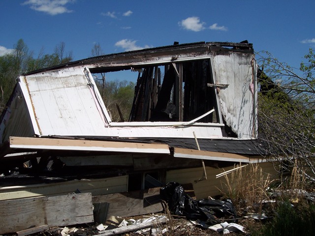 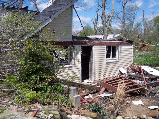 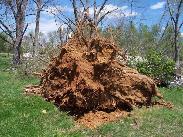 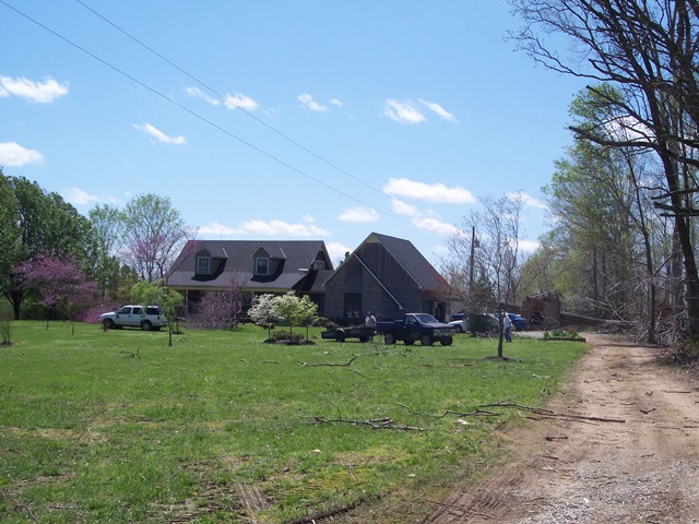 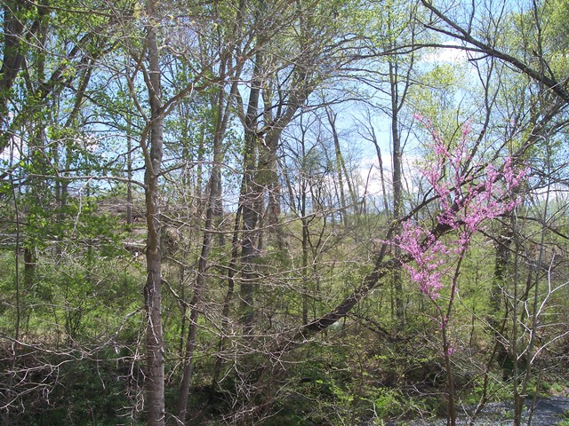 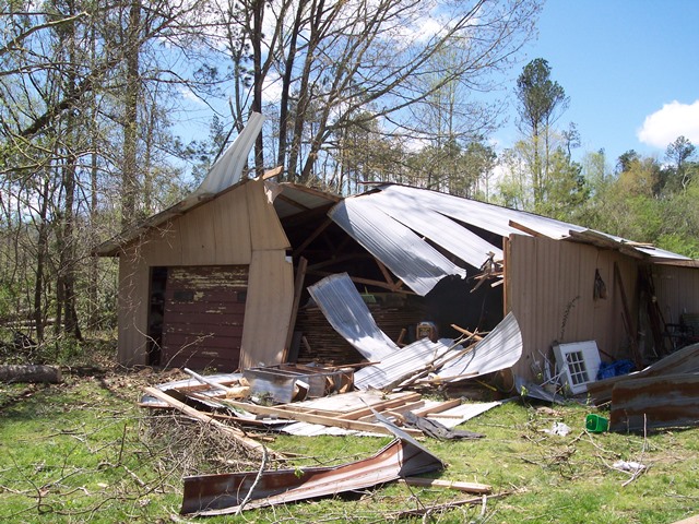 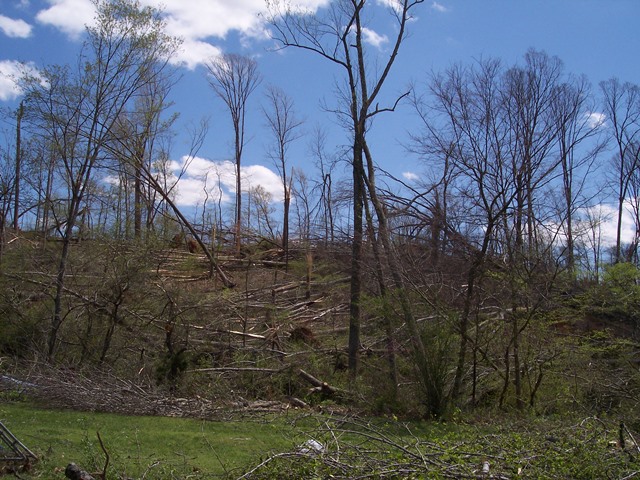 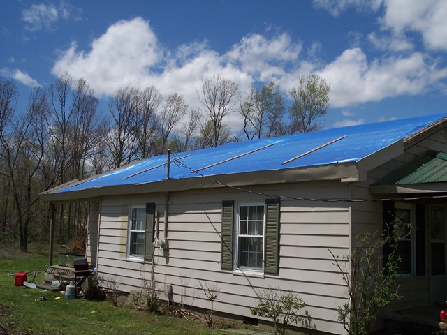 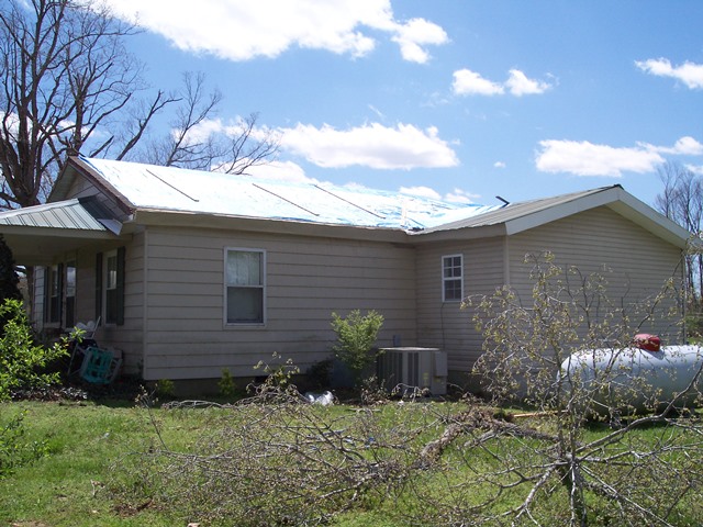  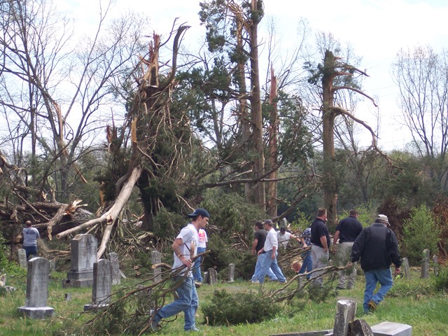 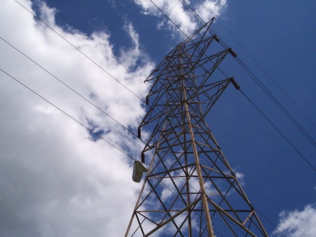 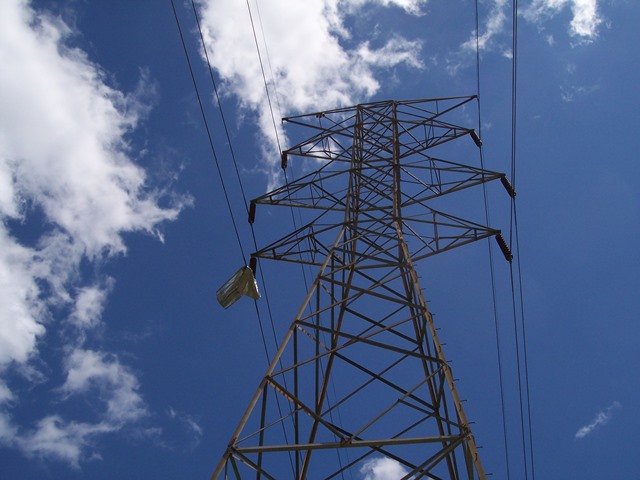 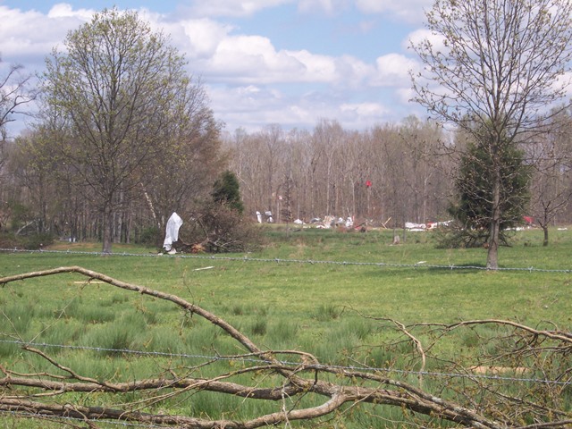 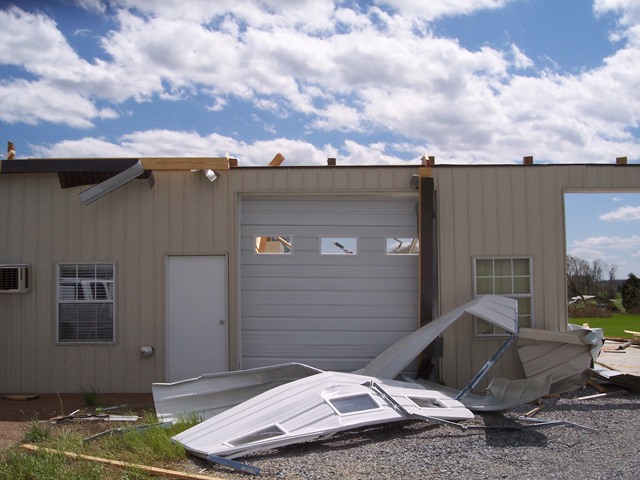  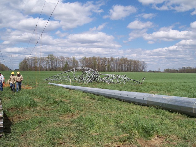 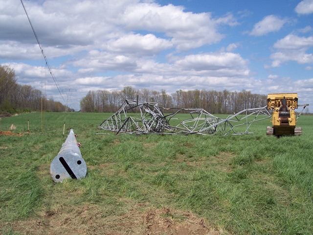 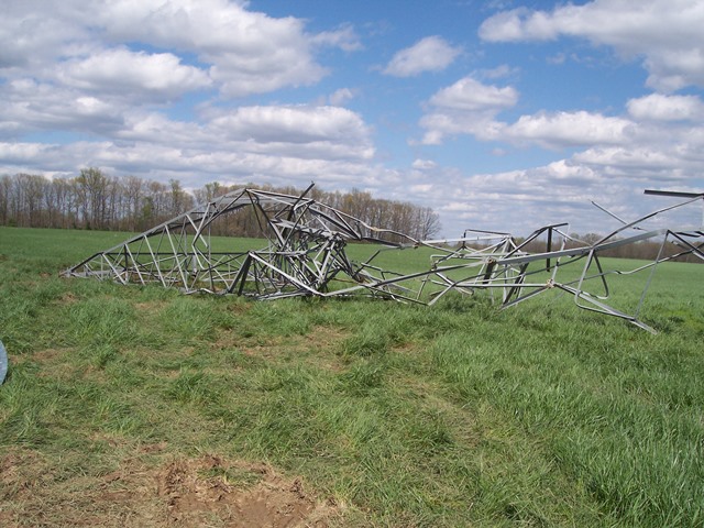 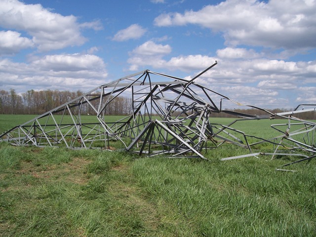 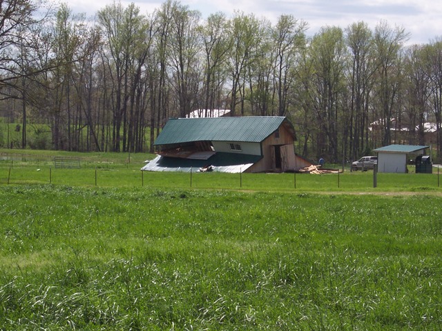 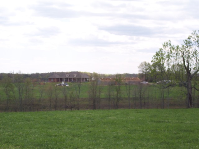 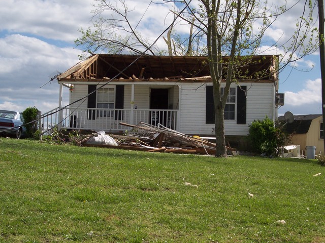 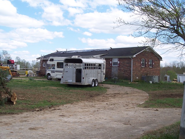 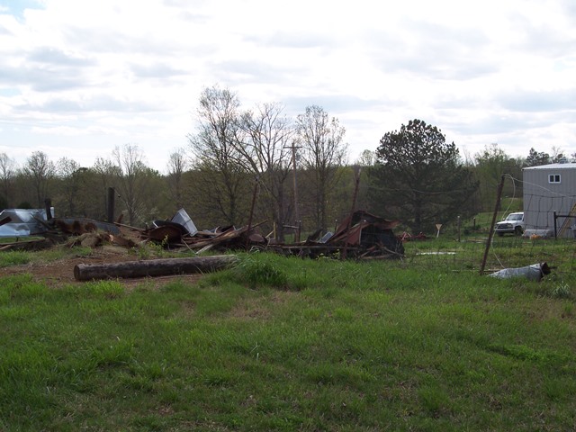 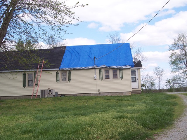 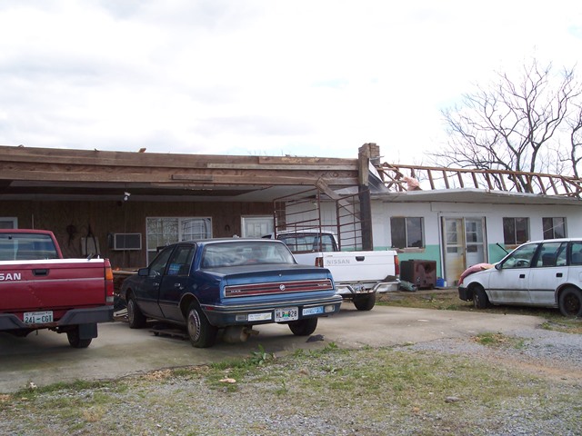 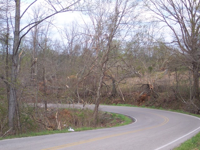 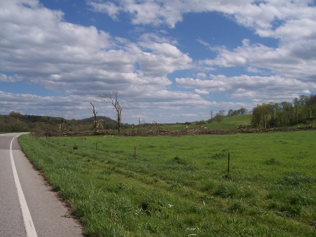 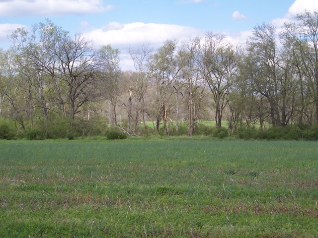 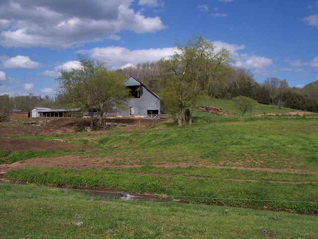 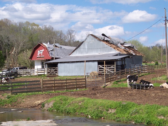 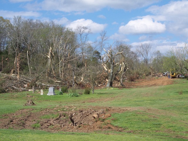 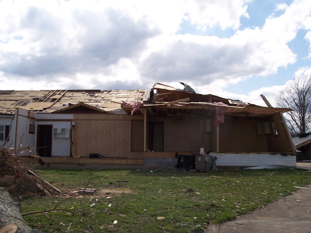 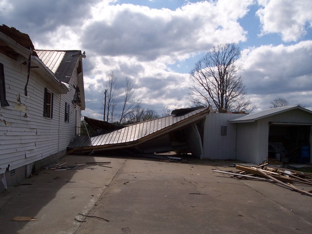 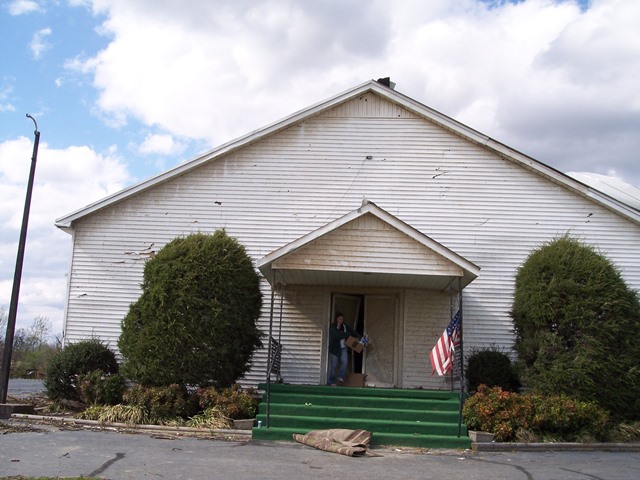 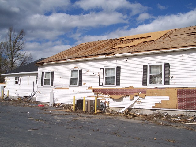 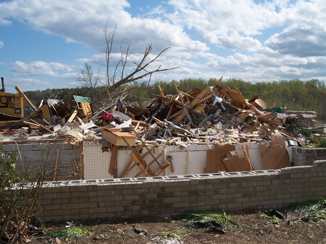 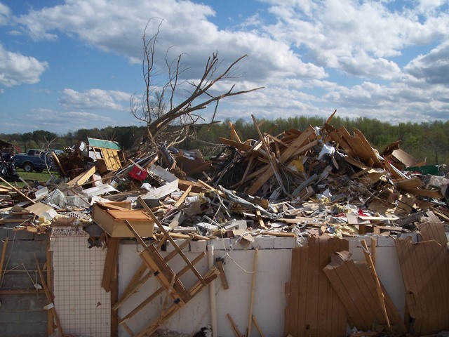 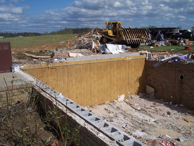 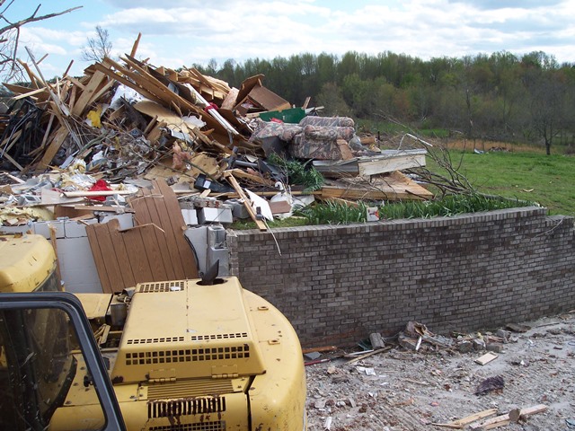 |
||
| EF0 Marshall County Tornado | |
| Counties: | Marshall |
| Time: | 11:40 AM CST |
| EF Scale: | EF0 |
| Damage Path Length: | 0.10 miles |
| Damage Path Width: | 10 yards |
| Fatalities: | 0 |
| Injuries | 0 |
| Damage: STORM DATA: A helicopter crew reported a tornado at the intersection of Highway 373 and Interstate 65. A NWS employee reported just a few trees were down. SHAMBURGER (2015): The location of this tornado was adjusted based on the narrative in Storm Data. In addition, the highway name intersecting with I-65 is incorrectly labeled in NCDC and Storm Data as Highway 343, which is in east Tennessee, instead of Highway 373, which is in Marshall County. |
|
| EF2 Bedford/Coffee County Tornado | |
| Counties: | Bedford |
| Time: | 12:11 PM CST |
| EF Scale: | EF2 |
| Damage Path Length: | 11.92 miles |
| Damage Path Width: | 200 yards |
| Fatalities: | 0 |
| Injuries | 0 |
|
Damage: STORM DATA (COFFEE COUNTY) - An EF0 tornado struck northwest Coffee County. A tractor trailer truck was blown on its side as it was heading westbound on Interstate 24 and at mile marker 99. SHAMBURGER (2024) - No NWS storm survey was conducted for this tornado. Official Storm Data records list this tornado in Bedford County, along with the next one in Coffee County, as two separate tornadoes. However, radar data and high resolution satellite imagery clearly indicate these were the same tornado with a continuous damage path between them. The tornado initially touched down near Minkslide Road and moved east-northeast, heavily damaging a home on Fairfield Pike. The tornado continued northeast across Anthony Road and Bell Buckle Wartrace Road where it blew down numerous trees in all directions. The tornado crossed Fairfield Pike again and continued east-northeast across Highway 64 into Coffee County where it blew over a tractor trailer on Interstate 24 before lifting west of Highway 41. The majority of the path was EF0 or EF1 intensity. |
|
| EF2 Cannon/Warren County Tornado | |
| Counties: | Warren |
| Time: | 12:42 PM CST |
| EF Scale: | EF2 |
| Damage Path Length: | 16.60 miles |
| Damage Path Width: | 250 yards |
| Fatalities: | 0 |
| Injuries | 0 |
|
Damage: SHAMBURGER (2024) - This long track tornado actually began in far southeast Cannon County near Bogard Road based on high resolution satellite imagery and radar data. The tornado then moved northeast across Ivy Bluff Trail, Neal Medley Road, and Crisp Springs Road, blowing down hundreds of trees in a forest west of Airport Lake Road. Crossing Highway 70 and passing just north of the Warren County Airport, the tornado caused severe damage to homes in the Beacon Road area along and west of Spring Valley Road. The tree damage west of Airport Lake Road along with damage photos in the Beacon Drive area clearly indicate the tornado reached low end EF2 intensity, and the rating was increased from the official EF1 rating in Storm Data. The tornado weakened and curved more east-northeast as it passed less than 3 miles north of McMinnville, crossing Yager Road, Highway 56, Bluff Springs Road, Faulkner Springs Road, McCullum Bend Road and Starlight Road. The tornado finally lifted just northeast of Lake Karen near Bird Lane, around 4.9 miles northeast of McMinnville. Another tornado was reported with this same supercell in southern White County near Quebeck a short time after this tornado. However, radar data clearly indicates that damage was from a downburst in the forward flank downdraft and hail core of the parent supercell, and not from a tornado. |
|
NWS Storm Survey Photos: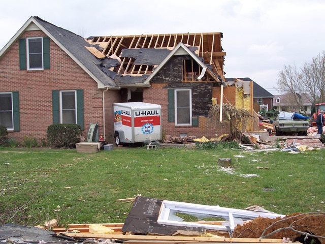 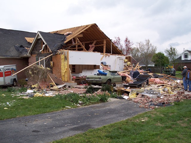 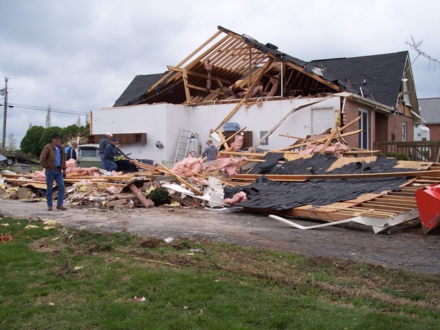 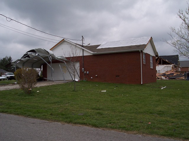 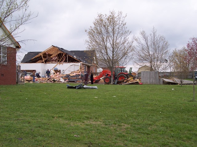 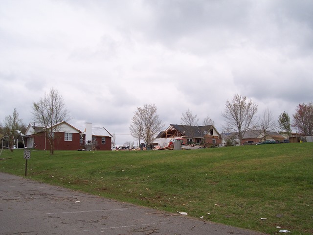 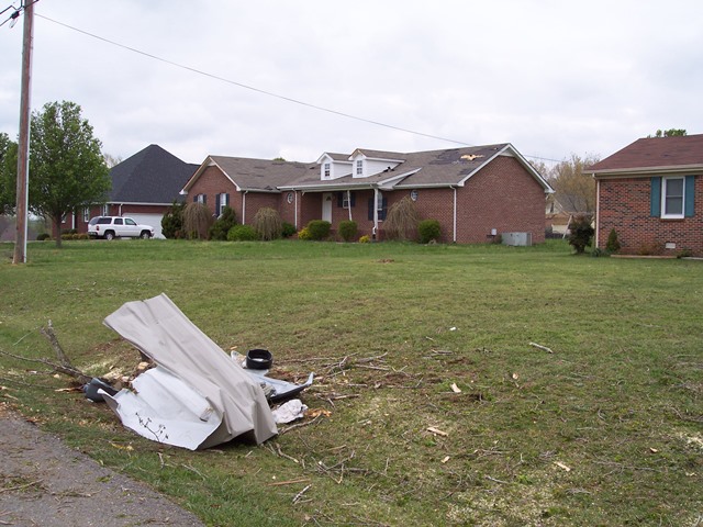 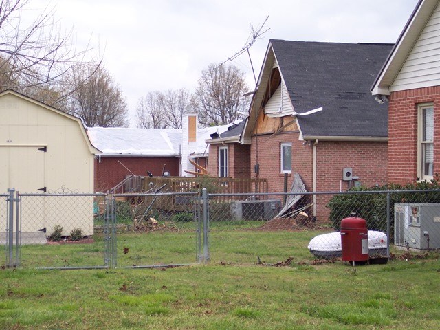 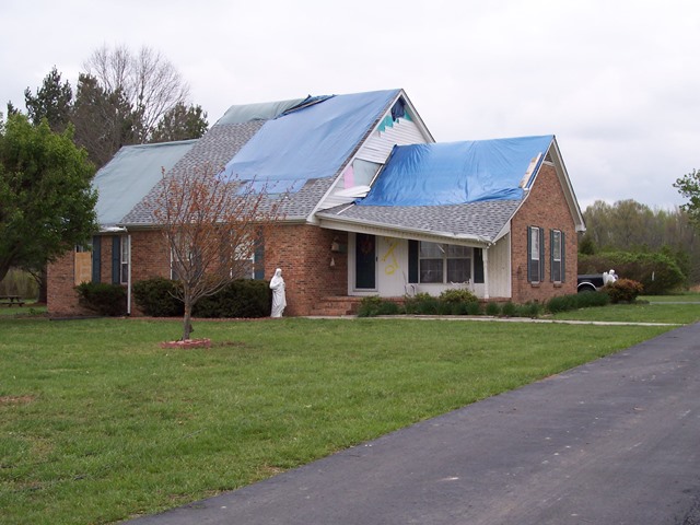 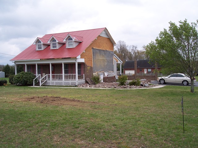 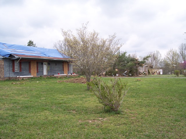 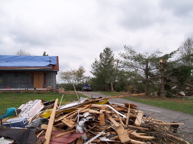 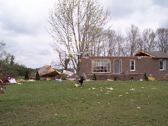 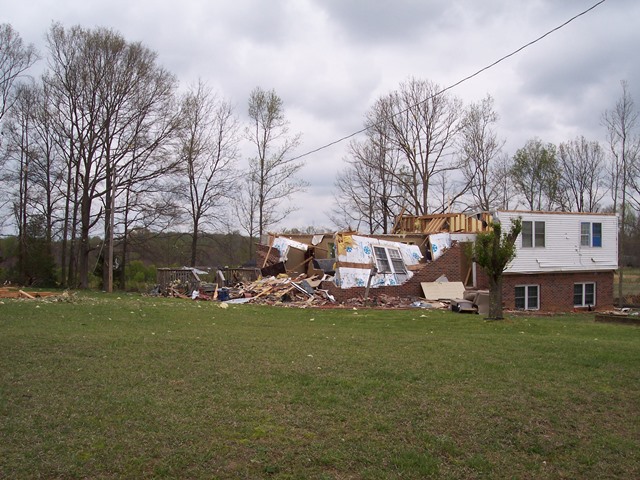 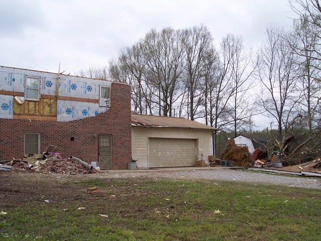 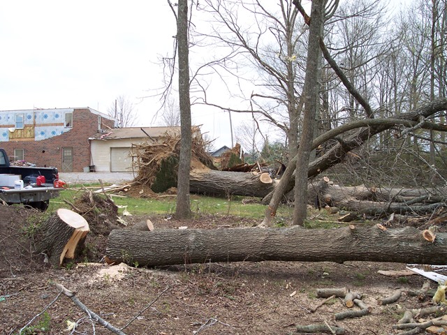 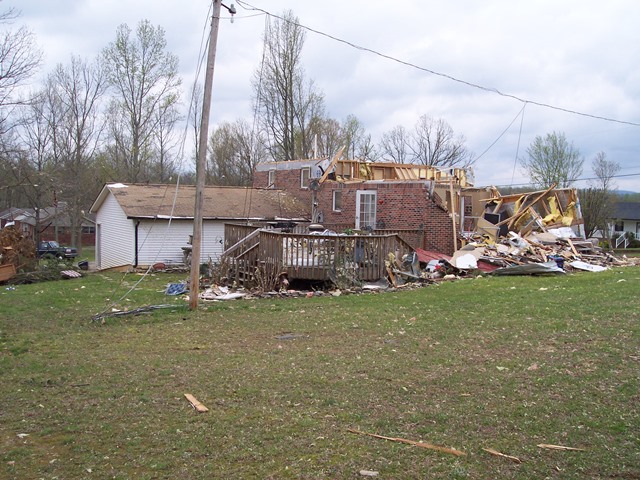 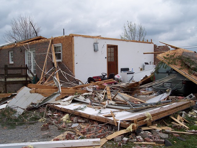 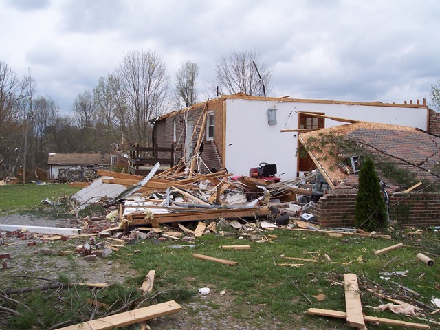 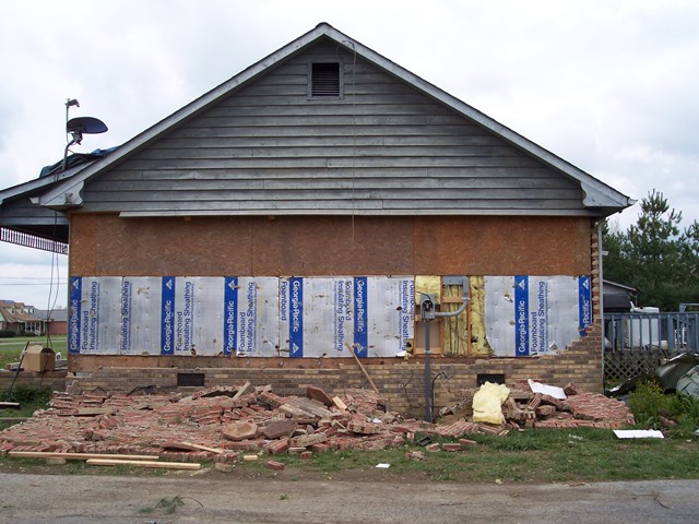 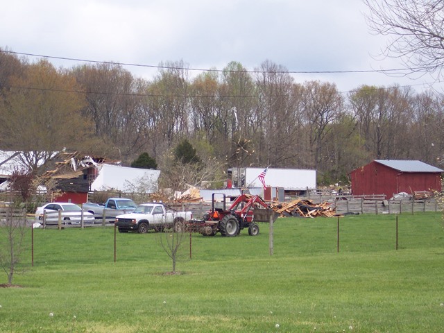 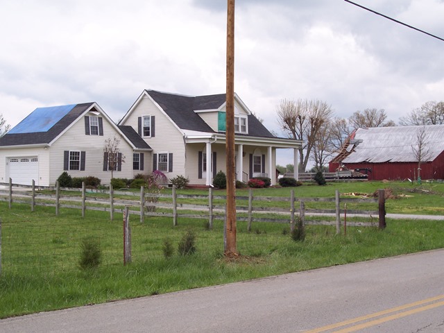 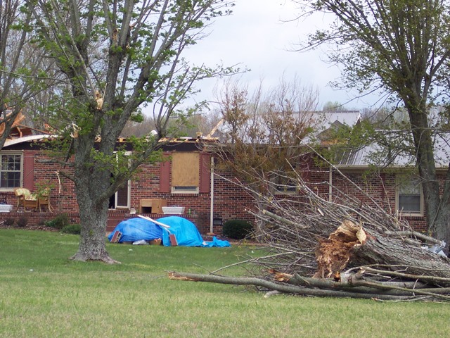 |
|
| White County Wind Damage | |
| Counties: | White |
| Time: | 1:20 PM CST |
| Damage Path Length: | 1.75 miles |
| Damage Path Width: | 800 yards |
| Fatalities: | 0 |
| Injuries | 0 |
| Damage: STORM DATA: Some homes were damaged. A power pole was snapped. One mobile home had roof torn off. Trees were snapped and uprooted. SHAMBURGER (2015) - No NWS storm survey was conducted for this wind damage, which is officially listed in Storm Data records as a tornado with a suspiciously large 800 yard path width. However, radar data clearly indicates that this damage occurred from a downburst in the forward flank downdraft and hail core of the parent supercell. |
|

