The Storm Prediction Center had placed Middle Tennessee in a moderate risk area for the evening of October 24, 2001. A high risk area existed just to the north in Kentucky. The emphasis of the risk across the Mid-South was for tornados and high winds. A strong low pressure center and associated cold front had moved through Missouri and West Tennessee earlier in the day and produced several tornados along with damage from high winds. This history and the SPC risk assessment alerted WFO Old Hickory to be prepared for an evening event. A Hazardous Weather Outlook issued Wednesday morning alerted area emergency management agencies and the amateur radio network to be ready for a busy late afternoon and evening.
A severe thunderstorm watch was issued for the southeast part of Middle Tennessee at 8:55 p.m. that included Coffee and Grundy Counties. A tornado watch had been in effect for most of Middle Tennessee since 6:00 p.m.
A very narrow band of strong thunderstorms moved across Middle Tennessee during the late afternoon with numerous severe thunderstorm warnings issued and verified. Wind damage was reported with almost all warnings. A severe thunderstorm warning was issued at 9:10 p.m. for Coffee County, including the city of Manchester. This warning highlighted the dangerous winds.
A report from the Coffee County Emergency Management Agency came into the WFO via the MTEARS amateur radio net reporting damage to a warehouse in Hillsboro (east Manchester) at 9:13 p.m. Radar indicated a strong wind couplet in this area. Radar reflectivity had shown an appendage associated with the storm cell on preceding scans. The ground truth combined with radar signatures justified a tornado warning, issued at 9:24 p.m. for Coffee and Grundy Counties until 10:00 p.m.The warning placed the tornado 8 miles east of Manchester, moving east at 45 miles an hour.
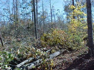
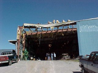
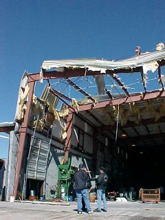
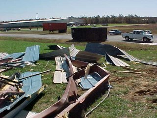
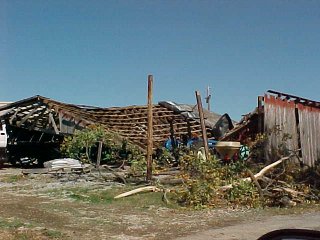
The storm track started north of Tullahoma, moved across Arnold Air Force Base, and into Manchester. The track was very narrow (1/4 mile or less) and sporadic. The damage near Tullahoma was tree damage attributed to straight line winds (photo 1). Many hardwood trees were uprooted with trunk diameters of 12 to 14 inches (estimated 60+ miles an hour). Isolated tree damage was also reported across Arnold AFB. More tree damage occurred as the storms crossed I-24 near Manchester and then moved into an industrial park where an estimated strong F2 tornado struck Interstate Warehouse System (IWS). The tornado destroyed the end of a warehouse, structurally rated at 90 miles an hour(photod 2-4). The bolts holding the steel girder frame of the building were sheared off on the outside and pulled out of the concrete on the inside (photo 5). Building material was blown across the warehouse buckling racks and bowing out a concrete wall. The wall was over a foot off vertical at the top. Roof material was blown 100 yards. Several trees were blown down across a road ½ mile from the warehouse, also showing evidence of rotation. The storm continued along an east-northeast track, damaging at least 2 barns (photos 6 & 7) and silos. This damage indicated straight line winds estimated at 60 miles an hour.
The storm survey was completed the afternoon of October 25th.The Coffee County Sheriff's office and Emergency Management Agency (Capt. Grady Vassar and Jimmy Floyd) were a tremendous help during the survey.


Ralph Troutman
Data Acquisition Program Manager
Earl King
Hydrometeorological Technician