National Weather Service United States Department of Commerce
Overview

FROM AUGUST 1982 STORM DATA PUBLICATION:

Heavy rains moved into and developed over North-Central Tennessee during the early morning hours of the 16th. Flash flooding spread over many counties, and damage/fatalities are described on a county-by-county basis. A 500 mb ridge was stationary over the Great Plains near 100 degrees west longitude. A shortwave trough most clearly evident at 700 mb moved slowly across Tennessee. A weak pressure gradient was analyzed at the surface, but an inverted trough moved through the weak pattern during the next two days. Ample moisture was available in the low levels with surface dewpoints in the mid 70s over Tennessee. Upper levels were also moist with dewpoint spreads less than 5 degrees.

 
Storm Data
August 1982 Storm Data


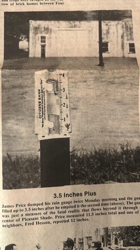
Smith County Flash Flood
FROM AUGUST 1982 STORM DATA PUBLICATION:
 
Two elderly woman were killed when the house they were in was swept from its foundation by waters from Peyton's Creek in Pleasant Shade. The women were drowned around 7:00 am CST. Boston Branch runs into Peyton's Creek in Pleasant Shade, and both flooded with the heavy rains. Rainfall in Pleasant Shade was estimated at 11 to 12 inches. Twenty homes and businesses were damaged or destroyed by the flooding in Pleasant Shade which is 10 miles north of Carthage. In addition to Pleasant Shade, 4 houses were flooded in Sykes, 4 in Carthage, 2 in New Middleton, and 6 in Elmwood. 
 
Photos of Flash Flooding in the Graveltown community (courtesy of Upper Cumberland Weather)
Graveltown Flash Flood
   
Carthage Courier Newspaper Photos (courtesy of Upper Cumberland Weather)
Carthage Courier newspaper article