| Rounds of Thunderstorms Roam West Texas 17-25 June 2014 |
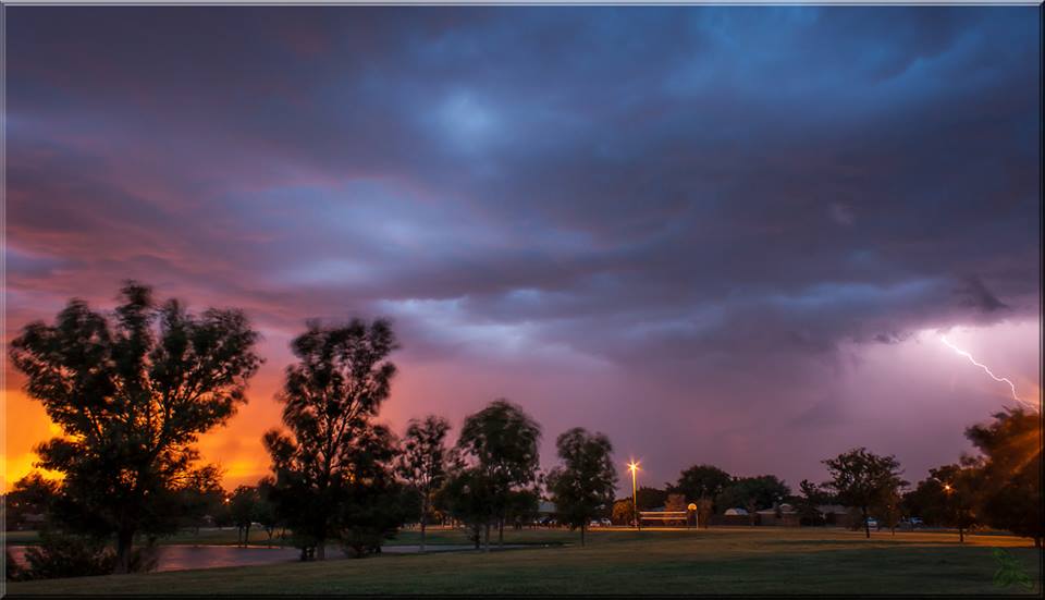 |
| View of a thunderstorm as it approached Lubbock on the evening of Thursday, 19 June 2014. The picture was taken by Erin Shaw. |
| Abundant moisture joined forces with several weak upper level disturbances to bring a number of rounds of thunderstorms to West Texas in middle to late June. The activity kicked off on the evening of Tuesday, June 17th, when a small cluster of storms affected portions of the southwest South Plains (not shown). This activity produced localized severe wind gusts, one which blew a semi-truck off the road west of Brownfield. |
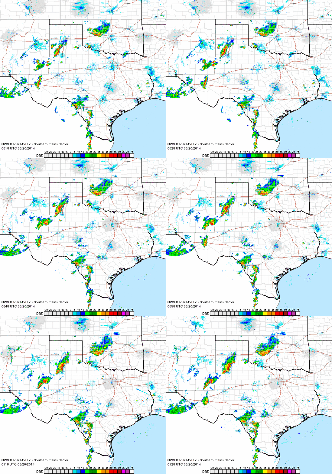 |
| Regional radar animation valid from 7:18 to 8:28 pm on Thursday, 19 June 2014. Another animation valid from 9:08 to 10:18 pm can be VIEWED HERE. |
| Scattered thunderstorms then affected the region the following two day, Wednesday and Thursday (18-19 June). One more organized complex of storms moved across the southern Texas Panhandle and northern and central South Plains Thursday evening (shown above), producing several pockets of quarter sized hail and wind gusts to around 60 mph. The complex gradually diminished early Friday morning, producing a small vortex, as can be seen in the below radar animation. This diminishing complex did also generate a wind gust to 63 mph near Silverton around 2 am. |
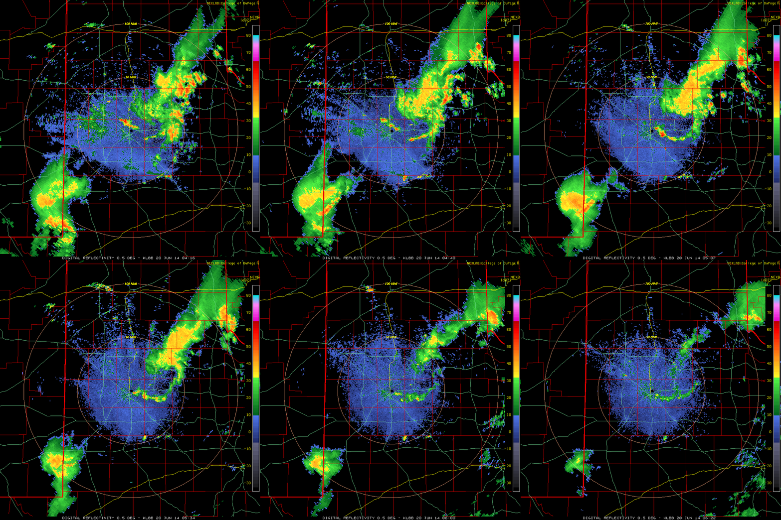 |
| Lubbock radar reflectivity animation valid from 11:15 pm on 19 June to 1:22 am on 20 June 2014. The animation is courtesy of the College of DuPage. |
| After a reprieve in thunderstorm activity on Friday and Saturday, things became much more active again late Sunday. A large area of thunderstorms developed well to the north, in parts of Kansas, Colorado, northeast New Mexico and the Oklahoma and Texas Panhandles Sunday afternoon (22 June). This activity congealed into a large complex that then swept southeastward. The thunderstorms were most intense in the Panhandles, with several tornadoes observed in Beaver, Lipscomb and Hemphill Counties during the evening hours. Severe straight-line winds then became the primary hazard as a squall line accelerated southeast. Winds as high as 93 mph were recorded at the West Texas Mesonet Station near Pampa, resulting in considerable damage. This squall line eventually moved into the southern Texas Panhandle, South Plains and Rolling Plains late Sunday night, prompting a rare severe thunderstorm watch from midnight to 7 am on Monday. Thankfully, the intensity of the squall line waned, though it did still generate numerous wind gusts of 50 to 64 mph. |
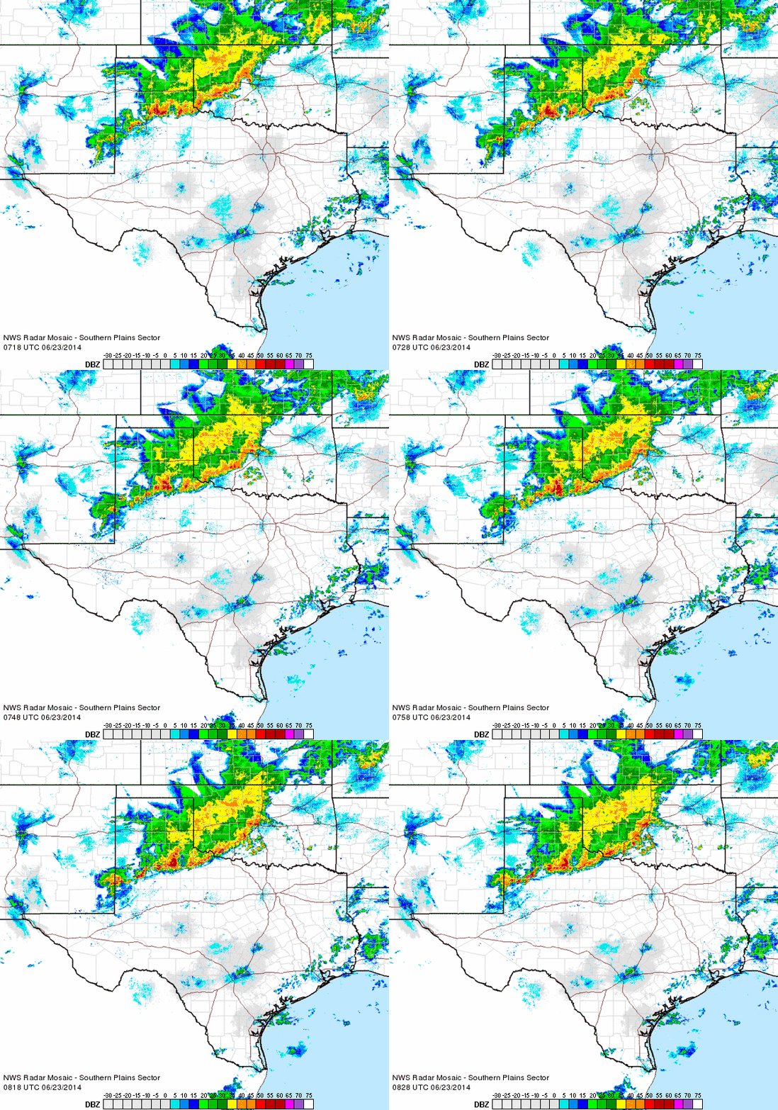 |
| Regional radar animation valid from 2:18 to 3:28 am on Monday, 23 June 2014. Additional radar animation can be found at: 11:38 pm on the 22nd to 12:48 am on the 23rd; 4:08 to 5:08 am on the 23rd. |
| In addition to the strong winds, the squall line dropped more welcome rains across a good portion of the southern Texas Panhandle and much of the Rolling Plains, with more spotty rainfall falling over the South Plains. This large area of thunderstorms stabilized the region for the remainder of day and evening, but another cluster of thunderstorms formed in the western Texas Panhandle late Monday night and then tracked southeast across the southern Texas Panhandle the northeast South Plains and much of the Rolling Plains during the day Tuesday (24 June). Another lull in activity followed Tuesday evening, with more limited showers and thunderstorms affecting the southern Texas Panhandle and far southwest South Plains Wednesday morning. One final small cluster of storms developed across the southern Rolling Plains Wednesday evening, dropping locally heavy rainfall near Clairemont, with golf ball sized hail also observed just west of Jayton. |
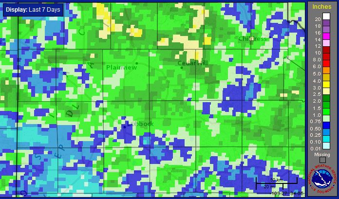 |
| Seven-day radar estimated precipitation ending at 3 am on 25 June 2014. |
|
As the above image illustrates, over the course of the relatively active week of weather, most of West Texas received more beneficial rains. The heaviest rain totals (1-2"+) favored central and northern sections of the region, though nearly everyone saw at least a little rainfall. Officially, Lubbock recorded 0.53" over this stretch while Childress received 0.90". A graphical display of various rainfall totals recorded by the West Texas Mesonet can be found below. In addition, the preliminary storm reports for the morning of the 23rd can be viewed below. A text version of the preliminary storm reports for the 19th and 23rd can also be found via the follow links: Preliminary storm reports for the afternoon and evening of June 19th |
|
|
|||
|
Preliminary Storm Reports received for June 23, 2014
|
Toggle 6-day Precipitation ending at 6 am on June 25, 2014
|
Toggle 24-hr rain totals valid at 12:30 am June 25, 2014
|
Toggle 24-hr Precipitation ending at 7:30 am on June 23, 2014
|