
Heat expands across the Desert Southwest, Plains, Mississippi Valley and Midwest into Monday. Fire weather concerns continue for portions of the Intermountain West. Active monsoonal moisture fuels thunderstorms over the Southwest with possible flash flooding. Tropical cyclone Fausto in the Pacific, should weaken as it approaches Hawaii; Dangerous surf, swells and rip currents are expected. Read More >
|
The NWS San Joaquin Valley County Warning and Forecast Area (CFWA) includes a large portion of the central California interior. Our CWFA lies between the crests of the Diablo Range and the Sierra Nevada from Merced and Mariposa Counties south through the Tehachapi Mountains, just beyond Bakersfield. It also includes all of Yosemite National Park and the Kern County portion of the Mojave desert. Elevations vary from only 90 feet above sea level near the Merced County line, to 14,495 feet at the peak of Mt. Whitney (the tallest mountain in the contiguous United States). Our service area includes valley, mountain, and desert climates, divisible into 21 forecast zones... 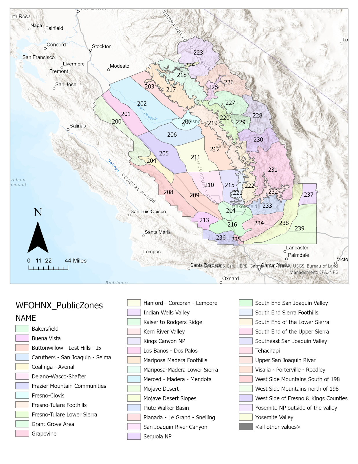 Several recreational areas lie within the service area...
Demographics of the public service/forecast area are as follows, using 1994 census data...
Most of the economy of the service area is related to agriculture. However, many jobs are related to oil production, forestry, and aerospace. Lemoore Naval Air Station, China Lake Naval Weapons Center, and Edwards Air Force Base are also major employers in the service area. |
|||||||||||||||||||||||||||||||||||


