Houston/Galveston, TX
Weather Forecast Office
 |
Hurricane Rita September 24, 2005 |
INTRODUCTION
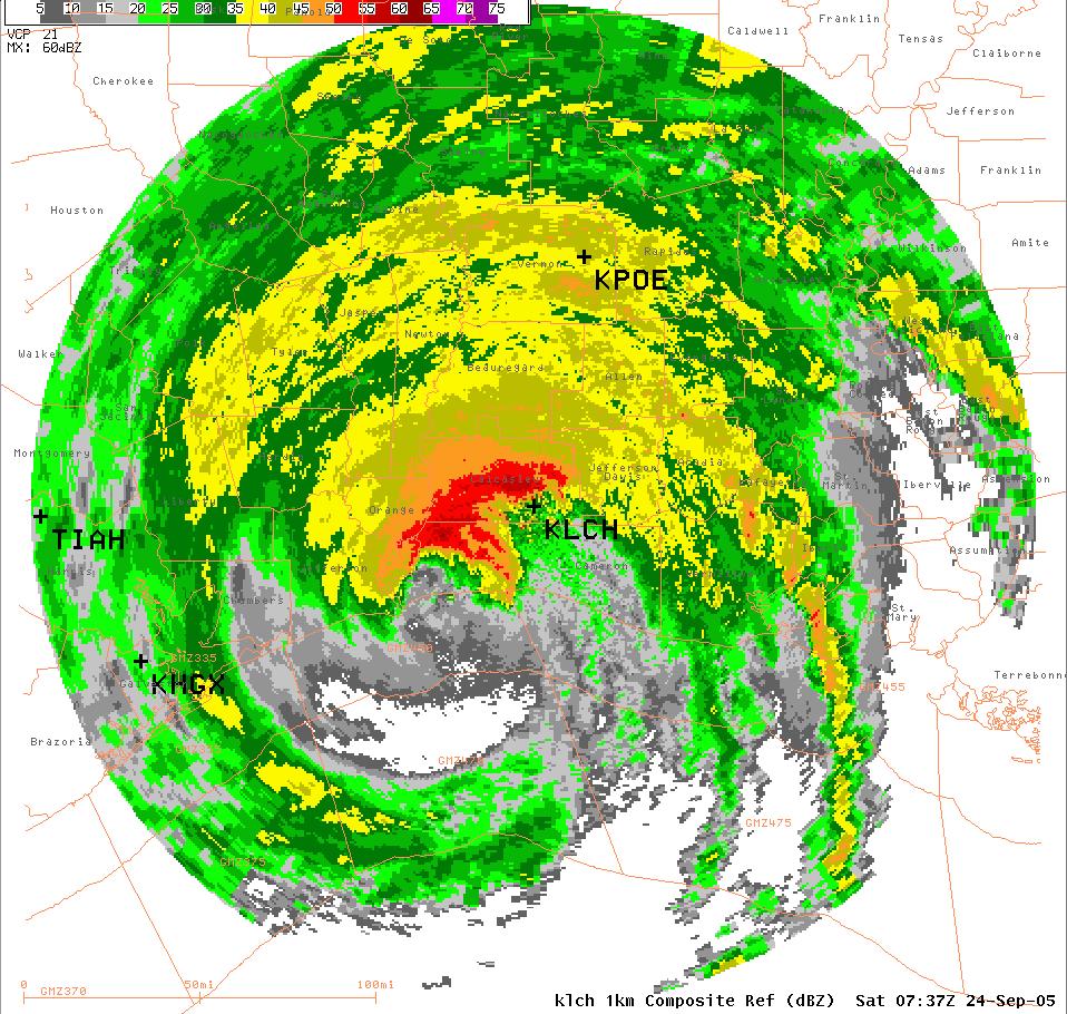
Hurricane Rita made landfall in southwestern Louisiana between Sabine Pass, Texas and Johnson's Bayou, Louisiana early Saturday morning, September 24, 2005. "Rita" was the second major hurricane to strike the Louisiana coast this season ("Katrina" was the first) and the third most intense hurricane ever recorded in the Atlantic Basin. Another significant hallmark of this event was the mass evacuations prompted by this storm in Texas and Louisisana. It is estimated that up to 2 million residents (most from the Houston/Galveston metro area) evacuated to avoid the effects of the storm. While Rita peaked as a Category 5 hurricane out in the Gulf...she made landfall over Cameron Parrish as a Category 3 hurricane.
Products and Related Links
CURRENT HAZARDS
-National Hurricane Center
-Storm Prediction Center
-Weather Prediction Center
-River Forecast Centers
-Aviation Weather Center
-Center Weather Service Units
-Spaceflight Meteorology Group
-Space Weather Prediction Center
CURRENT WEATHER
-Tides and Currents
-Observations
-Satellite
-Rainfall Reports
-Public Information Statement
-Galveston Beach Patrol (Flag Warning System)
FORECASTS
-Activity Planner
-Forecast Discussion
-Marine
-Tropical
-Aviation
-Fire
-Beach
-Models
-Drought
History
-Our Office
-National Weather Service
-NOAA
-Major Events
RADAR
-Houston/Galveston
-National
-Corpus Christi
-Lake Charles
-Austin/San Antonio
-Granger (Central Texas)
-Worldwide
-Education
Rivers/Lakes/Bayous
-Lower Colorado River Authority
-Harris County Flood Warning System
-Local
-National
-Jefferson County Drainage District 6
-Brazos River Authority
CLIMATE
-Houston Intercontinental
-Houston Hobby
-Galveston
-College Station
-Palacios
-Graphs
-Climate Summaries
-Local Data/Records
-Old Climate Page
-NCEI
-Storm Data
-Weather History
-Wind Roses
Education/Careers
-National Weather Service
-Careers
-Web Weather for Kids
-HGX Teacher Resources
-more
PREPAREDNESS/SAFETY
-Evacuation Planning
-Publications/Brochures
-StormReady
-2026 Hurricane Guide
-2026 Hurricane Guide (Spanish)
-SKYWARN Schedule
-FloodAware
-Weather Radio
-Evacuation ZipZone
-Evacuation Routes
-more
ADDITIONAL INFO
-Weather Ready Nation
-Weather Safety
-Severe Stats
-Air Now
-CoCoRaHS
-Miscellaneous Info
-Astronomical Info
-Frequent Products
-Find It Quick
-Watch, Warning, and Advisory Criteria
Tropical
-Preparedness Meetings
-Historical Tracks
-Education
-Climatology for SE TX
-Hurricane Harvey
-Hurricane Alicia
-Tropical Storm Imelda
-Local Page
US Dept of Commerce
National Oceanic and Atmospheric Administration
National Weather Service
Houston/Galveston, TX
1353 FM 646 Suite 202
Dickinson, TX 77539
281-337-5074
Comments? Questions? Please Contact Us.

