Overview
Severe storms developed over Southeast Michigan during the afternoon and early evening on Wednesday, July 7th. A severe thunderstorm watch was in effect during this time with multiple severe thunderstorm warnings issued. These severe storms brought damaging winds, small hail and locally heavy rainfall with the hardest hit areas across portions of Oakland and Macomb Counties. Numerous reports of damage were reported with trees uprooted, large tree limbs down and power lines down.
Photos
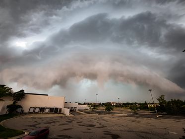 |
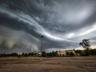 |
|
Novi, MI Credit: Ryan Jake Jakubowski |
Novi, MI Credit: Ryan Jake Jakubowski |
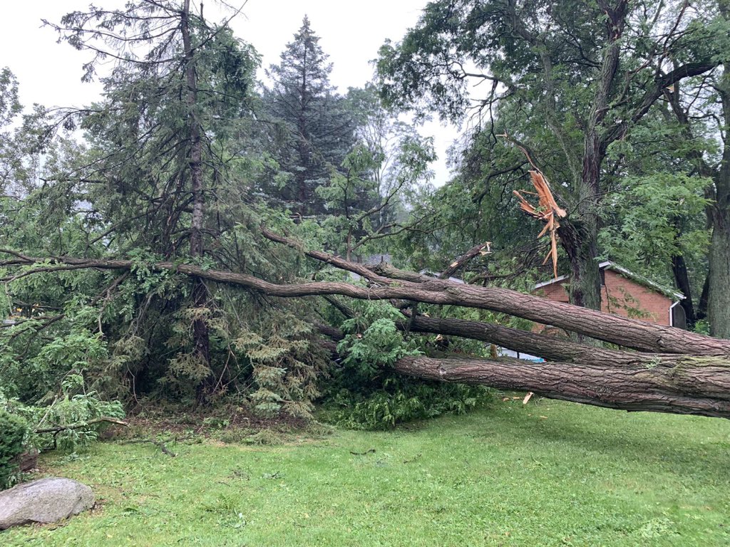 |
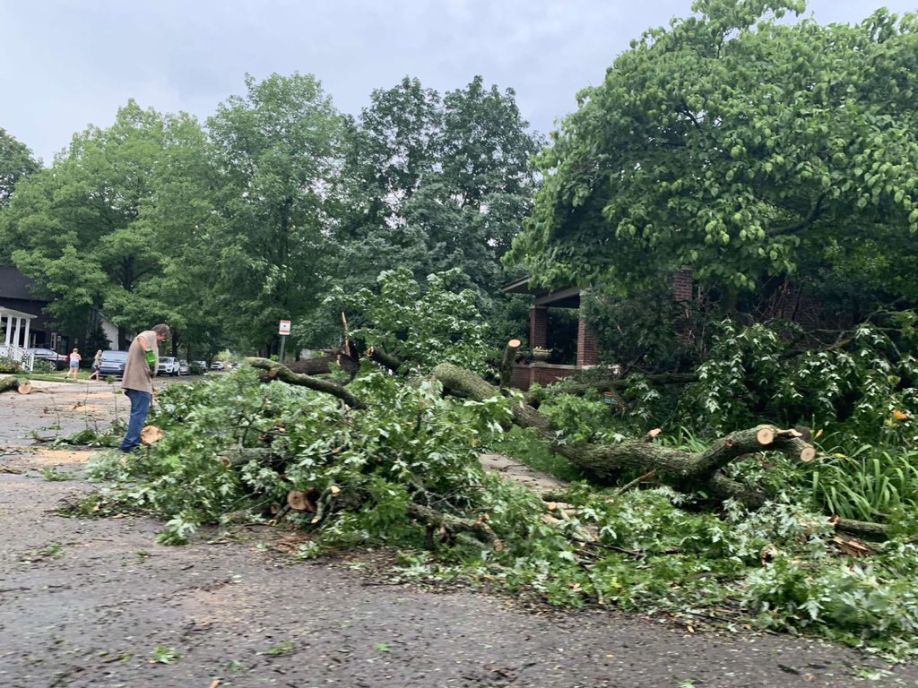 |
|
Farmington Credit: Spencer Geyman |
Farmington Credit: Spencer Geyman |
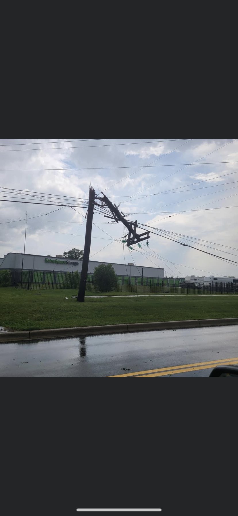 |
 |
|
Grand River & Halstead Credit: Chris Laney |
Macomb-Wilmar Ave Credit: Adam Bulk |
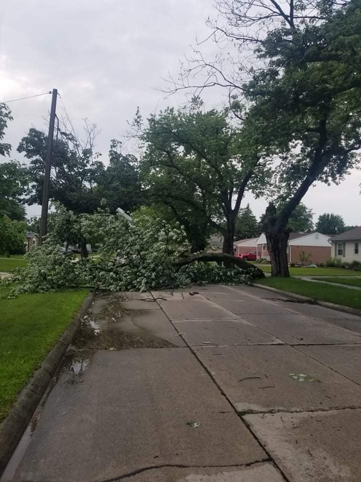 |
|
|
North Side of St Clair Shores Credit: Stephen Szulborski |
Beverly Hills Credit: Fritz Heuser |
 |
|
|
Wolverine Lake Credit: Cody Reynolds |
|
Radar
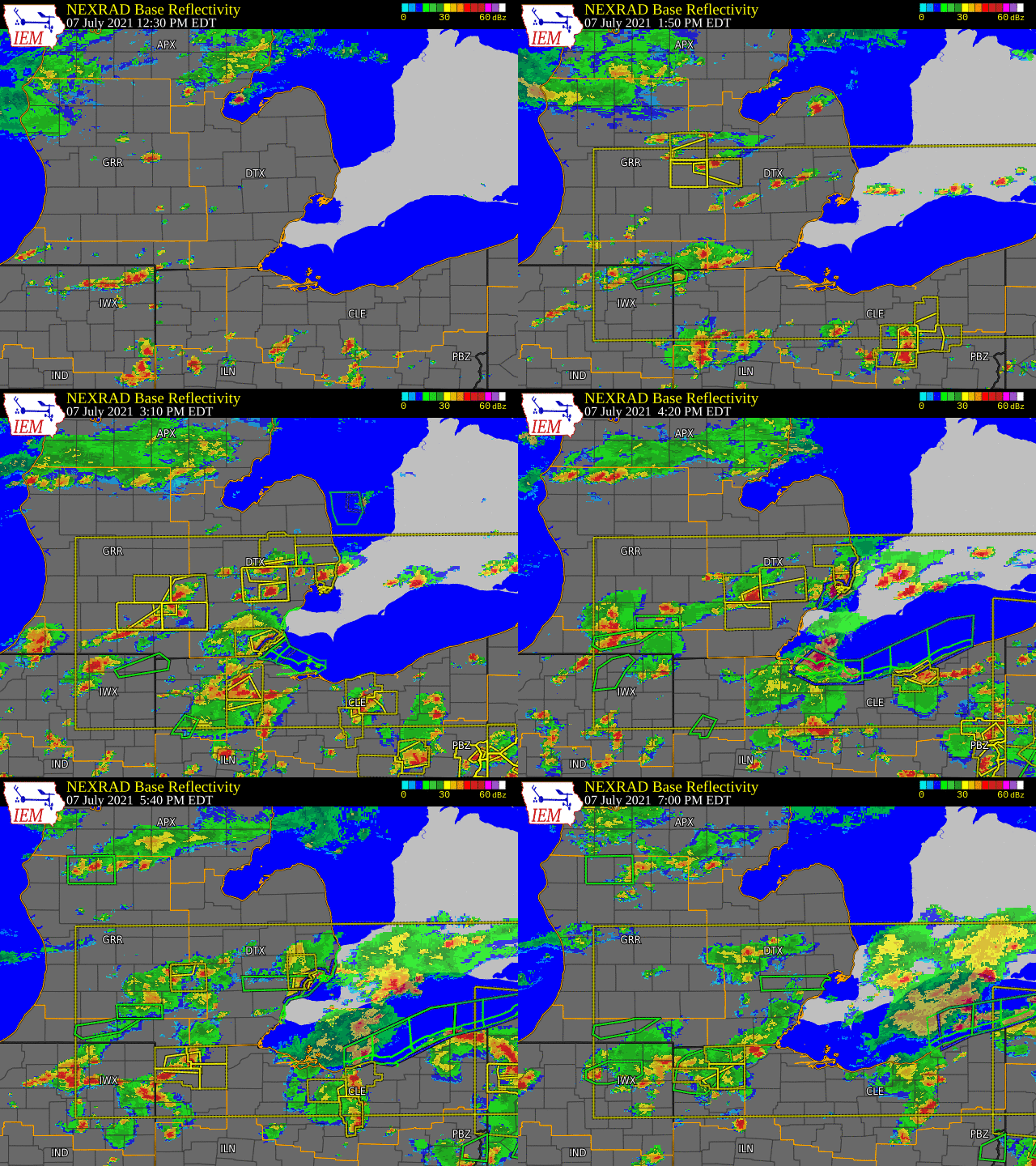  |
|
Click to Enlarge Radar loop courtesy of Iowa Environmental Mesonet (IEM) |
Storm Reports
Severe Weather Local Storm Reports:
PRELIMINARY LOCAL STORM REPORT...SUMMARY
NATIONAL WEATHER SERVICE DETROIT/PONTIAC MI
925 PM EDT WED JUL 7 2021

..TIME...   ...EVENT...      ...CITY LOCATION...     ...LAT.LON...
..DATE...   ....MAG....      ..COUNTY LOCATION..ST.. ...SOURCE....
            ..REMARKS..

0249 PM     TSTM WND DMG     4 ENE HOLLY             42.82N 83.55W
07/07/2021                   Oakland            MI   LAW ENFORCEMENT

            STATE POLICE REPORTS MULTIPLE TREES AND POWER LINES DOWN
            IN THE GROVELAND TOWNSHIP AREA.

0259 PM     TSTM WND DMG     3 ENE MONROE            41.93N 83.34W
07/07/2021                   Monroe             MI   PUBLIC

            SOCIAL MEDIA PICTURES OF NUMEROUS LARGE TREE LIMBS DOWN
            IN THE DETROIT BEACH NEIGHBORHOOD.

0316 PM     TSTM WND DMG     5 N SOUTHFIELD          42.55N 83.25W
07/07/2021                   Oakland            MI   BROADCAST MEDIA

            NUMEROUS LARGE TREE LIMBS DOWN AROUND MAPLE AND
            CRANBROOK.

0318 PM     HEAVY RAIN       2 SW PETERSBURG         41.88N 83.74W
07/07/2021  M1.00 INCH       Monroe             MI   AMATEUR RADIO

            48 MINUTE RAINFALL

0318 PM     TSTM WND DMG     5 NNE SOUTHFIELD        42.54N 83.21W
07/07/2021                   Oakland            MI   NWS EMPLOYEE

            LARGE TREE LIMB DOWNED NEAR CHESTNUT AND ELM STREETS IN
            BIRMINGHAM.

0330 PM     HEAVY RAIN       3 SW IDA                41.88N 83.62W
07/07/2021  M1.10 INCH       Monroe             MI   AMATEUR RADIO

            30 MINUTE RAINFALL

0343 PM     TSTM WND DMG     UNADILLA                42.44N 84.06W
07/07/2021                   LIVINGSTON         MI   911 CALL CENTER

            CENTRAL DISPATCH HAS RECIEVED NUMEROUS REPORTS OF TREES
            AND WIRES DOWN ACROSS SOUTHWESTERN LIVINGSTON COUNTY.

0351 PM     TSTM WND DMG     2 WNW ST. CLAIR SHORES  42.51N 82.92W
07/07/2021                   Macomb             MI   TRAINED SPOTTER

            SPOTTER REPORTS A FEW 5-6 INCH DIAMETER TREE LIMBS DOWN
            AT MELVIN AND GINLEY.

0351 PM     TSTM WND DMG     5 SSW MOUNT CLEMENS     42.53N 82.93W
07/07/2021                   Macomb             MI   PUBLIC

            SOCIAL MEDIA VIDEO OF LARGE TREE LIMBS DOWN AT
            INTERSECTION OF KELLY AND MASONIC BLOCKING PART OF THE
            ROAD.

0354 PM     TSTM WND DMG     2 WNW ST. CLAIR SHORES  42.51N 82.92W
07/07/2021                   Macomb             MI   TRAINED SPOTTER

            SPOTTER REPORTS 8 INCH DIAMETER HEALTHY TREE LIMB DOWN IN
            MIDDLE OF ROCK STREET.

0354 PM     TSTM WND DMG     5 S MOUNT CLEMENS       42.53N 82.89W
07/07/2021                   Macomb             MI   PUBLIC

            SOCIAL MEDIA PICTURES OF A LARGE TREE UPROOTED THAT
            LANDED ON A HOUSE NEAR MASONIC AND HARPER.

0415 PM     HEAVY RAIN       BLOOMFIELD HILLS        42.58N 83.25W
07/07/2021  M1.00 INCH       OAKLAND            MI   TRAINED SPOTTER

            1 HOUR RAINFALL

0420 PM     MARINE TSTM WIND 6 WSW HARSENS ISLAND    42.56N 82.68W
07/07/2021  M40.00 MPH       St. Clair          MI   MESONET

            MEASURED AT CLUB ISLAND

0445 PM     TSTM WND DMG     3 E NOVI                42.47N 83.43W
07/07/2021                   Oakland            MI   LAW ENFORCEMENT

            STATE POLICE REPORTING WIRES DOWN ACROSS BOTH DIRECTIONS
            OF I-275 NEAR GRAND RIVER. SOME WIRES DOWN ON CARS.

0447 PM     TSTM WND DMG     1 NNE NOVI              42.50N 83.48W
07/07/2021                   OAKLAND            MI   TRAINED SPOTTER

            MULTIPLE TREE LIMBS DOWNED NEAR NOVI AND 12 MILE ROADS.

0449 PM     TSTM WND DMG     2 N FARMINGTON          42.49N 83.38W
07/07/2021                   Oakland            MI   TRAINED SPOTTER

            SPOTTER REPORTS MULTIPLE TREES DOWN BLOCKING ROADWAYS
            ACROSS THE AREA. SOME ROADS WERE IMPASSIBLE.

0449 PM     TSTM WND DMG     3 E NOVI                42.47N 83.44W
07/07/2021                   OAKLAND            MI   NWS EMPLOYEE

            MULTIPLE LARGE TREES UPROOTED.

0449 PM     TSTM WND DMG     FARMINGTON              42.46N 83.38W
07/07/2021                   OAKLAND            MI   PUBLIC

            SOCIAL MEDIA PICTURES OF MULTIPLE LARGE TREE LIMBS DOWN
            IN DOWNTOWN FARMINGTON.

0458 PM     TSTM WND DMG     2 W BEVERLY HILLS       42.52N 83.26W
07/07/2021                   Oakland            MI   PUBLIC

            SOCIAL MEDIA PICTURES OF MULTIPLE APPROX 5 INCH DIAMETER
            TREE LIMBS DOWN.

0524 PM     HEAVY RAIN       5 ENE NOVI              42.50N 83.41W
07/07/2021  M1.15 INCH       Oakland            MI   PUBLIC

            1 HOUR RAINFALL, MOST FELL WITHIN 10 MINUTES

0533 PM     TSTM WND DMG     3 NW ST. CLAIR SHORES   42.52N 82.93W
07/07/2021                   MACOMB             MI   BROADCAST MEDIA

            MULTIPLE REPORTS OF LARGE TREES AND LIMBS DOWN.

0600 PM     HEAVY RAIN       4 W ORTONVILLE          42.85N 83.51W
07/07/2021  M1.46 INCH       OAKLAND            MI   TRAINED SPOTTER

            4 HOUR RAINFALL.

0651 PM     HEAVY RAIN       1 NE ROSEVILLE          42.52N 82.92W
07/07/2021  M1.20 INCH       MACOMB             MI   PUBLIC

            4 HOUR TOTAL RAINFALL.
 |
|
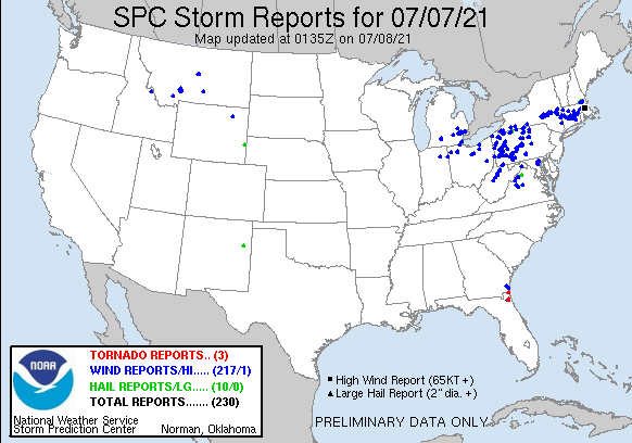
National Storm Reports for July 7, 2021 |
Environment
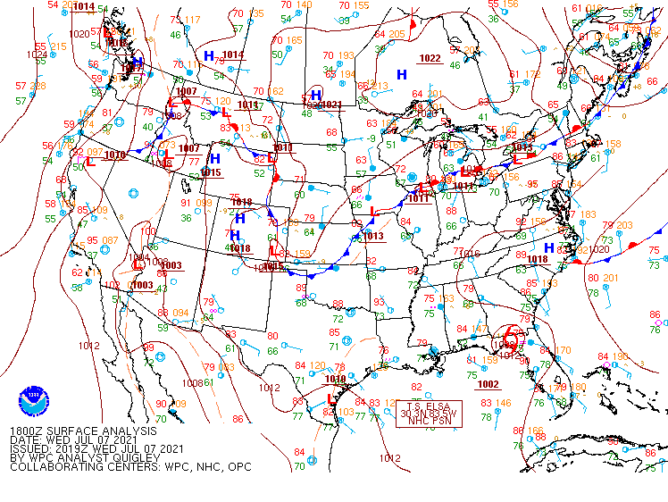
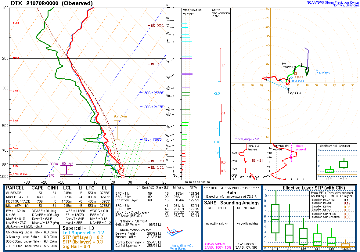
The environment on Wednesday, July 7, 2021 was primed for the development of numerous thunderstorms along with the potential for isolated to scattered severe thunderstorms. A stationary boundary was draped across lower Michigan (Fig. 1) – just south of the I-69 corridor. This boundary provided not just a focus for thunderstorm development, but also a differential heating boundary between a warm, moist, and unstable airmass to the south of the boundary and a more quasi-stable airmass to the north characterized by more widespread cloud cover than south of the boundary. By the early afternoon, temperatures had warmed well into the 80s F along with surface dewpoints well into the 60s to near 70 F. By the evening hours, PWAT values had increased to a little over 1.60 inches based on the 8 PM KDTX sounding (Fig. 2), which was above the 90th percentile per the Storm Prediction Center (SPC) PWAT climatology (not shown). The atmosphere clearly had plenty of one of three key ingredients for thunderstorm development – moisture. The second ingredient – a source of lift – was provided by the stationary frontal boundary, which acted as a source of frontal lift, as well as the aforementioned differential heating zone between more expansive cloud cover to the north and less cloud cover to the south. Further lifting mechanisms that aided in thunderstorm development on July 7 were synoptic shortwave disturbances moving through the midlevel flow (not shown) as well as interactions between lake breezes and outflow boundaries (not shown).
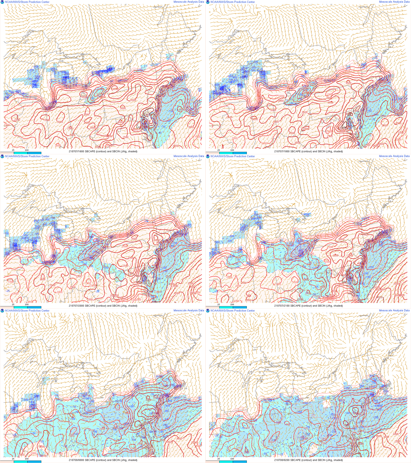
A third ingredient for thunderstorm development, instability, was also easily met, and also provided clues for the earlier than usual start time for the active period of thunderstorms/severe weather. Forecast SBCAPE off the 8 AM KDTX sounding (Fig. 3) indicated values in excess of 2000 J/kg based on a forecast MaxT of just 81 F, and with temperatures reaching well into the 80s for eventual high temperatures, this amount of instability was likely realized. MLCAPE values between 1200-1500 J/kg were also anticipated, which is a measure of instability through a deeper layer of the atmosphere. The big factor in determining the early onset of the thunderstorms, however, was the lack of CIN observed already by midday. While the 8 AM KDTX sounding revealed SBCIN greater than -100 J/kg, MLCIN was less than -25 J/kg, providing a clue that once the morning surface-based inversion was overcome, convective inhibition would virtually be nil, as was the case evident in the SPC mesoanalysis of SBCAPE during the early afternoon hours (Fig. 4.).
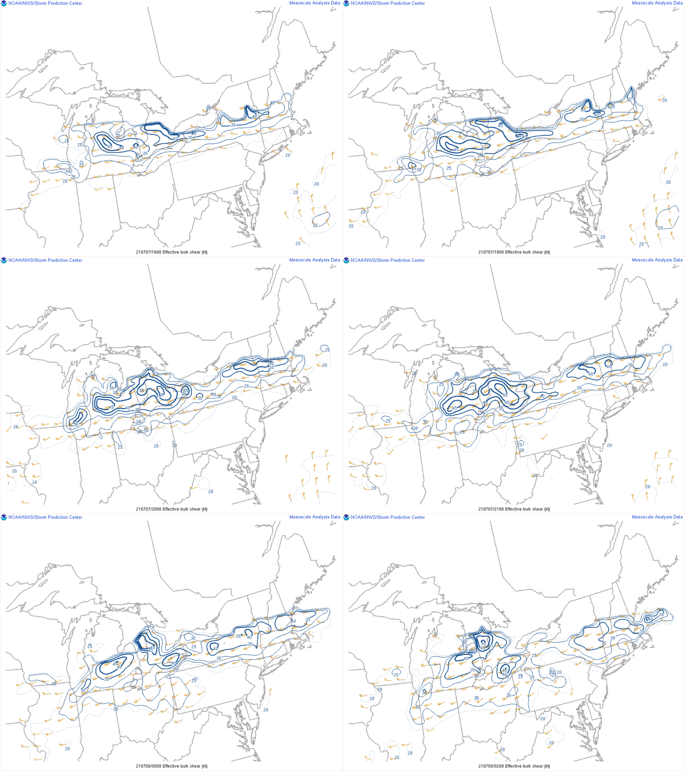
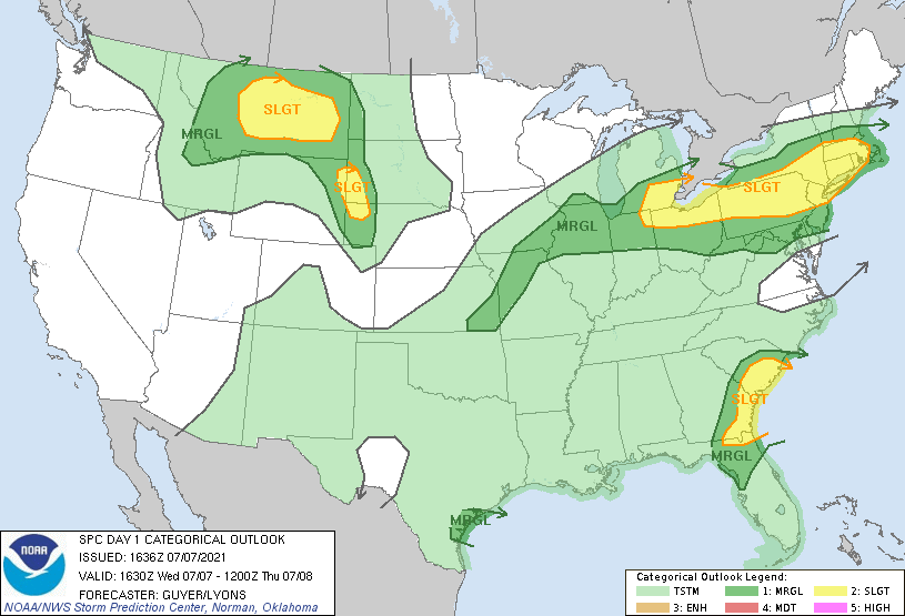
The final ingredient(s), which added to not just an organized thunderstorm threat, but a risk for severe thunderstorms, was sufficient wind shear. Effective bulk shear values across much of where the severe wind reports occurred was 30-40 knots, more than supportive for severe thunderstorms given the amount of instability in place (Fig. 5). Winds in the 2-6 km layer were largely unidirectional out of the west, also supportive of a severe wind threat (Fig. 3). Coupled with a relatively high web bulb zero height above 10.3 kft (Fig. 3) and steep low-level lapse rates in excess of 8 C/km (Fig. 6), sub cloud-layer thermodynamics were favorable for wet microburst potential. Given all of these favorable environmental factors, SPC included all areas of southeast Michigan mainly south of the I-69 corridor in a Slight Risk for severe thunderstorms (Fig. 7), indicating the greatest risk for damaging winds (Fig. 8).
The end result was the issuance of multiple Severe Thunderstorm Warnings across northern portions of the Detroit Metro and eastward into portions of St. Clair county. Other warnings were also issued further south near the Ohio border. Damaging winds caused the greatest number of severe reports, with portions of Oakland and Macomb counties being the hardest hit. Numerous trees and power lines were reported down, with over 130,000 power outages reported by DTE at one point. Wind damage from downed power lines was so extensive in southern Oakland county that it resulted in significant traffic disruption as well as large portions of I-96, I-696, and I-275 were shut down where they converge near the “Mixer” interchange causing major traffic delays for several hours during the evening commute.
Click on the images below to see them expanded.
 |
 |
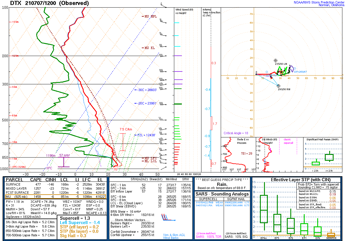 |
| Figure 1. Weather Prediction Center (WPC) surface map 1800 UTC July 7, 2020 (2 pm EDT July 7) | Figure 2. DTX upper air sounding from 0000 UTC July 8, 2020 (8 pm EDT July 7) | Figure 3. DTX upper air sounding from 1200 UTC July 7, 2020 (8 am EDT July 7) |
 |
 |
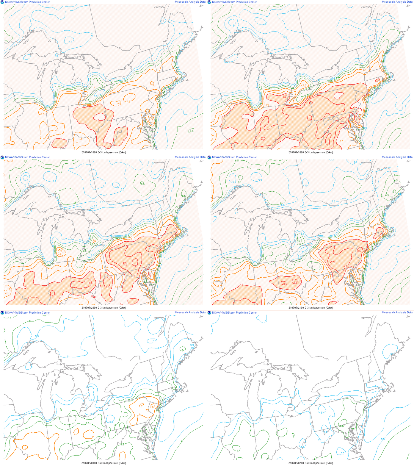 |
| Figure 4. Storm Prediction Center loop of SB CAPE from 1600 UTC July 7 to 0200 UTC July 8, 2020 (12 pm to 10 pm July 7). | Figure 5. Storm Prediction Center loop of effective bulk shear (kts) from 1600 UTC July 7 to 0200 UTC July 8, 2020 (12 pm to 10 pm July 7). | Figure 6. Storm Prediction Center loop of low-level lapse rates from 1600 UTC July 7 to 0200 UTC July 8, 2020 (12 pm to 10 pm July 7). |
 |
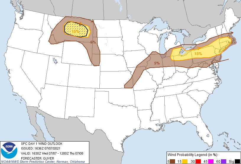 |
| Figure 7. Storm Prediction Center (SPC) Day 1 Convective Outlook issued 1630 UTC 7 July (12:30 pm July 7). | Figure 8. Storm Prediction Center (SPC) Day 1 Categorical Wind Outlook issued 1630 UTC 7 July (12:30 pm July 7). |
 |
Media use of NWS Web News Stories is encouraged! Please acknowledge the NWS as the source of any news information accessed from this site. |
 |