Overview
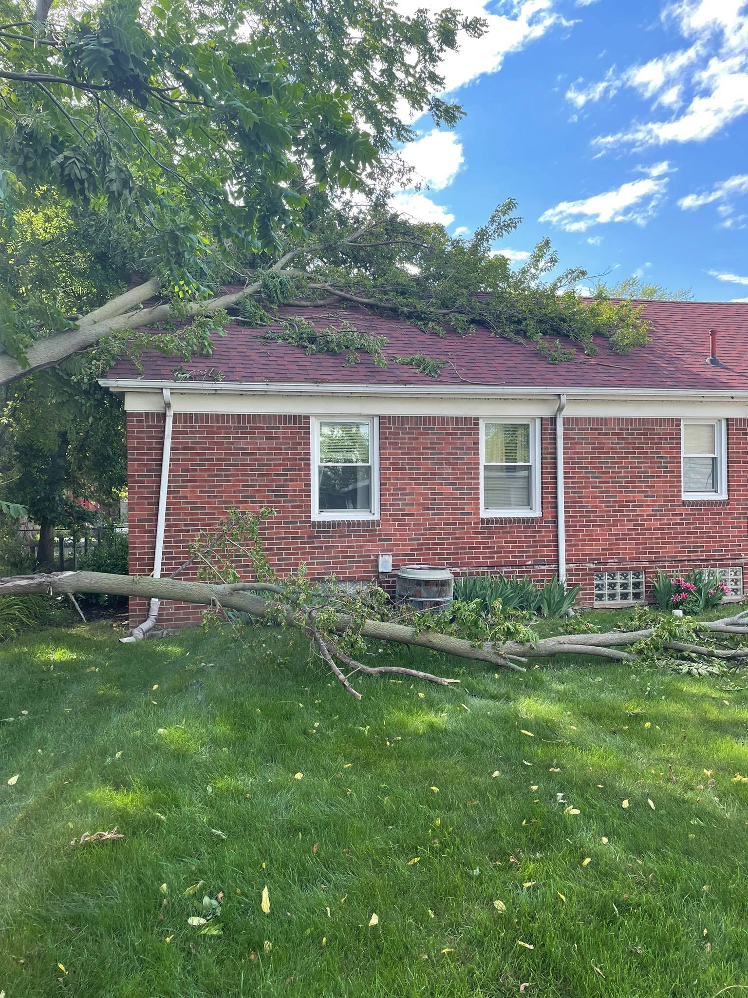
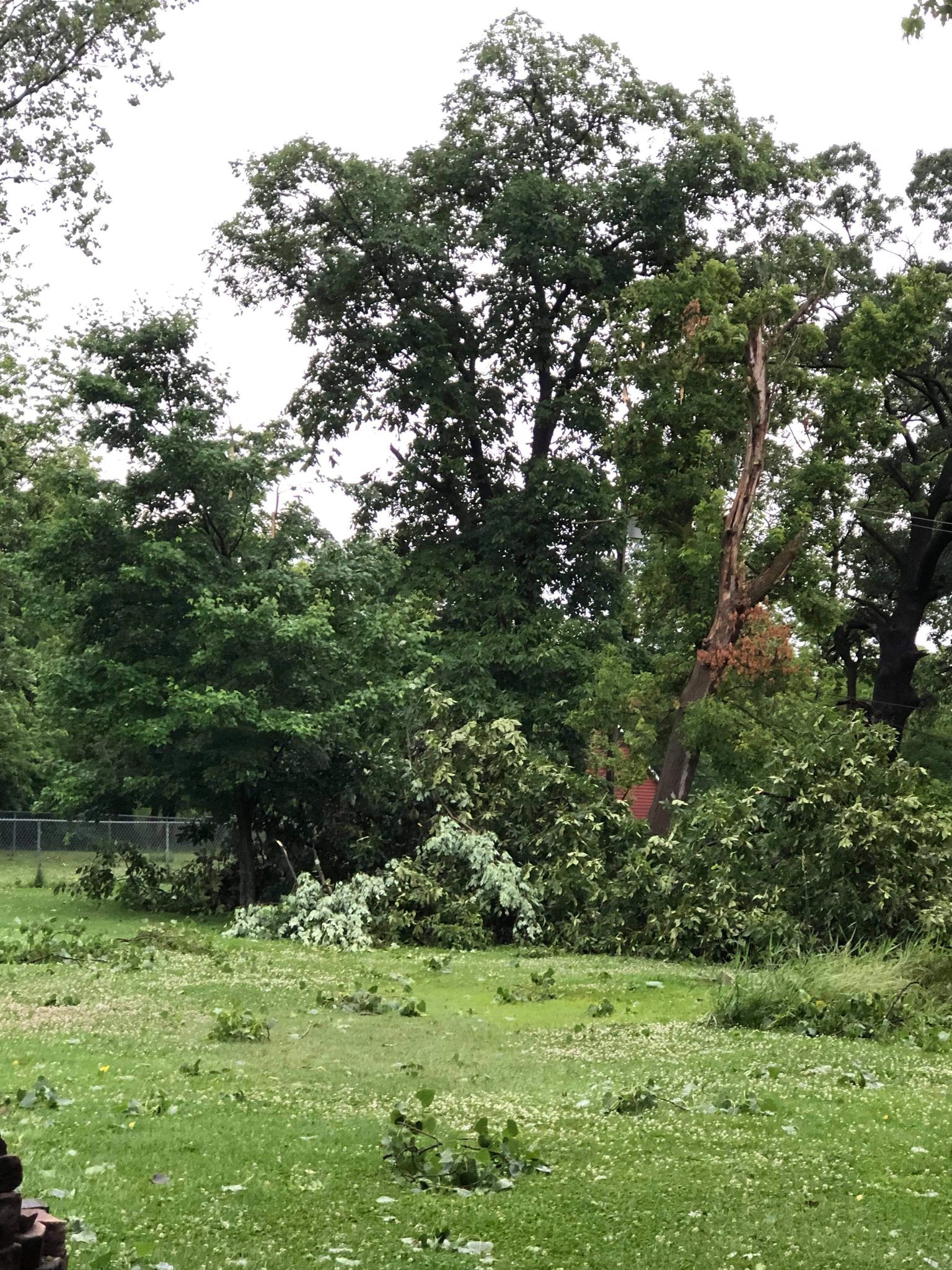
After roughly a week of eventful severe weather across portions of southeast Michigan initially characterized by large hail, a complex system of multicell and discrete thunderstorms brought another round of severe weather mainly south of the M-59 corridor (and especially south of I-94) beginning during the evening hours of June 20, 2021 and extending into the early morning hours of June 21, 2021. Numerous reports of wind damage were received, with multiple trees down in the hardest hit areas of Lenawee, Monroe, Wayne, and portions of Oakland counties. The damaging wind, estimated at 50-60+ mph in strength, resulted in at least 60,000 power outages across portions of southeast Michigan. The severe thunderstorms occurred south of a stationary boundary draped near the I-94 border, with a moist and unstable boundary to the south of it across far southern Lower Michigan into the northern Ohio Valley.
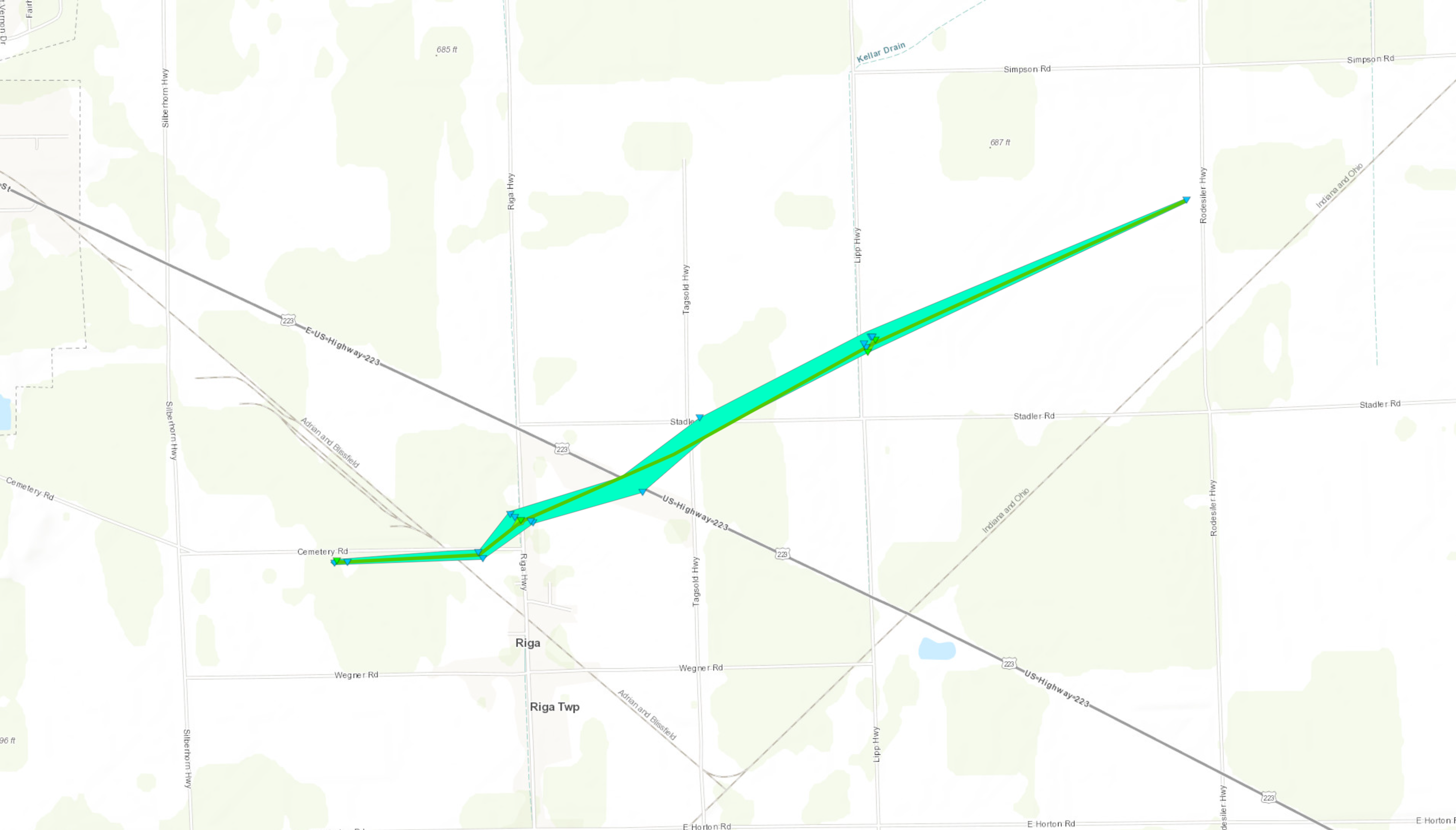
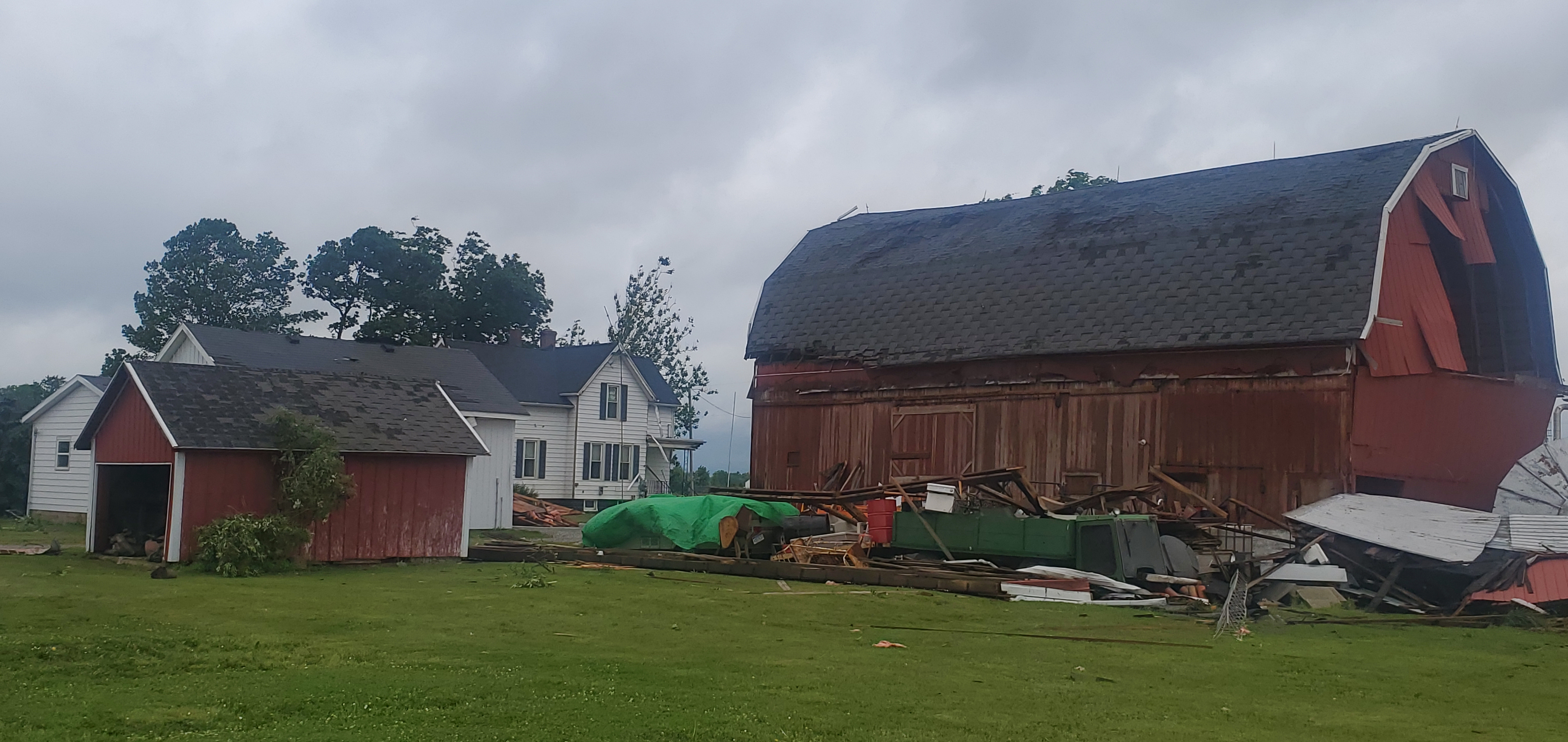
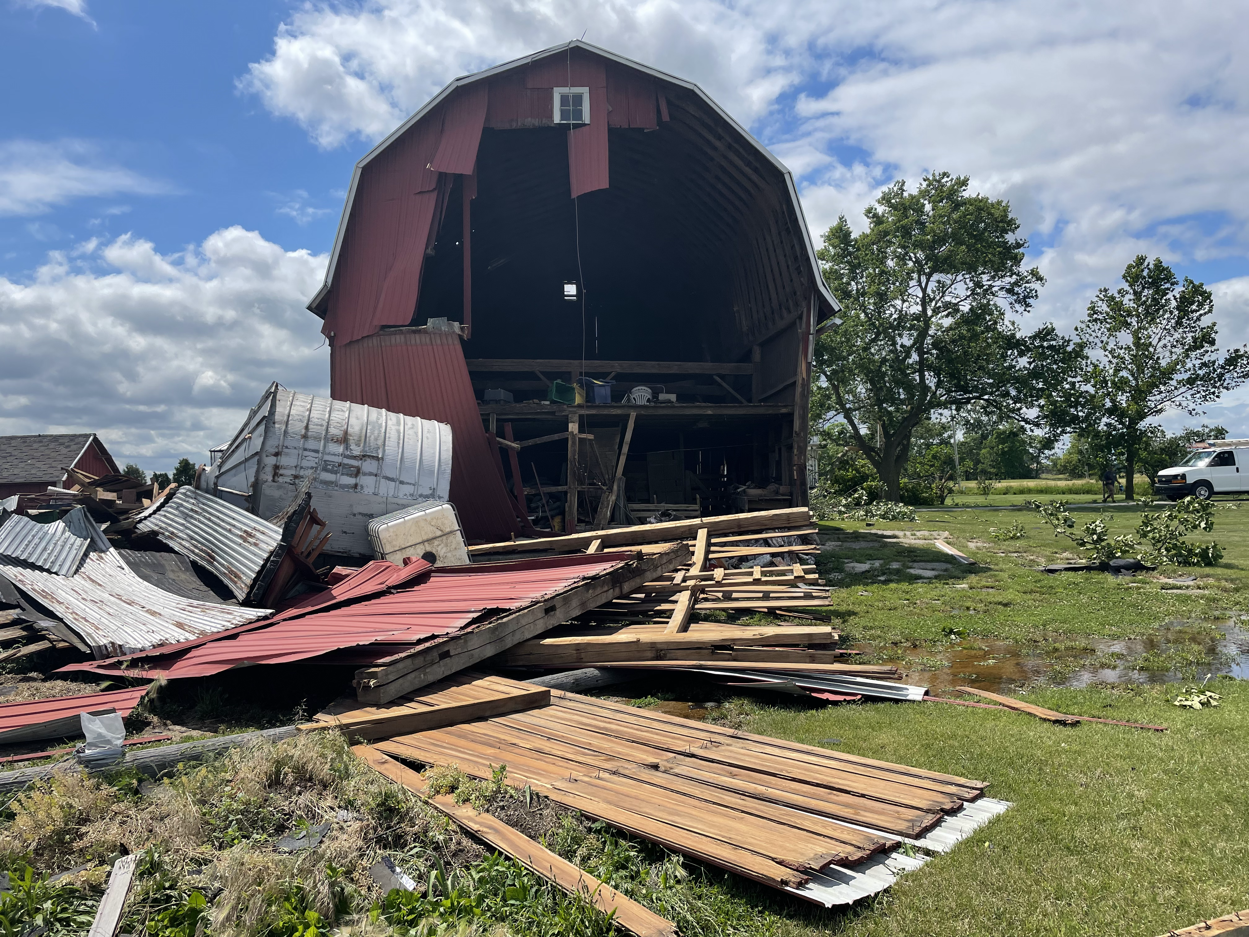
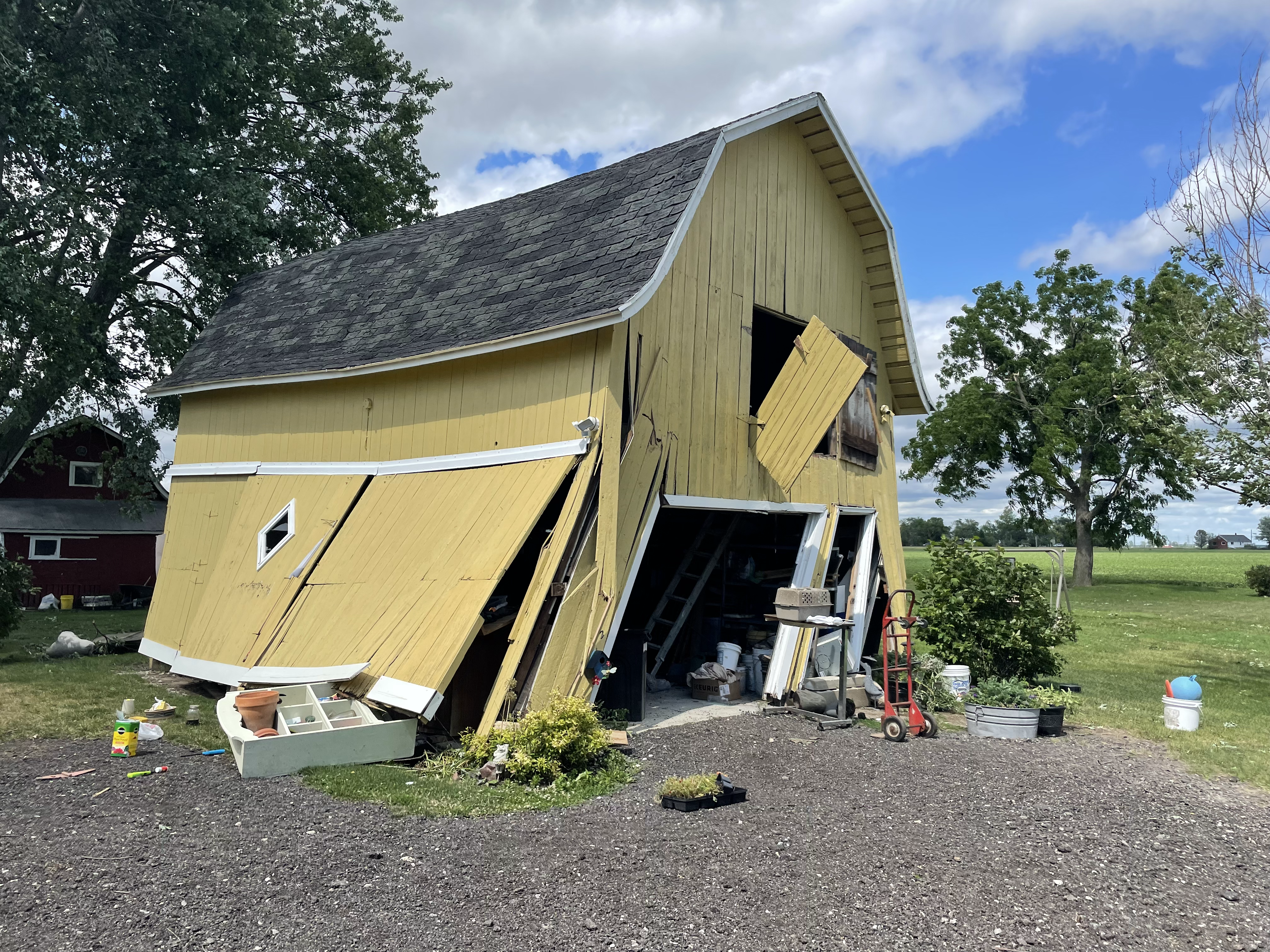
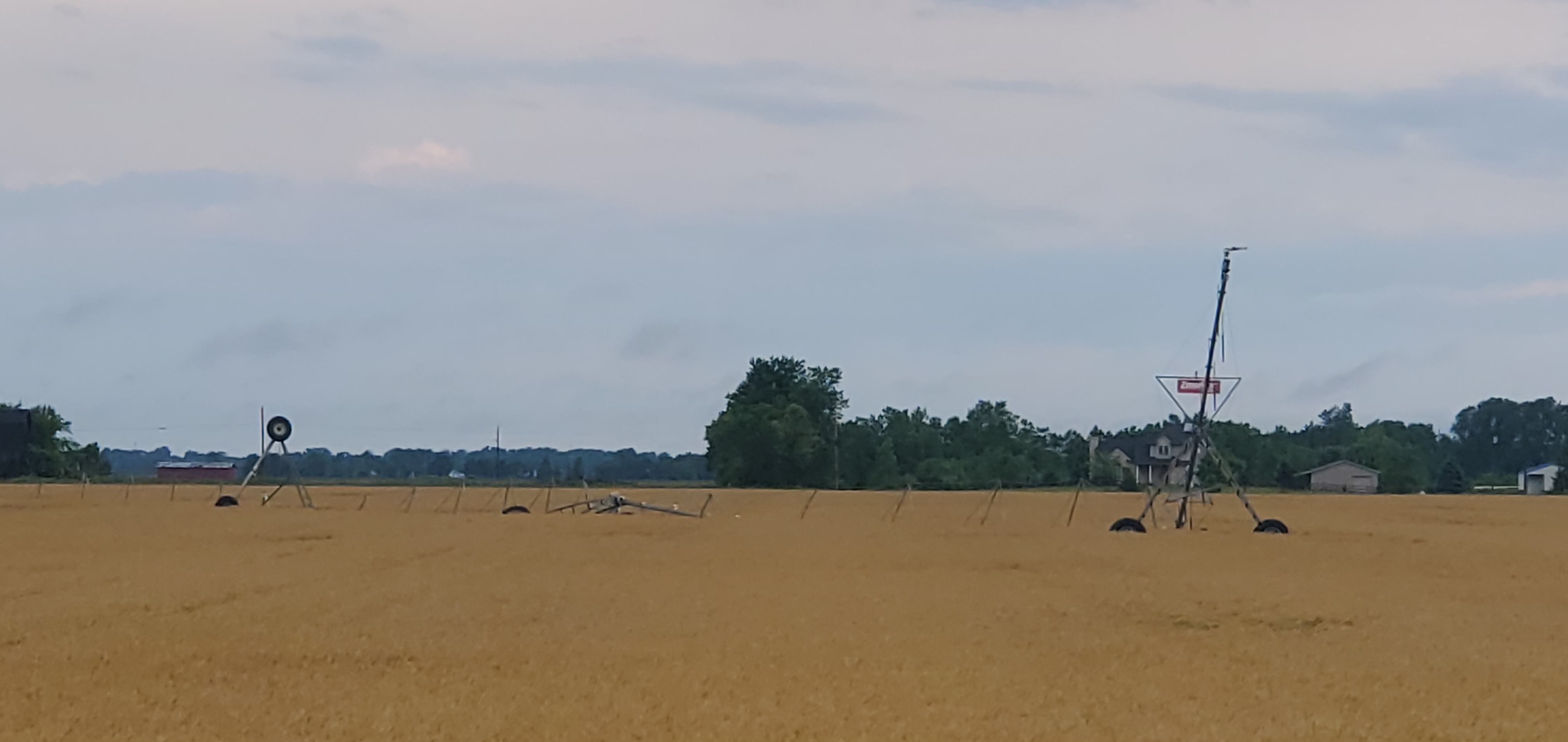
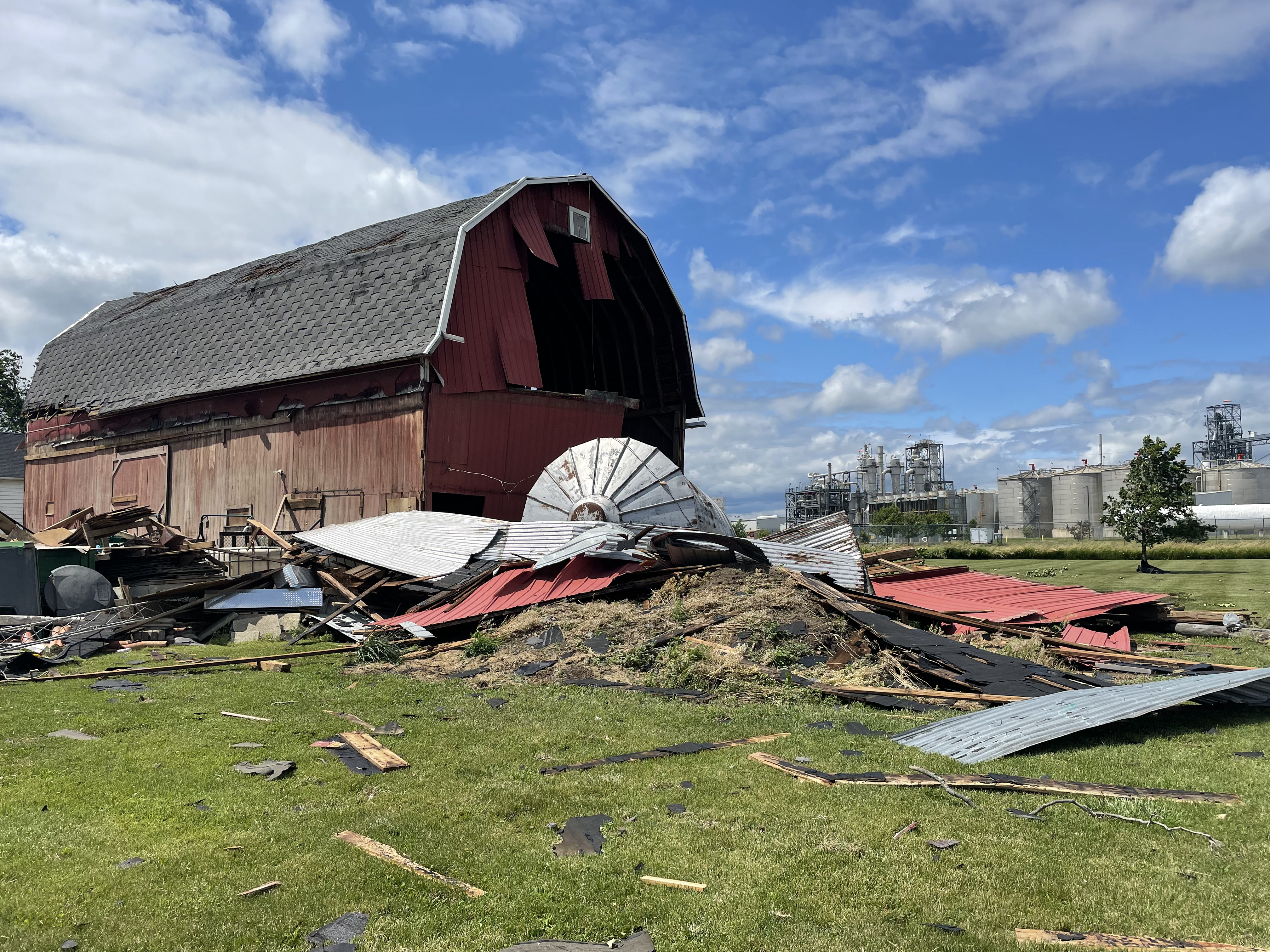
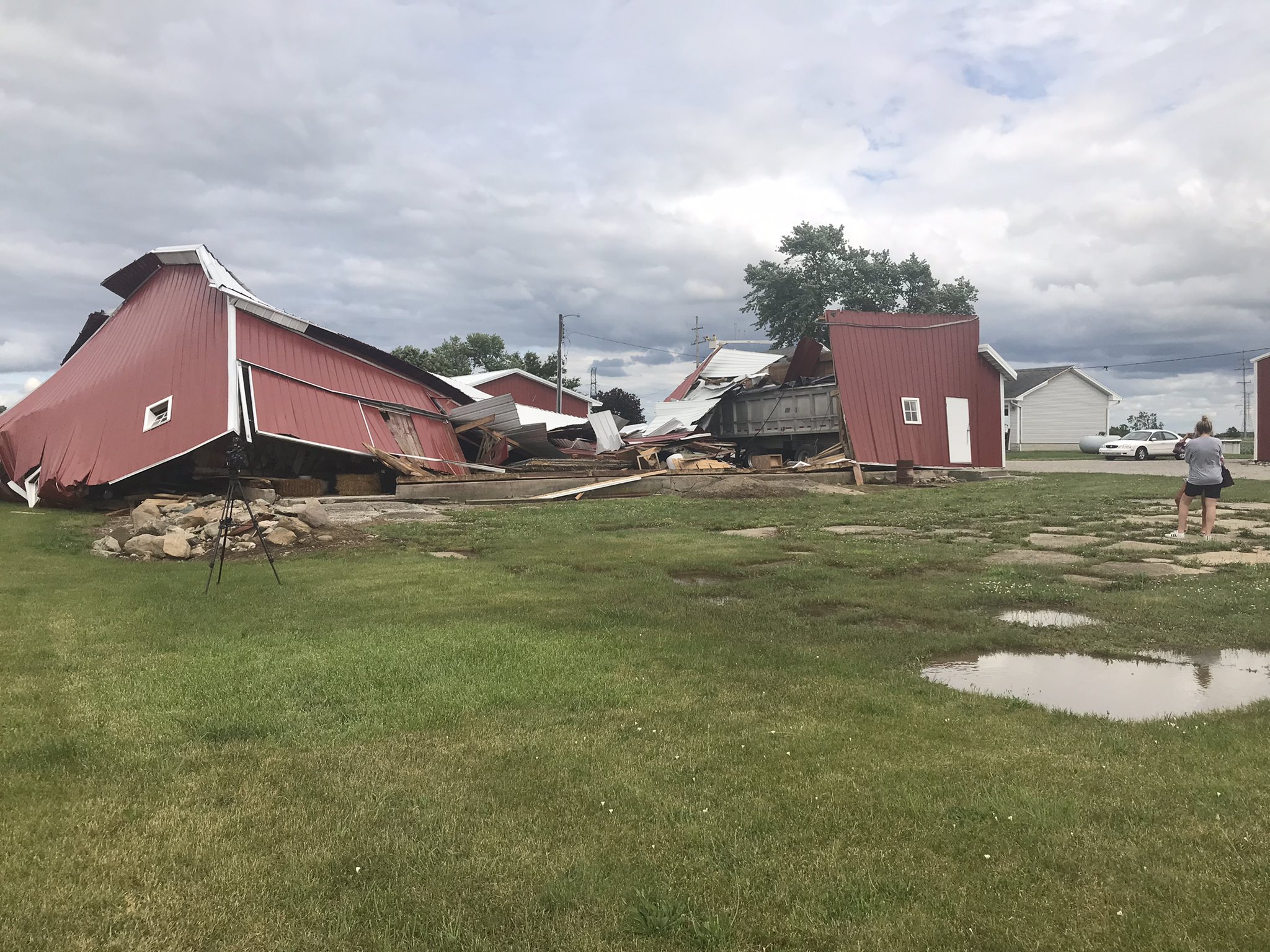
In addition to the numerous wind reports, the first tornado of 2021 occurred in Riga Township, located in far southeast Lenawee county. This was the first tornado in southeast Michigan since September 2019 in Sanilac county. The Riga tornado was rated EF-1 with estimated peak winds of 90 mph and a path length just shy of 3 miles. The tornado damaged at least 5 homes, 4 outbuildings, 3 barns, and numerous trees. Some highlights of the damage included snapped large tree limbs, roof loss, collapsed barn walls, and a destroyed small sheet metal silo. The tornado was the first in Lenawee county since an EF-1 tornado that occurred northwest of Adrian back on June 6, 2010.
Tornado Information:
|
Tornado - Riga Township, MI
Track Map

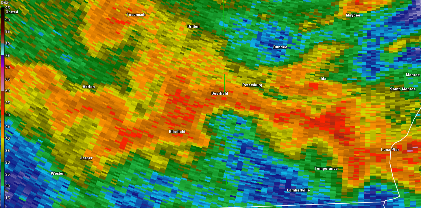
Radar Velocity Image at 9:25 PM EDT Inbound velocities (green) located next to outbound velocities (red)
|
||||||||||||||||
The Enhanced Fujita (EF) Scale classifies tornadoes into the following categories:
| EF0 Weak 65-85 mph |
EF1 Moderate 86-110 mph |
EF2 Significant 111-135 mph |
EF3 Severe 136-165 mph |
EF4 Extreme 166-200 mph |
EF5 Catastrophic 200+ mph |
 |
|||||
Photos & Local Media Coverage
WTOL Toledo Channel 11 Story on Tornado
WXYZ Detroit Channel 7 Story on Tornado
 |
 |
 |
 |
| Tornado damage Riga Township. | Tornado damage Riga Township. | Tornado damage Riga Township. | Tornado damage Riga Township. |
 |
 |
 |
 |
| Tornado damage Riga Township | Tornado damage Riga Township |
Ecorse (Courtesy: Nicholas Janeski) |
Ecorse (Courtesy: Nicholas Janeski) |
 |
 |
 |
|
|
Royal Oak (Courtesy: Isaac Polanski) |
Deerfield Township (Courtesy: WTOL) |
Grosse Ille (Courtesy: Cynthia Blasses) |
Radar
 |
 |
Storm Reports
PRELIMINARY LOCAL STORM REPORT...SUMMARY
NATIONAL WEATHER SERVICE DETROIT/PONTIAC MI
1020 PM EDT MON JUN 21 2021

..TIME...   ...EVENT...      ...CITY LOCATION...     ...LAT.LON...
..DATE...   ....MAG....      ..COUNTY LOCATION..ST.. ...SOURCE....
            ..REMARKS..

0918 PM     TSTM WND DMG     CLAYTON                 41.86N 84.24W
06/20/2021                   LENAWEE            MI   911 CALL CENTER

            TREES DOWNED NEAR CLAYTON VIA LENAWEE COUNTY SHERIFF.

0919 PM     TSTM WND DMG     5 NNW TEMPERANCE        41.84N 83.61W
06/20/2021                   Monroe             MI   911 CALL CENTER

            DISPATCH REPORTS MULTIPLE TREES DOWN AROUND MOROCCO RD
            AND DOUGLAS RD

0919 PM     TSTM WND DMG     2 N GROSSE ILE          42.16N 83.15W
06/20/2021                   WAYNE              MI   PUBLIC

            LARGE TREE SNAPPED NEAR THE INTERSECTION OF MERIDIAN RD
            AND POTAWATOMI DR

0923 PM     TORNADO          2 SE BLISSFIELD         41.81N 83.84W
06/20/2021  F1               LENAWEE            MI   NWS STORM SURVEY

            ONE RESIDENCE SUSTAINED SIGNFICANT ROOF DAMAGE,A NEARBY
            SMALL SHEET METAL SILO COLLAPSED,AND WALLS OF A SMALL
            BARN COLLAPSED.

0923 PM     TSTM WND DMG     2 ESE BLISSFIELD        41.82N 83.83W
06/20/2021                   LENAWEE            MI   911 CALL CENTER

            REPORTS OF MULTIPLE TREES DOWN. DAMAGE TO BARN.

0924 PM     TORNADO          2 ESE BLISSFIELD        41.82N 83.83W
06/20/2021  F1               LENAWEE            MI   NWS STORM SURVEY

            ONE RESIDENCE HAD A CHIMNEY COLLPASE WITH MULTIPLE TREES
            UPROOTED ON THE PROPERTY AND NEARBY FALLEN POWER POLES.

0926 PM     TSTM WND DMG     5 SSE DUNDEE            41.90N 83.61W
06/20/2021                   Monroe             MI   911 CALL CENTER

            DISPACTH REPORTS MULTIPLE TREES DOWN AROUND ALBAIN RD AND
            DOUGLAS RD

0926 PM     TORNADO          3 ESE BLISSFIELD        41.82N 83.81W
06/20/2021  F1               LENAWEE            MI   NWS STORM SURVEY

            RESIDENCE HAD AC UNIT OVERTURNED, DAMAGE TO ROOF AND
            SIDING, ROOF DAMAGE TO A LARGE BARN, SEVERAL LARGE TREES
            SNAPPED,AND AN OUTBUILDING ROOF WAS COMPLETELY REMOVED.

0940 PM     TSTM WND DMG     4 NE DUNDEE             42.00N 83.61W
06/20/2021                   Monroe             MI   911 CALL CENTER

            DISPATCH REPORTS MULTIPLE TREES DOWN AROUND DAY RD AND
            PLANK RD

0941 PM     TSTM WND DMG     3 SSE DETROIT           42.34N 83.10W
06/20/2021                   WAYNE              MI   PUBLIC

            TREE DOWN AND PARTIALLY BLOCKING RIGHT TURN LANE AT
            INTERSECTION OF MARTIN LUTHER KING JR BLVD AND JEFFRIES
            SERVICE DR. RELAYED VIA SOCIAL MEDIA PHOTO.

0948 PM     MARINE TSTM WIND 5 E ESTRAL BEACH        42.00N 83.14W
06/20/2021  M54.00 MPH       LEZ444             MI   MESONET

            MEASURED AT DETROIT RIVER LIGHT.

0952 PM     TSTM WND DMG     3 NE GREGORY            42.49N 84.04W
06/20/2021                   LIVINGSTON         MI   911 CALL CENTER

            TREE DOWN OVER SHAFFER RD AND PINGREE RD.

0952 PM     TSTM WND DMG     2 SSE GREGORY           42.43N 84.06W
06/20/2021                   LIVINGSTON         MI   911 CALL CENTER

            LARGE TREE DOWN IN UNADILLA.

1001 PM     TSTM WND DMG     1 ESE PINCKNEY          42.45N 83.93W
06/20/2021                   LIVINGSTON         MI   911 CALL CENTER

            TREE DOWN OVER DEXTER-PINCKNEY ROAD.

1005 PM     TSTM WND DMG     HOWELL                  42.61N 83.94W
06/20/2021                   LIVINGSTON         MI   911 CALL CENTER

            TREES DOWN OVER POWERLINES IN THE CITY OFF HOWELL CAUSING
            POWER OUTAGES.

1028 PM     TSTM WND DMG     1 W NOVI                42.48N 83.51W
06/20/2021                   OAKLAND            MI   PUBLIC

            SEVERAL 1 TO 4 INCH TREE LIMBS DOWNED.

1039 PM     TSTM WND DMG     5 W WEST BLOOMFIELD     42.57N 83.48W
06/20/2021                   OAKLAND            MI   PUBLIC

            LARGE 7 INCH DIAMETER TREE DOWNED NEAR OAKLEY PARK RD AND
            COMMERCE RD.

1039 PM     MARINE TSTM WIND 3 E DOWNTOWN DETROIT    42.33N 82.99W
06/20/2021  M44.00 MPH       WAYNE              MI   MESONET

            MEASURED AT BELLE ISLE-DOSSIN MUSEUM

1042 PM     TSTM WND DMG     2 NW ROYAL OAK          42.53N 83.18W
06/20/2021                   OAKLAND            MI   TRAINED SPOTTER

            LARGE TREE LIMB DOWNED NEAR THE INTERSECTION OF NORTHWOOD
            AND MAPLEWOOD.

1043 PM     MARINE TSTM WIND 4 NNE GROSSE POINTE     42.43N 82.87W
06/20/2021  M42.00 MPH       LCZ460             MI   MESONET

            MEASURED AT GROSSE POINTE YACHT CLUB

1044 PM     TSTM WND DMG     4 SSE PONTIAC           42.60N 83.26W
06/20/2021                   OAKLAND            MI   NWS EMPLOYEE

            LARGE TREE LIMB NEARLY 2 FEET IN DIAMETER DOWNED NEAR THE
            INTERSECTION OF WOODWARD AVE AND SQUARE LAKE RD.

1049 PM     TSTM WND DMG     2 S CLARKSTON           42.71N 83.42W
06/20/2021                   OAKLAND            MI   PUBLIC

            A COUPLE OF DOWNED 4 INCH TREE LIMBS.

1100 PM     MARINE TSTM WIND 6 WSW HARSENS ISLAND    42.56N 82.68W
06/20/2021  M45.00 MPH       ST. CLAIR          MI   MESONET

            MEASURED AT CLUB ISLAND MESONET

1155 PM     MARINE TSTM WIND 1 E NEWPORT             42.00N 83.28W
06/20/2021  M50.00 MPH       MONROE             MI   MESONET

            MEASURED AT ARMSTRONG RD TEMPEST MESONET STATION

1208 AM     MARINE TSTM WIND 5 E ESTRAL BEACH        42.00N 83.14W
06/21/2021  M43.00 MPH       LEZ444             MI   MESONET

            MEASURED AT DETROIT RIVER LIGHT

0411 AM     TSTM WND DMG     2 NE DUNDEE             41.98N 83.63W
06/21/2021                   Monroe             MI   911 CALL CENTER

            DISPATCH REPORTS MULTIPLE TREES AND POWERLINES DOWN
            AROUND STOWELL RD AND BIGELOW RD

0421 AM     TSTM WND DMG     4 NNW MONROE            41.97N 83.41W
06/21/2021                   Monroe             MI   911 CALL CENTER

            DISPATCH REPORTS MULTIPLE TREES DOWN AROUND LASALLE AND
            REINHARDT RD

0422 AM     TSTM WND DMG     1 W MONROE              41.91N 83.40W
06/21/2021                   Monroe             MI   911 CALL CENTER

            DISPATCH REPORTS MULTIPLE TREES DOWN AROUND W 5TH STREET
            AND SMITH STREET

0439 AM     MARINE TSTM WIND 5 E ESTRAL BEACH        42.00N 83.14W
06/21/2021  M48.00 MPH       LEZ444             MI   MESONET

            MEASURED AT DETROIT RIVER LIGHT HOUSE

0514 AM     TSTM WND GST     5 NNE DOWNTOWN DETROIT  42.40N 83.02W
06/21/2021  M43.00 MPH       Wayne              MI   ASOS

            MEASURED AT DETROIT CITY AIRPORT
 |
|
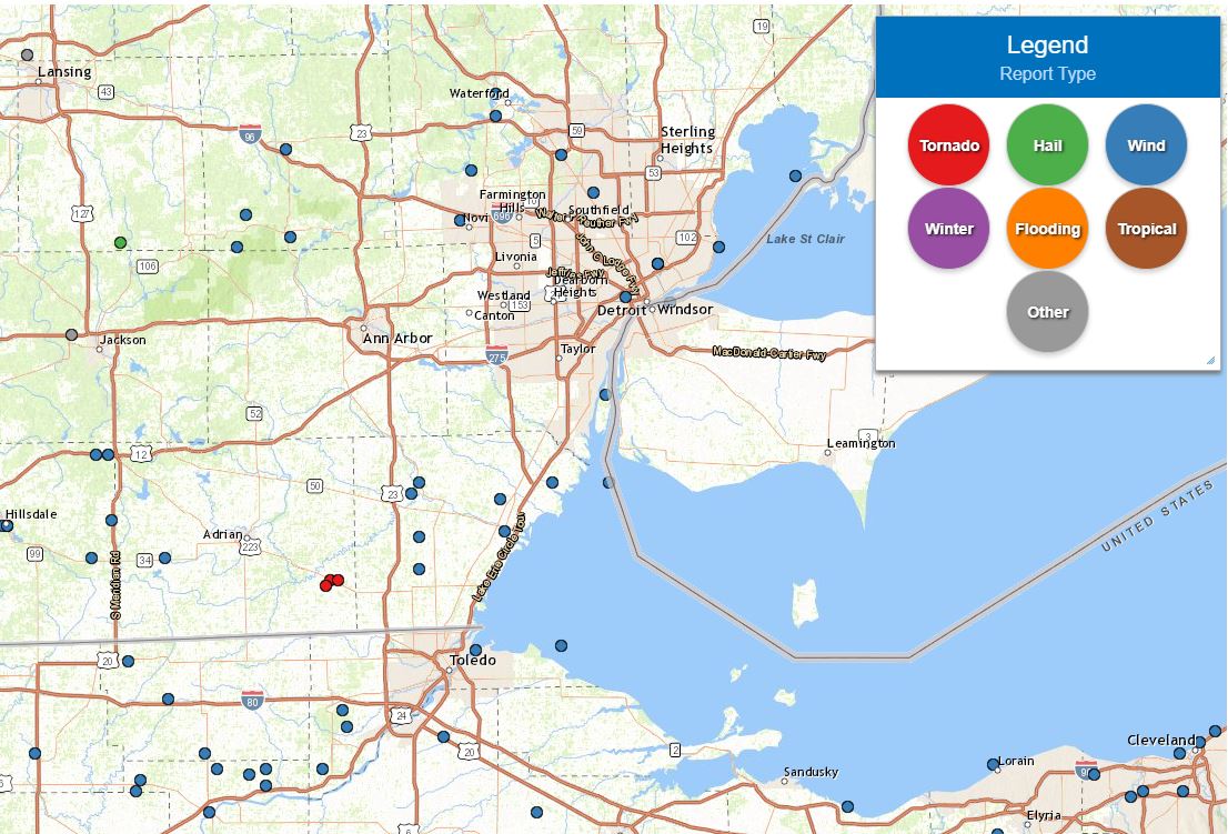
Above image depicts the local storm reports across the region late Sunday into early Monday, June 20-21, 2021. |
 |
|
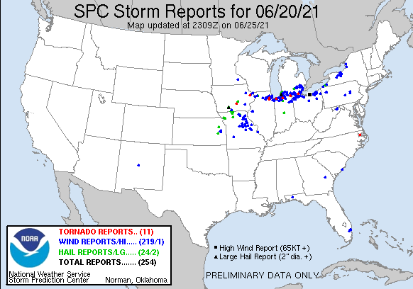
National Storm Reports for June 20, 2021 |
Environment Overview
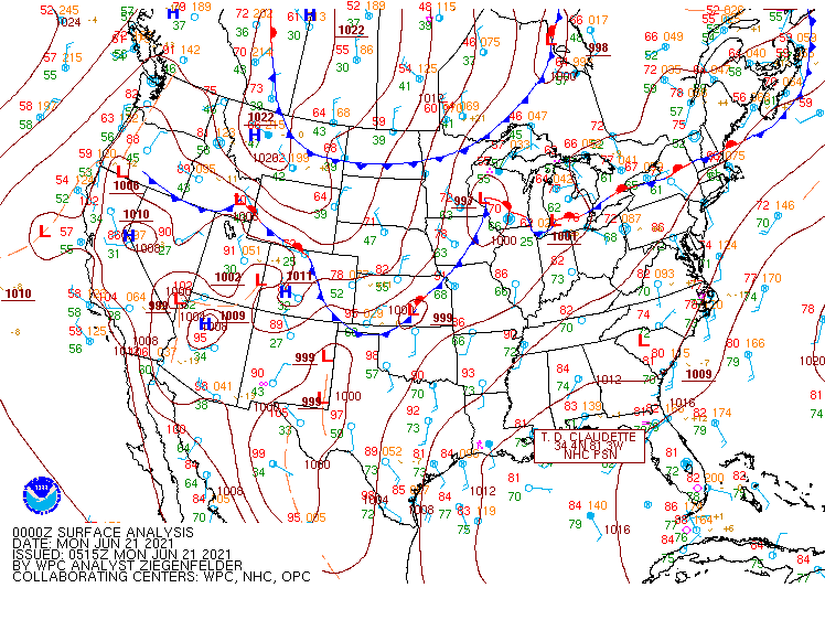
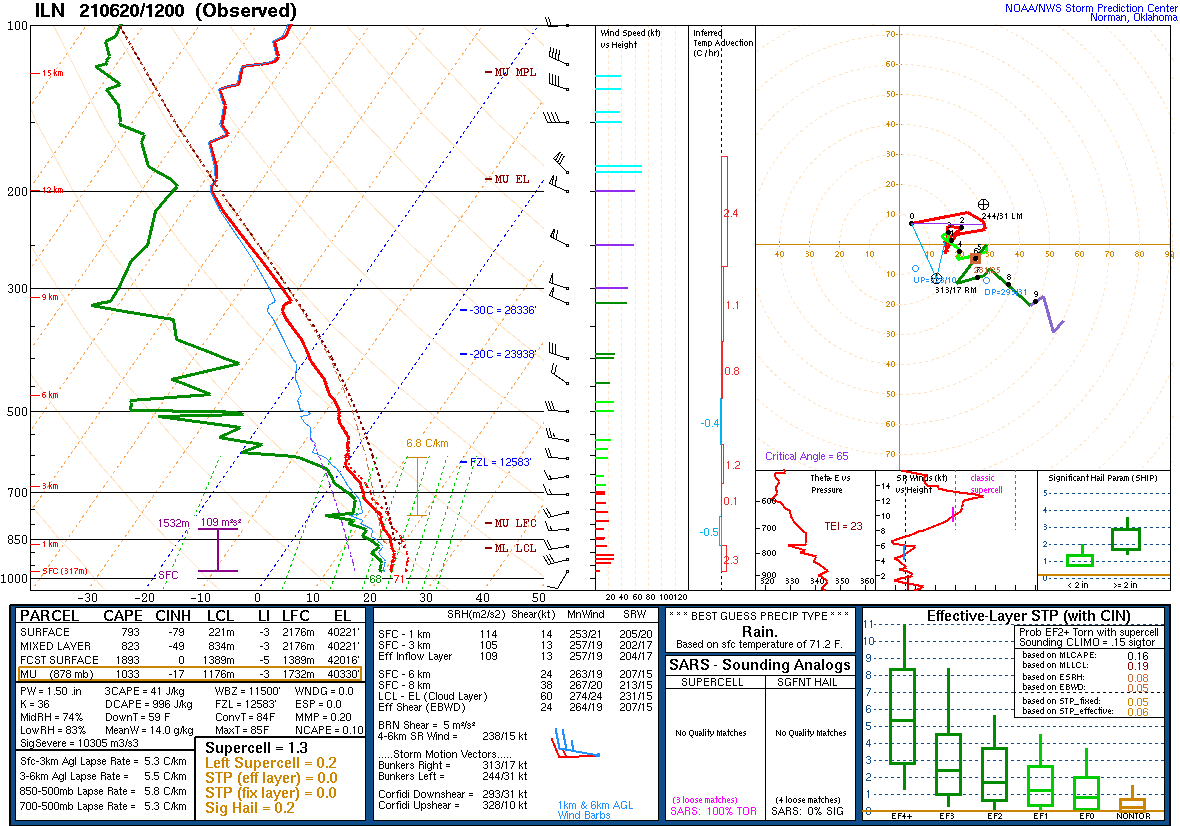
A stationary frontal boundary remained draped around the I-94 corridor for much of the day (June 20, 2021), with anticipation that the boundary would lift slightly northward into the nighttime hours in response to deepening of a seasonally strong low pressure system west of Lake Michigan (Fig. 1). Below the front, a moist and unstable airmass was in place characterized by temperatures in the mid to upper 80s and surface dewpoints well into the 60s to near 70 F (not shown). With the KDTX sounding residing above the front and not representative of the moist and unstable airmass in place for the severe thunderstorms that eventually occurred, a more accurate representation to use is the KILN sounding out of Wilmington, OH (Fig. 2). The morning sounding revealed a forecasted unstable airmass with forecast surface-based CAPE (SBCAPE) of around 1900 J/kg and mixed-layer CAPE just shy of 1000 J/kg. Abundant moisture was also in place with a PWAT value of 1.50 inches. LCL heights, which lower values mean more favorability for tornadogenesis, were less than 750 feet (221 meters).
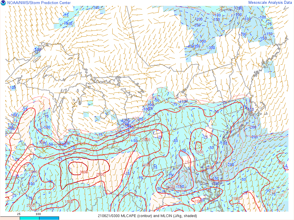
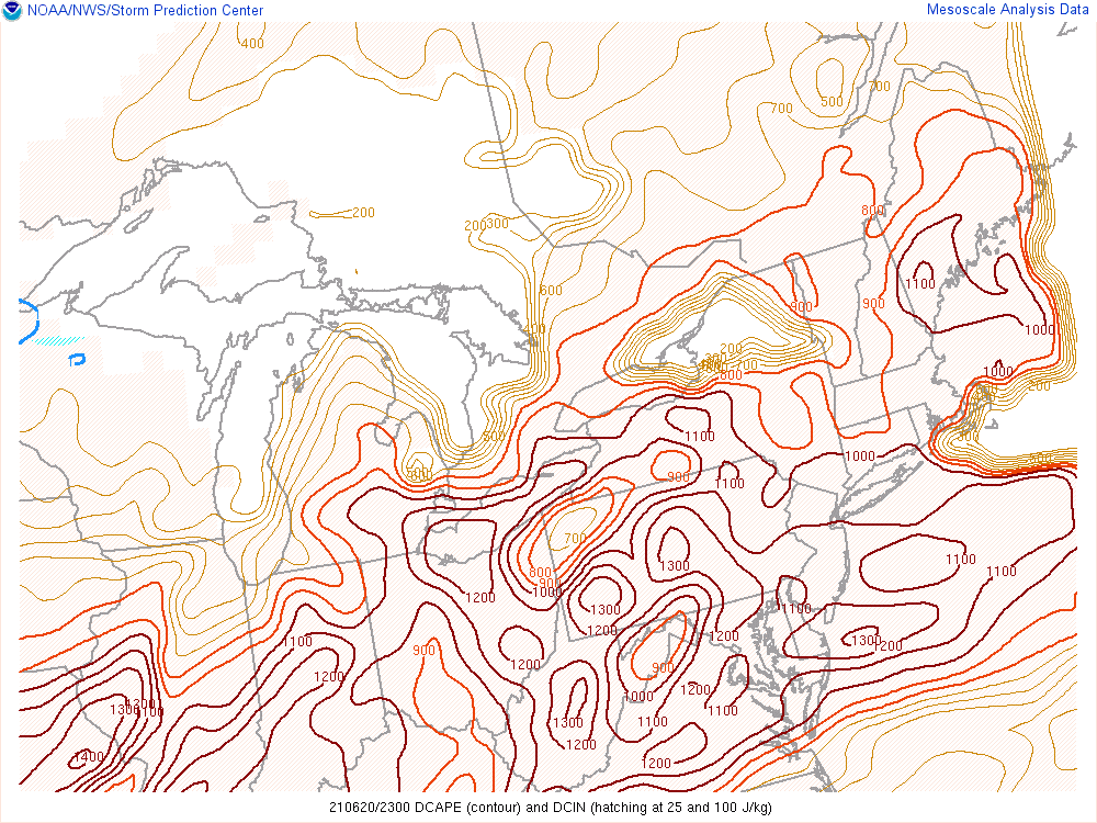
SPC mesoanalysis during the evening hours also revealed an environment conducive not just for widespread thunderstorm development, but the potential for severe thunderstorms. Thunderstorm organization was supported by effective bulk shear values of 35-45 knots (Fig. 3), with an instability gradient in place between the I-94 corridor and the Ohio border for thunderstorms to feed off of heading into the early overnight hours (Fig. 4). For the wind threat, DCAPE values also provided a clue, as values easily exceeded 1000 J/kg, indicative of enhanced downdraft potential (Fig. 5). All of these factors led the Storm Prediction Center (SPC) to place southeast Michigan roughly south of the M-59 corridor in an Enhanced Risk for severe thunderstorms (Fig. 6), including a 5% probability for tornadoes (which for southeast Michigan standards, is an enhanced risk (not shown)).
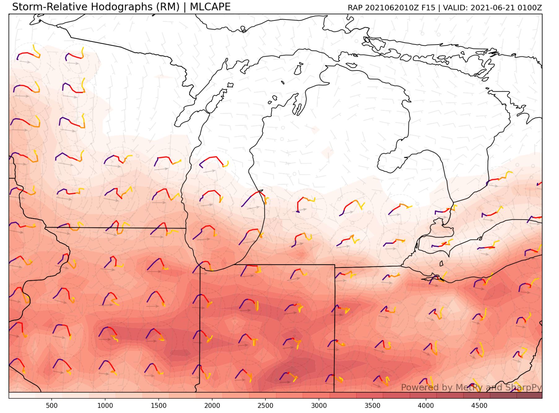
A few complicating factors were in play leading up to the event however. Throughout much of the afternoon, there was a fair amount of capping (convective inhibition or CIN) in place which made it difficult to ascertain whether rapidly developing severe thunderstorms further west in western Indiana would continue to be severe as they progressed towards southeast Michigan. Additionally, the hodograph, which is a measure of storm-relative wind through the atmospheric column and can infer potential thunderstorm mode, offered multiple scenarios. The evening KDTX sounding (not shown) revealed more of a “straight” hodograph through the lowest 6 km of the atmosphere, which would infer the potential for more of a multicell or splitting thunderstorm mode to the event. However, hi-resolution model forecasts of hodographs, such as from the Rapid Refresh Model (RAP) indicated more of a “curved” hodograph through the same layer, which would infer more potential of discrete thunderstorms capable of rotation (Fig. 7).
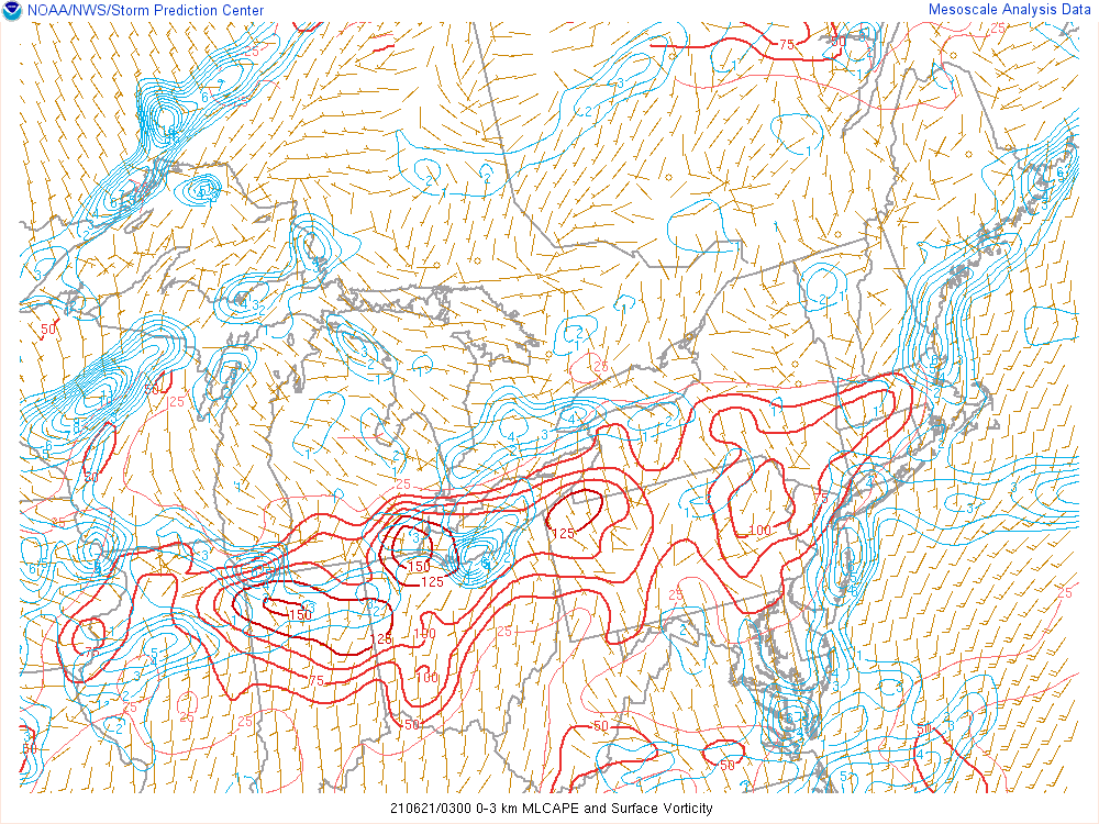
What ultimately happened was a mixture of both storm modes, although dominated more by the multicell thunderstorm nature due to upscale propagation of severe thunderstorms already ongoing in Indiana and southwest Lower Michigan. However, the “curved” hodograph did provide a signal that rotation would be possible if enough horizontal vorticity could be ingested into an updraft. Figure 8 depicts an overlay of surface vorticity and 0-3 km CAPE. These fields can be useful to help analyze potential quick spin-up tornadoes, like the one that occurred in Riga Township. A maximum in both of these fields occurred roughly near and around the time the tornado occurred.
Click on the images below to enlarge them.
 |
 |
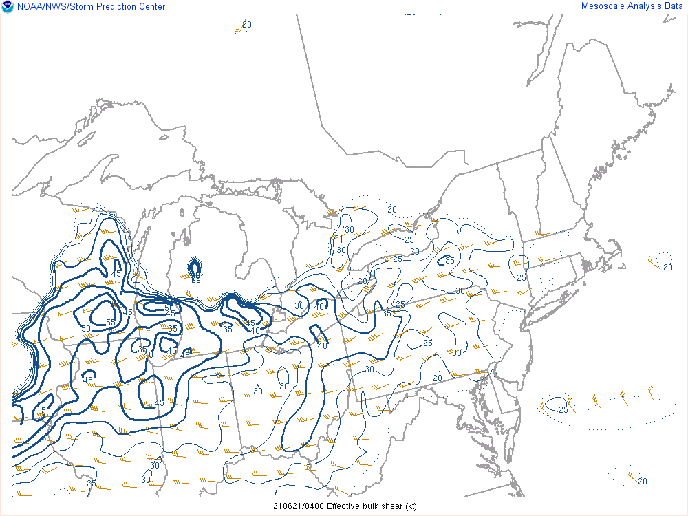 |
| Figure 1: Weather Prediction Center (WPC) surface map, valid 8 PM June 20, 2021. | Figure 2: KILN observed sounding, valid 8 AM June 20, 2021. | Figure 3: SPC effective shear, valid 12 AM June 21, 2021. |
 |
 |
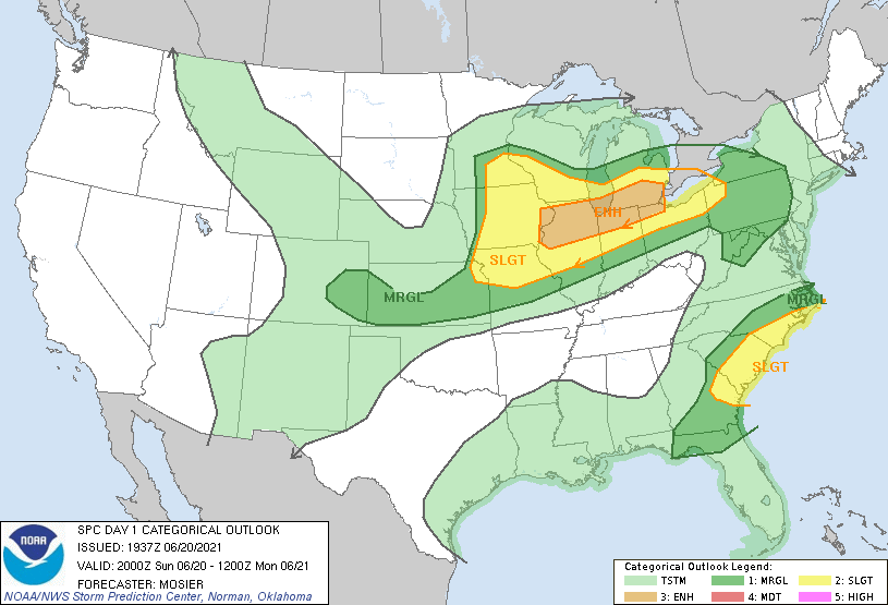 |
| Figure 4:SPC MLCAPE/MLCIN, valid 11 PM June 20, 2021. | Figure 5: SPC DCAPE, valid 7 PM June 20, 2021. | Figure 6: SPC Day 1 Convective Outlook. |
 |
 |
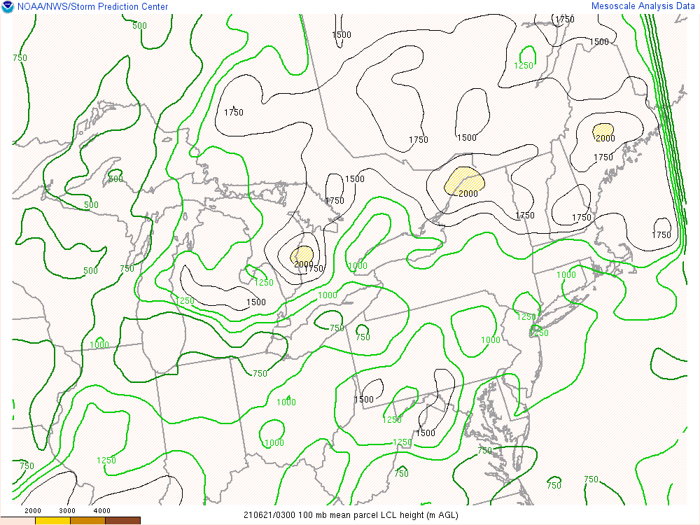 |
| Figure 7: RAP forecast hodographs overlaid with MLCAPE, valid 9 PM June 20, 2021. | Figure 8: SPC 0-3 km Convective Available Potential Energy (CAPE) overlaid against surface-based vorticity, valid from 11 PM June 20, 2021. | Figure 9:SPC LCL heights, valid 11 PM June 20, 2021. |
 |
Media use of NWS Web News Stories is encouraged! Please acknowledge the NWS as the source of any news information accessed from this site. |
|