
Heat expands across the Desert Southwest, Plains, Mississippi Valley and Midwest into Monday. Fire weather concerns continue for portions of the Intermountain West. Active monsoonal moisture fuels thunderstorms over the Southwest with possible flash flooding. Tropical cyclone Fausto in the Pacific, should weaken as it approaches Hawaii; Dangerous surf, swells and rip currents are expected. Read More >
Dodge City, KS
Weather Forecast Office
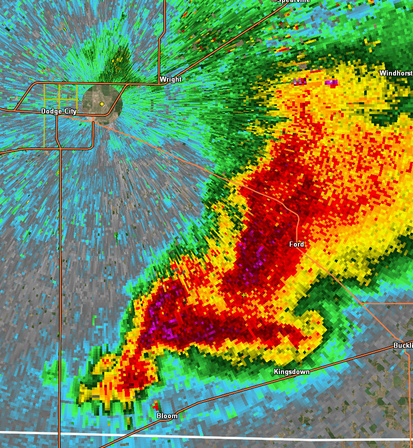
A supercell thunderstorm southeast of Dodge City late Tuesday evening produced very large hail (softball reported), a very large wall cloud, a funnel cloud and high wind damage north of Kingsdown and south of Ford. Here is a look at the radar image at 542 PM....
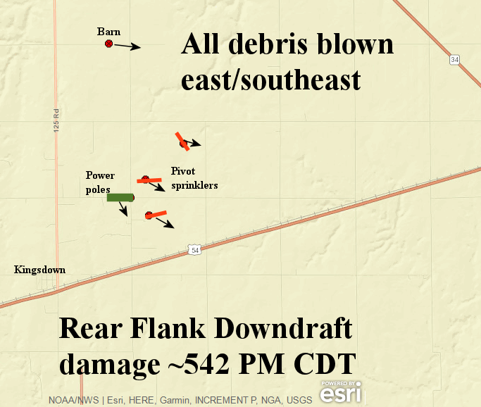
The surge of high winds on the southern periphery of the wall cloud and rotation (Rearflank downdraft) produced damage to a barn, three pivot sprinklers and 10 power poles (creating power flashes). Here is the map of the damage.
US Dept of Commerce
National Oceanic and Atmospheric Administration
National Weather Service
Dodge City, KS
104 Airport Road
Dodge City, KS 67801-9351
620-225-6514
Comments? Questions? Please Contact Us.

