
Isolated severe storms capable of hail and gusty winds are possible mainly this evening across portions of the mid-Mississippi Valley. Clusters of thunderstorms may produce isolated flash flooding in the Florida peninsula. Elevated fire weather risk is possible in the Northern Plains into western Minnesota. Read More >
Severe Blizzard of March 23-25, 1957
Analysis of an unprecedented storm
Southwestern Kansas is certainly known for its wild variability in weather throughout the year given its geography and climate, and many significant impact storms have been recorded in the roughly 145-year weather history of southwestern Kansas. When it comes to severe winter storms, and in particular blizzards, there are probably less than a handful of blizzards that are used as "benchmarks" to compare recent storms to in terms of ferocity and widespread impact. Of these storms in Southwest Kansas, there is one particular "single" winter storm that seems to stand above the rest of them, and that is the incredible blizzard of late-March 1957.
Meteorological Setting:
The first 20 days of March ’57 were relatively "normal" by March standards...with winter temperatures dominating the first third of the month. By March 10th, a significant warm-up occurred with Dodge City reaching 79°F. High temperatures were above normal for 6 of the next 7 days. The average observed high in Dodge City March 10-17, 1957 was 67°F and the average low during that 8 day stretch was 36°F. This is actually fairly common preceding a significant late-winter or early-spring storm. By March 18-19th, the overall large scale pattern was becoming more active over the western U.S., particularly the southern branch of the polar jet stream. A weak storm system in this southern branch flow produced about a half-inch of rain in Dodge City on the 20th. Major changes were taking place well upstream in the northern branch of the polar jet, as it was beginning to amplify over the northeastern Pacific Ocean rather substantially. By March 22nd, the northern branch polar jet stream had amplified to the point that it was beginning to interact with the southern branch jet stream over the Southwest U.S. -- a key component to major storm development in the central U.S. Over the next several days, the classic ingredients all came together for a major blizzard in western Kansas: robust, deep atmospheric cyclogenesis to provide very strong winds, influx of Gulf of America moisture, and cold Canadian air. The degree of large scale cyclone development was unprecedented, even by Great Plains standards in the month of March. Below are a few atmospheric charts to illustrate:
500mb pressure level charts showing the significant mid level low
(These charts were made and analyzed by Jonathan Finch)
March 22 at 9am CST -- Upper low just beginning to develop over the "4 corners" region
March 22 at 9pm CST -- Upper low centered near Taos, NM (~537 decameter low)
March 23 at 9am CST -- Upper low centered near Pampa, TX (~537 low), however note the tremendous speed-max about to round the base of the trough over southern Arizona! This will play a pivotal role in the significant deepening of the low.
March 23 at 9pm CST -- Upper low became quasi-stationary over western Oklahoma (~531low)
March 24 at 9am CST -- Upper low continued to deepen and moved east-southeast only 100 miles in 12 hours! (~527 low)
March 24 at 9pm CST -- Upper low over southeastern OK (~528 low)
Surface observation and analysis charts (data gathered and analyzed by Jonathan Finch)
March 23 at 11:30pm CST -- Surface low developing near Childress, TX
March 23 at 12:30pm CST -- Surface low west of Oklahoma City, OK was undergoing occlusion. Widespread snow and blowing snow in western Kansas with blizzard conditions well underway
March 24 at 6:30am CST -- Surface low deepened and was very occluded by this time. The low was anchored just west of Oklahoma City, not moving in the last 18 hours!
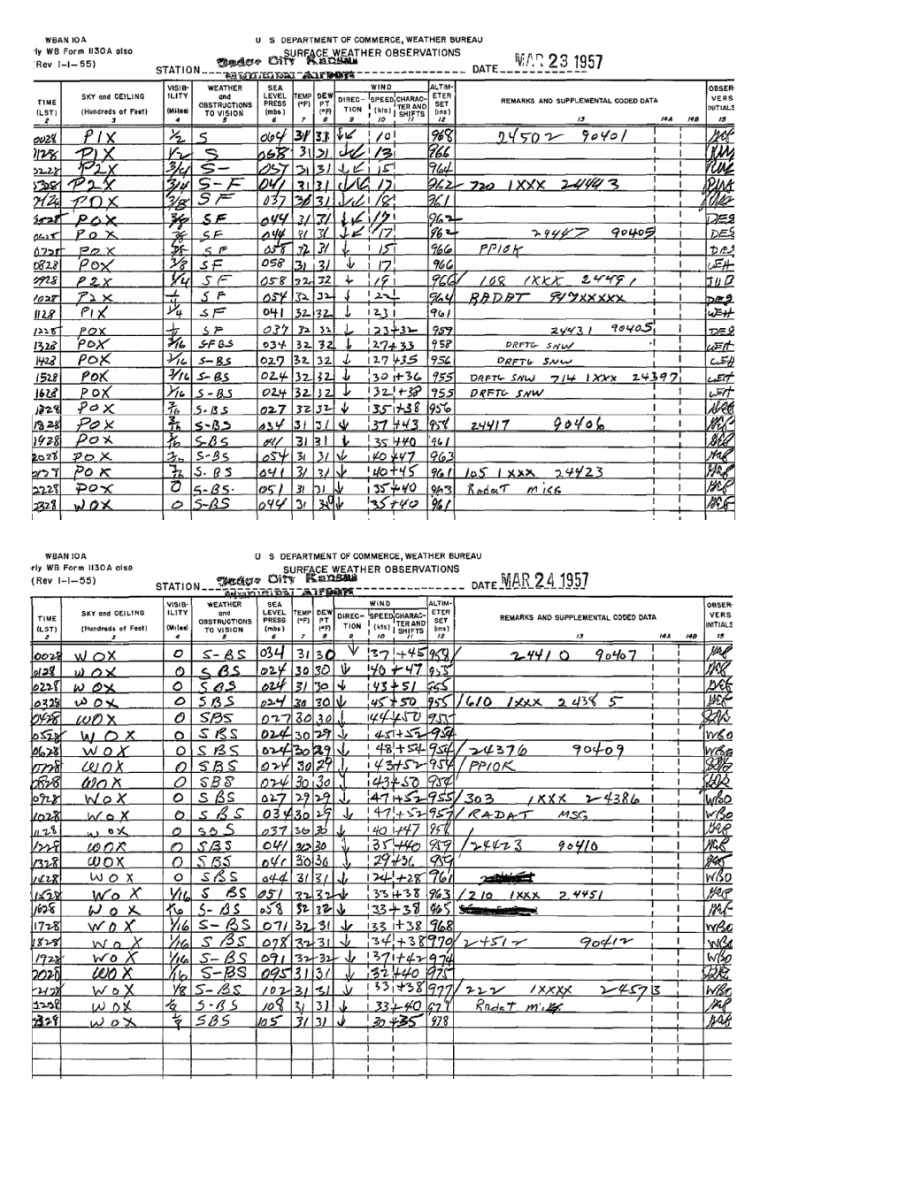
Hand-written surface observation sheets from during the storm
| Dodge City | Garden City |
 |
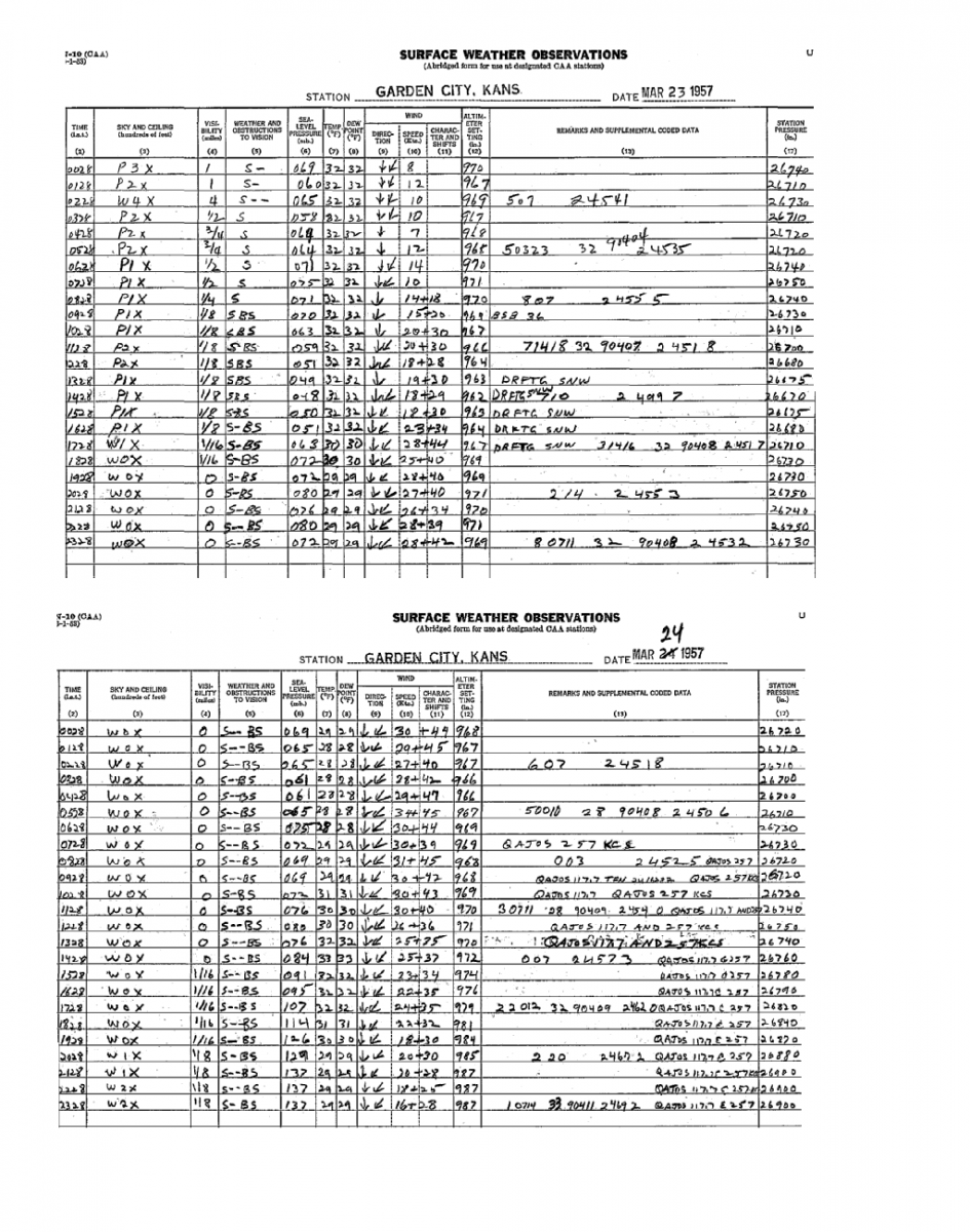 |
Dodge City reported less than 1/4 mile visibility in snow and blowing snow for a staggering 44 consecutive hours!! This is the most consecutive hours of reported blizzard conditions in recorded hourly weather observations for the Dodge City station. The January 1886 blizzard is also one etched in western Kansas history and was more severe than the 1957 storm because it was so much colder, but it is not exactly known how many consecutive hours blizzard criteria were met. There were actually two separate storms that produced severe blizzards back-to-back in January 1886, however the majority of news stories and personal accounts of this event made it appear as if it was one long storm. The other famous blizzards of more recent memory were the March 1987 back-to-back blizzards that crippled western Kansas. The first storm in March 1987 occurred exactly 30 years to the day after the 1957 blizzard featured in this story.
Photos, articles, and stories of the Great 1957 Blizzard:
Special thanks to Kansas Heritage Center of Dodge City for access to their great "Blizzards" archive!
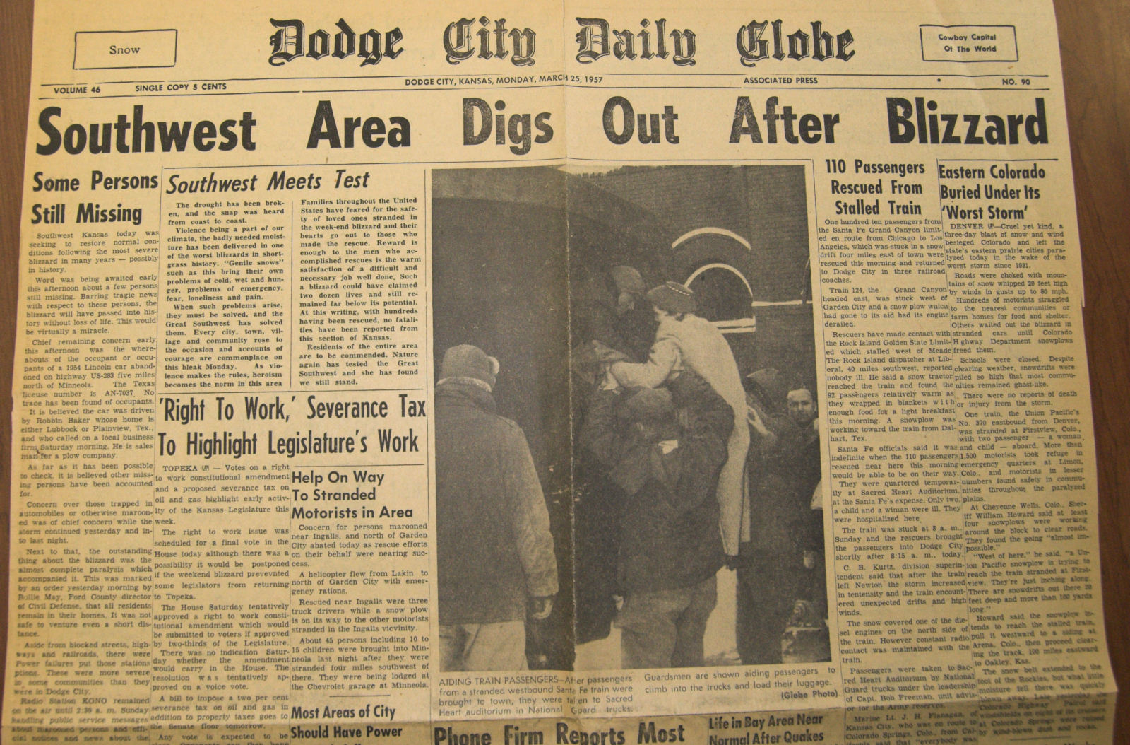
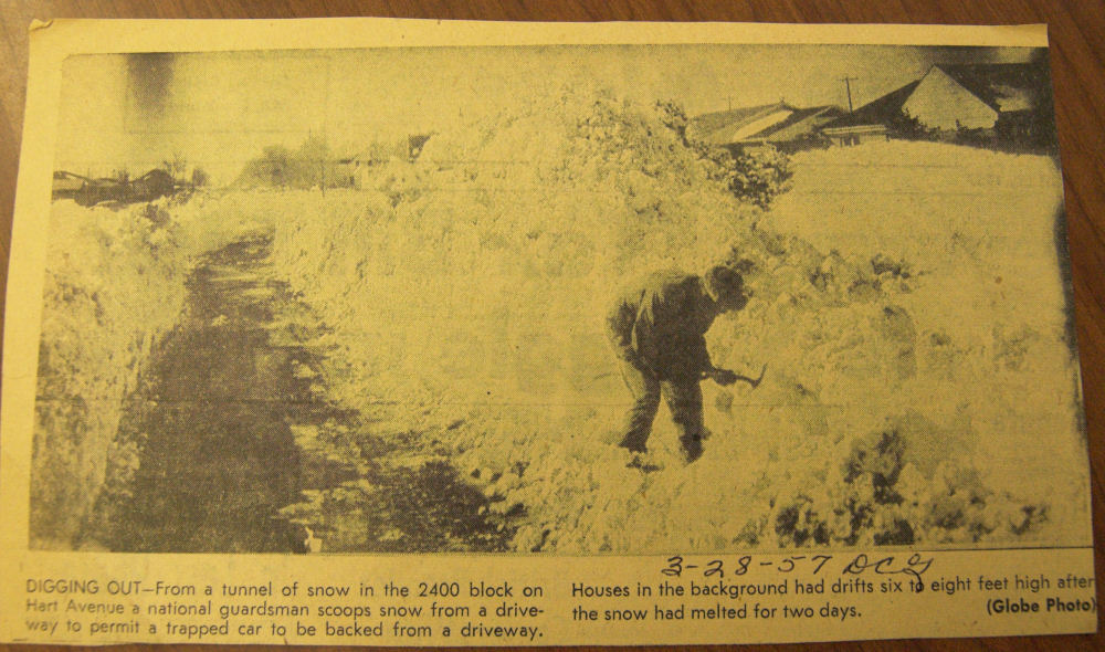
The front page of the Dodge Globe on March 25, 1957:
 |
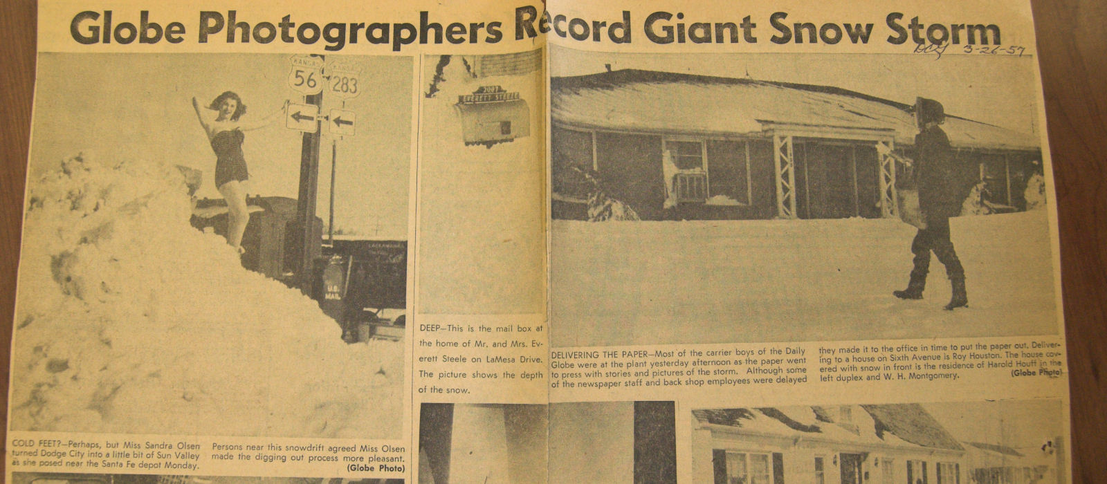
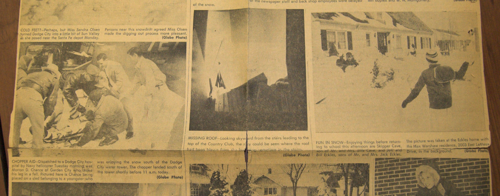
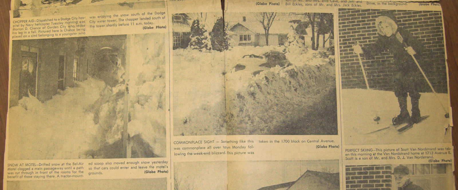
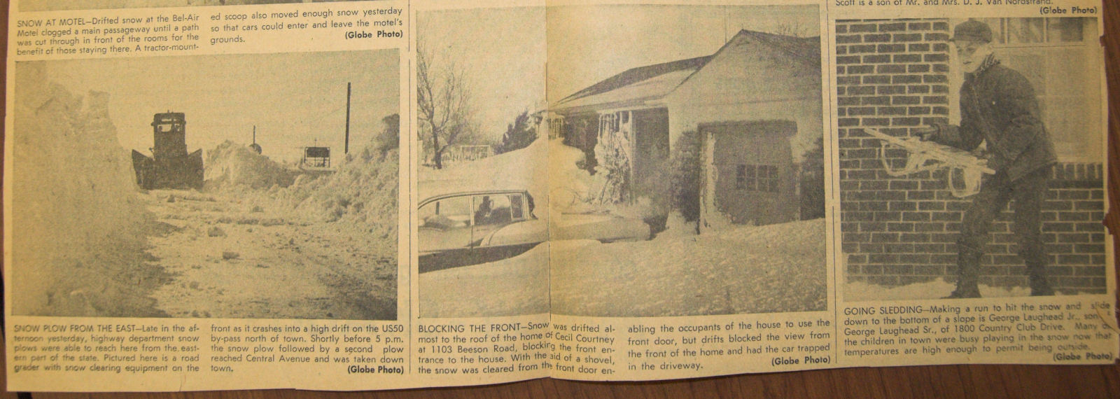
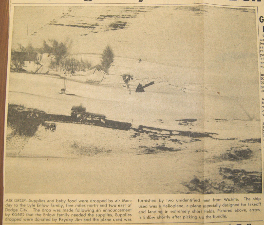
Additional images from the Dodge Globe just after the blizzard:
 |
 |
 |
 |
 |
 |
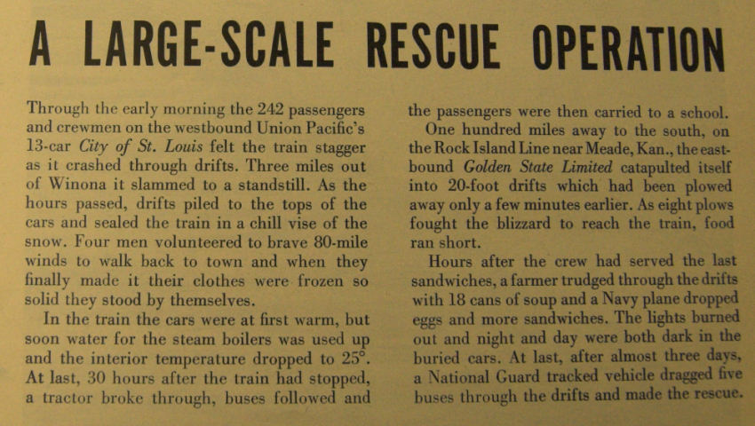
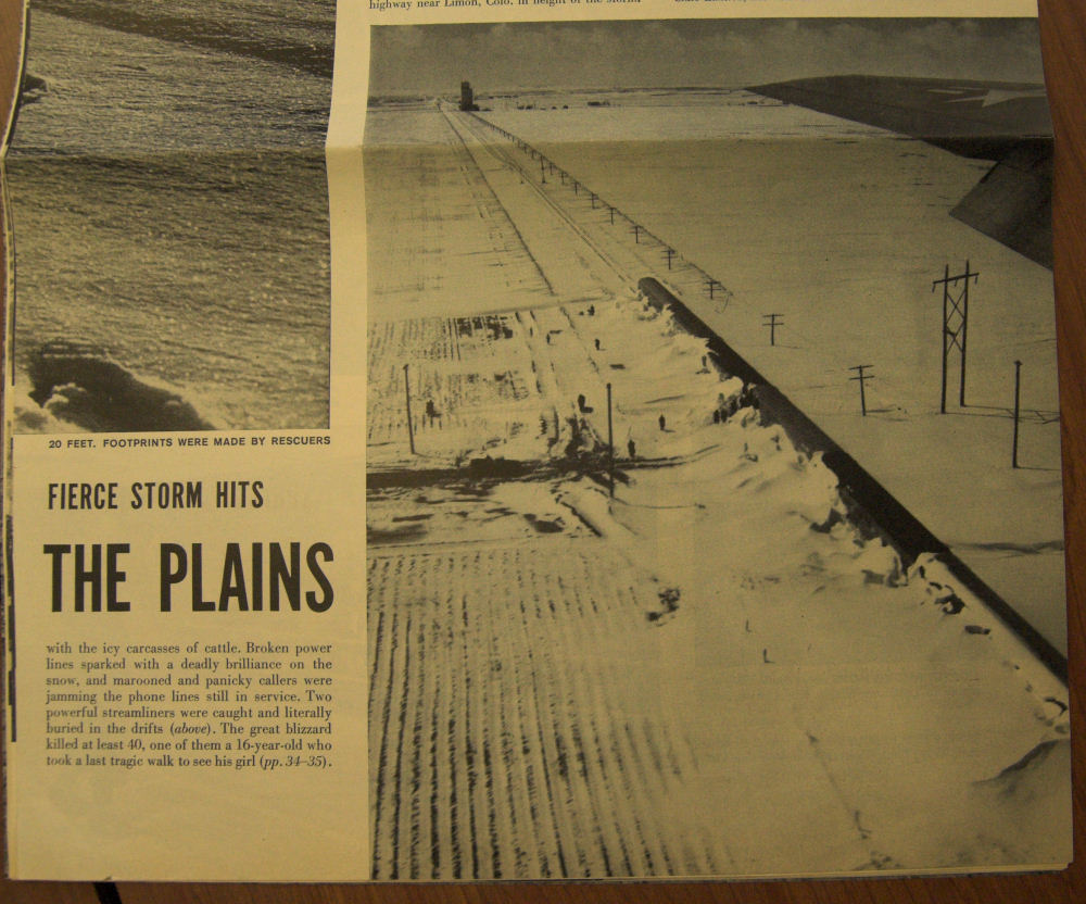
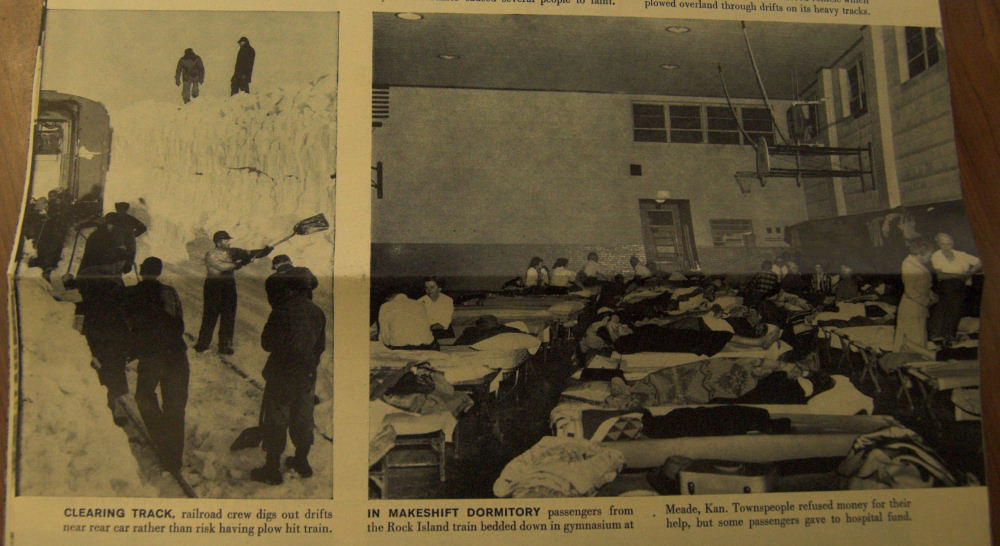
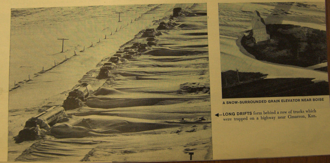
The blizzard took a serious toll on transportation across all of western Kansas for several days. Major railroad lines (Santa Fe, Union Pacific, Rock Island) had passenger trains stranded due to the tremendous storm: One near Garden City, another near Meade, and yet another farther north near Winona.
From Life Magazine story: (courtesy Kansas Heritage Center)
 |
 |
 |
 |
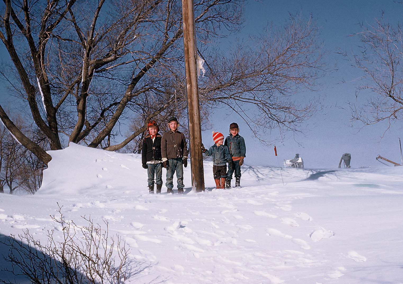
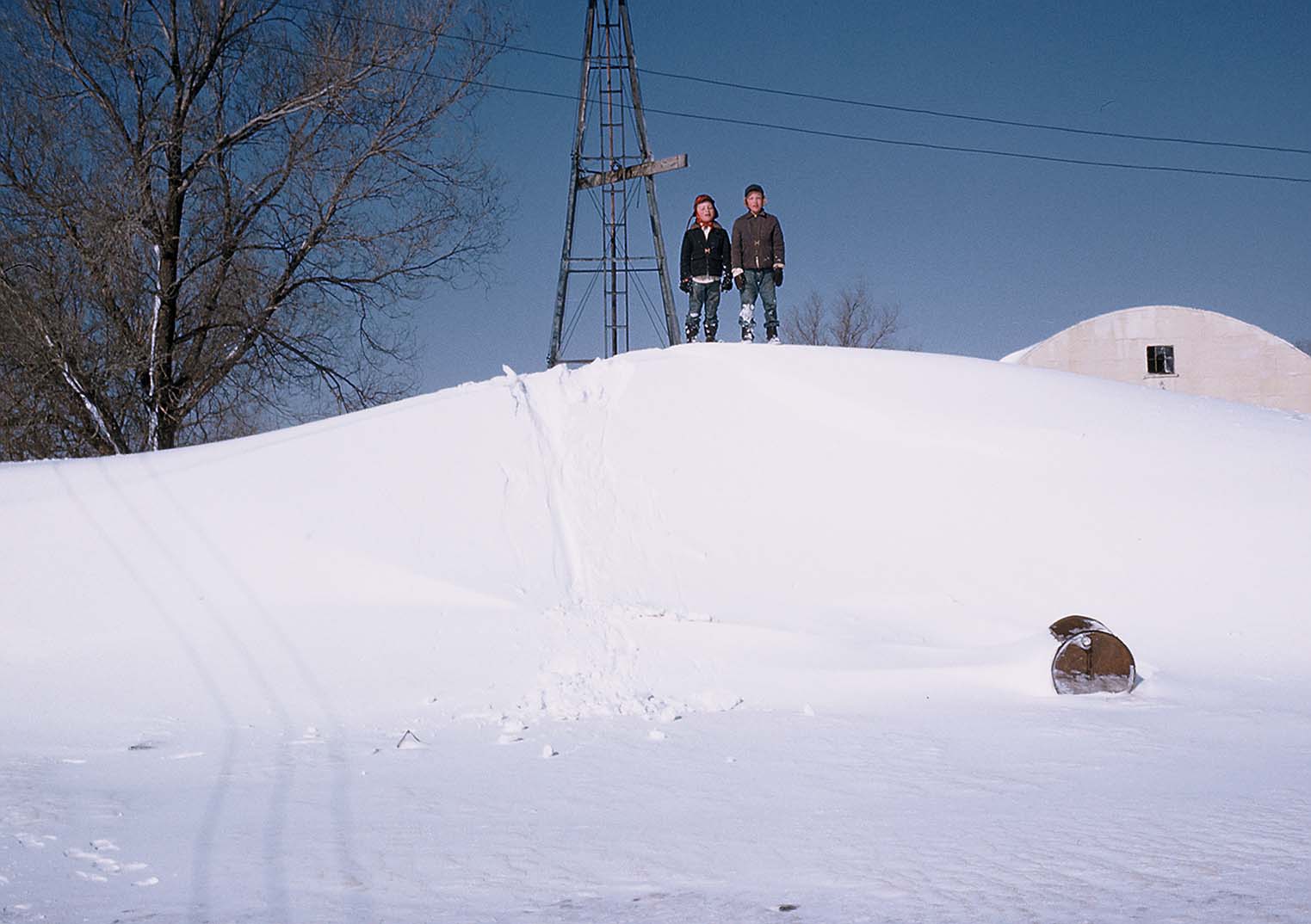
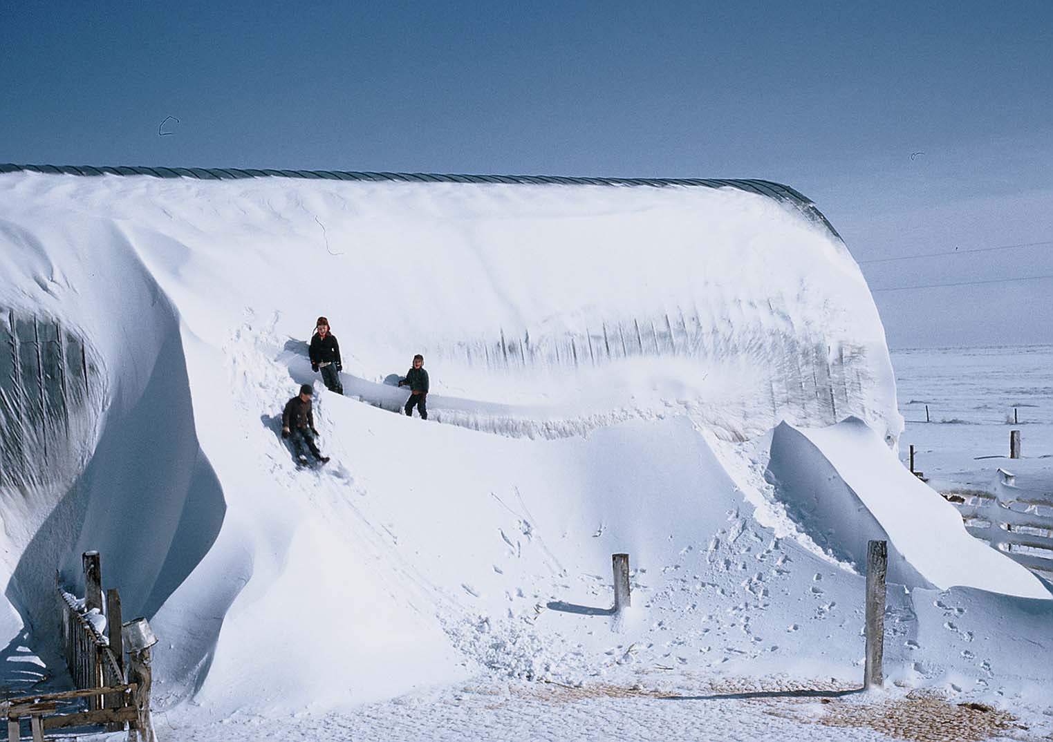
The following images were submitted by Don and Mary Gerard - Hamilton county - ~19NW Syracuse
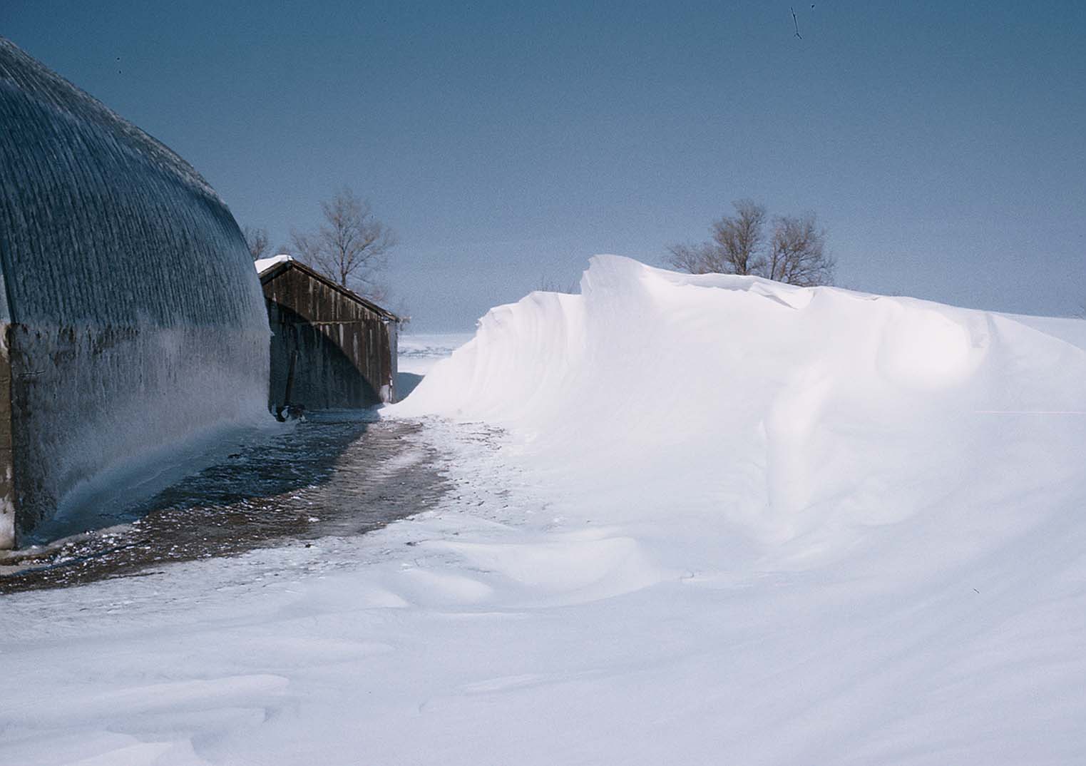
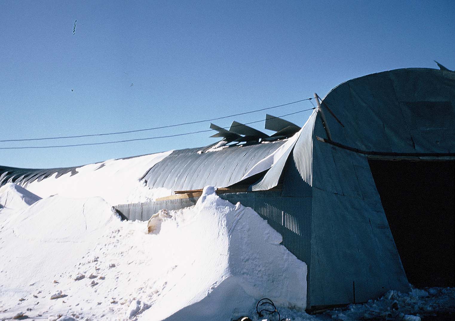
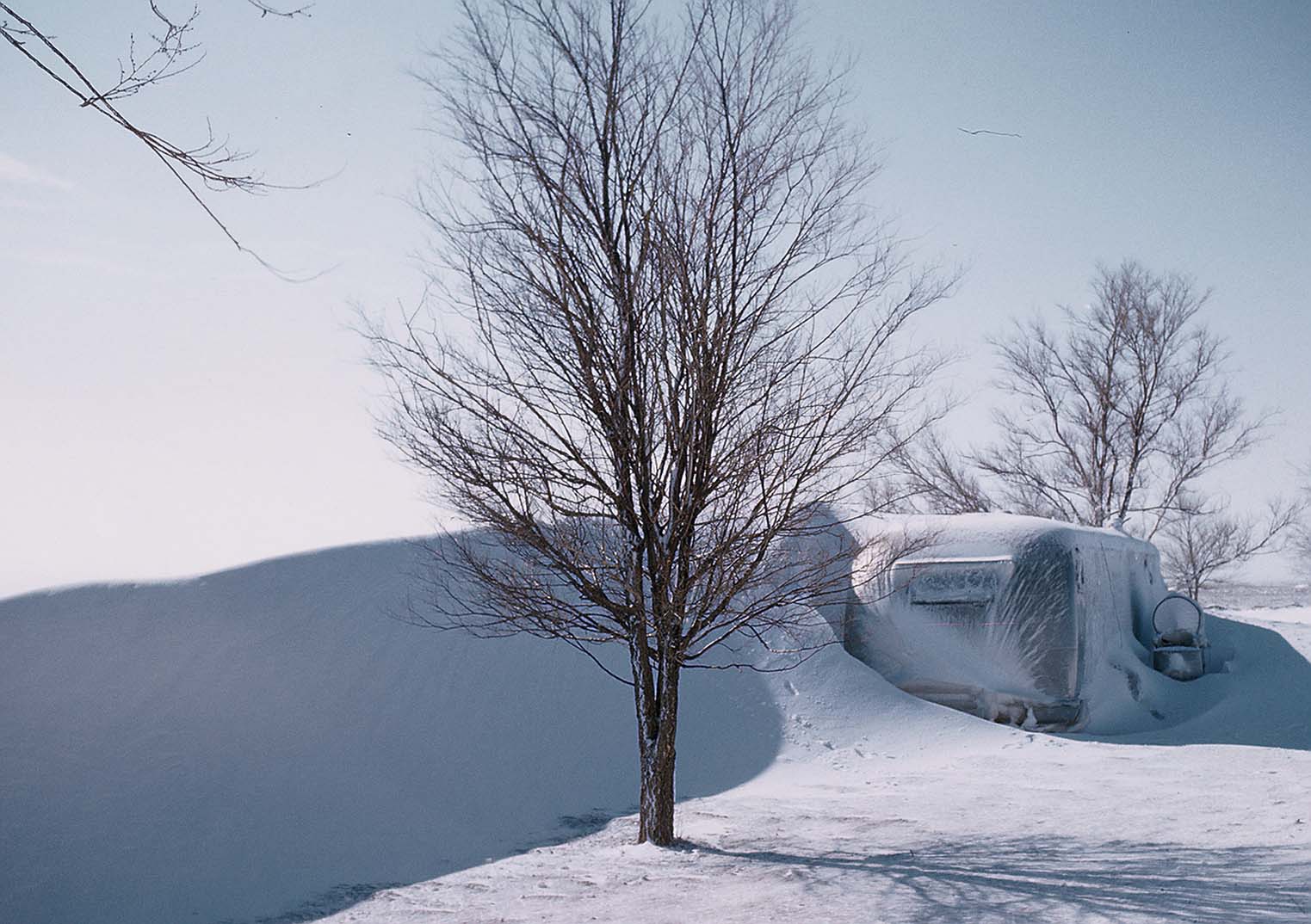
. . .Below are a few stories that were submitted to us. . .
Terry Keenan, Ness City, KS writes:
I was twelve years old at the time, living on a farm northeast of Seward kansas in Stafford county. After the rain and sleet hit, putting ice on everything, the wind and snow lasted for over two days. Our electricity was off over six weeks since every power pole in the area had been
snapped. My older brother had a summertime job from college putting them back. After the storm was over, you could not go anywhere. Phone lines were down, no tv, no transistor radios. My dad asked me to saddle our horse and ride into Seward, two miles as the crow flies. To my amazment the horse went thru the tall drifts without any trouble. I arrived in town, picked up our mail and left with news for the family. We did not have school for two weeks. Since we had milk cows, chickens, windmill water, things could have been worse. We played ten point pitch most nights to a cole-lamp.
Leona Tuttle of Gove County, KS writes:
"Memories of the ’57 Blizzard" (recently printed in Gove County Advocate)
Jim and I may have been the last “pioneers” in Gove County. In 1957 we lived on a rented farm. The house didn’t have electricity, running water, or a telephone. We did have a light plant (similar to a generator). For several years, the only running water available was from the windmill that was approximately a hundred yards from the house. We had to pump it by hand into buckets and haul it to the house. As for a telephone, at that time there were only 10 people allowed on one party line. We had to wait until there was available space on the line in our area. Consequently, in 1957 we didn’t have any telephone communication available to us. We had a propane refrigerator and cook stove. In the living room we heated with a stove using fuel oil and in the kitchen we used a wood stove for heat.
In March 1957, there was not a big snowstorm predicted. Jim went to Quinter to work on a water well drilling rig he and Raymond Goff were building in Jesse Long’s shop. Knowing we were running low on fuel oil, he planned to get some before returning home. The blizzard developed so quickly that by mid-afternoon no one could get out of Quinter.
With use of the light plant I listened to the radio (KXXX) and realized the blizzard might be really bad. I decided I’d better get prepared. Jim was probably not going to make it home. I carried in two pails of water and all the cut wood we had. I thought if the fuel oil ran out I would need more wood. I remembered we had some old fence posts so I carried them in just in case I needed them. The snow continued to fall, and with the strong winds, the snow drifts were getting very deep.
As nightfall approached, I got out more blankets in case we needed them. We had three girls. Gwendolyn was three and a half, Dolores was two, and Rose had just turned one. Our bedrooms were on the second story of the house. The only way they were heated was by the heat rising up the open stairway. Under normal circumstances, this was adequate heat for the second story bedrooms. When I put the girls to bed upstairs, I bundled them up really good. I even put a snowsuit on Rose. Before the day ended, the fuel oil had run out in the living room stove. I spent the night beside the wood stove keeping the fire stoked up to heat the upstairs. When I started to burn the old hedge fence posts in the stove I had no way to cut them. As the post burned down on one end I would shove it in a little further, and after it burned down enough I could close the stove door.
As morning came, I could still see blizzard conditions outside. With no way for Jim to contact me, he felt like he needed to come home. The roads were impassable with any type of vehicle. No one could travel anywhere. Jim decided to borrow a horse from his Uncle Ralph Tuttle. He then rode home in the blizzard from Quinter which is approximately 20 miles by road. He had a rubberized suit that he wore when drilling water wells in the winter. He wore this suit to keep out the wind and moisture during the ride home. He traveled south out of Quinter and stopped at Dutch and Edith Jamison’s to warm up. He then headed west and south. The snow drifts were so deep he had to get off and lead the horse around or over them. Sometimes he couldn’t see very far. He knew the route and used the sight of fence posts and electric and telephone poles to keep on the right roads. He arrived home just as it was getting dark. When he walked in the back door he literally scared me to death. I wasn’t expecting anyone and when this person walked in with a yellow rubberized suit and a cold red face it was a big surprise. He was very thankful his family was okay and for the warm house.
It was several days before anyone from town knew if he made it or not. When the storm was over, the snow drifts were as high as the eaves of our two story house. Gwendolyn said she can remember looking out an upstairs window and couldn’t see the clothesline because the drifts had covered them. Later, we made steps in the snow drifts to get to the windmill.
Carl Sanders of Russell, KS (from near Meade in 1957) writes:
Information on the Great Blizzard of 1957.
I was raised on a cattle ranch 3 ½ miles southwest of Meade, KS. In the morning of the 24th the storm was in full blow and a complete white out around our farmstead. I was a sophomore in high school at this time.
For some reason our phone and electricity never failed in the entire time of the storm. We had contact with my grandparents and anyone out of the old Meade telephone exchange. (We still had operators at that time) Meade lost the phone lines out of the city and had some electric outages also.
Sometime before the evening of the 24th my Grandfather heard that the Rock Island Zepher was missing somewhere between Meade and Liberal, KS. The railroad telegraph lines stayed up. My Dad was a ham radio operator and had contact where ever there was another ham on the air. Many were not on during this time but many were. By the 2ndmorning of the storm period the train was located stuck in a cut 4 miles west of Meade. The information was relayed to my father who talked to a Pratt, KS ham who notified a National Guard unit that had some APC’s that they shipped out that day and the next morning got to the train with food, water, and medicine. The passengers’ were faired into the Meade High School’s gym that had been set up as an emergency shelter. This info is in the last weeks Life Magazine Issue with pictures.
There was a drill rig on our ranch at this time and with us chaining up all four wheels on a brand new 4 wheel drive International ¾ ton pickup we were able to get to the unit with a crew change and food for the 4 men stuck out there for 3 days.
There are dozens of stories of how my dad relayed all info coming out of Meade to the world as what was needed and the conditions of area to the media.
Mike Umscheid, Dodge City NWS Meteorologist (lead author)
Jonathan Finch, Dodge City NWS Meteorologist
Acknowledgements:
Special thanks again to Kansas Heritage Center
Thanks to Carl Sanders, Jon and Leona Tuttle and Terry Keenan for sharing their unique stories