| Snow / Ice | Heat | Cold | Wind | Frost / Freeze | Fog | Fire |
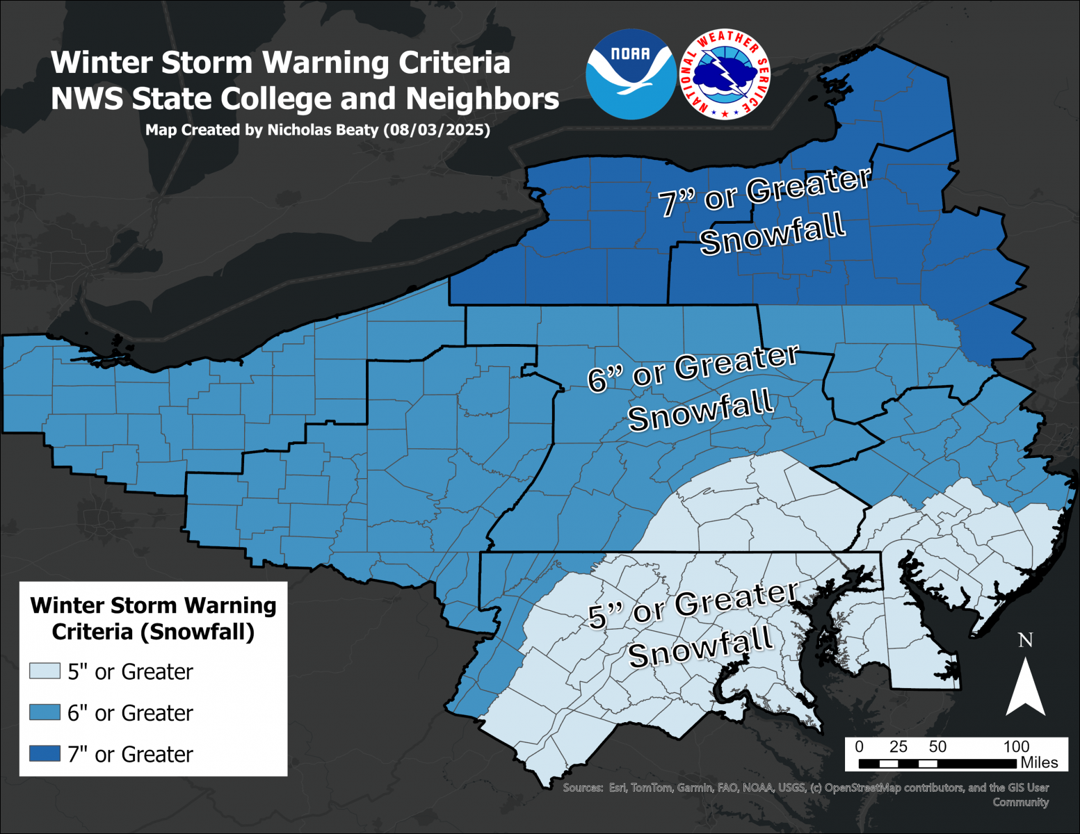
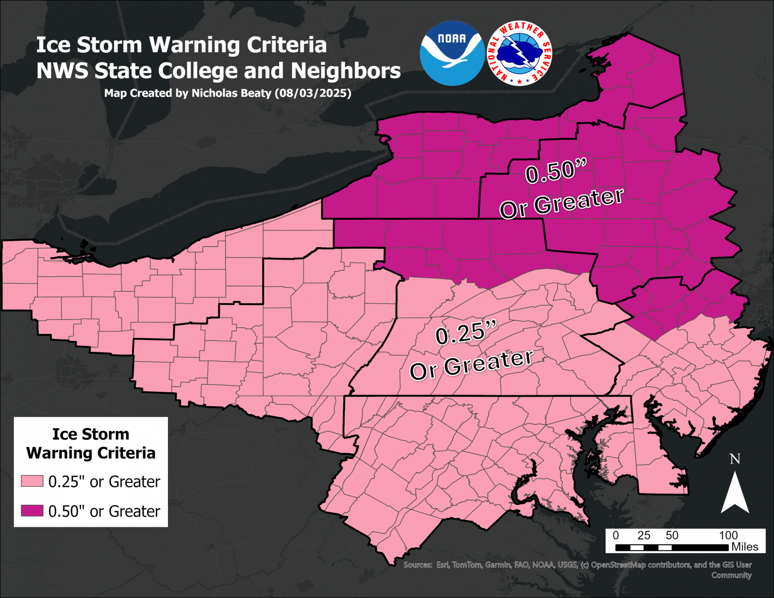
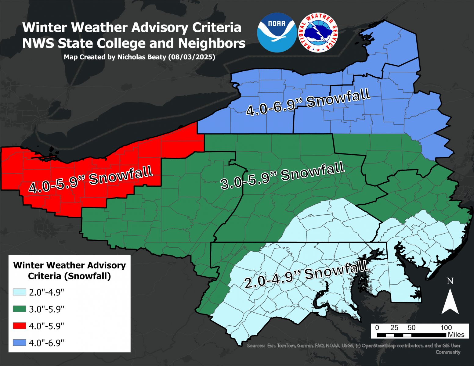
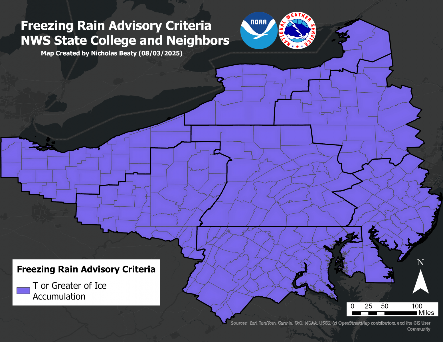
Winter Precipitation
Statements for these hazards will be issued under the header "PHLWSWCTP (WWUS41 KCTP)."
|
||||||||||||||||||||||||
Non-Precipitation Phenomena
The State College NWS Office will issue Advisories and Warnings under the header "PHLNPWCTP (WWUS71 KCTP)" for these situations:
|
||||||||
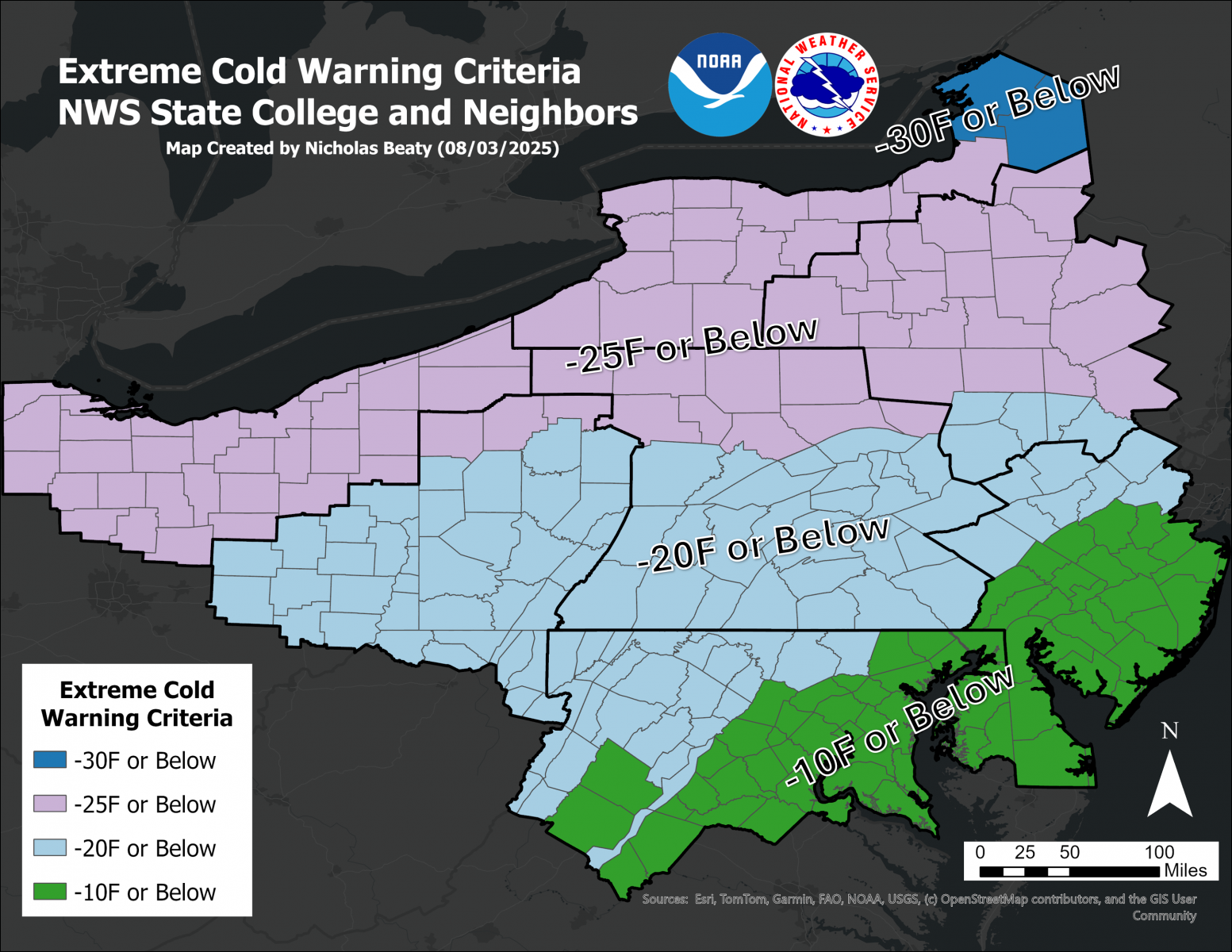
Non-Precipitation Phenomena Warning Terminology
The State College NWS Office will issue Advisories and Warnings under the header "PHLNPWCTP (WWUS71 KCTP)" for these situations:
|
||||||||||
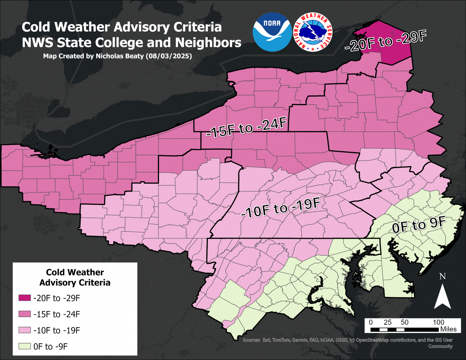
Non-Precipitation Phenomena Warning Terminology
The State College NWS Office will issue Advisories and Warnings under the header "PHLNPWCTP (WWUS71 KCTP)" for these situations:
|
||||||||
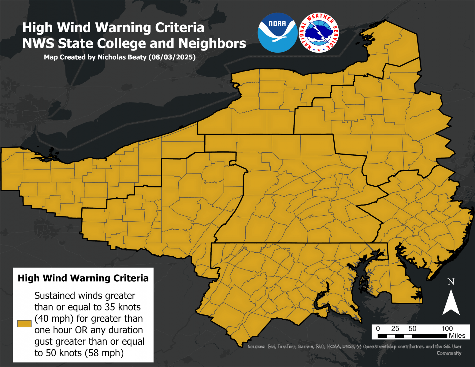
Non-Precipitation Phenomena Warning Terminology
The State College NWS Office will issue Advisories and Warnings under the header "PHLNPWCTP (WWUS71 KCTP)" for these situations:
|
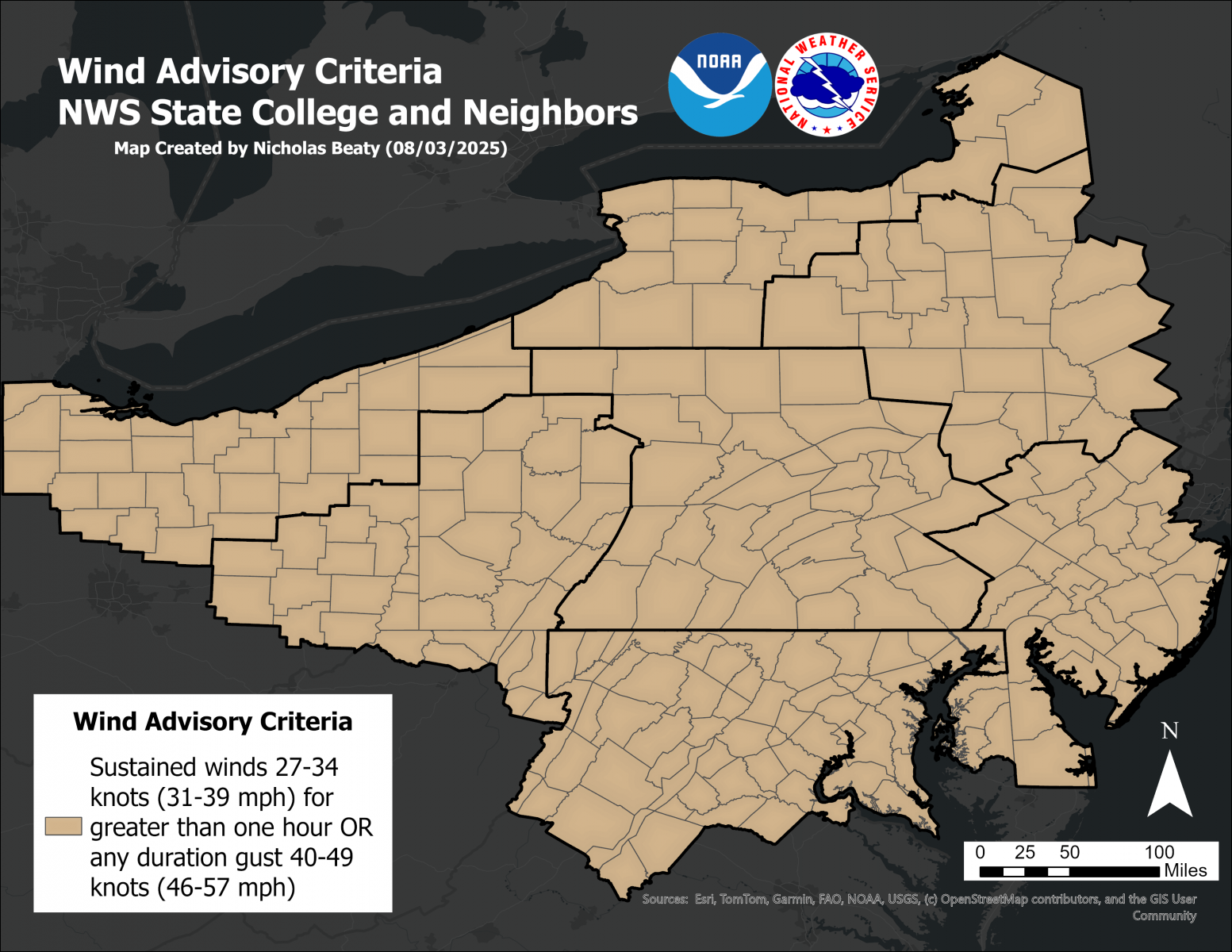
Non-Precipitation Phenomena Warning Terminology
The State College NWS Office will issue Advisories and Warnings under the header "PHLNPWCTP (WWUS71 KCTP)" for these situations:
|
||||||
Fire Weather Products
The State College NWS Office will issue these two Fire Weather related products under the header "PHLRFWCTP (WWUS81 KCTP)" for situations when the following criteria are met:
|


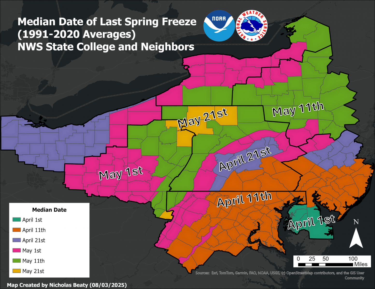 See a map of the Median Date of the Last Freeze in Spring
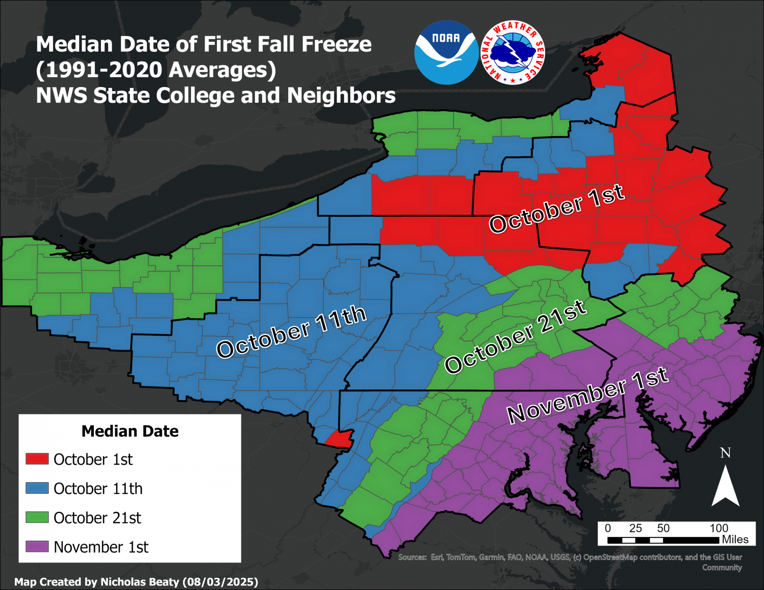 Median Date of the First Autumn Freeze
 Send Us a Report