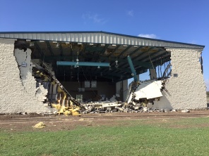
 Granjeno Community Center after estimated 95 mph wind blew down back wall, which was largely free–standing despite cinderblock construction with rebar |
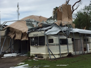
 Crumpled tin roof(s) surrounding an RV and mobile home in the Chimney Park Mobile Home Park in south Mission, after estimated 85 to 95 mph thunderstorm winds swept through hours earlier. |
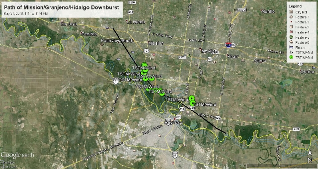
May, 2016 Roars Out of the Rio Grande Valley Pre–Midnight Downburst Ravages Southern Hidalgo County on the 31st Severe weather season saved its best for last. For the Rio Grande Valley, an active severe weather season (thunderstorm wind damage, large hail, excessive lightning) typically begins in late March and concludes sometime in May. On May 31, 2016, all you–known–what broke loose in southern Hidalgo County, capping a somewhat active season that began in mid March, picked up in mid April, and resumed for the second half of May. Atmospheric puzzle pieces, including a continued favorable southwest to northeast flow of embedded energy impulses aloft, an old outflow boundary in South Texas that set off a band of strong to severe storms during the afternoon across the Coastal Bend, and evening development east of the Sierra Madre near Zapata County, came together over Hidalgo County just prior to midnight. A mini–supercell and associated downburst core moved across south central Hidalgo County, Texas, beginning in the Palmview/Mission area and generally tracking along and just north of the Rio Grande before crossing the river southeast of Pharr, Texas. An NWS survey, combined with radar assessment, determined a path length of 19.4 miles and path width which varied between 1 and 3 miles. Peak winds were estimated by the survey to be 85 to 95 mph, though >100 mph winds may have occurred on elevated surfaces, particularly at the State Farm (sports) Arena in the City of Hidalgo. Initial damage to scattered healthy tree limbs and some poorly built roofs in the Mission/Palmview area would intensify by the time the downburst reached the Madero and Granjeno communities, where more than 100 homes sustained varying levels of damage, dozens of power poles were felled, and hundreds of softwood trees were uprooted. On the whole, the storm produced the most widespread damage in Hidalgo County in more than four years (McAllen Hailstorm of March 29, 2012). Specific damage and associated impacts included the following:
Despite the damage, there were no reported injuries or fatalities, even though dozens of families became homeless in the aftermath, and long term shelters were opened in the Madero area. In the Chimney Park RV/Mobile Home Park, very few residents were onsite as the location is largely populated by "Winter Texans" between November and April. Damage totals will easily exceed $10 million [an update will be provide here during the summer of 2016]. In addition to the wind, one to two inch diameter hail occurred with the storm, some driven by the strong winds. Additional hail–related damage was noted by the Emergency Management Coordinator of Pharr, where 2 inch diameter hail broke windows. Peak winds "pulsed" at two phases of the storm, and likely lasted 5 or more minutes in most cases which likely enhanced the damage profile. |
|
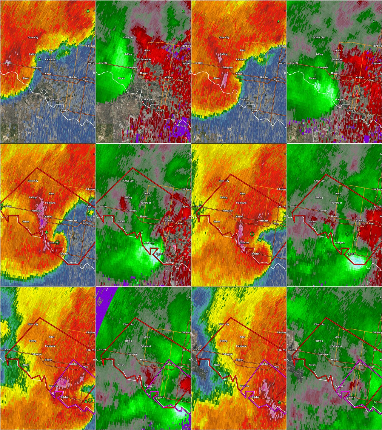
 Two–panel loop of 0.5° reflectivity (left) and velocity (right) between 1111 and 1152 PM, May 31. Velocity values, taken at around 4,000 feet, were underestimating what occurred on the ground, possibly due to the combination of additional wind drag below the height of the beam, and the fact that damage was from north–northeast winds which were perpendicular to the beam, and a known source of wind speed underestimation (speeds depicted on radar were 60 to 70 mph in light blue-green rather than 85 to 95 mph estimated from the ground survey).  Map of surveyed track area and start (near Palmview) and end in the U.S. (southeast of Pharr) based on corroborating reports from Emergency Management and other officials on the ground. Click to download the KMZ file to open in Google Earth, which includes damage point descriptions as well as photos of the scene. Need Google Earth? Click here. |
|