Record setting heat is expected over the next several days from the Intermountain West through the northern Plains. Furthermore, fire weather concerns increase with dry and breezy conditions. Meanwhile, heavy rainfall and severe thunderstorm threats for the Ohio/Tennessee Valleys, central Appalachians and Southeast today. The threat shifts to central Gulf Coast and across central Texas this week. Read More >
Bismarck, ND
Weather Forecast Office
Overview of September 20-21 Flooding
|
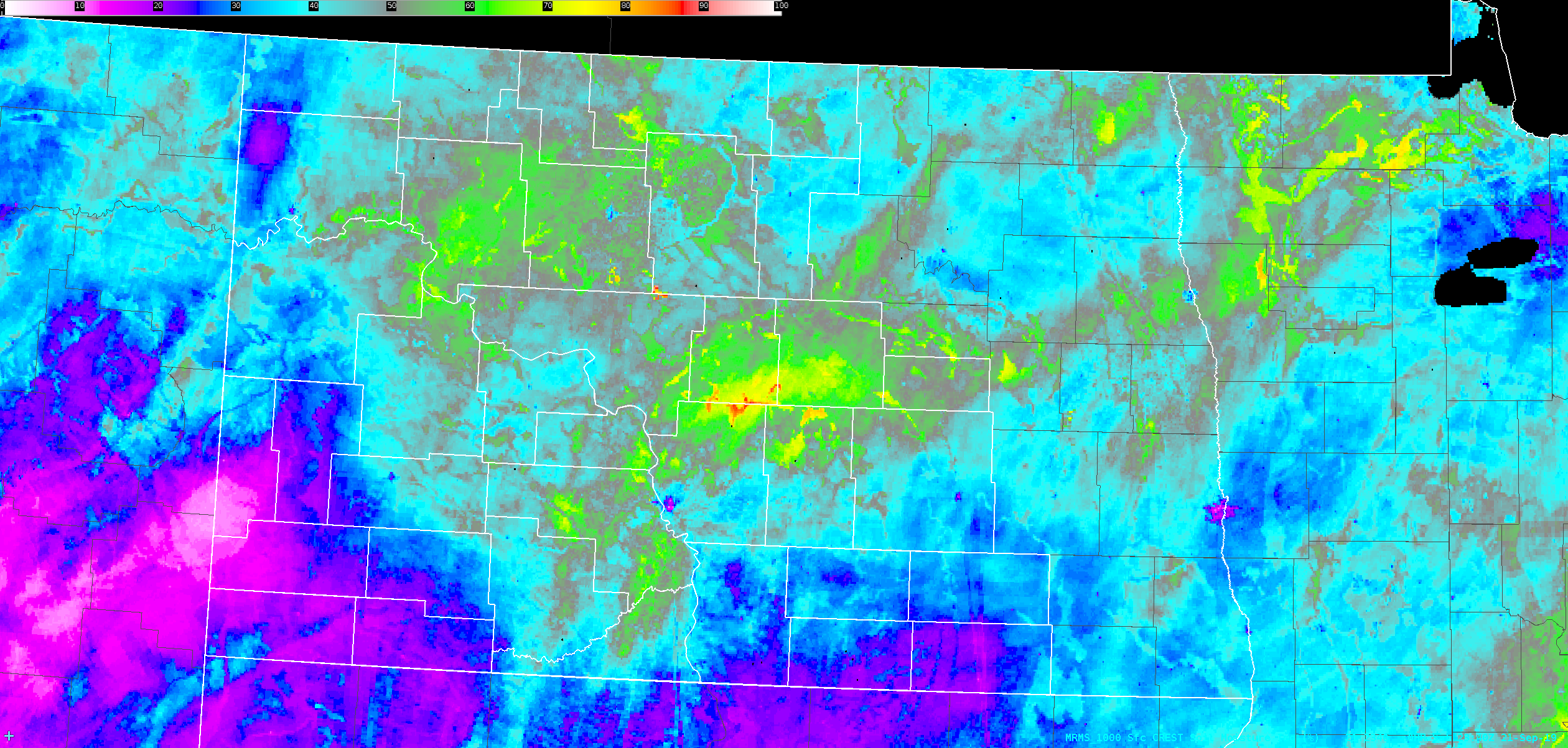
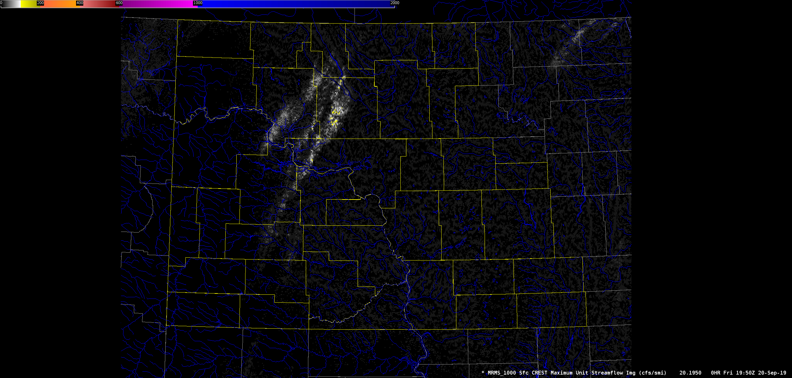
A large mid to upper level low pressure system moved across North Dakota on September 20th through September 21st, 2019. This low pressure system led to excessive rain across much of central North Dakota, as the atmosphere featured anomalously high moisture with a low level jet impinging on a stationary frontal boundary. These ingredients created a perfect scenario for thunderstorm training, which generally occurred in a line extending from Morton through Burleigh, Kidder, Stutsman, Sheridan, Wells, and Foster counties. The hardest hit areas were in portions of Sheridan and Wells counties, where some areas received over 7 inches of rain in less than 15 hours. This led to rather extensive rural flooding, which resulted in a road washout on Highway 200 in Wells County. |
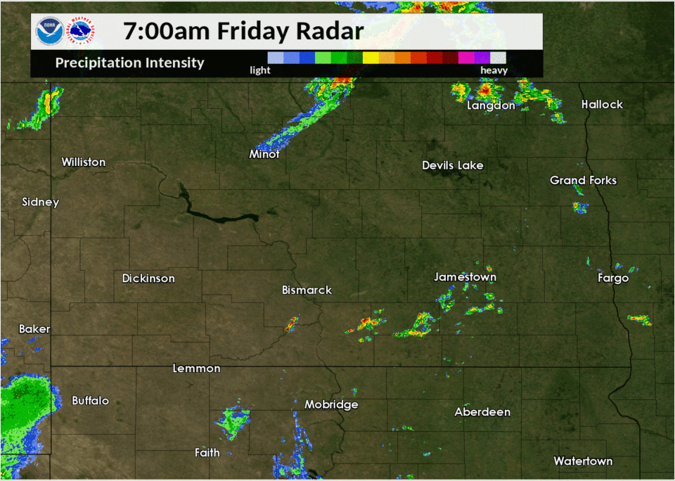
.png) Radar Estimated Rainfall Amounts |
|
Road Washout on Highway 200 in Wells County |
MRMS CREST Soil Moisture |
Radar Loop |
|
MRMS CREST Max Unit Streamflow |
 |
Media use of NWS Web News Stories is encouraged! Please acknowledge the NWS as the source of any news information accessed from this site. |
|
US Dept of Commerce
National Oceanic and Atmospheric Administration
National Weather Service
Bismarck, ND
2301 University Drive, Building 27
Bismarck, ND 58504
701-250-4224
Comments? Questions? Please Contact Us.