|
|
|
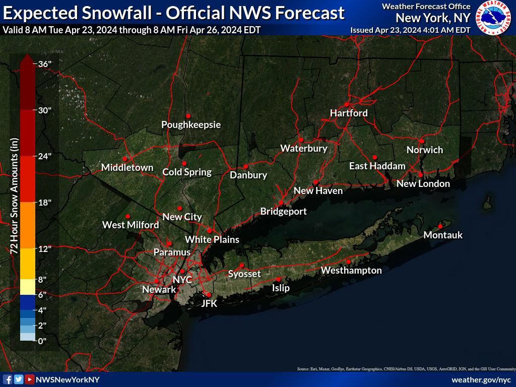
Expected Snow Accumulation
|
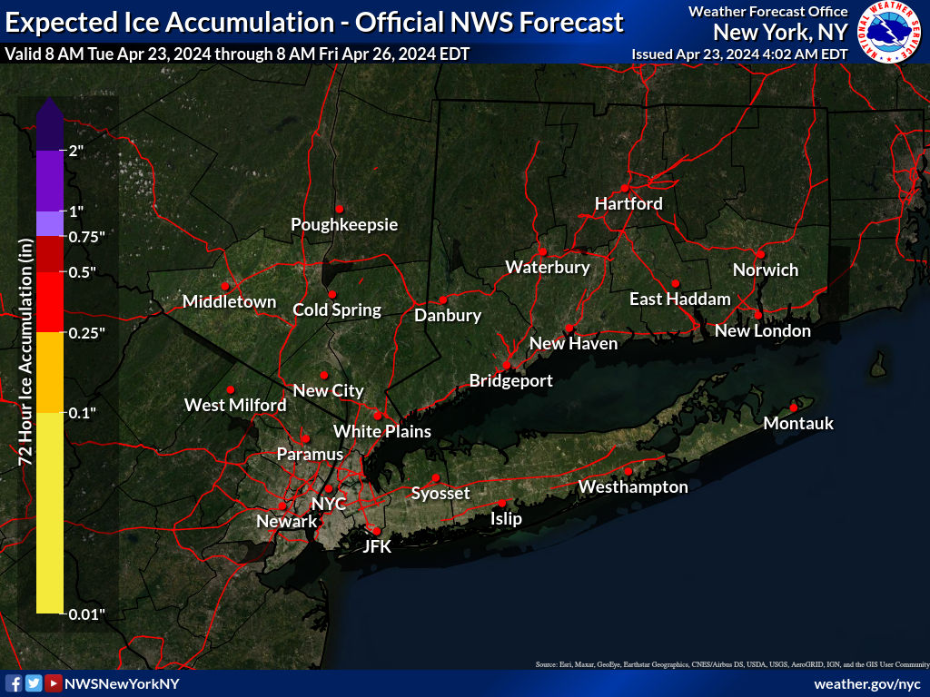
Expected Ice Accumulation
|
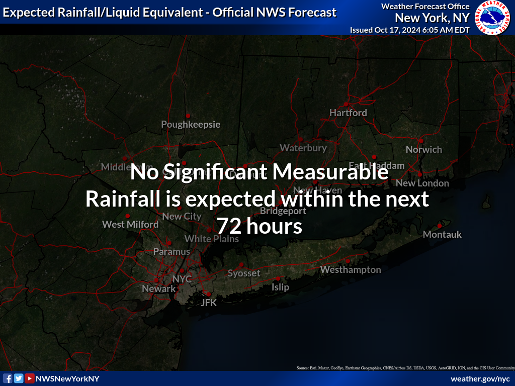
Expected Liquid Equivalent Total
|
**Click Here for the Latest Probabilistic Snow Forecasts**
Hazard Assessment
|
Weather Map
|
Latest Radar
|
Latest Satellite
|
| Winter Weather |
 Day 1-3 24 Hr Snow/Ice Probabilities |
 6 Hr Snowfall Forecast (thru 36 hrs) |
 Forecast Surface Low Positions |
 Latest Snow Reports |
| Excessive Rainfall |
 Excessive Rainfall Forecasts |
 QPF Forecasts |
 River Flood Outlook Forecasts |
 Ensemble River Forecasts |
| Coastal Flooding |
 NWS NY Coastal Flood Page |
 Coastal Flooding Impacts Viewer |
 Coastal Flood Exposure |
 Coastal Change Hazard |
| Excessive Cold |
 Day 1-5 Temperatures |
 Day 1-5 Wind Chills |
 Day 6-10 Wind Chill Outlook |
 Day 6-10 Temperature Outlook |
|
|
 Coastal Flood |
 Excessive Heat |
 Fire Weather |
 Flooding |
 Marine |
 Severe Weather |
 Tropical |
 Winter Weather |


 Coastal Flooding