Missouri Basin, Pleasant Hill
River Forecast Center
Upper Missouri Basin
May precipitation across the Upper Missouri Basin was below average. Precipitation summaries include: Milk St. Mary, 94 percent; Milk Canada, 104 percent; Lower Milk, 59 percent;
above Toston, 54 percent; Toston to Ft. Peck, 73 percent.
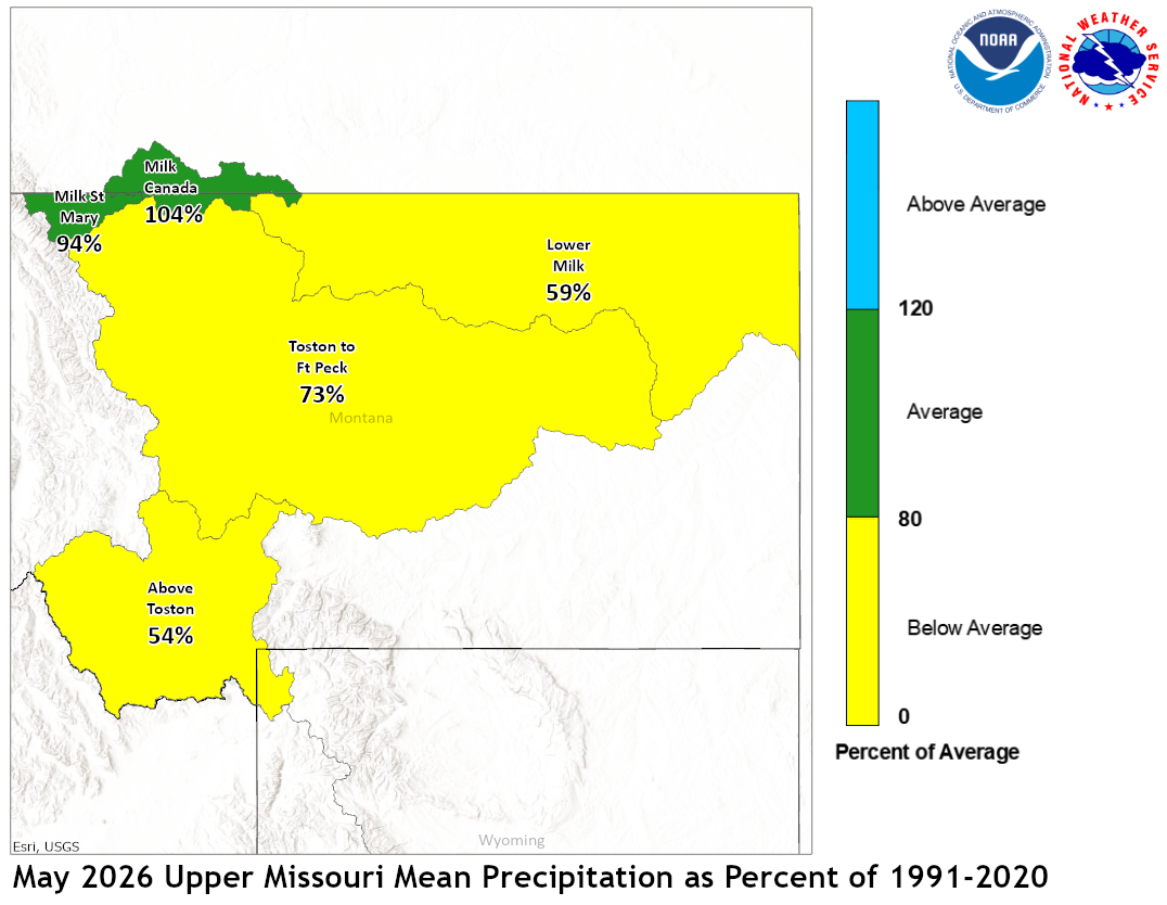

May 2026 Upper Missouri Mean Precip Oct-May WY2026 Upper Missouri Mean Precip
Of the four major irrigation reservoirs in Montana; Lima
Reservoir had 87 percent average storage, Clark Canyon was
holding 69 percent of average water, Gibson Reservoir had 105
percent of average stored water, and Fresno Reservoir had
43 percent of average stored water.
Yellowstone Basin
Precipitation during May was below average. The upper Yellowstone
River Basin received 64 percent of average precipitation while the Lower
Yellowstone River Basin reported 53 percent of average. The Bighorn
Basin received 49 percent of average precipitation while the
Wind River Basin received 56 percent of average. The Little Bighorn -
Upper Tongue Basin received 56 percent of average and the Powder River
had 40 percent of average precipitation.


May 2026 Yellowstone Mean Precip Oct-May WY2026 Yellowstone Mean Precip
Month end storage at Boysen Reservoir was 96 percent of average.
Stored water in Buffalo Bill Reservoir was 107 percent of average.
Month end storage was 92 percent of average at Bighorn Reservoir.
Platte Basin
Precipitation during May in the Upper North Platte Basin was 119
percent of average. In the Lower North Platte Basin, precipitation
was 89 percent of average. The North Platte Plains below Guernsy
Reservoir had 53 percent. The South Platte Mountains had 114
percent whereas the Plains had 81 percent of average May
precipitation.
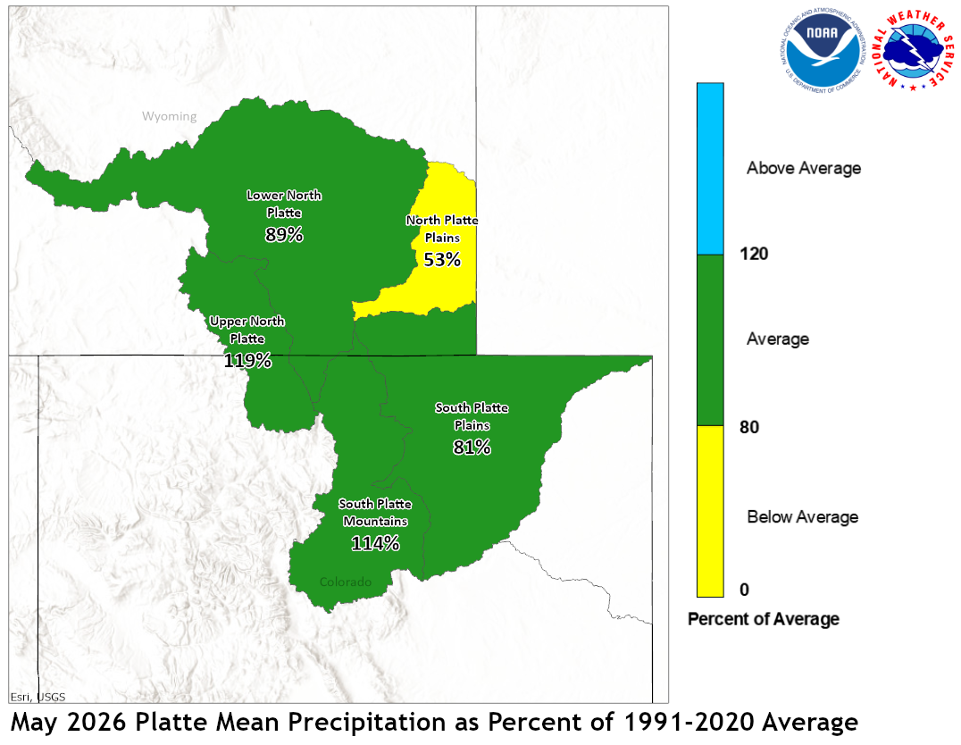

May 2026 Platte Mean Precip Oct-May WY2026 Platte Mean Precip
Stored water in the South Platte Basin was 90 percent of average
on June 1.
US Dept of Commerce
National Oceanic and Atmospheric Administration
National Weather Service
Missouri Basin, Pleasant Hill
1803 North 7 Highway
Pleasant Hill, MO 64080-9421
Comments? Questions? Please Contact Us.


